For historical information only, do not use for navigation or aviation purposes!
| Coordinates | N522018 E0073230 (WGS84) Google Maps |
| Elevation | 129 ft |
| Location indicator | EDNP (-1995), ETNP (1995-2005) |
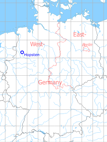
Germany during the Cold War Map
The history of the Cold War airfields: Hopsten
During World War II
Use
Fliegerhorst der Luftwaffe
Situation
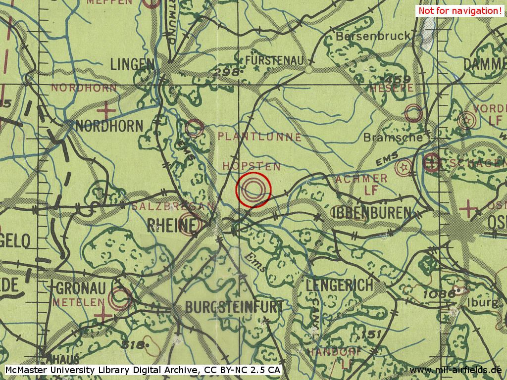
Hopsten Air Base in World War II on a US map from 1943 - (McMaster University Library Digital Archive, License: Creative Commons Attribution-NonCommercial 2.5 CC BY-NC 2.5 CA /MULDA/)
During the Cold War
Use
German Airforce base.
Situation
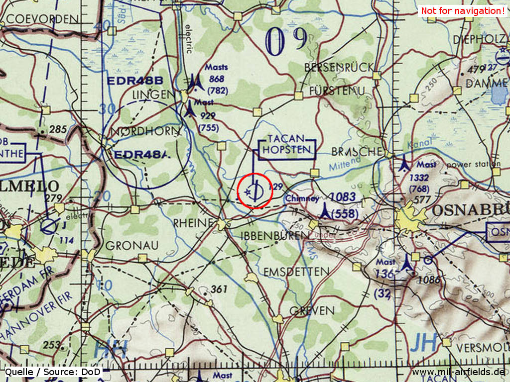
Hopsten Air Base on a map of the US Department of Defense from 1972 - (ONC E-2 (1972), Perry-Castañeda Library Map Collection, University of Texas at Austin /PCL MC/)
Overview
Hopsten 1977 - Source: GEMILFLIP 1977
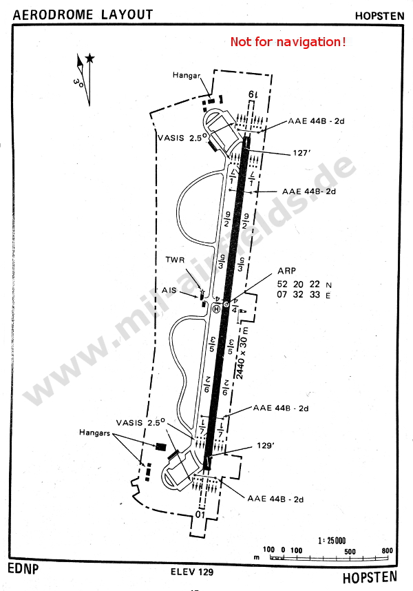
Runways
Data for the year 1990:
- 01/19: 2440 m x 30 m Beton
Radio beacons
Data for the year 1990:
- TACAN: CH27 "HOP", am Platz
Radar
ASR/PAR (1990)
Radio communication
Call sign: DHK 40
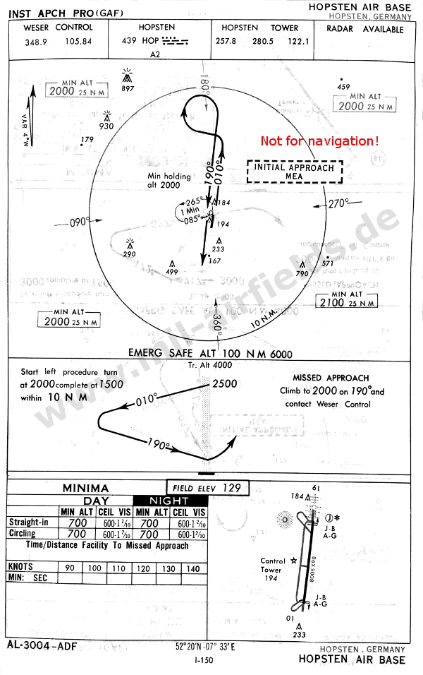
Maps
NDB approach to Hopsten in 1966 (Source: USAF/USN FLIP).
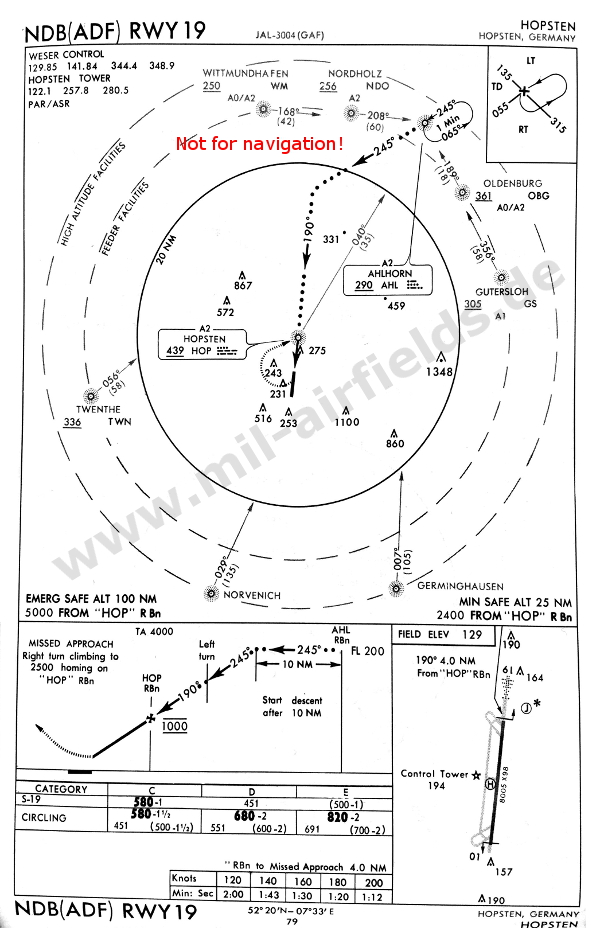
In 1968, the NDB was no longer at the northern part of the field, instead it is on the extended centerline (Source: DoD FLIP 1968)
Units
Jagdbombergeschwader 36 (JaboG 36) with F-4F (1990), Fluglehrzentrum F-4F (-2005)
Today
Use
Closed since end of 2005.
Links
- http://www.westfalengeschwader.com/ - Traditionsgemeinschaft Westfalengeschwader e.V.
 Follow mil-airfields on Facebook