RAF Burtonwood
RAF Burtonwood
Historische Anflugkarten
Nur zur geschichtlichen Information, nicht zur Navigation oder zum Fliegen verwenden!
| Koordinaten | N532435 W0023913 (WGS84) Google Maps |
| Location indicator | MJXB, EGOB (US Army, Army Heliport) |
| Operator | US Air Force (USAF), US Army |
1950er Jahre
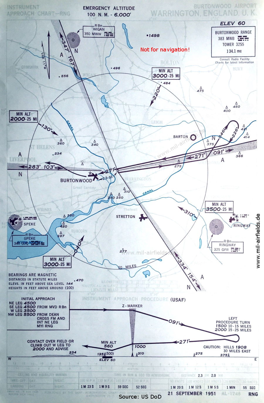
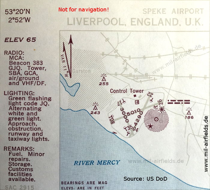
Range-Anflug Landebahn 27 (September 1951) - Flugplätze in der Umgebung: Barton, Manchester Ringway, Speke, Stretton (Quelle: US DoD)
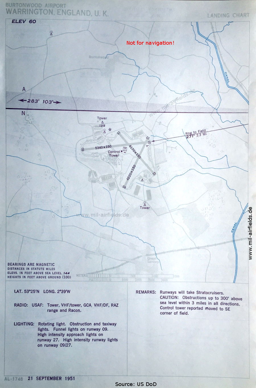
Flugplatz-Karte (September 1951) - Es gibt drei Startbahnen - 04/22: Länge 1286 m, Breite 46 m (4220 Fuß x 150 Fuß), 09/27: Länge 1628 m, Breite 46 m (5340 Fuß x 150 Fuß), 15/33: Länge 1271 m, Breite 46 m (4170 Fuß x 150 Fuß). (Quelle: US DoD)
Quelle für alle Karten, sofern nicht anders gekennzeichnet: US Department of Defense (US DoD)
Links
https://www.historicaviationmilitary.com/burtonwoo... - Burtonwood Home Page - Landing charts 1954
https://atchistory.wordpress.com/2017/02/04/raf-bu... - RAF Burtonwood (EGOB)
Empfohlen

Bildquellen sind auf der jeweiligen Zielseite angegeben, klicke auf die Vorschau um sie zu öffnen.
 mil-airfields.de bei Facebook