Großbritannien: Flugplätze und Flughäfen
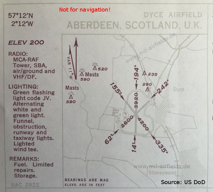
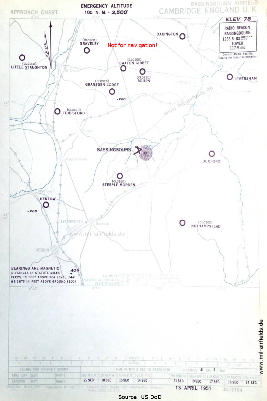
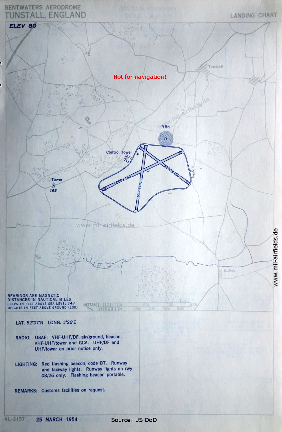
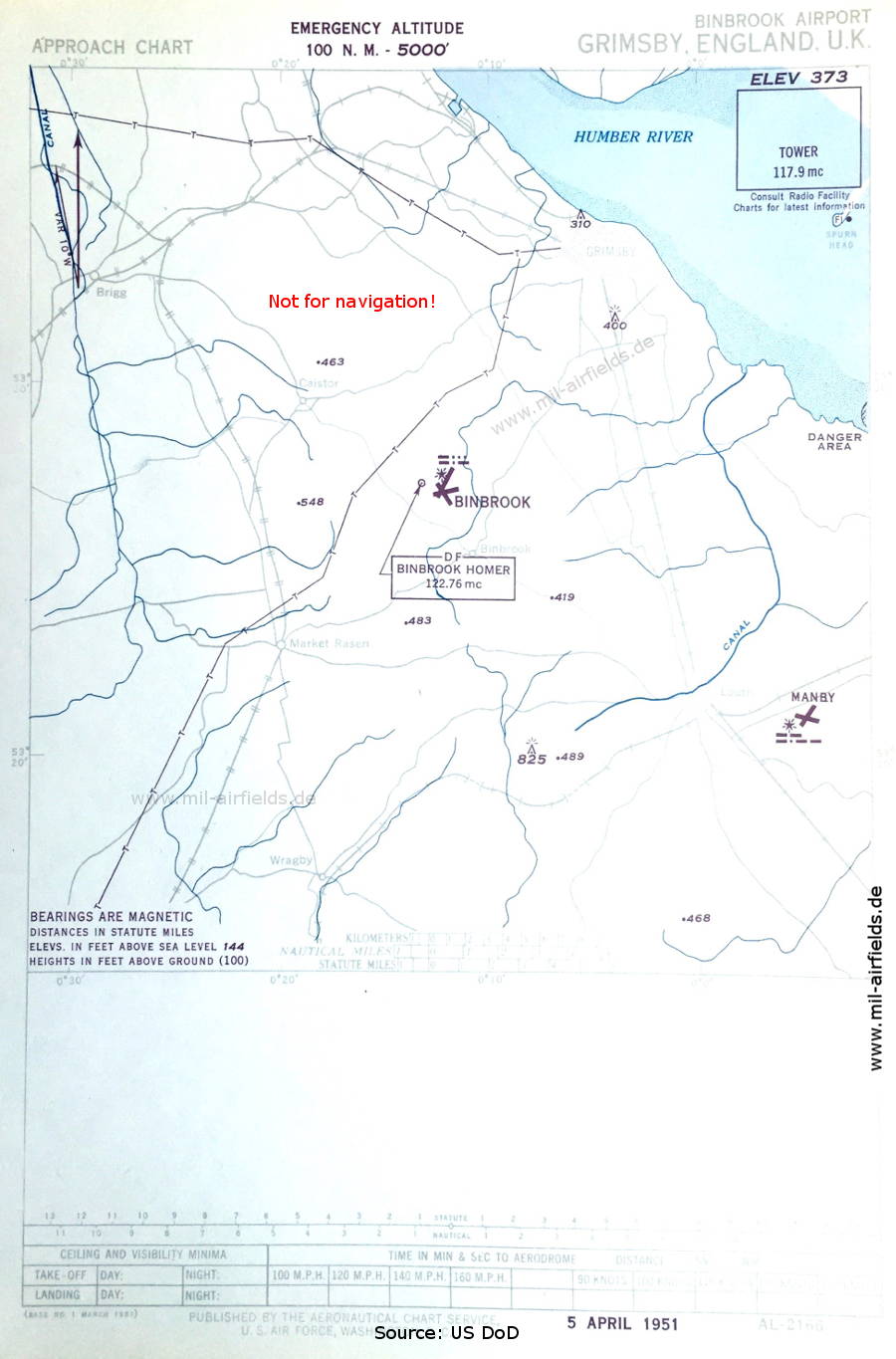
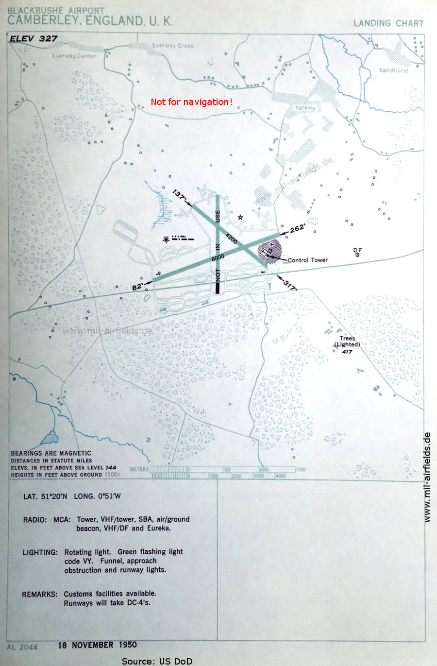
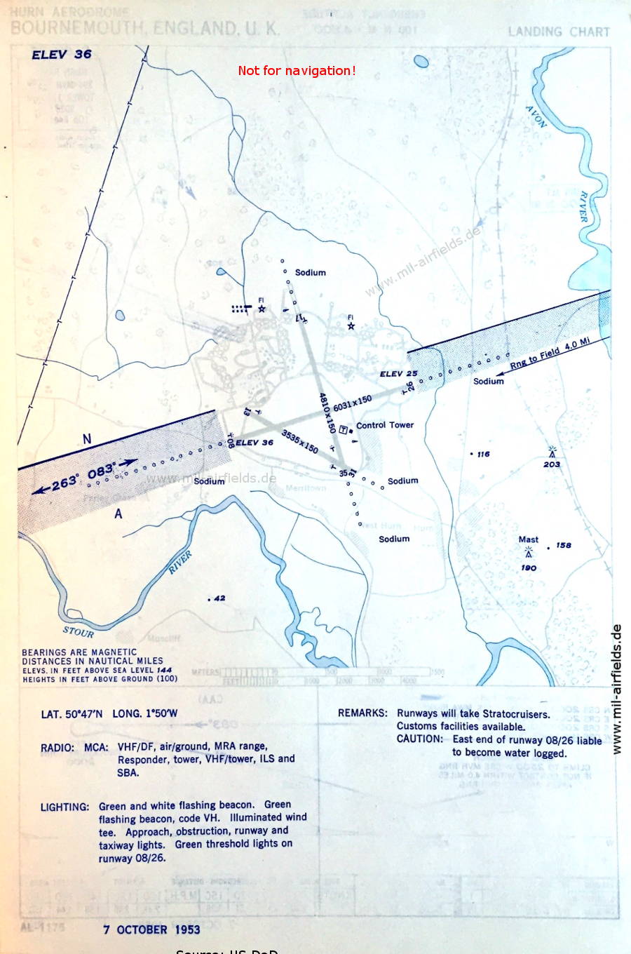
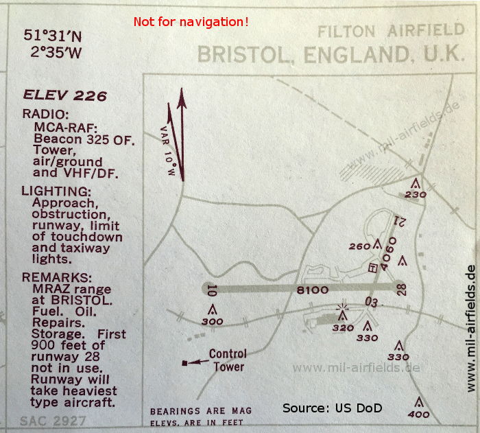
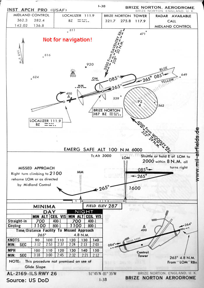
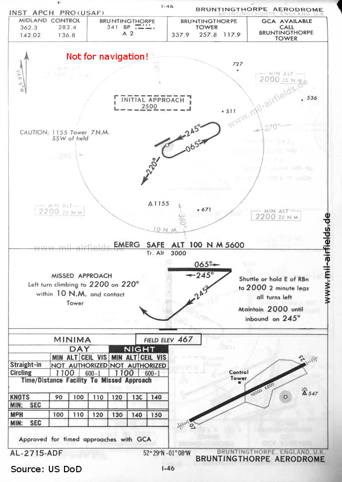
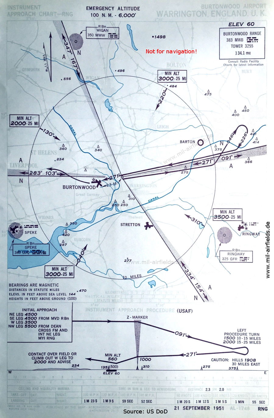
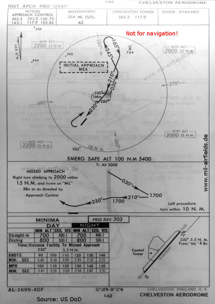
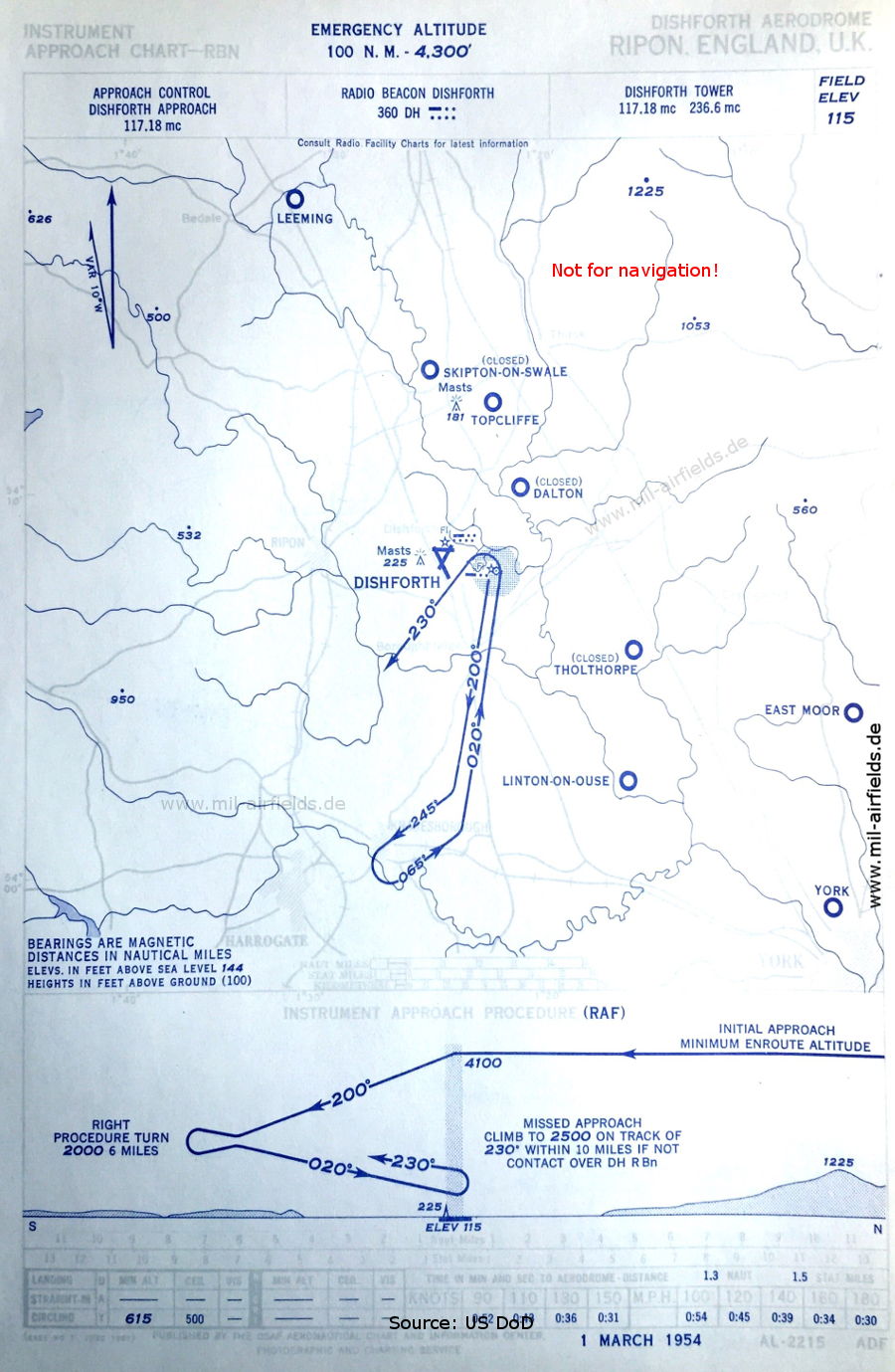
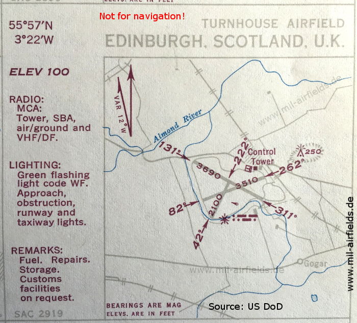
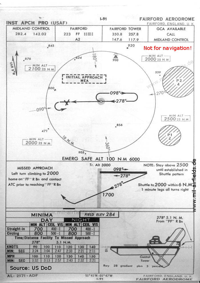
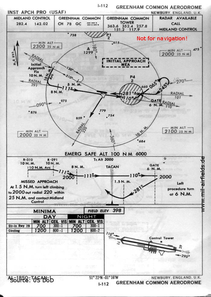
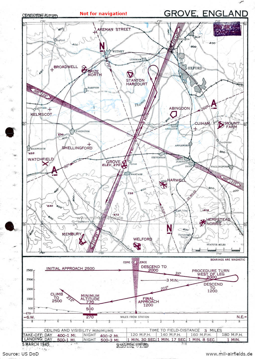
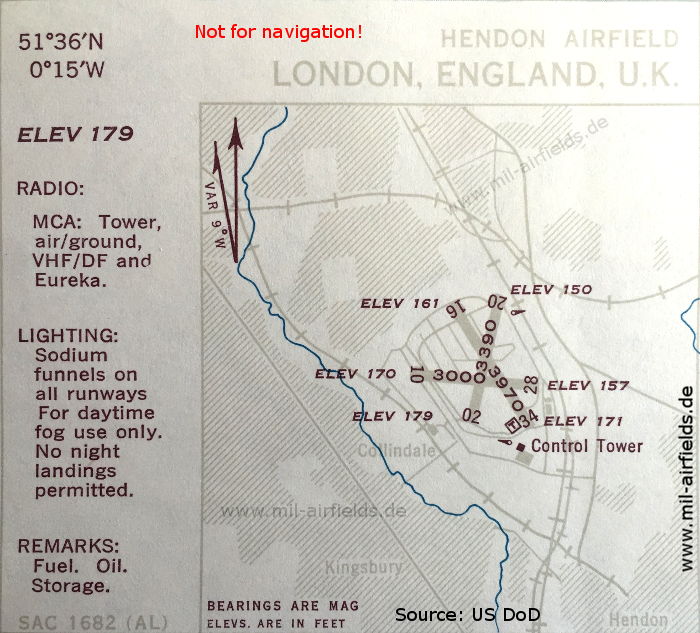
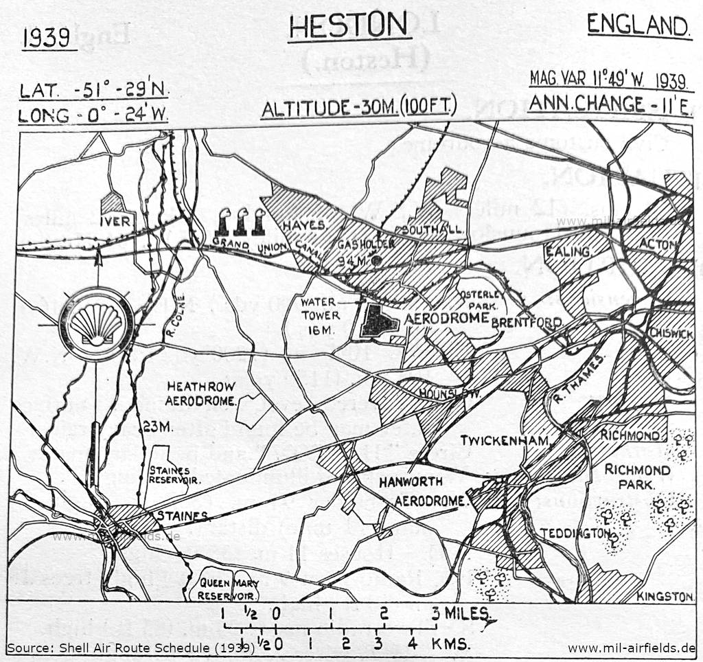
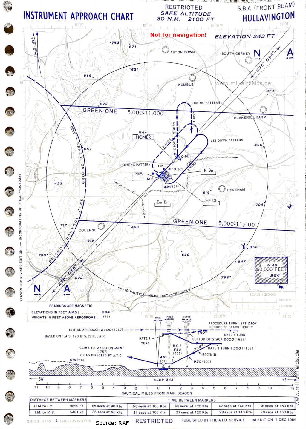
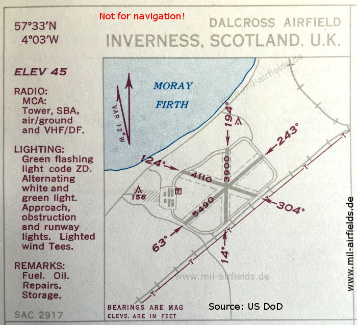
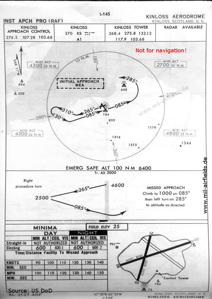
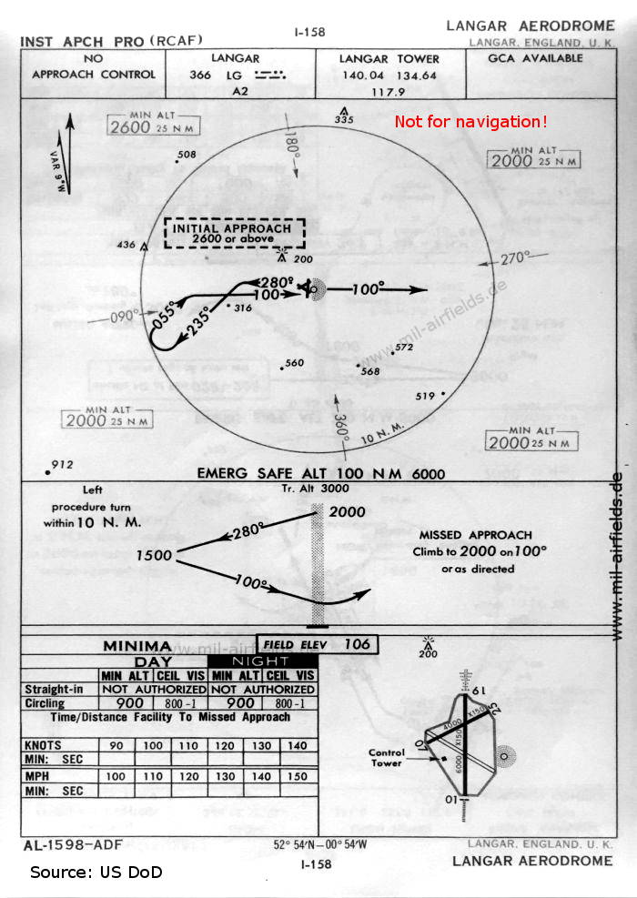
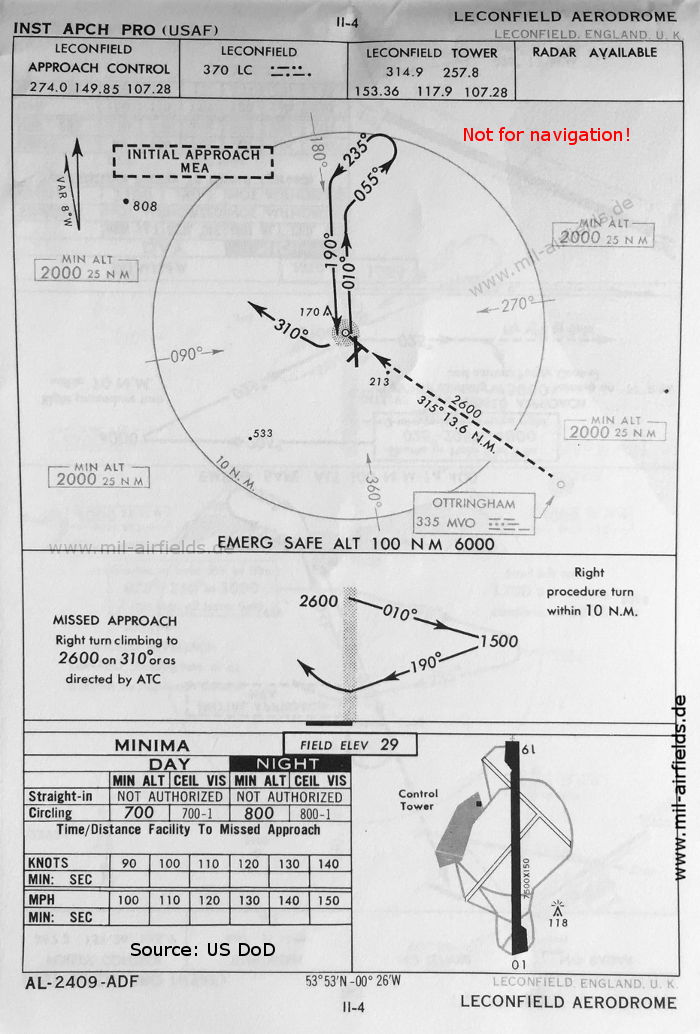
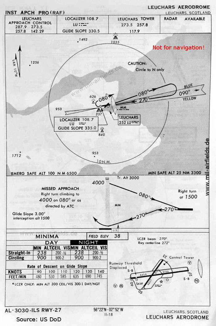
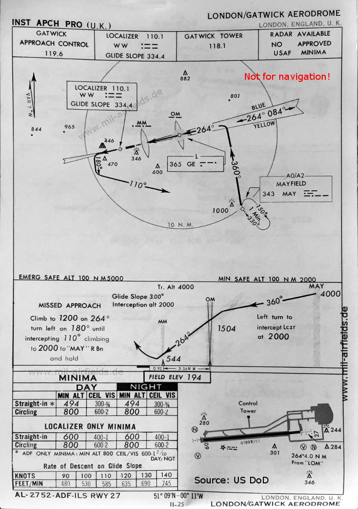
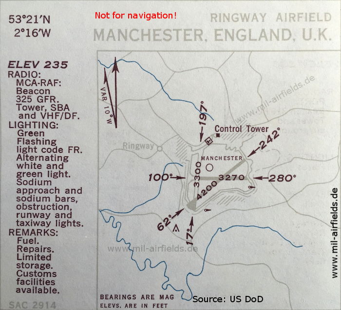
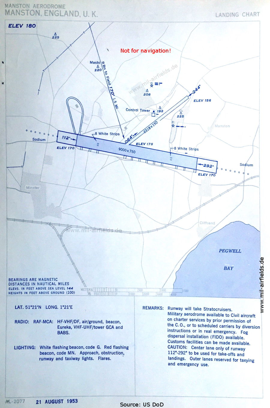
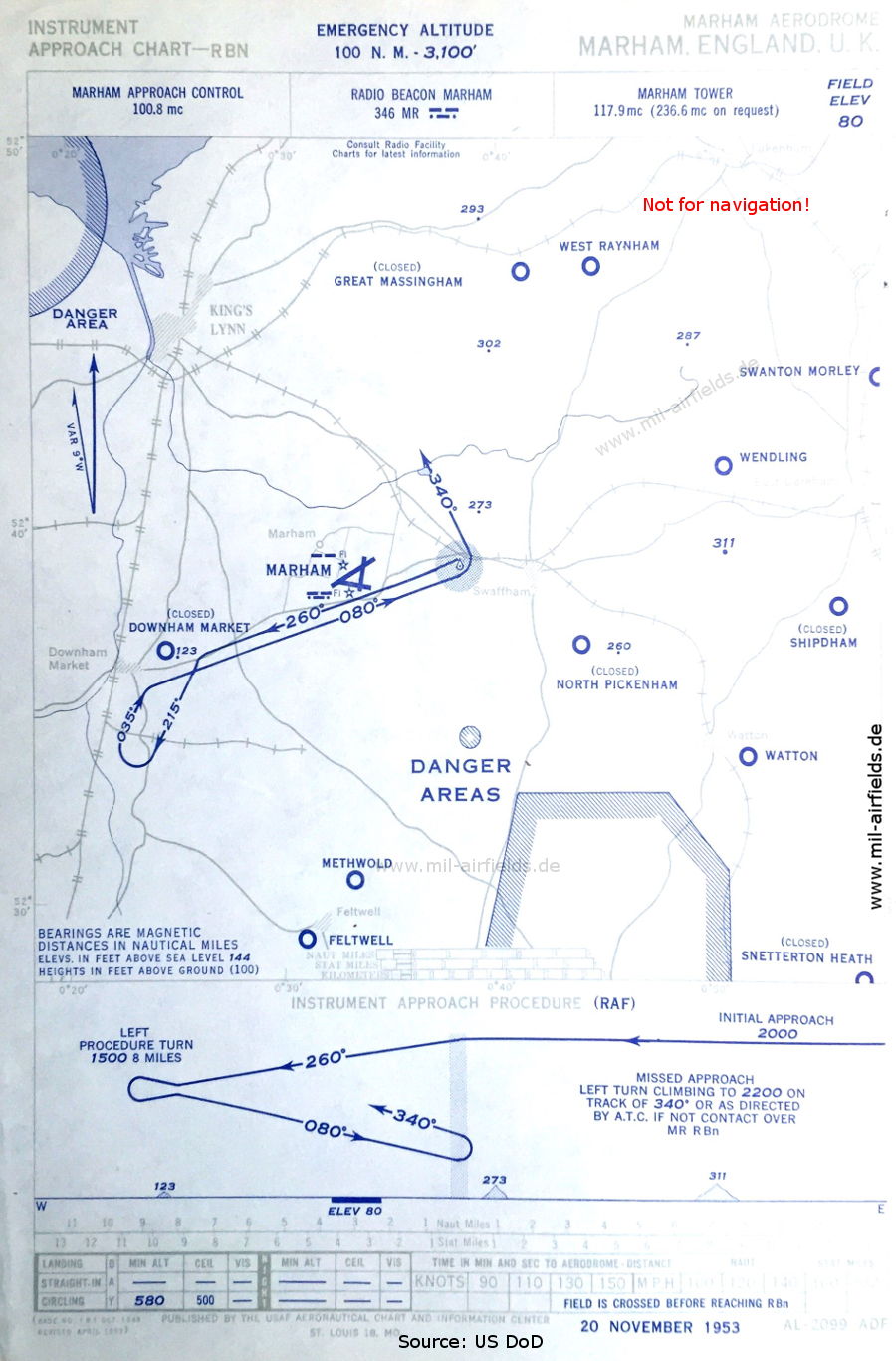
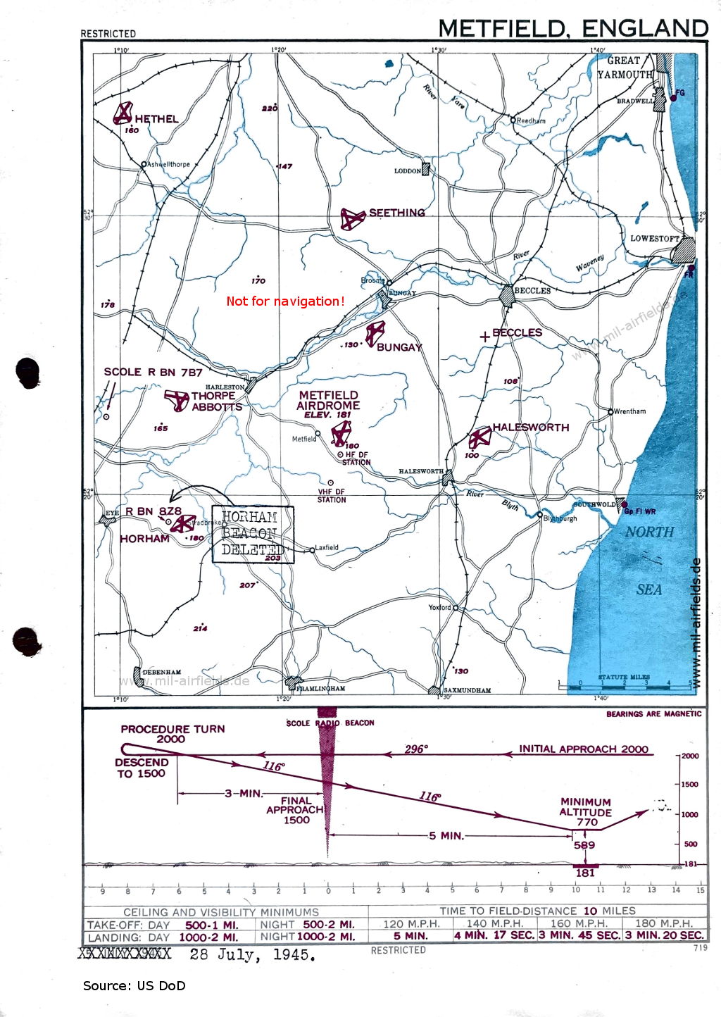
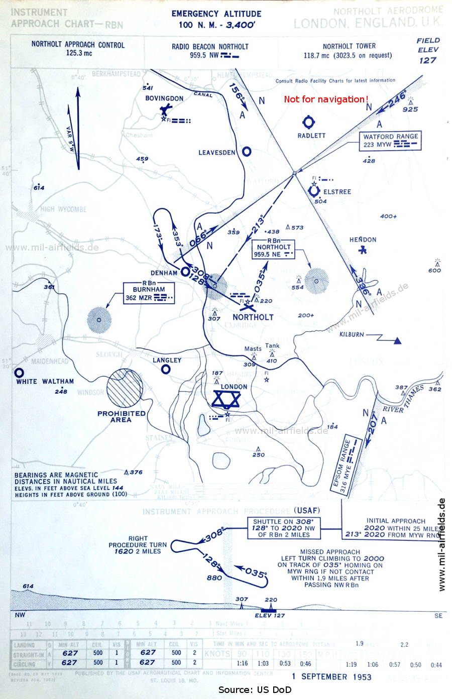
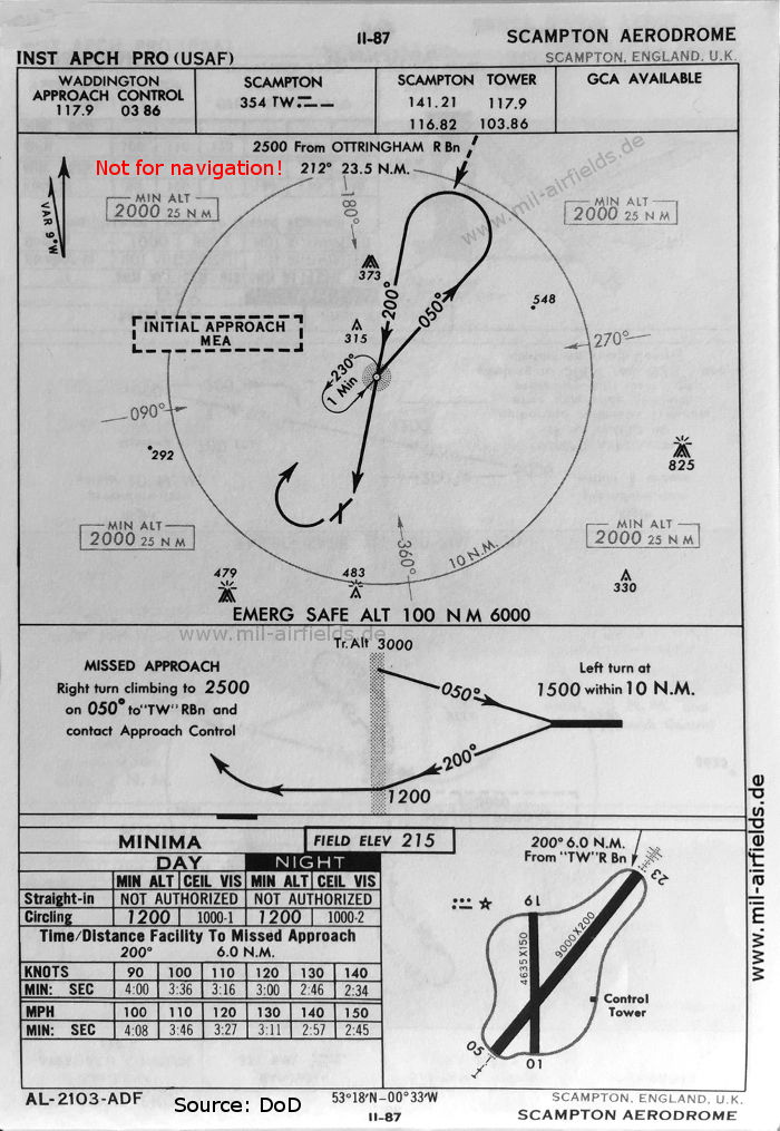
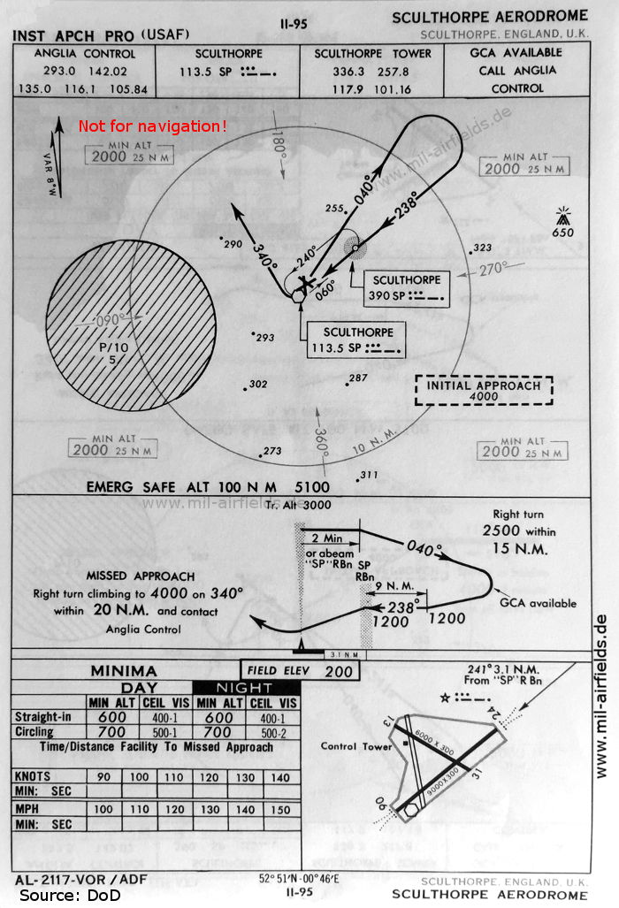
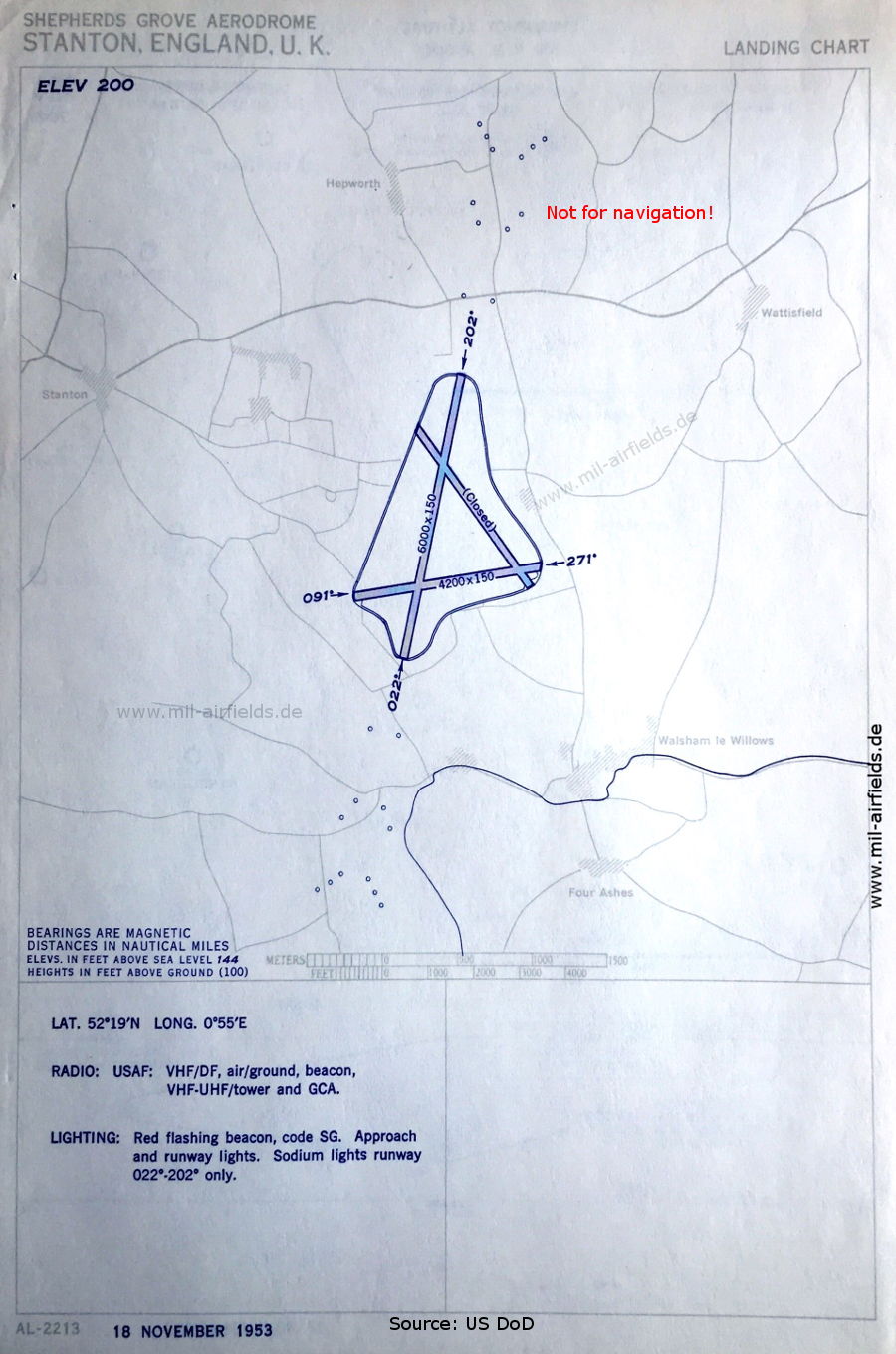
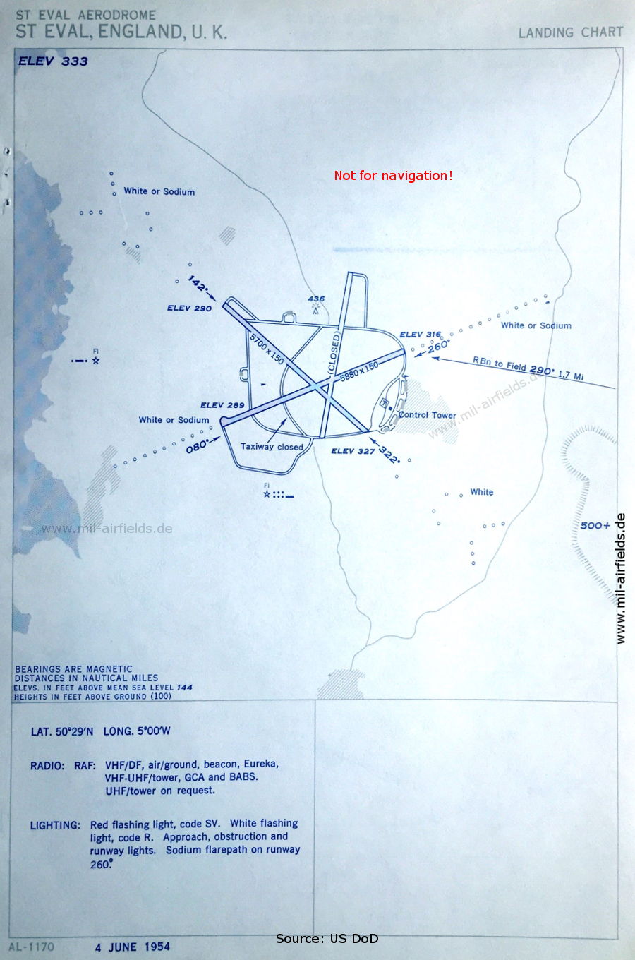
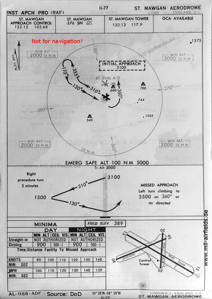
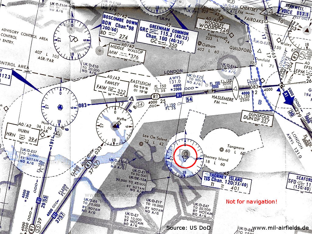
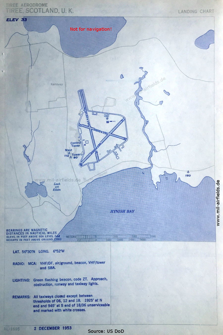
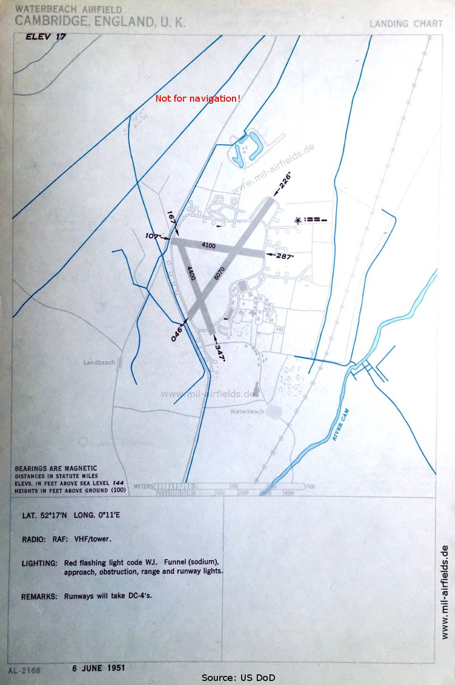
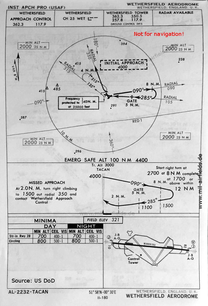
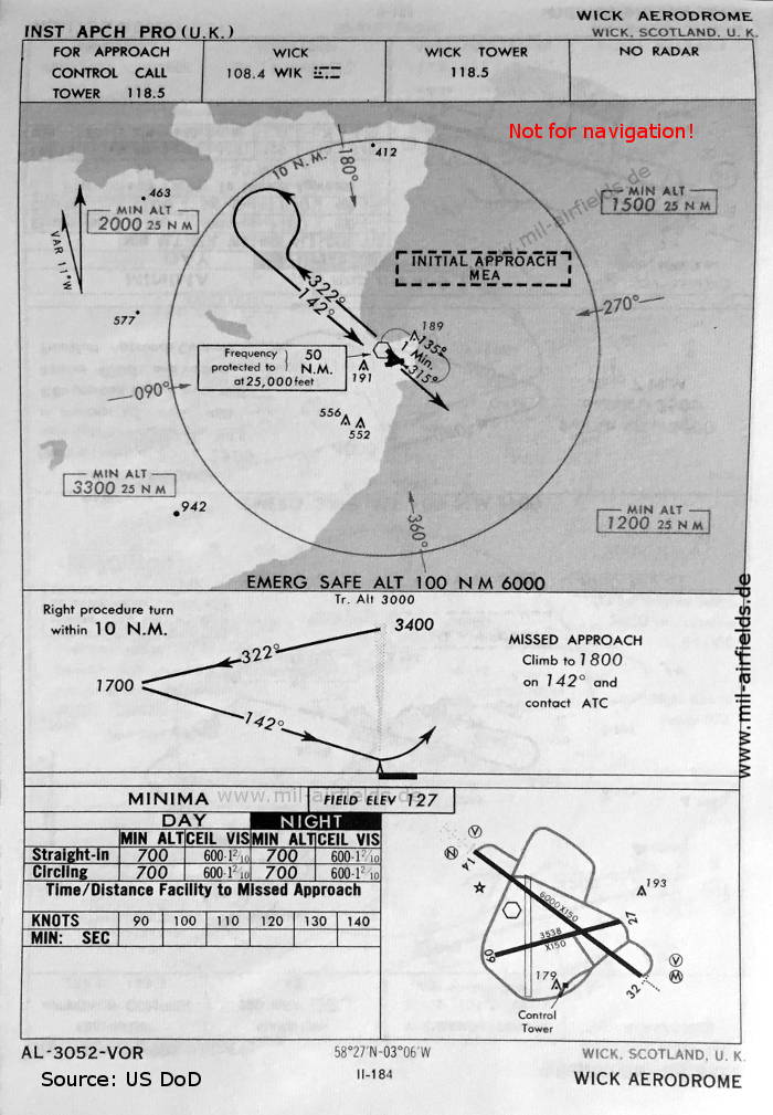
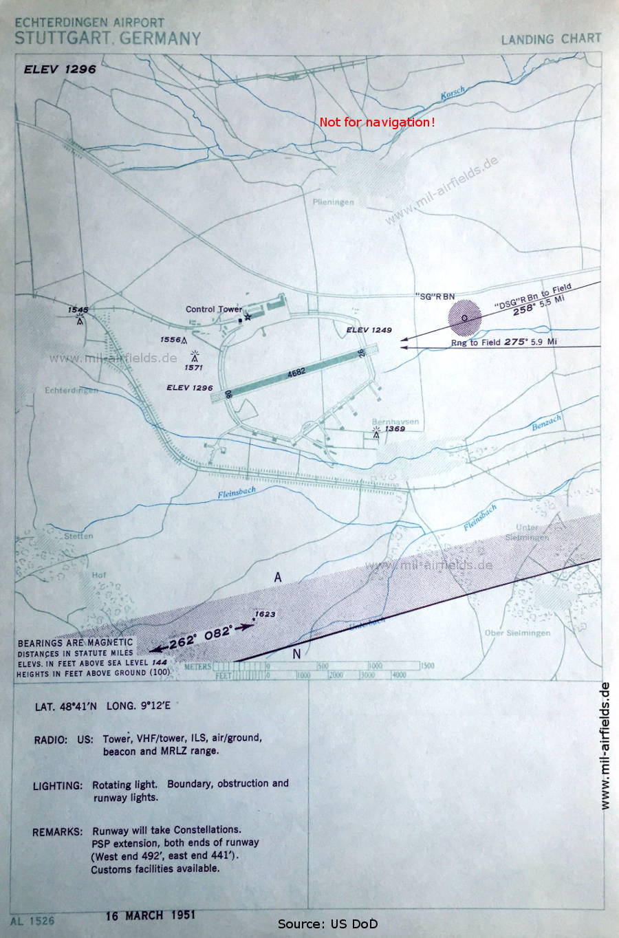
Historische Anflugkarten
Nur zur geschichtlichen Information, nicht zur Navigation oder zum Fliegen verwenden!


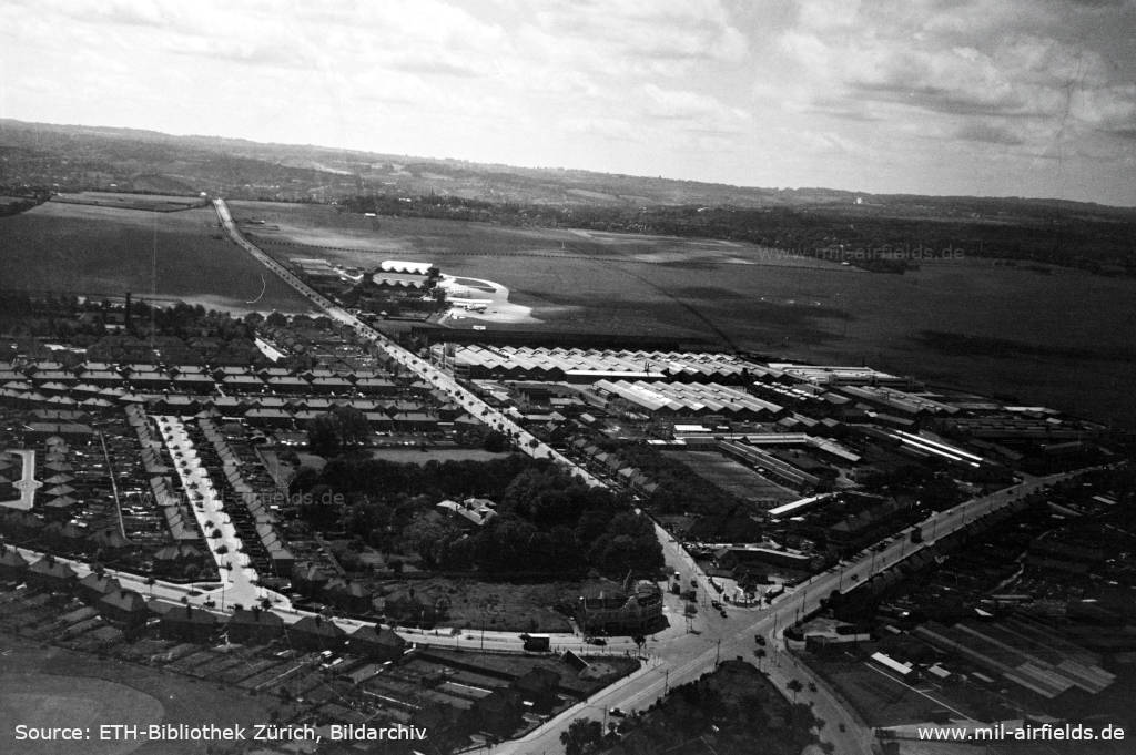


Titelbild: BOAC British Overseas Airline Cooperation Lockheed L-749A Constellation,G-ALAK. Quelle: ETH-Bibliothek Zürich, Bildarchiv/Stiftung Luftbild Schweiz / Fotograf: Swissair / LBS_SR03-04031, Lizenz: CC BY-SA 4.0
Links
https://atchistory.wordpress.com/2015/11/03/aerodr... - Aerodrome and approach charts - Interessante Seite über die Geschichte der Flugsicherung in Großbritannien, enthält auch alte Karten
http://pdboyinsuffolk.blogspot.com/2013/04/militar... - Military Low Flying Mapping in the UK
http://pdboyinsuffolk.blogspot.com/2012/11/the-gre... - The Green 1
http://www.ais.org.uk/ - UK AIP
http://www.ukairfields.org.uk/ - UK Airfields
https://atchistory.wordpress.com/2017/06/12/uk-air... - UK Airways, AERAD and Low Flying Maps
https://www.aidu.mod.uk/aip/index.html - UK Mil AIP
Empfohlen

Bildquellen sind auf der jeweiligen Zielseite angegeben, klicke auf die Vorschau um sie zu öffnen.