Nicosia Airport
RAF Nicosia, Διεθνές Αεροδρόμιο Λευκωσίας, Lefkoşa Uluslararası Havalimanı
Historical approach and aerodrome charts
For historical information only, do not use for navigation or aviation purposes!
| Coordinates | N350903 E0331635 (WGS84) Google Maps |
| Location indicator | LCNC |
The airport is closed since the Turkish invasion in 1974.
In the 1950s
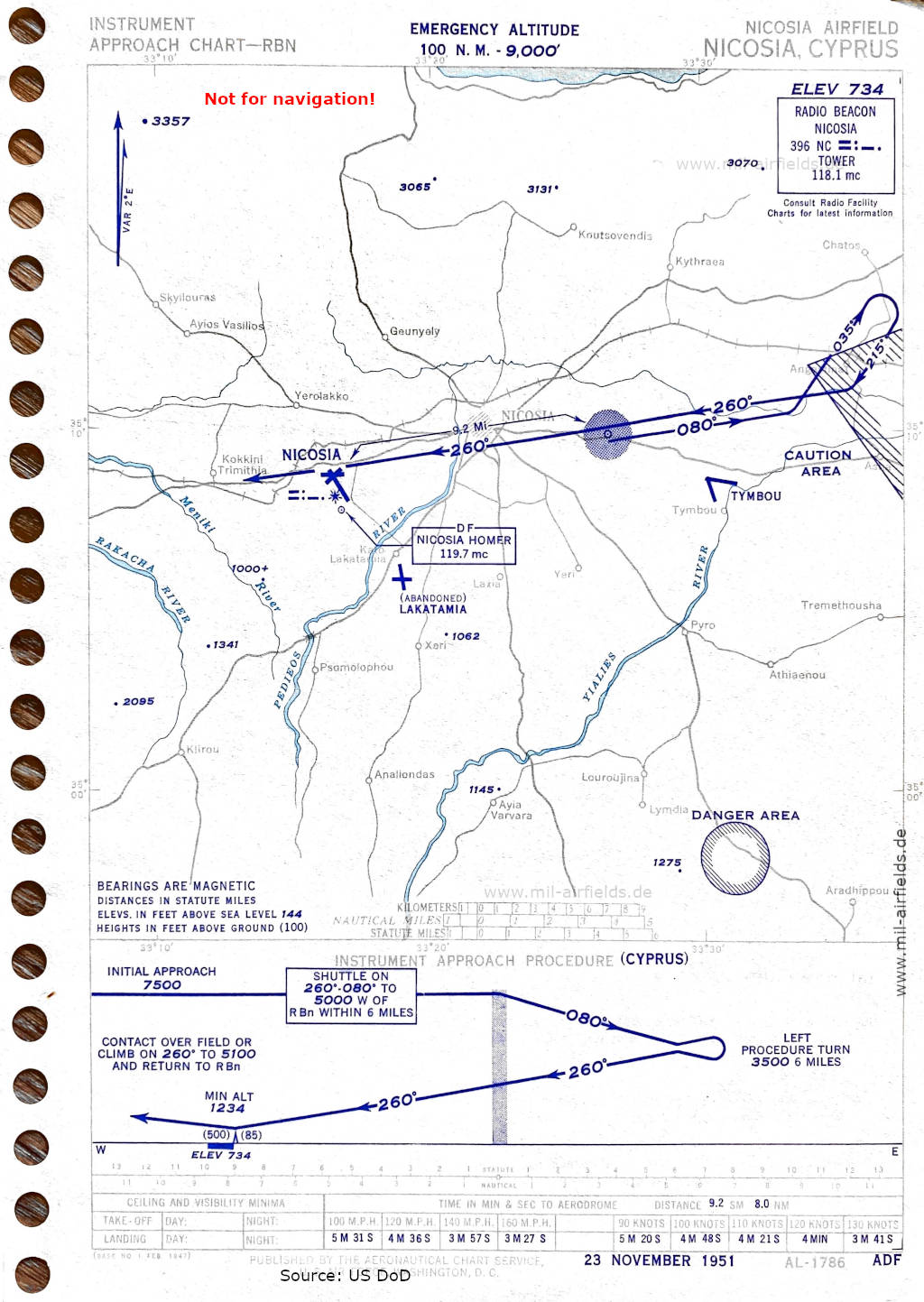
NDB approach (November 1951) (Source: US DoD)
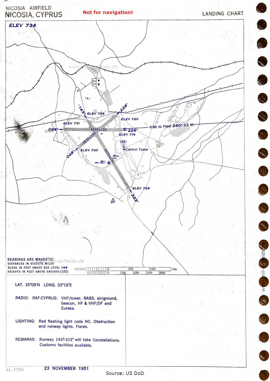
Airport map (November 1951) - There are three runways - 048/228: length 1088 m, width 46 m (3570 feet x 150 feet), 086/266: length 1381 m, width 46 m (4530 feet x 150 feet), 143/323: length 1820 m, width 46 m (5970 feet x 150 feet). (Source: US DoD)
In the 1960s
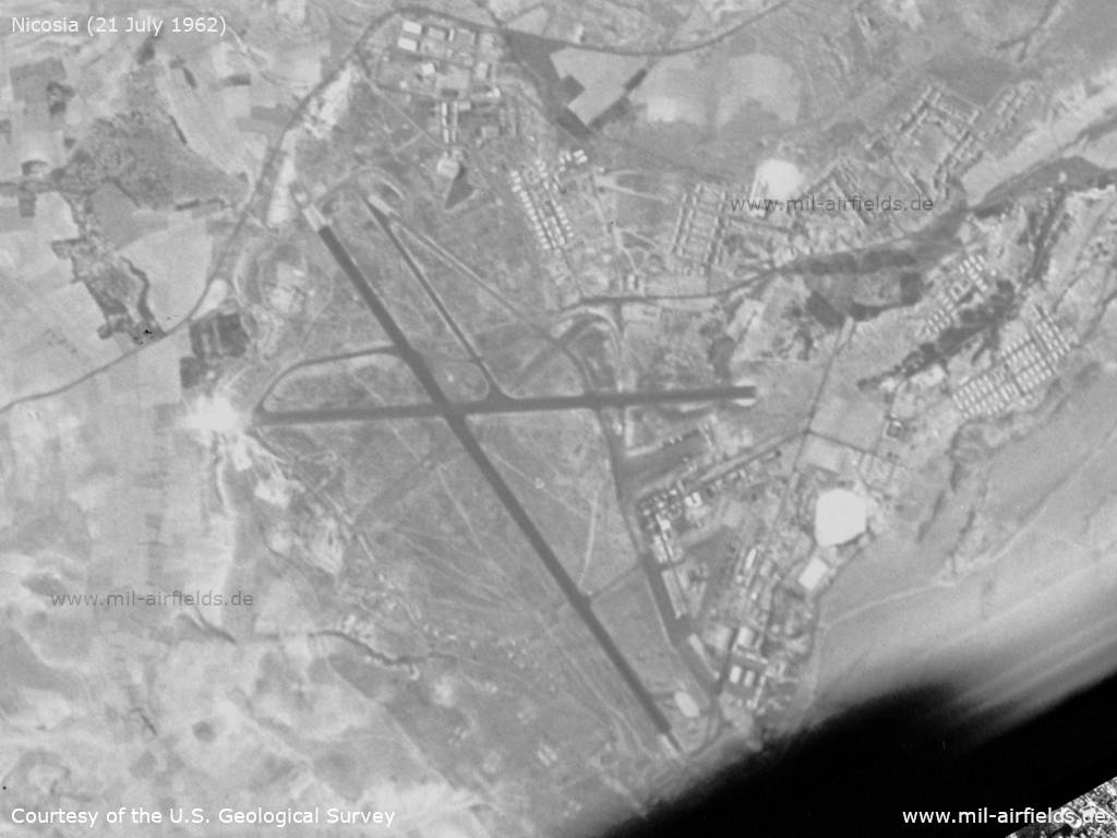
Satellite image from 21 July 1962 (Source: U.S. Geological Survey)
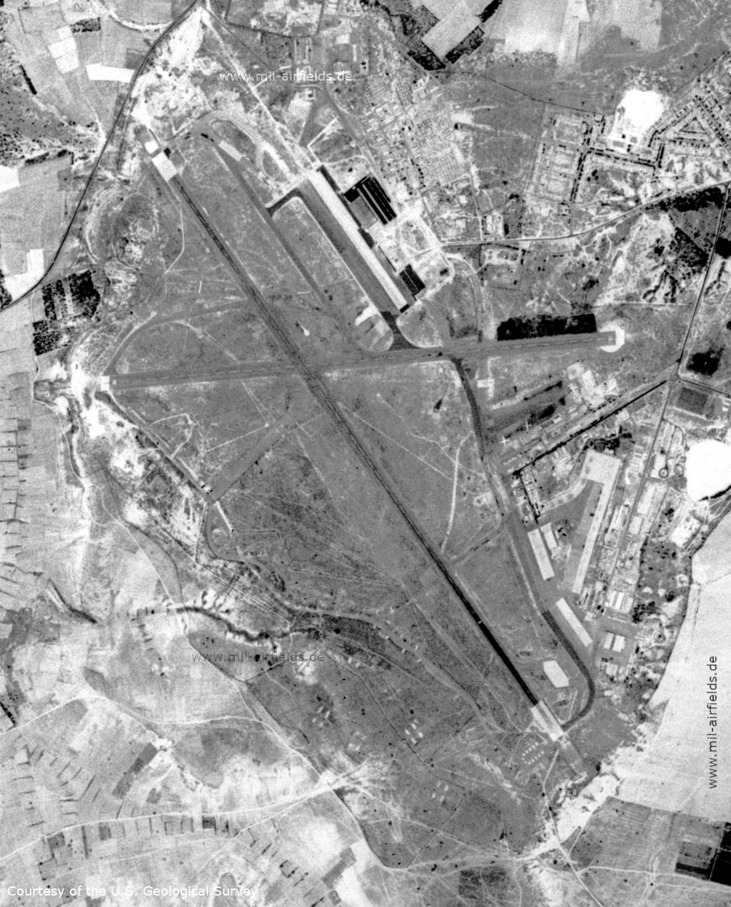
Satellite image from 28 June 1967
Index to the objects shown on the maps
Aerodromes:
- Lakatamia, Nikosia, Tymbou (Ercan)
Radio beacons with identifier:
- Nicosia NDB "NC", Eureka, BABS
Air traffic control / Communications:
- Nicosia Tower, Nicosia Homer
Source for all maps, if not marked otherwise: US Department of Defense (US DoD)