Fürth Industriehafen Airport
Nuremberg-Fürth Industriehafen Airfield, Fürth Industrie
Historical approach and aerodrome charts
For historical information only, do not use for navigation or aviation purposes!
| Coordinates | N492854 E0105712 (WGS84) Google Maps |
| Elevation | 1046 ft |
| Federal state | Bayern (Bavaria) |
Location Indicator: DDID
In the 1950s
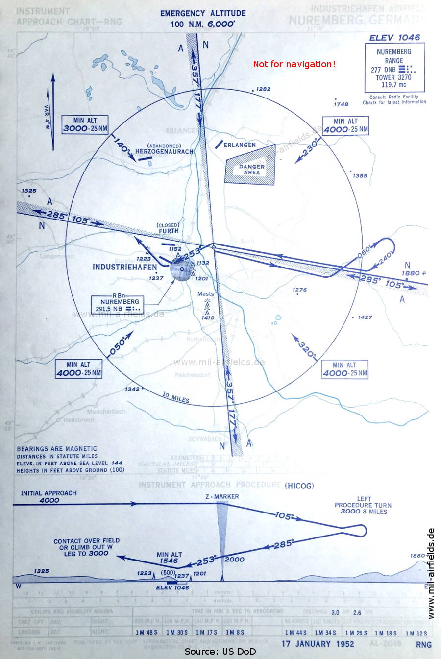
Range approach (January 1952) - Airfields in the vicinity: Erlangen, Fürth Atzenhof (geschlossen), Herzogenaurach. (Source: US DoD)
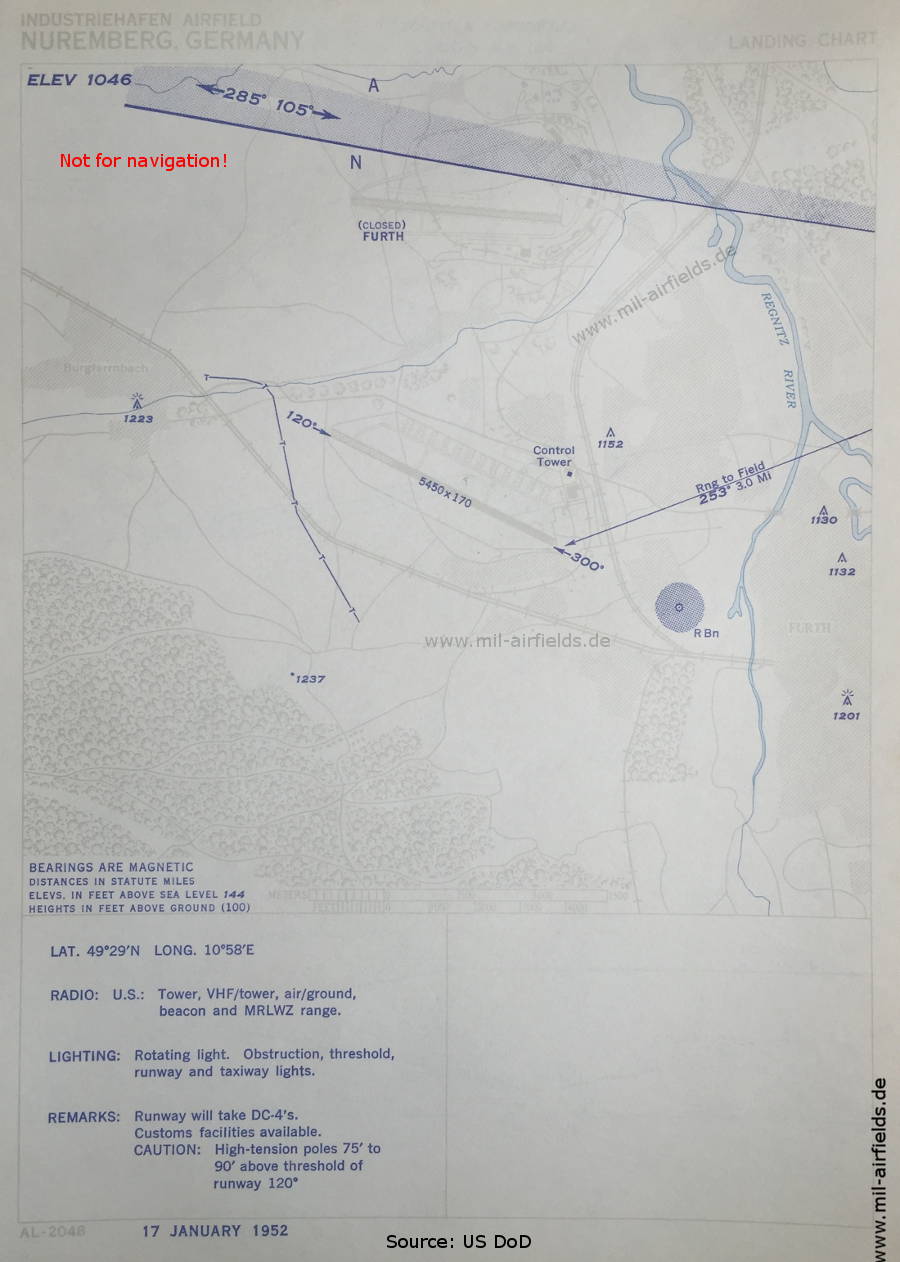
Aerodrome chart (January 1952) - The airfield is operated by US troops. In the north the closed airfield Fürth-Atzenhof is marked, the runway is made of perforated steel plates (PSP). (Source: US DoD)
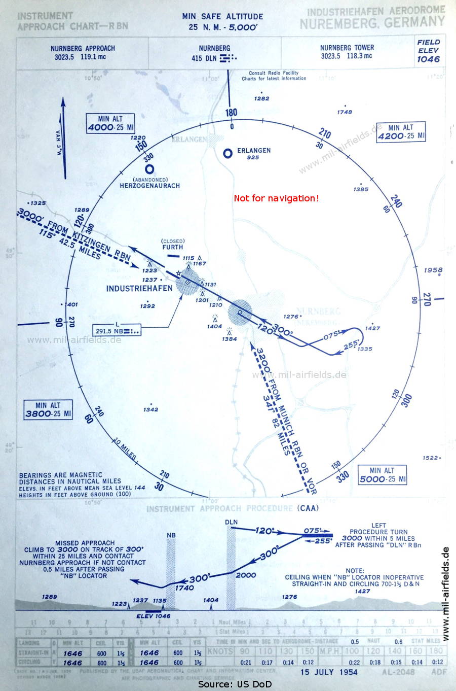
NDB approach (July 1954) (Source: US DoD)
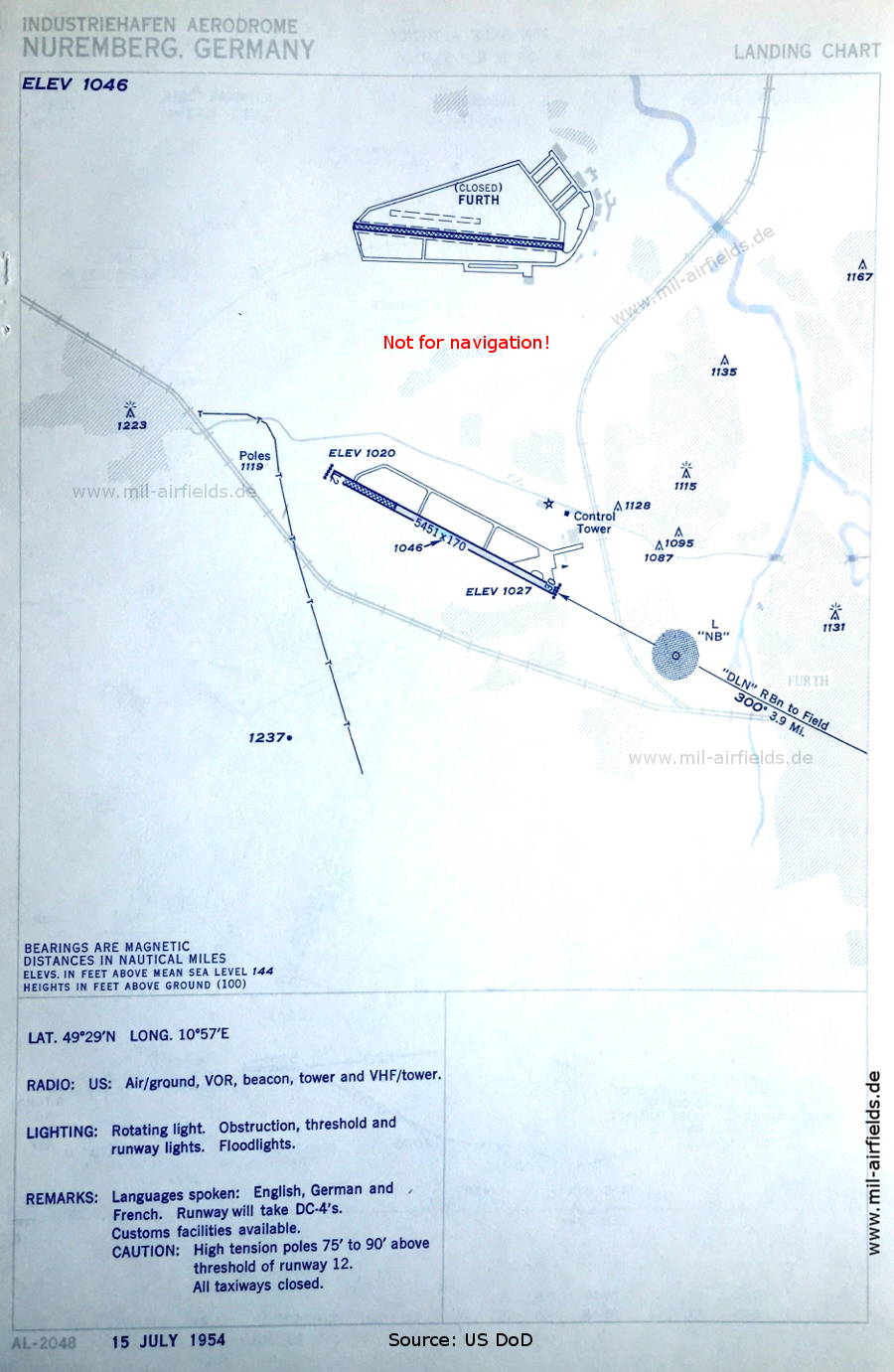
Aerodrome chart (July 1954) - Interesting is the indication of a VOR, as it is not shown on any other map. (Source: US DoD)
Source for all maps, if not marked otherwise: US Department of Defense (US DoD)
Recommended

Image credits are shown on the respective target page, click on the preview to open it.
Navigation
Approach and airfield charts - Federal Republic of Germany