Giebelstadt Air Base
Historical approach charts: DBGS, EDAG, EDEU, ETEU, EDQG
For historical information only, do not use for navigation or aviation purposes!
| Coordinates | N493853 E0095800 (WGS84) Google Maps |
| Elevation | 979 ft |
| Federal state | Bayern (Bavaria) |
| Location indicator | DBGS (195x), EDAG, EDEU (-1995), ETEU (1995-), EDQG (200x-) |
Source for all maps, if not marked otherwise: US Department of Defense (US DoD)
In the 1950s
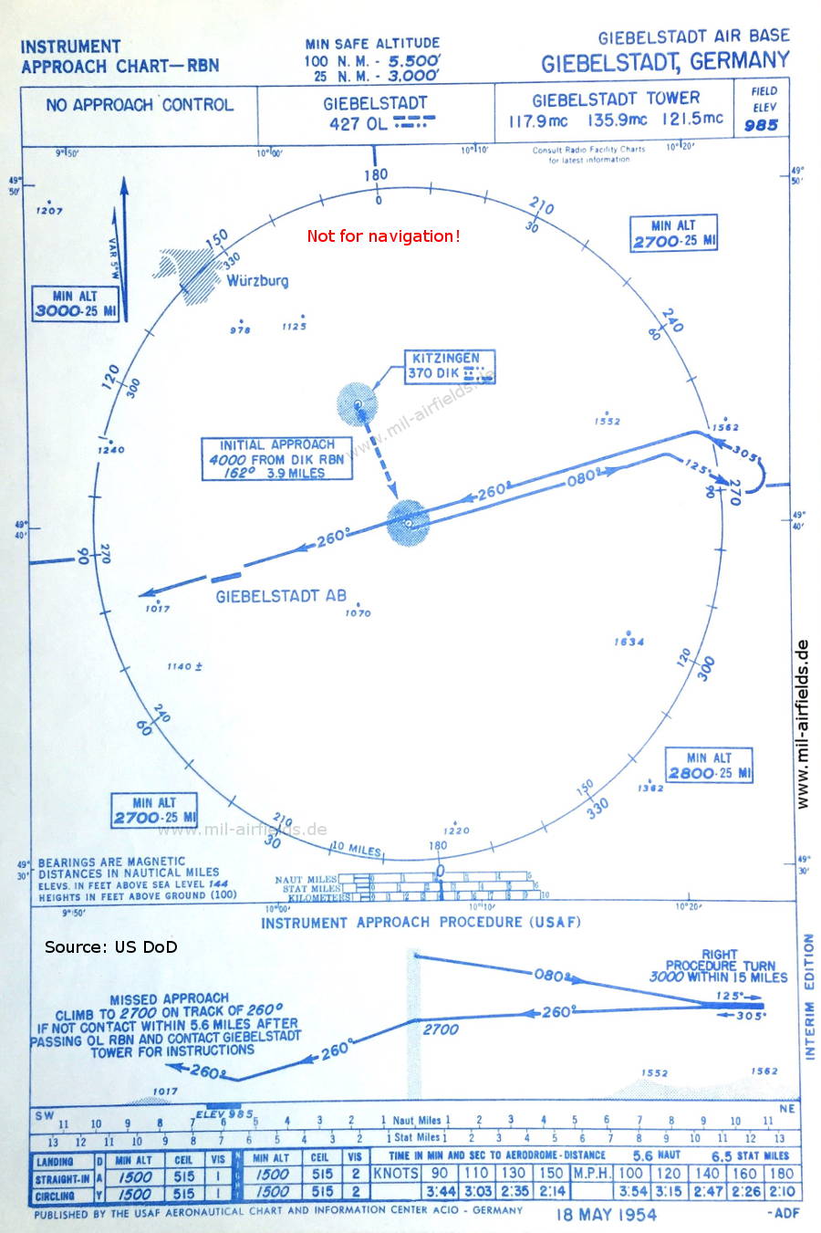
NDB approach (May 1954) - Interim edition. (Source: US DoD)
Navigation
Approach and airfield charts - Federal Republic of Germany