RAF Gutersloh, Germany
RAF Gutersloh
Historical approach and aerodrome charts
For historical information only, do not use for navigation or aviation purposes!
| Coordinates | N515522 E0081822 (WGS84) Google Maps |
| Elevation | 236 ft |
| Federal state | Nordrhein-Westfalen (North Rhine-Westphalia) |
| Location indicator | EDUO (-1995), ETUO (1995-2013) |
Location Indicator: DAGU, EDUO, ETUO
User: Royal Air Force (RAF), Army Air Corps (ACC)
In the 1960s
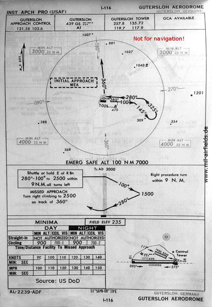
NDB approach runway 28 (October 1960) (Source: US DoD)
Source for all maps, if not marked otherwise: US Department of Defense (US DoD)
Navigation
Approach and airfield charts - Federal Republic of Germany