Spangdahlem Air Base (DBSP, EDAD, ETAD)
Historical approach charts
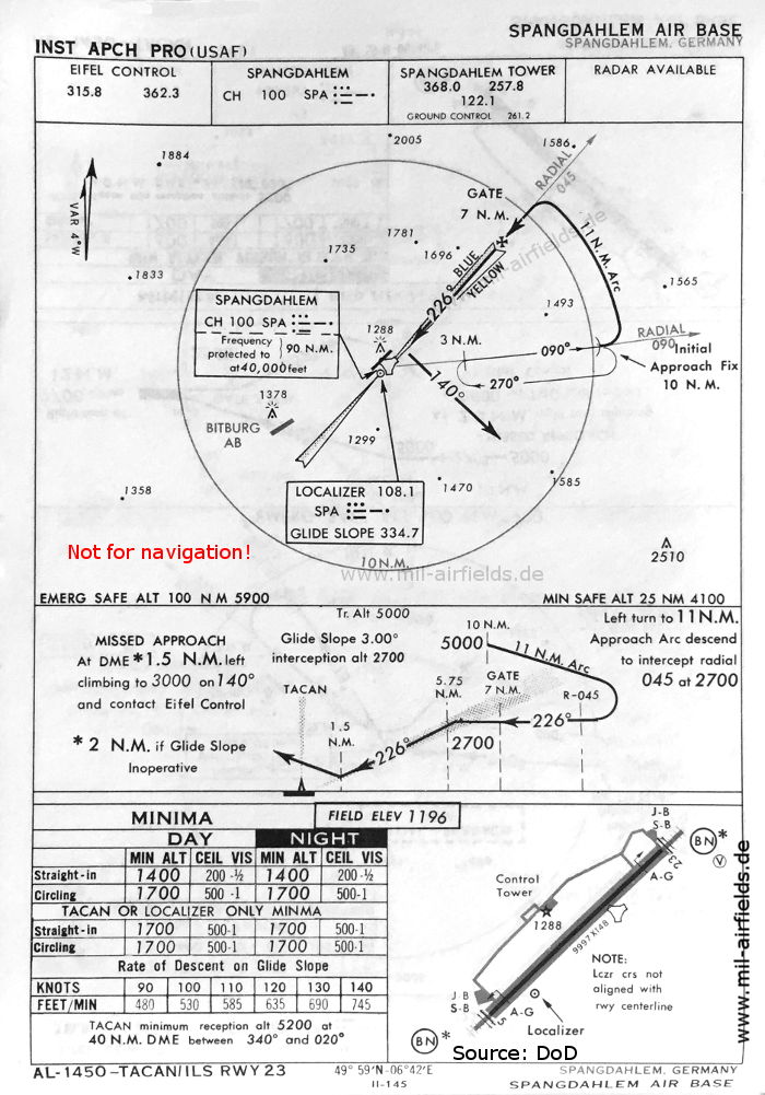
For historical information only, do not use for navigation or aviation purposes!
| Coordinates | N495835 E0064154 (WGS84) Google Maps |
| Federal state | Rheinland-Pfalz (Rhineland-Palatinate) |
Source for all maps, if not marked otherwise: US Department of Defense (DoD)
In the 1950s
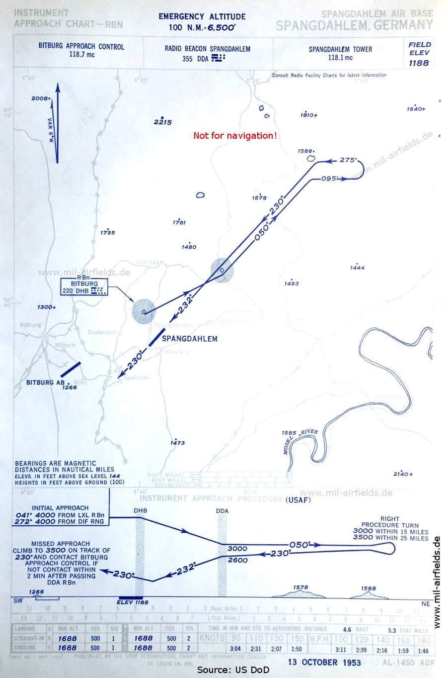
NDB approach (October 1953) (Source: US DoD)
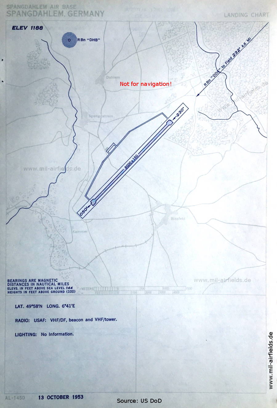
Aerodrome chart (October 1953) (Source: US DoD)
In the 1960s
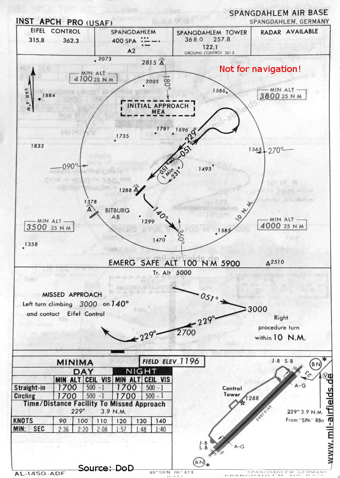
NDB approach runway 23 (May 1966) (Source: US DoD)
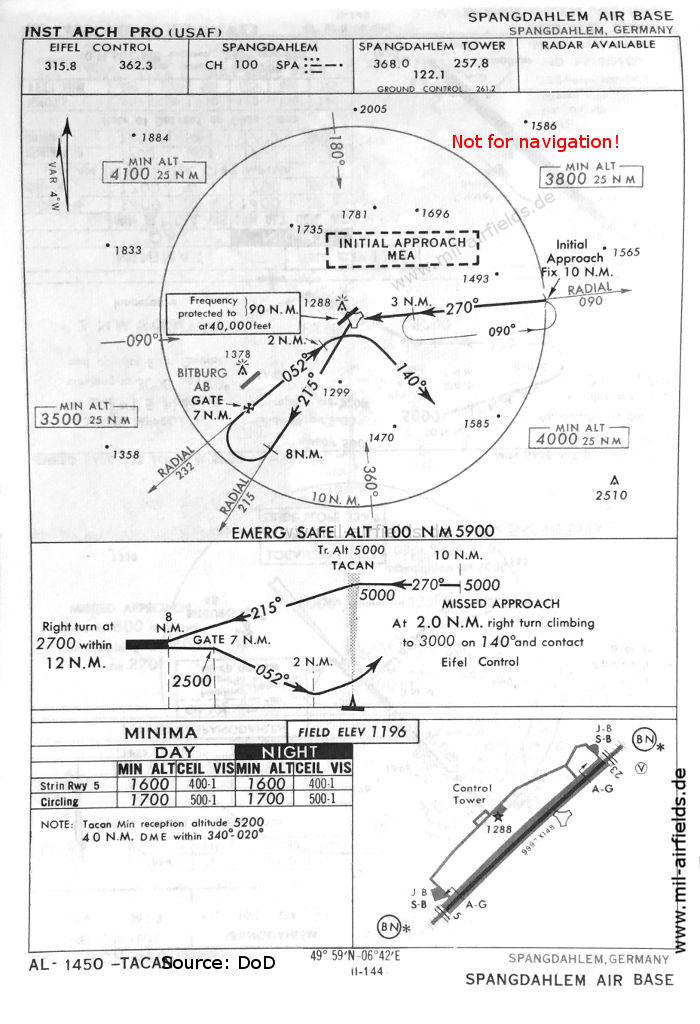
TACAN approach runway 05 (May 1966) (Source: US DoD)
ILS approach runway 23 (May 1966) (Source: US DoD)
Navigation
Approach and airfield charts - Federal Republic of Germany