Sylt Airfield
RAF Sylt
Historical approach charts - Federal Republic of Germany
For historical information only, do not use for navigation or aviation purposes!
| Coordinates | N545442 E0082033 (WGS84) Google Maps |
| Elevation | 51 ft |
| Location indicator | EDNY (197x), EDHX (198x), EDXW (200x) |
Source for all maps, if not marked otherwise: US Department of Defense (DoD)
In the 1960s
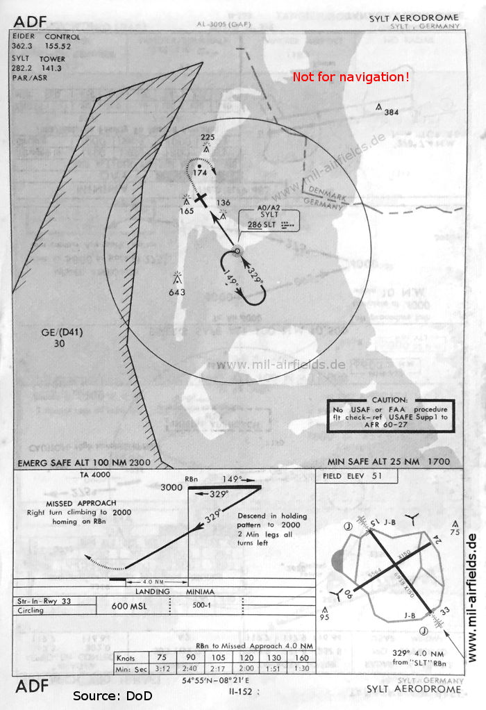
NDB approach runway 33 (May 1966) - The approach control is "Eider Control" at Husum. (Source: DoD)
Navigation
Approach and airfield charts - Federal Republic of Germany