Dinard Pleurtuit Airport
Aéroport Dinard Bretagne, Aéroport de Dinard-Pleurtuit-Saint-Malo
Historical approach and aerodrome charts
For historical information only, do not use for navigation or aviation purposes!
| Coordinates | N483521 W0020449 (WGS84) Google Maps |
| Region | Bretagne |
| Location indicator | LFRD |
In the 1950s
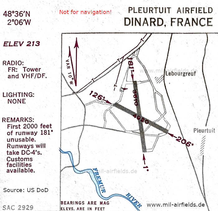
Aerodrome (October 1950) - There are two runways - 001/181: length 1100 m (3610 feet), 126/206: length 1500 m (4920 feet). (Source: US DoD)
Index to the objects shown on the maps
Radio beacons / Radiophares aéronautiques:
Air traffic control / Contrôle de la circulation aérienne:
- Tower
Places
- Lebourgreuf
- Pleurtuit
Source for all maps, if not marked otherwise: US Department of Defense (US DoD)