Thessaloniki Airport
Κρατικός Αερολιμένας Θεσσαλονίκης "Μακεδονία", Mikra Air Base
Historical approach and aerodrome charts
For historical information only, do not use for navigation or aviation purposes!
| Coordinates | N403111 E0225812 (WGS84) Google Maps |
| Location indicator | LGTS |
Lake Koroneia / Λίμνη Κορώνεια
In the 1950s
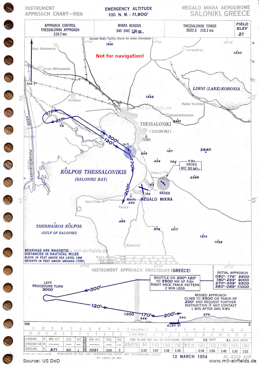
Approach (March 1954) (Source: US DoD)
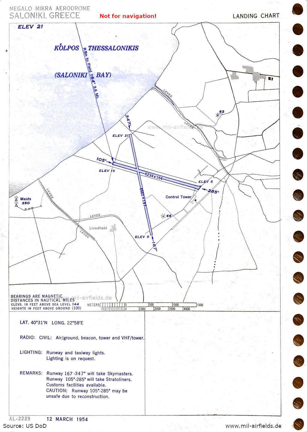
Aerodrome (March 1954) - There are two runways - 105/285: length 1900 m, width 50 m (6234 feet x 164 feet), 167/347: length 2000 m, width 60 m (6562 feet x 197 feet). (Source: US DoD)
Index to the objects shown on the maps
Aerodromes:
- Saloniki Megalo Mikra, Sedes
Radio beacons with identifier:
- Mikra NDB "SWC"
- Sedes NDB "SD"
Air traffic control / Communications:
- Thessaloniki Approach, Thessaloniki Tower
Places:
- Agia Triada / Αγία Τριάδα, Agios Athanasios / , Άγιος Αθανάσιος, Agios Vasileios / Άγιος Βασίλειος, Asvestochori / Ασβεστοχώρι
- Epanomi / Επανομή
- Lake Koroneia / Λίμνη Κορώνεια
- Livadaki
- Nea Mesimvria / Νέα Μεσημβρία
- Peraia / Περαία
- Sindos / Σίνδος
- Thermaic Gulf / Θερμαϊκός Κόλπος, Thermi / Θέρμη, Thessaloniki / Θεσσαλονίκη
Source for all maps, if not marked otherwise: US Department of Defense (US DoD)
 mil-airfields.de at Facebook