Luxembourg Findel Airport
Sandweiler
Historical approach and aerodrome charts
For historical information only, do not use for navigation or aviation purposes!
| Coordinates | N493737 E0061246 (WGS84) Google Maps |
In the 1950s
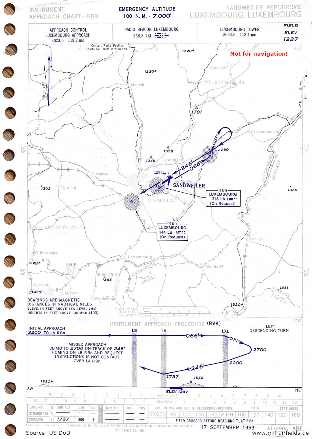
NDB approach runway 25 (September 1953) (Source: US DoD)
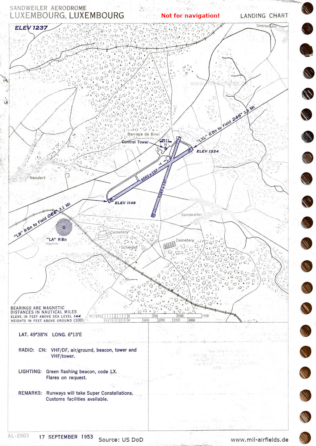
Aerodrome (September 1953) - There are two runways - 07/25: length 2000 m, width 60 m (6561 feet x 197 feet), 03/21: length 1600 m, width 60 m (5249 feet x 197 feet). (Source: US DoD)
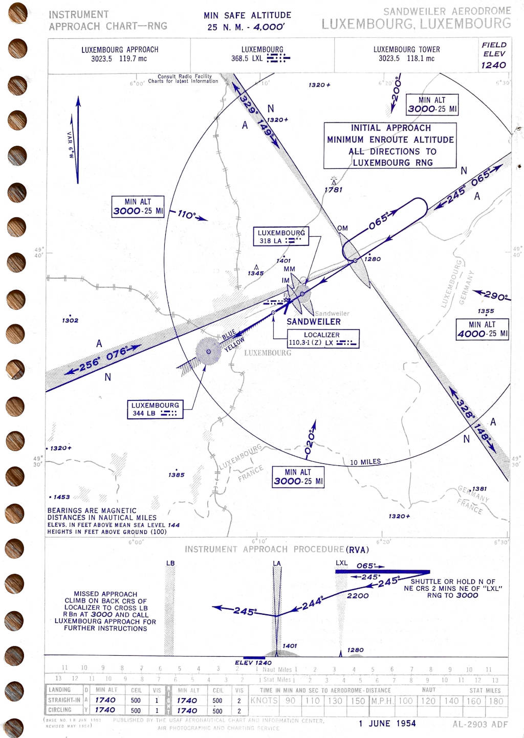
Range approach runway 25 (June 1954) (Source: US DoD)
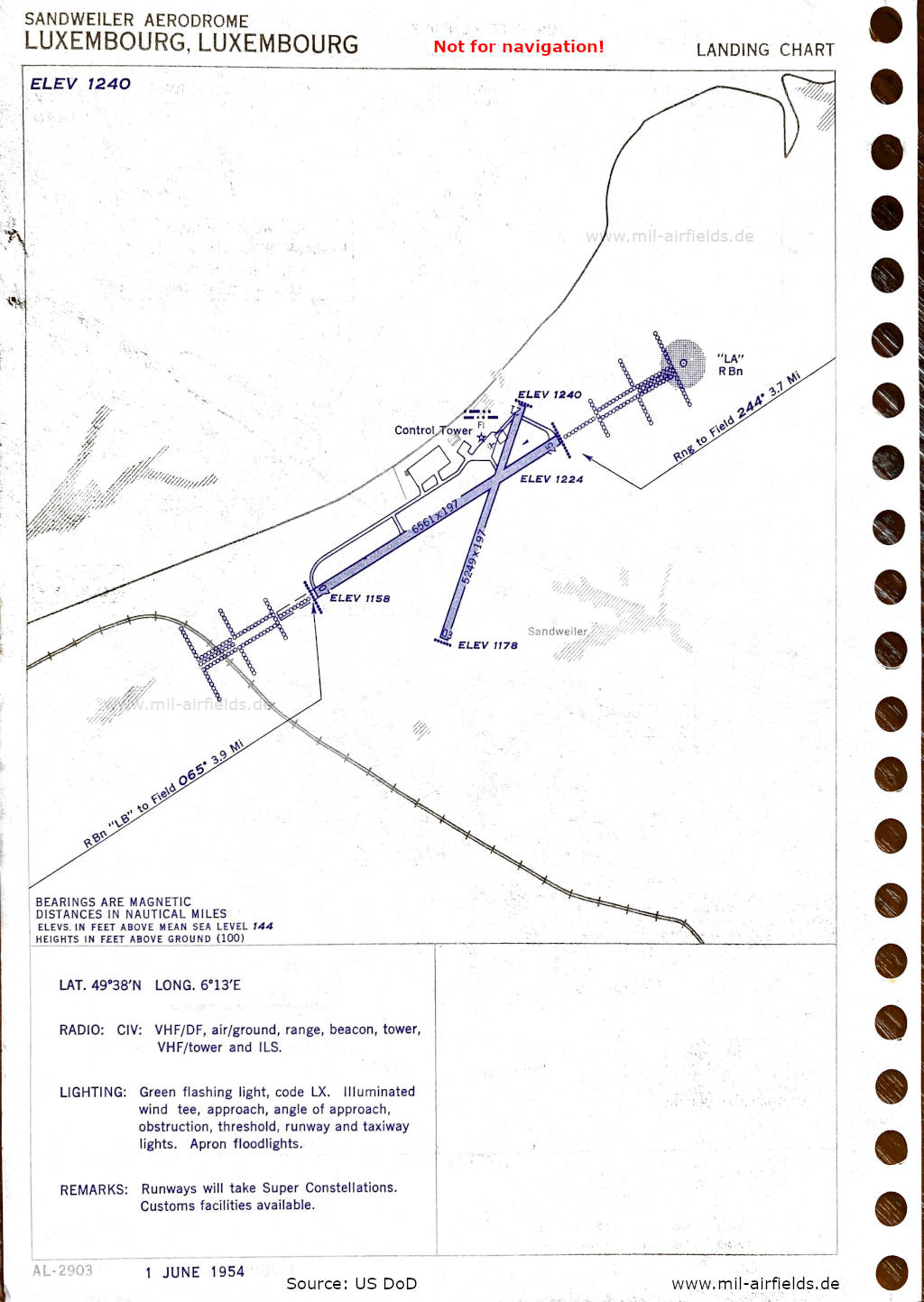
Airport map (June 1954) (Source: US DoD)
Index to the objects shown on the maps
Radio beacons with identifier / Radiophares aéronautiques:
- Luxembourg Range "LXL", NDB "LA", "LB", "LXL", Localizer "LX
Air traffic control / Contrôle de la circulation aérienne:
- Luxembourg Approach, Luxembourg Tower
Places
- Audun-le-Tiche
- Barriere de Birel, Bettembourg
- Consdorf
- Differdange, Dudelange
- Esch-sur-Alzette
- Garnich, Grevenmacher
- Hamm
- Mamer, Mersch, Mondorf-les-Bains
- Neudorf
- Remich, Rumelange
- Sandweiler, Senningen
- Villerupt
Source for all maps, if not marked otherwise: US Department of Defense (US DoD)
Recommended

Image credits are shown on the respective target page, click on the preview to open it.
 mil-airfields.de at Facebook