Malta Luqa Airport
RAF Luqa, Ajruport Internazzjonali ta' Malta, Malta International Airport
Historical approach and aerodrome charts
For historical information only, do not use for navigation or aviation purposes!
| Coordinates | N355053 E0142909 (WGS84) Google Maps |
| Location indicator | LMML |
In the 1950s
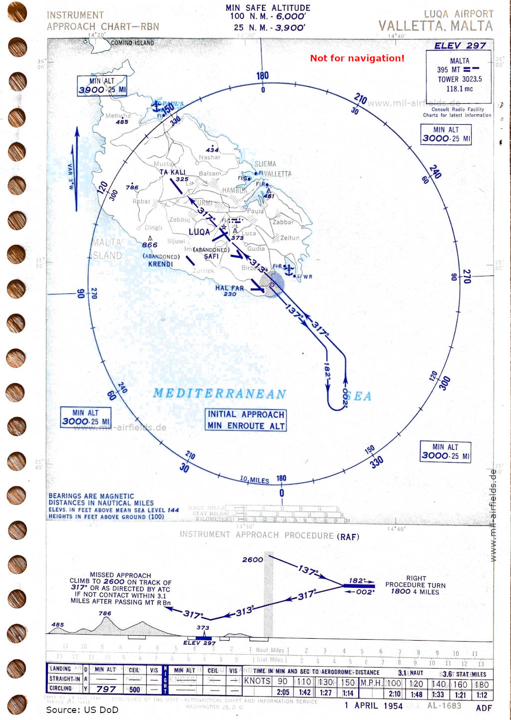
NDB approach runway 32 (April 1954) (Source: US DoD)
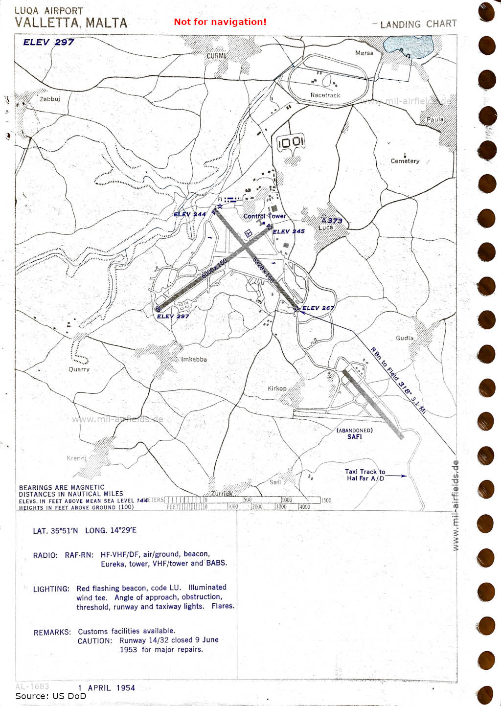
Airport map (April 1954) - There are two runways - 06/24: length 1829 m, width 46 m (6000 feet x 150 feet), 14/32: length 1624 m, width 46 m (5328 feet x 150 feet). Noteworthy is the taxiway from Safi airfield to Ħal-Far airfield. (Source: US DoD)
Index to the objects shown on the maps
Aerodromes:
- Hal Far, Krendi, Luqa, Safi, San Pawl il-Baħar / St. Paul’s Bay, Ta Kali
Radio beacons with identifier:
- Malta NDB "MT", Eureka, BABS
Air traffic control / Communications:
- Malta Tower
Places:
- Ħal Balzan, Birżebbuġa
- Dingli
- Il-Gudja
- Imqabba
- Kirkop
- Marsa, il-Mellieħa
- Naxxar
- Ħal Qormi, Qrendi
- Rabat, Raħal Ġdid / Paola
- Ħal Safi
- Ħaż-Żabbar, Ħaż-Żebbuġ, Iż-Żejtun, Żurrieq
Source for all maps, if not marked otherwise: US Department of Defense (US DoD)
 mil-airfields.de at Facebook