Bodø Airport
Bodø lufthavn, Bodø hovedflystasjon, Luftforsvarsbase Bodø, Bodo
Historical approach and aerodrome charts
For historical information only, do not use for navigation or aviation purposes!
| Coordinates | N671608 E0142139 (WGS84) Google Maps |
| Location indicator | ENBO |
In the 1960s
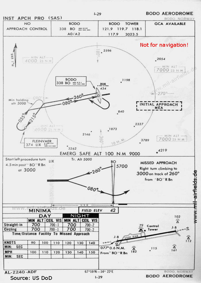
NDB approach runway 08 (October 1960) - There is one runway - 08/26: length 2895 m, width 45 m (9500 feet x 148 feet). (Source: US DoD)
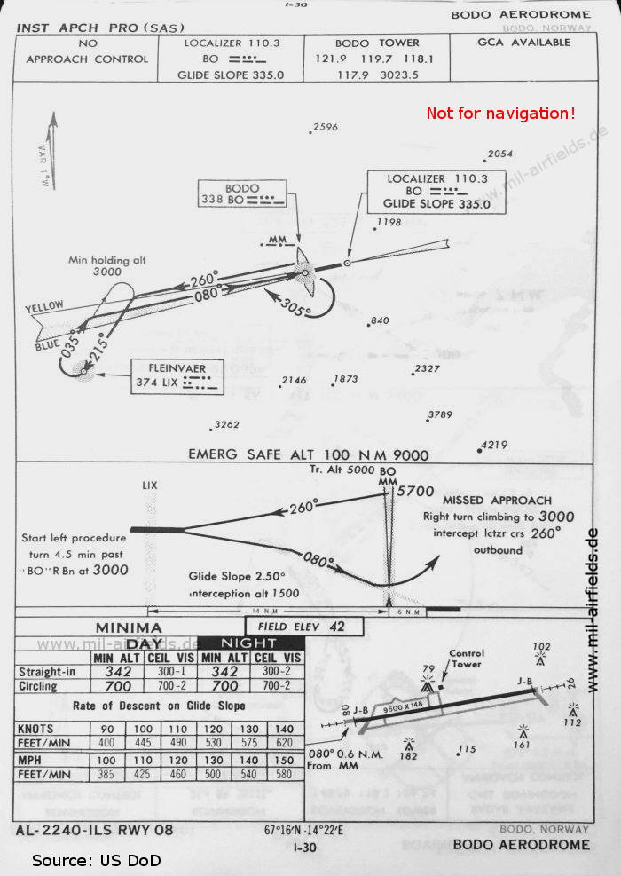
ILS approach runway 08 (October 1960) (Source: US DoD)
Index to the objects shown on the maps
Radio beacons / Radiofyret:
- Bodø NDB "BO", ILS Localizer "BO", Middle Marker,
- Fleinvær (Fleinvaer) NDB "LIX"
Air traffic control / Flygekontrolltjeneste:
- Bodø Tower
Source for all maps, if not marked otherwise: US Department of Defense (US DoD)
 mil-airfields.de at Facebook