Kristiansand Kjevik Airport
Kristiansand lufthavn, Kjevik
Historical approach and aerodrome charts
For historical information only, do not use for navigation or aviation purposes!
| Coordinates | N581218 E0080511 (WGS84) Google Maps |
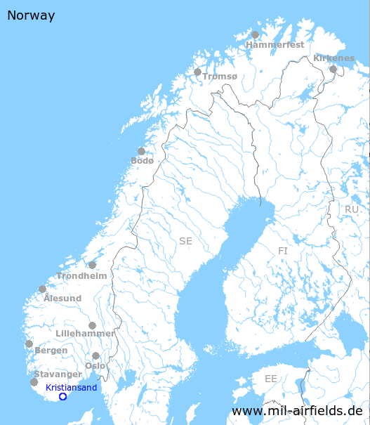
| Region | Agder, Sørlandet, Skagerrak, Kristiansandsfjord, Topdalsfjord |
| Location indicator | ENCN |
In the 1940s
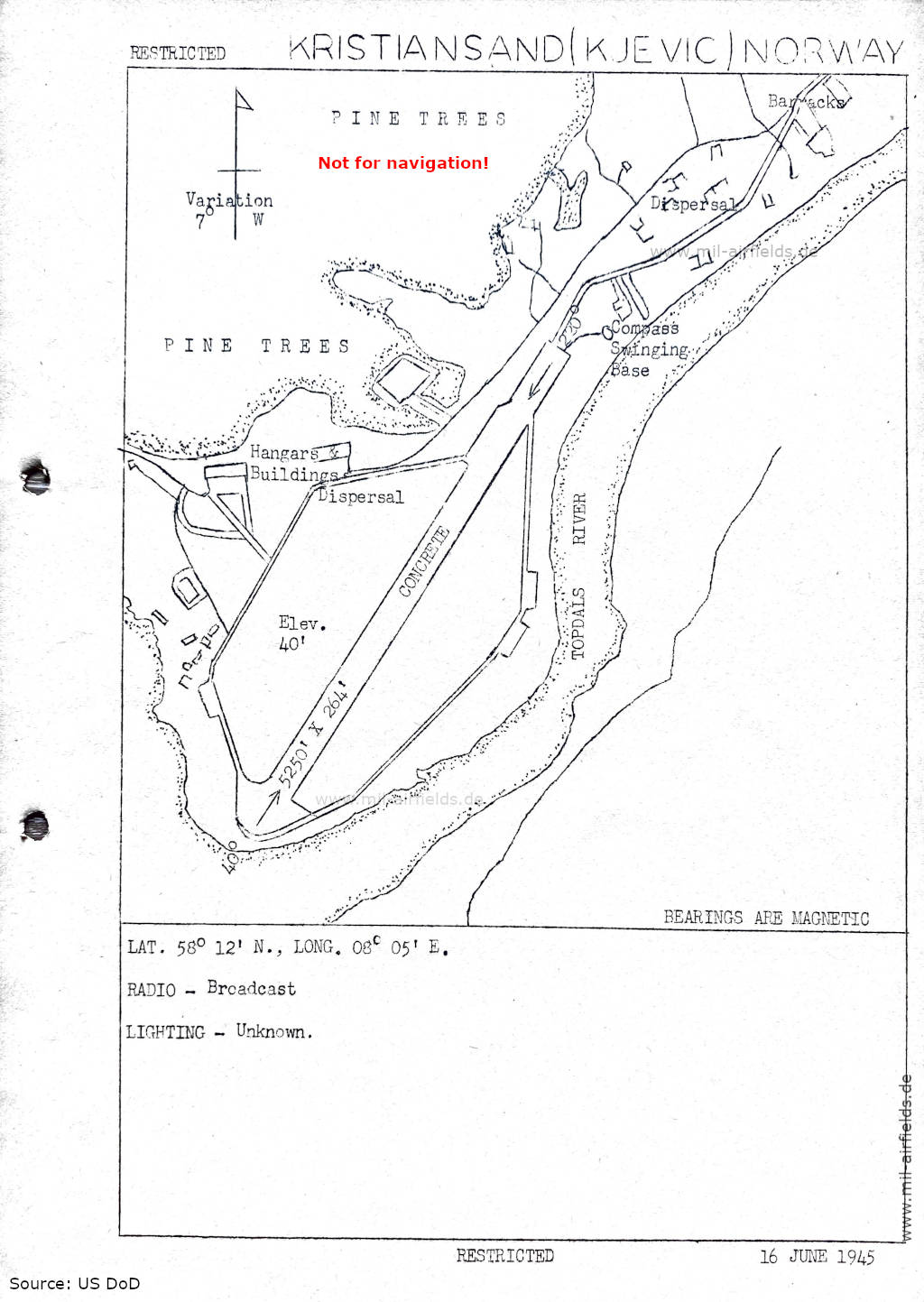
Airfield (June 1945) (Source: US DoD)
In the 1950s
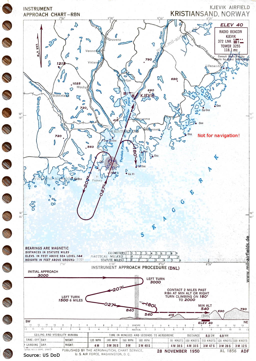
NDB approach (November 1950) (Source: US DoD)

Aerodrome (November 1950) - There is one runway - 040/220: length 1521 m (4990 feet). (Source: US DoD)
In the 1960s
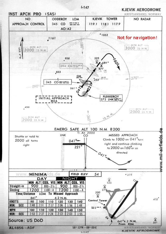
NDB approach runway 04 (October 1960) (Source: US DoD)
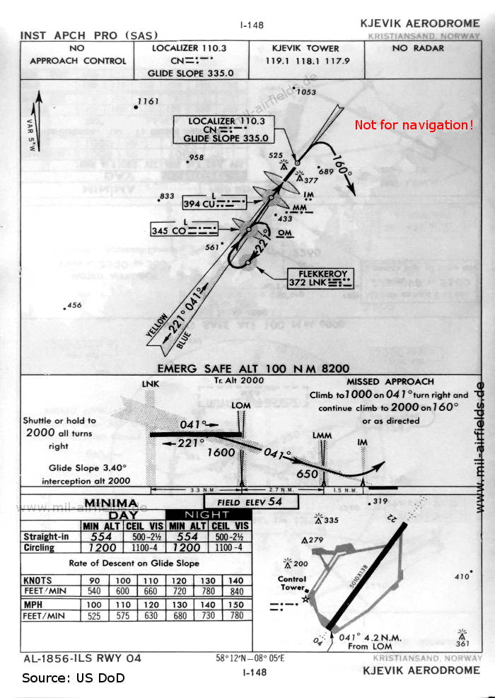
ILS approach runway 04 (October 1960) (Source: US DoD)
Index to the objects shown on the maps
Radio beacons / Radiofyret:
- Flekkeroy (Flekkerøy / Flekkerøya) NDB "LNK"
- Kjevik NDB "LNK", Locator "CO", "CU", ILS Localizer "CN", Outer Marker, Middle Marker, Inner Marker
Air traffic control / Flygekontrolltjeneste:
- Kjevik Tower
Source for all maps, if not marked otherwise: US Department of Defense (US DoD)
 mil-airfields.de at Facebook