Oslo Gardermoen Airport
Oslo lufthavn, Gardermoen flystasjon
Historical approach and aerodrome charts
For historical information only, do not use for navigation or aviation purposes!
| Coordinates | N601140 E0110557 (WGS84) Google Maps |
| Location indicator | ENGM |
In the 1950s
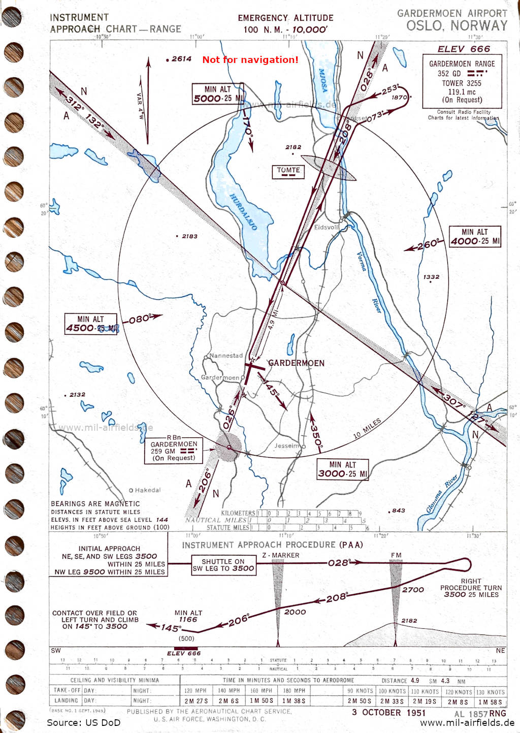
Range approach (October 1951) (Source: US DoD)
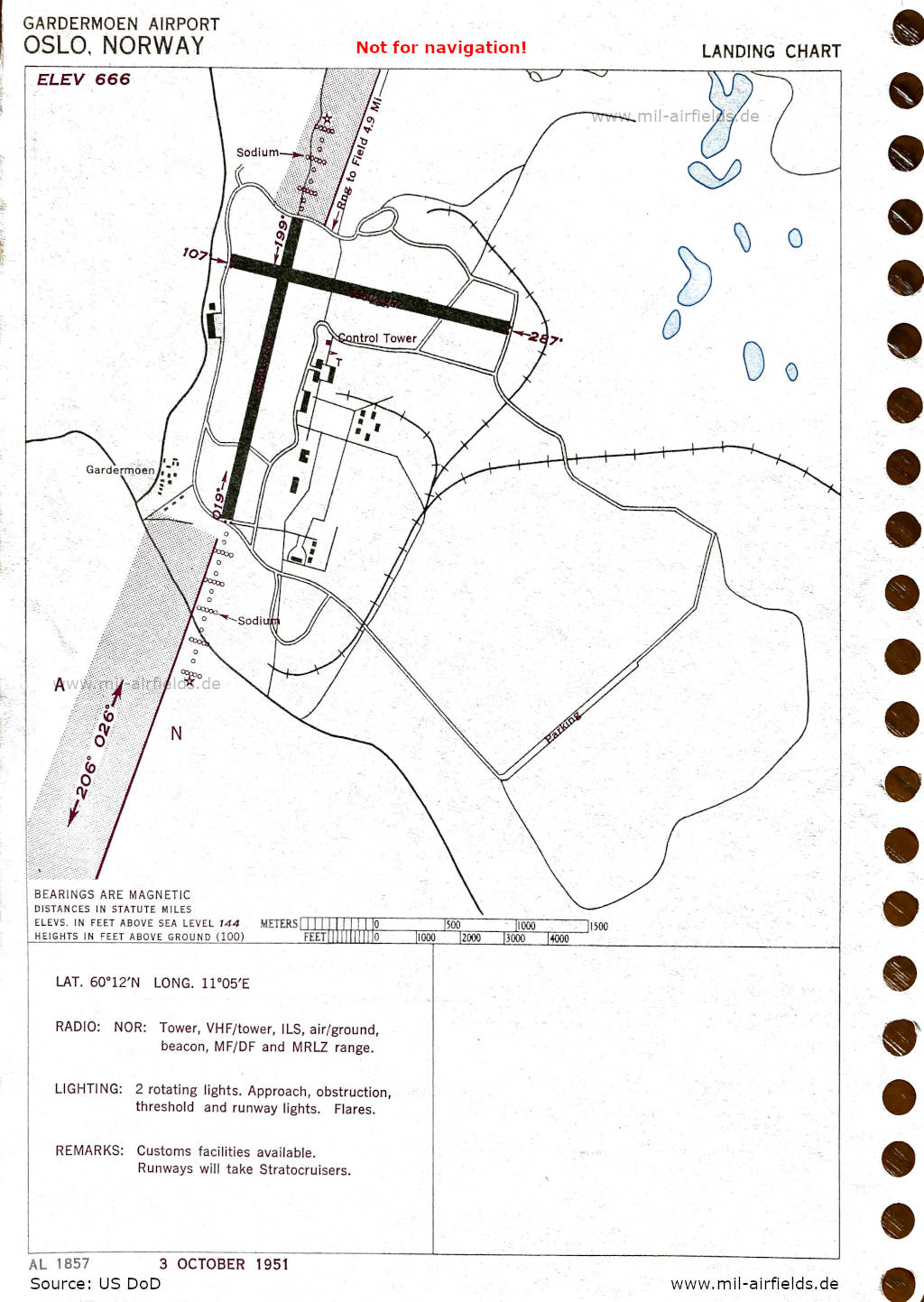
Airport map (October 1951) - There are two runways - 019/199: length 1999 m, width 50 m (6560 feet x 164 feet), 107/287: length 1999 m, width 80 m (6560 feet x 262 feet). At the beginning of each approach light system is a rotating beacon. In the south east is a remote parking area, see "Parking" at the bottom right. (Source: US DoD)
In the 1960s
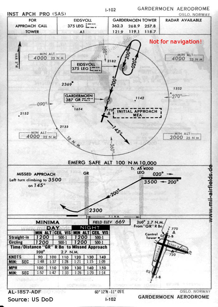
NDB approach runway 20 (October 1960) - Now the runways are - 02/20: length 2500 m, width 50 m (8202 feet x 164 feet), 11/29: length 1999 m, width 79 m (6560 feet x 260 feet). (Source: US DoD)
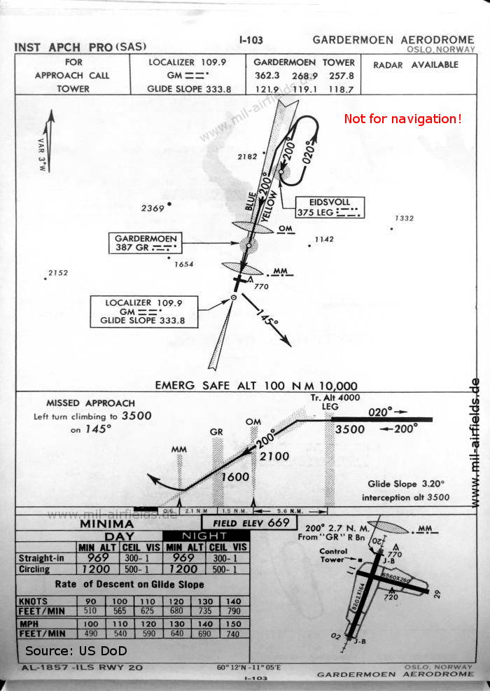
ILS approach runway 20 (October 1960) (Source: US DoD)
Index to the objects shown on the maps
Radio beacons with identifier / Radiofyret:
- Eidsvoll NDB "LEG"
- Gardermoen Range "GD", NDB "GM", "GR", ILS Localizer "GM", Outer Marker, Middle Marker
- Tomte Fan Marker
Air traffic control / Communications / Flygekontrolltjeneste:
- Gardermoen Tower
Places:
- Eidsvoll
- Gardermoen, Glomma
- Hurdalsjøen
- Jessheim
- Langset
- Mjøsa
- Nannestad
- Vorma
Source for all maps, if not marked otherwise: US Department of Defense (US DoD)
 mil-airfields.de at Facebook