Lajes Air Base, Azores
Base Aérea das Lajes, Base Aérea Nº 4, BA4
Historical approach and aerodrome charts
Base Aérea das Lajes / Base Aérea Nº 4 / BA4 / Lages, Lagens, Terceira, Açores
For historical information only, do not use for navigation or aviation purposes!
| Coordinates | N384551 W0270535 (WGS84) Google Maps |
Location Indicator: LPLA
In the 1950s
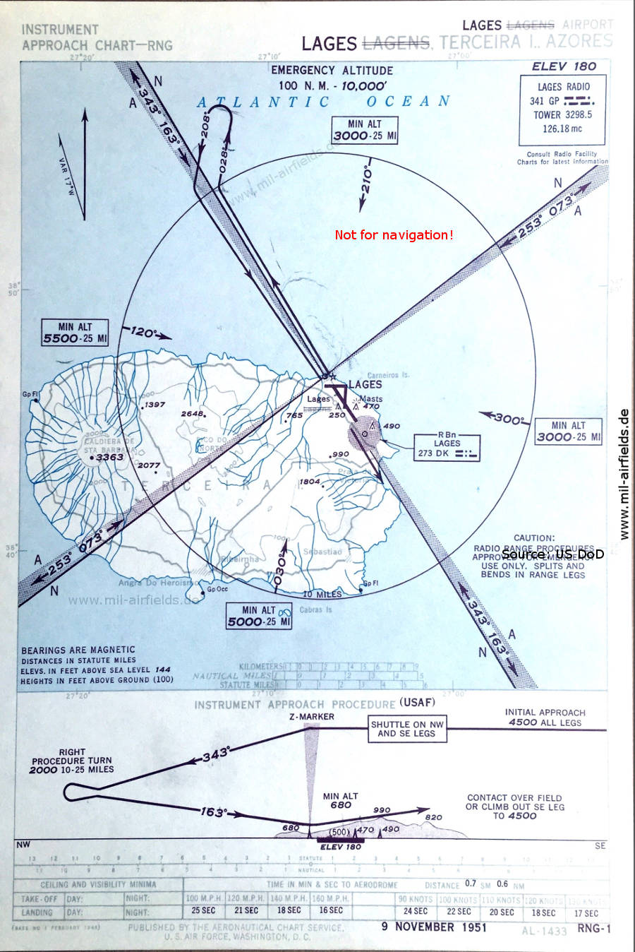
Range approach runway 16 (November 1951)
(Source: US DoD)
(Source: US DoD)
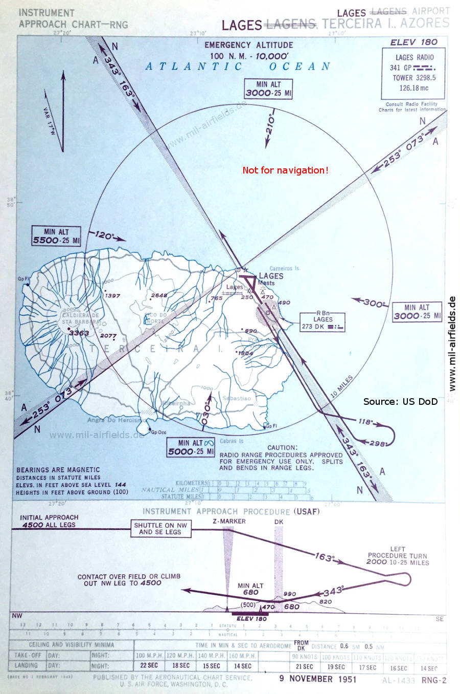
Range approach runway 34 (November 1951)
(Source: US DoD)
(Source: US DoD)
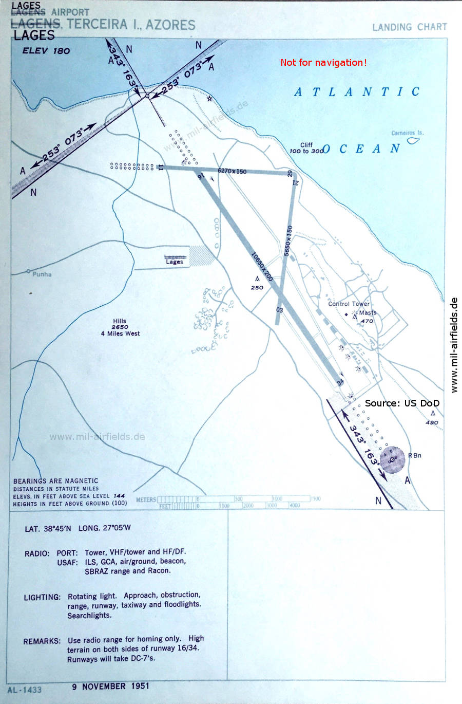
Aerodrome (November 1951)
There are three runways: 03/21 with 1722 m x 46 m (5650 feet x 150 feet), 11/29 with 1911 m x 46 m (6270 feet x 150 feet), 16/34 with 3246 m x 61 m (10650 feet x 200 feet).
(Source: US DoD)
There are three runways: 03/21 with 1722 m x 46 m (5650 feet x 150 feet), 11/29 with 1911 m x 46 m (6270 feet x 150 feet), 16/34 with 3246 m x 61 m (10650 feet x 200 feet).
(Source: US DoD)
In the 1960s
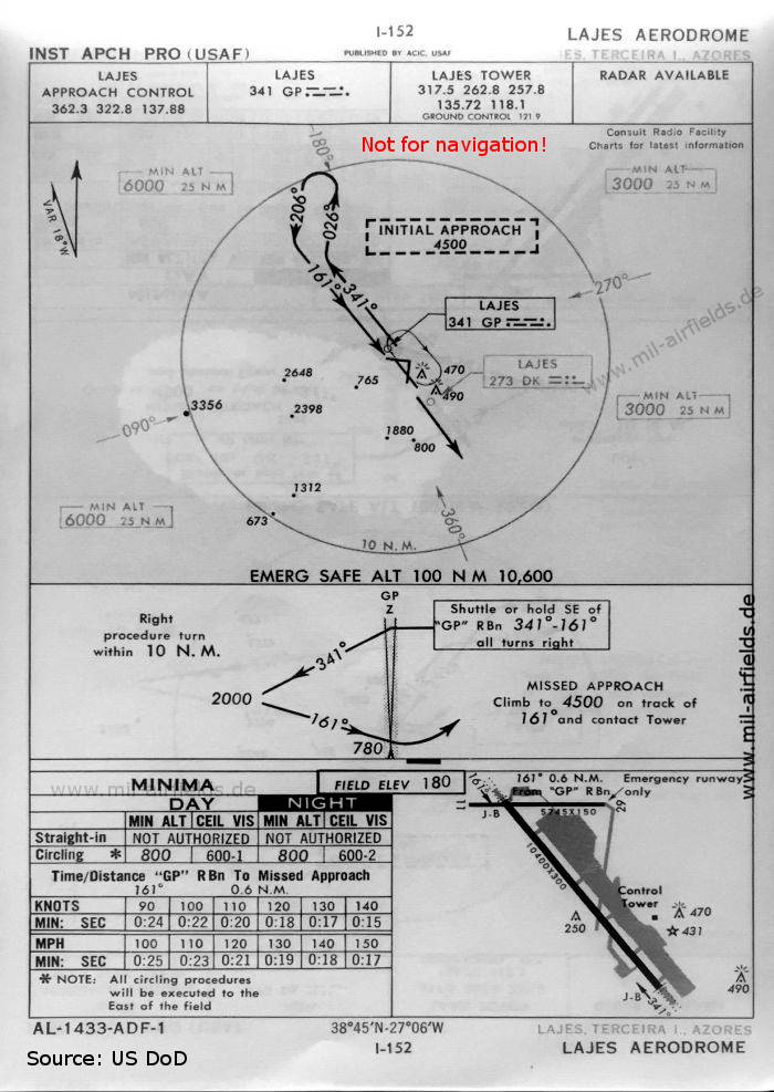
NDB approach runway 16 (October 1960)
Now two runways are shown - 16/34: length 3170 m, width 91 m, unusually wide (10400 feet x 300 feet). Runway 11/29 with a length of 1751 m and width of 46 m (5745 feet x 150 feet) now only serves for emergencies. Runway 03/21 is closed.
(Source: US DoD)
Now two runways are shown - 16/34: length 3170 m, width 91 m, unusually wide (10400 feet x 300 feet). Runway 11/29 with a length of 1751 m and width of 46 m (5745 feet x 150 feet) now only serves for emergencies. Runway 03/21 is closed.
(Source: US DoD)
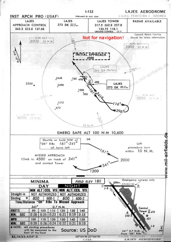
NDB approach runway 34 (October 1960)
(Source: US DoD)
(Source: US DoD)
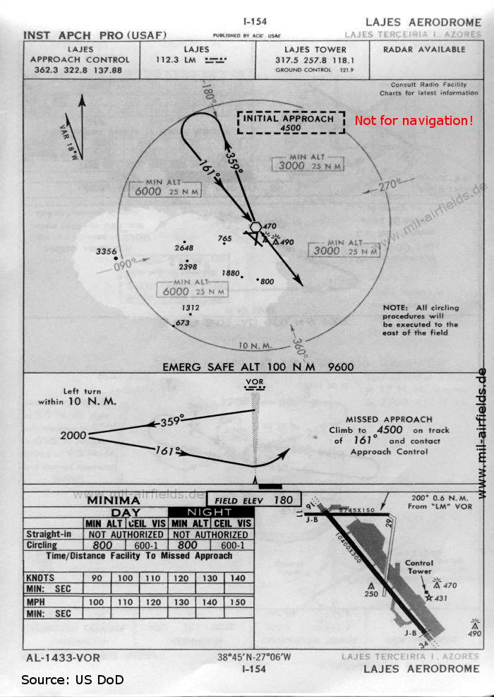
VOR approach runway 16 (October 1960)
Like many other airfields used by the US Air Force, Lajes had a VOR beacon for a few years.
(Source: US DoD)
Like many other airfields used by the US Air Force, Lajes had a VOR beacon for a few years.
(Source: US DoD)
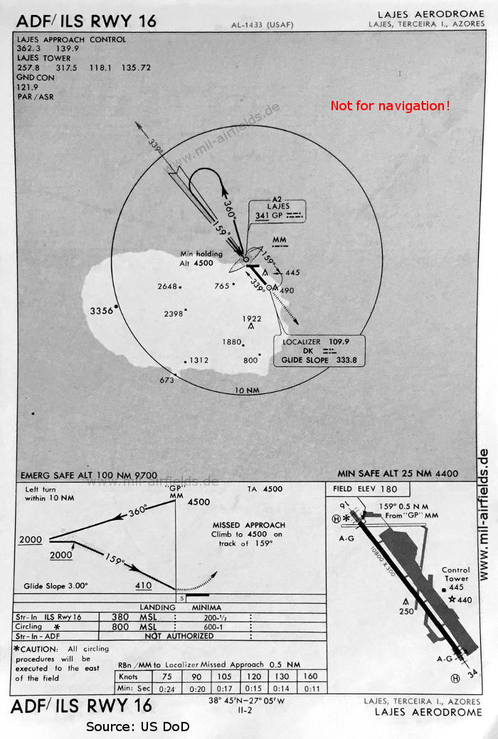
NDB/ILS approach runway 16 (May 1966)
Now runway 11/29 is closed as well. Runway 16/34 is shown with a length of 3292 m (10800 feet).
(Source: US DoD)
Now runway 11/29 is closed as well. Runway 16/34 is shown with a length of 3292 m (10800 feet).
(Source: US DoD)
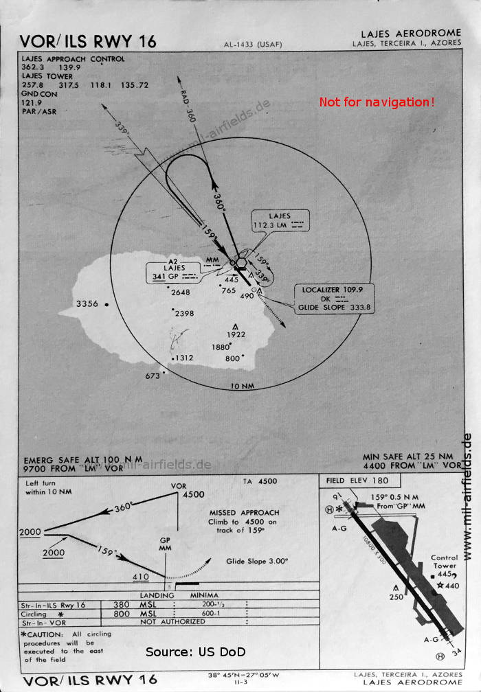
VOR/ILS approach runway 16 (May 1966)
(Source: US DoD)
(Source: US DoD)
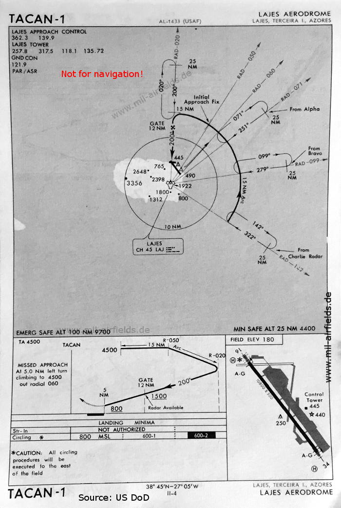
TACAN 1 approach (May 1966)
(Source: US DoD)
(Source: US DoD)
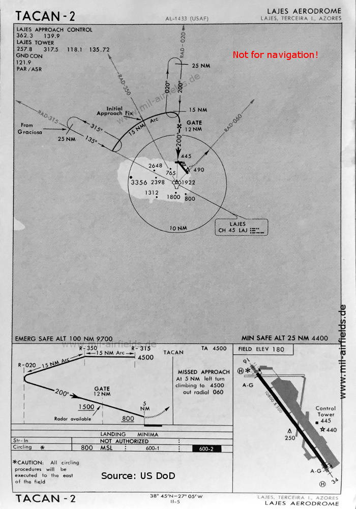
TACAN 2 approach (May 1966)
(Source: US DoD)
(Source: US DoD)
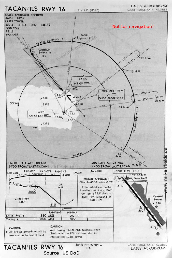
TACAN/ILS approach runway 16 (May 1966)
(Source: US DoD)
(Source: US DoD)
Source for all maps, if not marked otherwise: US Department of Defense (US DoD)
Index to the objects shown on the maps
Aerodromes / Aeródromos:
- Lajes / Lagens / Lages
Radio beacons / Radiofarol:
- Lages Range "GP", NDB "DK"
- Lajes Locator "GP", VOR "LM", TACAN "LAJ", ILS "DK", Middle Marker
Air traffic control / Controlo do Tráfego Aéreo:
- Lages Radio, Lajes Approach Control, Lajes Tower
 Bert (mil-airfields.de)
Do you like this page?
Then I would be happy if you could help bringing more visitors here. That would help me a lot with my other projects ...
Then I would be happy if you could help bringing more visitors here. That would help me a lot with my other projects ...
- Post the page on social media
- Post this page in forums
- Place links to this site, e.g. in Wikipedia.
Recommended
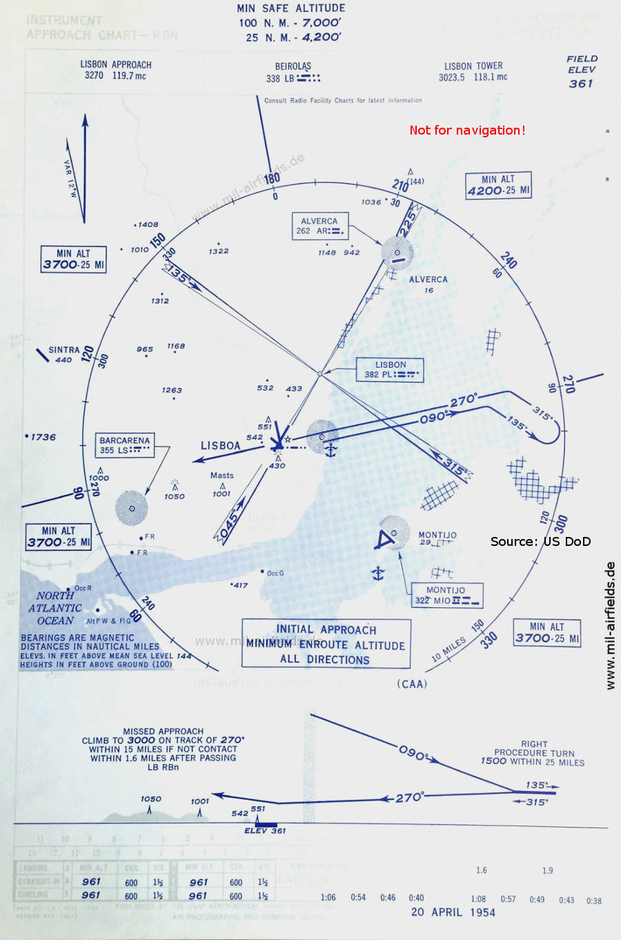
Image credits are shown on the respective target page, click on the preview to open it.
 mil-airfields.de at Facebook