Porto Pedras Rubras Airport (Oporto)
Historical approach and aerodrome charts
Aeroporto do Porto - Cartas de aproximação históricos
For historical information only, do not use for navigation or aviation purposes!
| Coordinates | N411445 W0084050 (WGS84) Google Maps |
Location Indicator: LPPR
In the 1950s
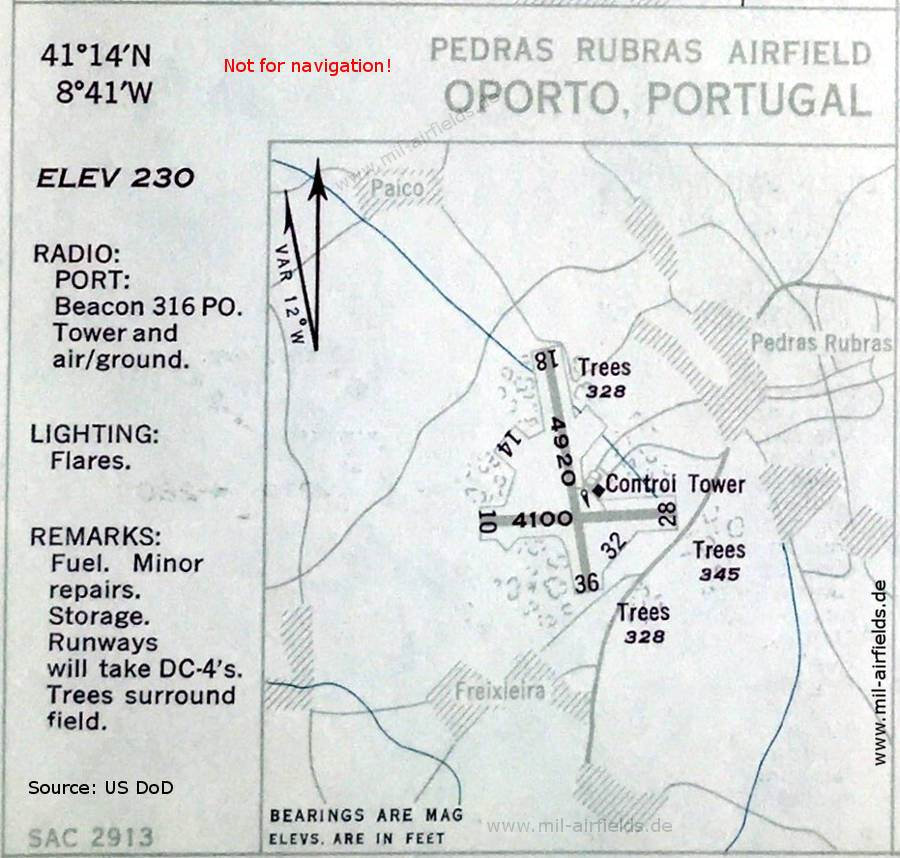
Airfield map (October 1951) - There are three runways: 10/28 with 1250 m (4100 feet), 14/23 unpaved and 18/36 with 1500 m (4920 feet). Other places: Freixleira, Paico. (Source: US DoD)
In the 1970s
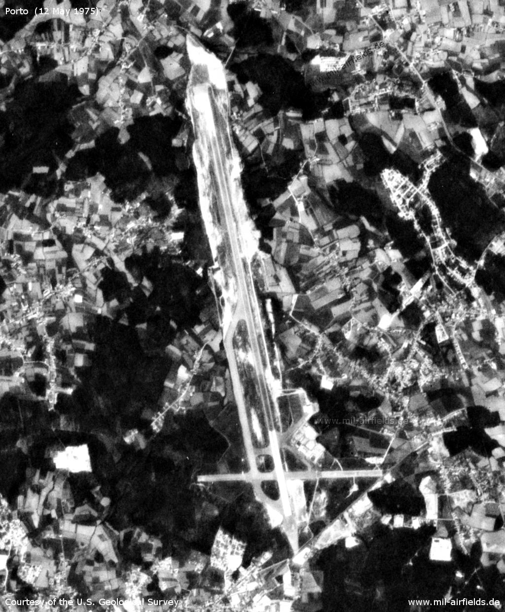
Satellite image from 12 May 1975 (Source: U.S. Geological Survey)
Source for all maps, if not marked otherwise: US Department of Defense (US DoD)
Index to the objects shown on the maps
Radio beacons / Radiofarol:
- Porto NDB "PO"
Recommended
Image credits are shown on the respective target page, click on the preview to open it.
 mil-airfields.de at Facebook