Bucharest Băneasa Airport
Aeroportul Internațional București Băneasa
Historical approach and aerodrome charts
For historical information only, do not use for navigation or aviation purposes!
| Coordinates | N443011 E0260608 (WGS84) Google Maps |
| Location indicator | LRBS |

In the 1950s
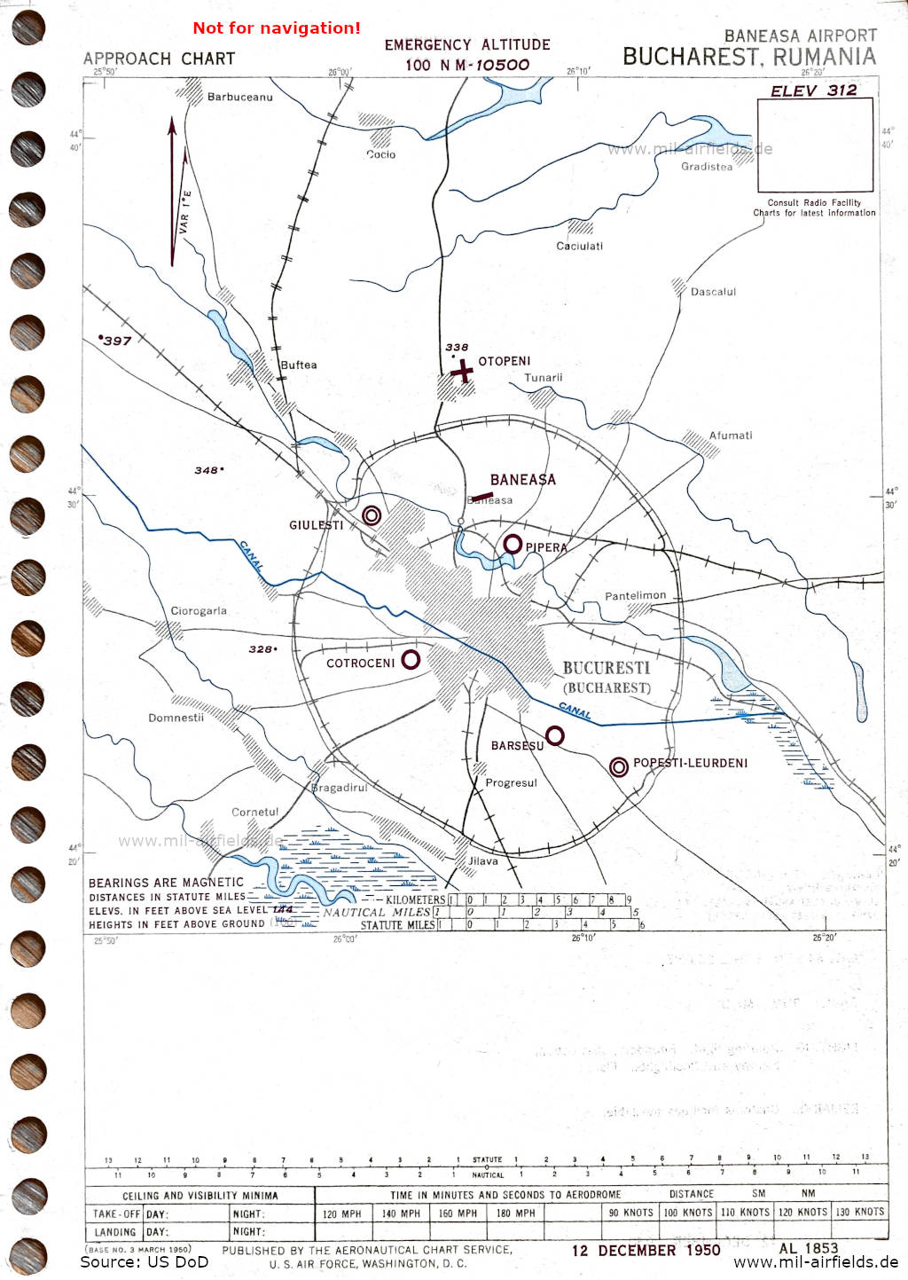
Approach (December 1950) (Source: US DoD)
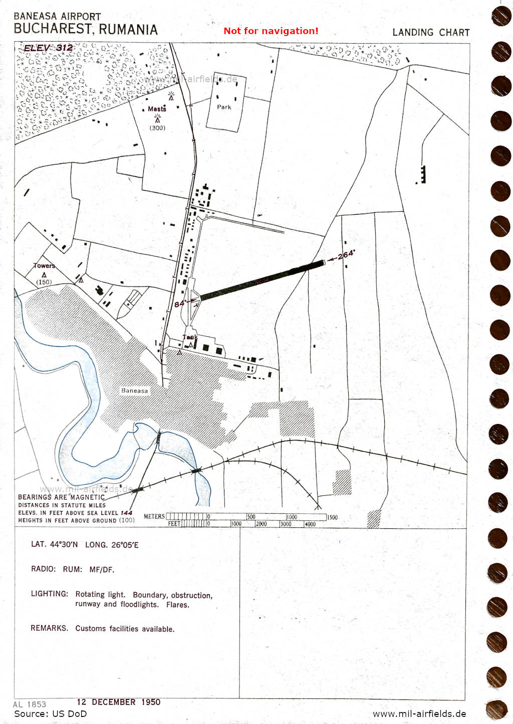
Airport map (December 1950) - There is one runway - 084/264: length 1189 m (3900 feet). (Source: US DoD)
Index to the objects shown on the maps
Aerodromes:
- Baneasa, Barsesu
- Cotroceni
- Giulesti
- Otopeni
- Pipera, Popesti-Leurdeni
Radio beacons with identifier:
Places
- Afumati
- Baneasa, Barbuceanu, Bragadirul, Bucuresti, Buftea
- Caciulati, Ciorogaria, Cocio, Cornetul
- Dascalul, Domnestii
- Gradistea
- Jilava
- Pantelimon, Progresul
- Tunarii
Source for all maps, if not marked otherwise: US Department of Defense (US DoD)