Belgrade Zemun Airport / Аеродром Београд Земун
Historical approach charts Yugoslavia
For historical information only, do not use for navigation or aviation purposes!
Belgrade-Zemun Airport was located in the former People's Republic of Serbia (Narodna Republika Srbija / Народна Република Србија). Today, the airport is closed, the area belongs the municipality "Novi Beograd" (Нови Београд).
Source for all maps, if not marked otherwise: US Department of Defence (DoD)
In the 1950s
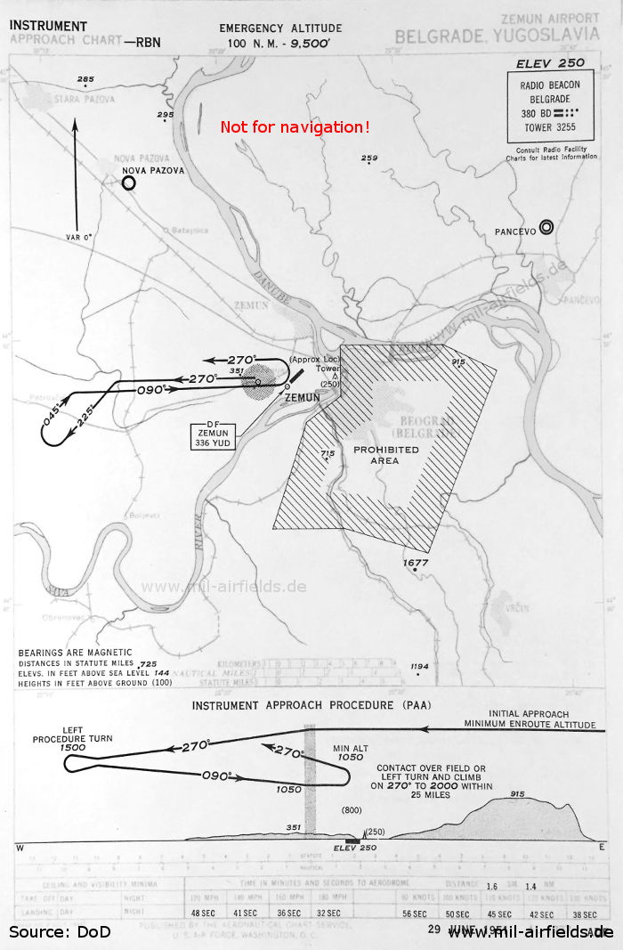
NDB approach (June 1951)
The radio beacon 'BD' is located approx. 3 km (1.6 nautical miles) west of the field. Airfields in the vicinity: Nova Pazova, Pancevo
(Source: DoD)
The radio beacon 'BD' is located approx. 3 km (1.6 nautical miles) west of the field. Airfields in the vicinity: Nova Pazova, Pancevo
(Source: DoD)
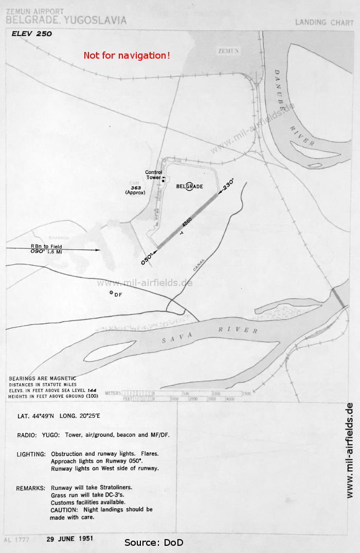
The airport (June 1951)
The runway 05/23 is 1,390 m (4,560 feet) long. Approach lights are only available for approaches from the southwest. In the approach sector 05 is a direction finder (DF). On the airfield there is a circle with the inscription 'Belgrade'. A railway siding leads around the northern part.
(Source: DoD)
In the 1960s
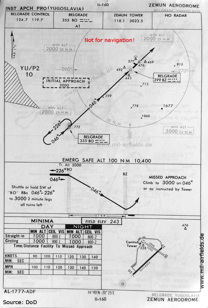
NDB approach runway 05 (October 1960)
Now the runway length is 1,598 m (5,242 feet) and the width 80 m (263 feet). In contrast to the 1951 map, a grass runway 12/30 with the dimensions 1068 m x 80 m is shown.
(Source: DoD)
Now the runway length is 1,598 m (5,242 feet) and the width 80 m (263 feet). In contrast to the 1951 map, a grass runway 12/30 with the dimensions 1068 m x 80 m is shown.
(Source: DoD)