For historical information only, do not use for navigation or aviation purposes!
| Coordinates | N535505 E0121646 (WGS84) Google Maps |
| Former East Germany (GDR) | District of Schwerin |
| Federal state | Mecklenburg-Vorpommern (Mecklenburg-Western Pomerania) |
| Location indicator | ETNL |
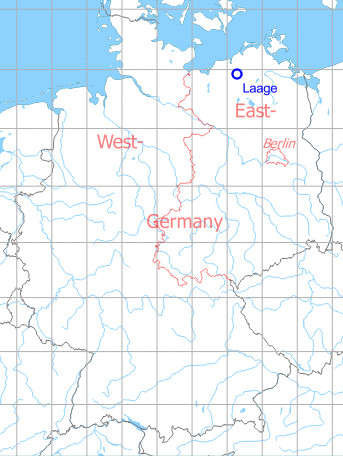
Germany during the Cold War Map
The history of the Cold War airfields: Laage
Contents
Location of airfield
4 km west of Laage.
During the Cold War
Use
Airbase of former East German Airforce (LSK/LV) and East German Navy aviation.
1980s
Overview
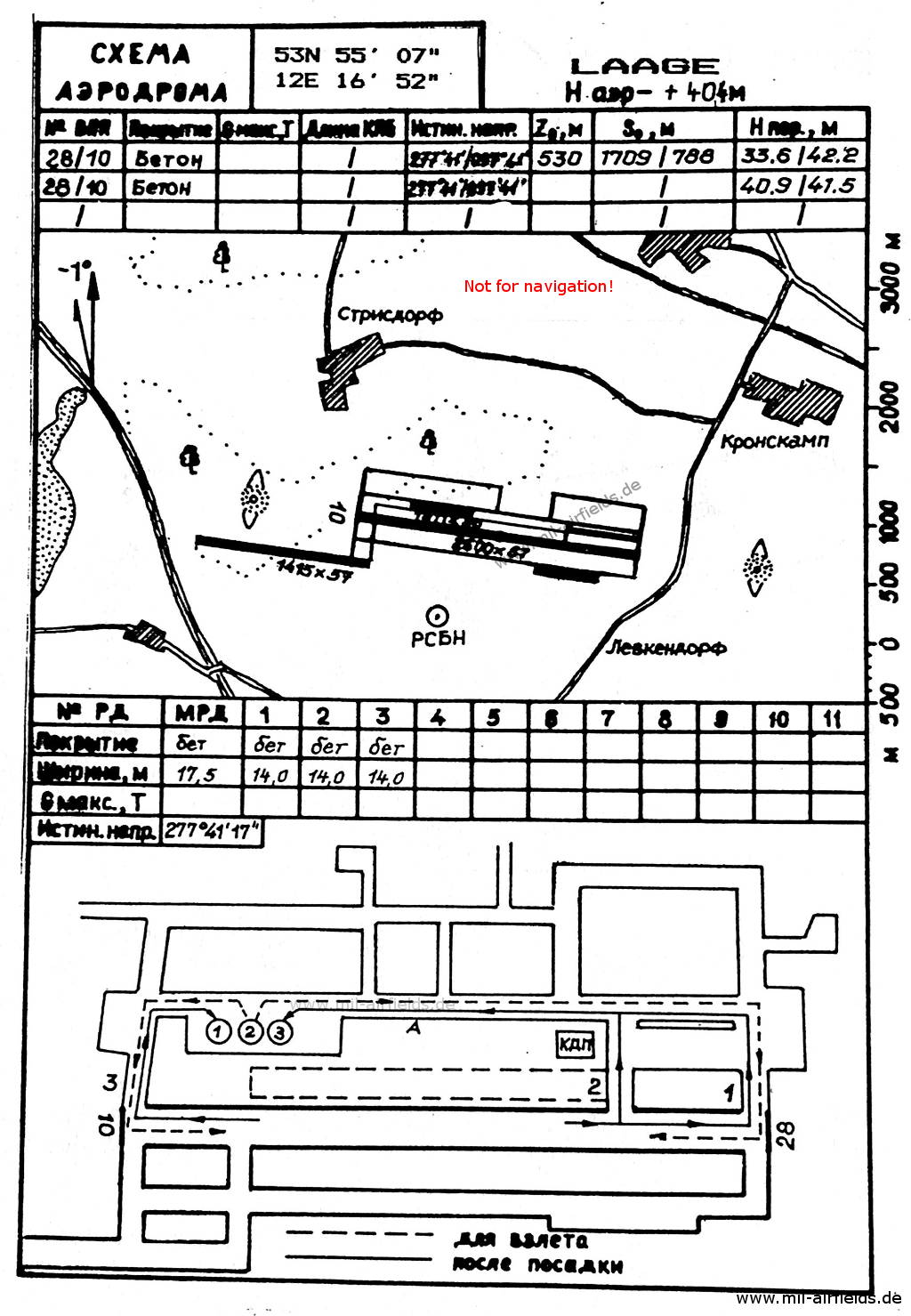
Map of Laage from the former East German National People's Army from 1989 - The taxiway to the autobahn is shown as an additional runway.
Source: Verzeichnis 012
Runways
- 10/28: 2400m x 57m Concrete
- 10/28: 1810m x 80m Grass
Taxiways, aprons
The airfield was connected by a taxiway with the nearby highway.
Radio beacons
- LOM28: 1247 "LR", 4059m to threshold 28
- LMM28: 976 "L", 970m to threshold 28
- LOM10: 1247 "RL", 3710m to threshold 10
- LMM10: 976 "R", 880m to threshold 10
- RSBN: Channel 40 "LR", at field
- PRMG: Channel 38, The PRMG in landing direction 28 is not approved for automated control.
Radio communication
- Tower "LEKTOR START" 129.5 (Channel 7), 124.0 (Common Channel 1)
Telephone
Stabsnetz S1: Number 83834, Code names "Körpermaß", "Gromada"
Units
- Jagdbombenfliegergeschwader JGB-77 (Post box 94412),
- Fliegertechnisches Bataillon 77 (PB 94436),
- Sauerstoffgewinnungs- und Versorgungseinrichtung SGVE-77 (PB 94477),
- Marinefliegergeschwader MFG-28 (PB 54729),
- Fliegertechnisches Bataillon 28 (PB 54721),
- Nachrichten- und Flugsicherungsbataillon NFB-28/NFB-77 (PB 52049),
Real property
The airfield had the East German Forces object ID 02/184. Further properties: 02/185, 02/188, 02/233 (Recreational object JBG-77 at Sabel, Hohensprenzer See)
History
- 1988
The US Military Liaison Mission wrote: "... the air team made a strong effort, photographing and analyzing the East German Air Force Wing and Naval Squadron FITTERs at Laage Airfield. Our analysis of the bort number placement, under or in front of the cockpit, helped the intelligence community to determine which aircraft belonged to the naval unit and which belonged to the air force." Source: /USMLM 1988/
Images
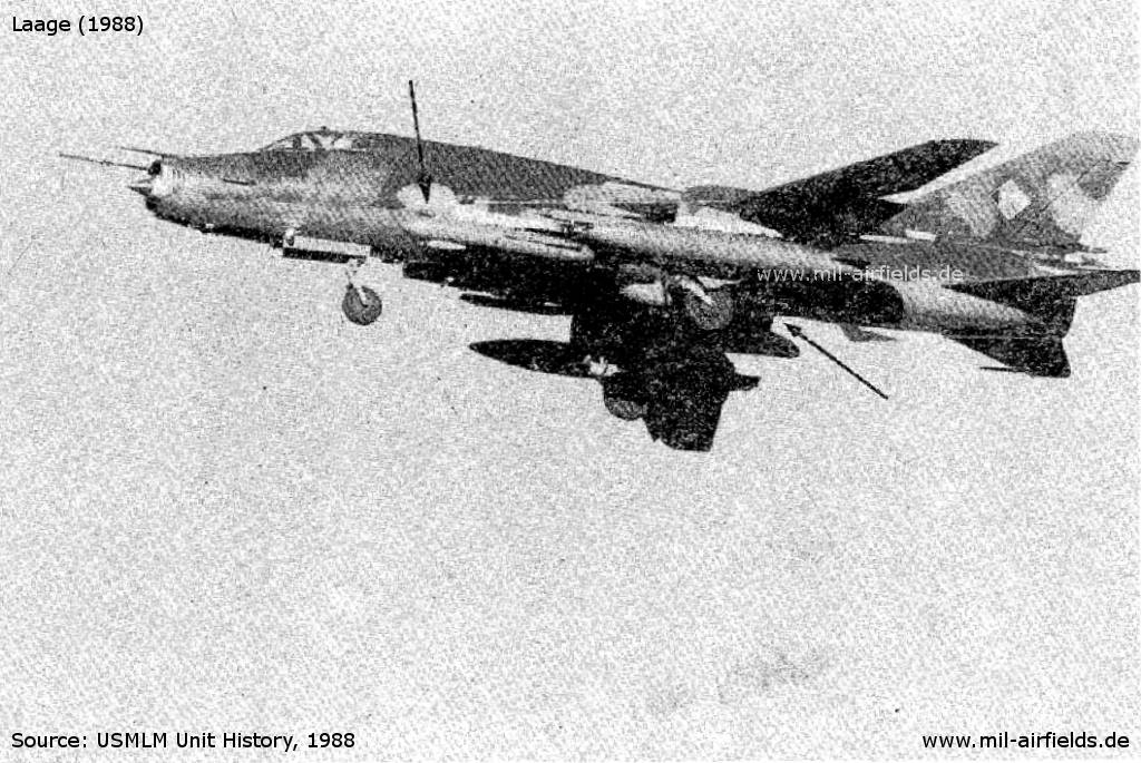
Su-22 FITTER K with an unidentified fuselage dome and ODD POD (arrows) - The picture has been taken by the US Military Liaison Mission in 1988. Source: /USMLM 1988/.
Source: USMLM 1988
In the 1990s and 2000s
Images
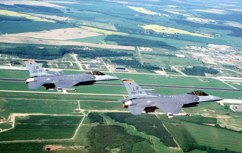
Two F-16 Fighting Falcons of the US Air Force Reserve over Laage in June 1996
Source: US DoD, Scene Camera Operator: SRA Sean Worrell
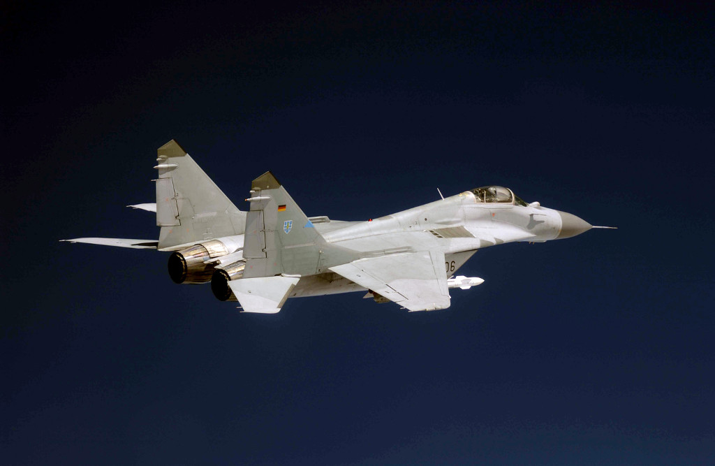
A MiG-29 Fulcrum of German Air Force Fighter Wing 73 from Laage (2003)
Source: US DoD, Scene Camera Operator: TSGT Michael Ammons
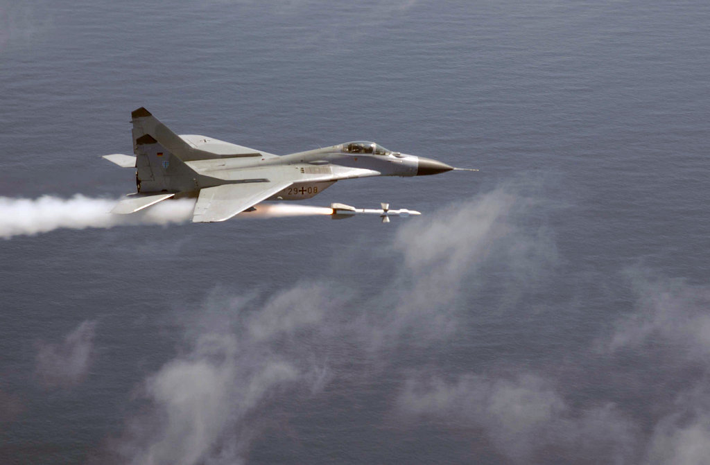
A MiG-29 Fulcrum of Fighter Wing 73 of German Air Force Fighter Wing 73 (JG 73) fires a radar-guided air-to-air missile AA-10 Alamo (2003)
Source: US DoD, Scene Camera Operator: TSGT Michael Ammons
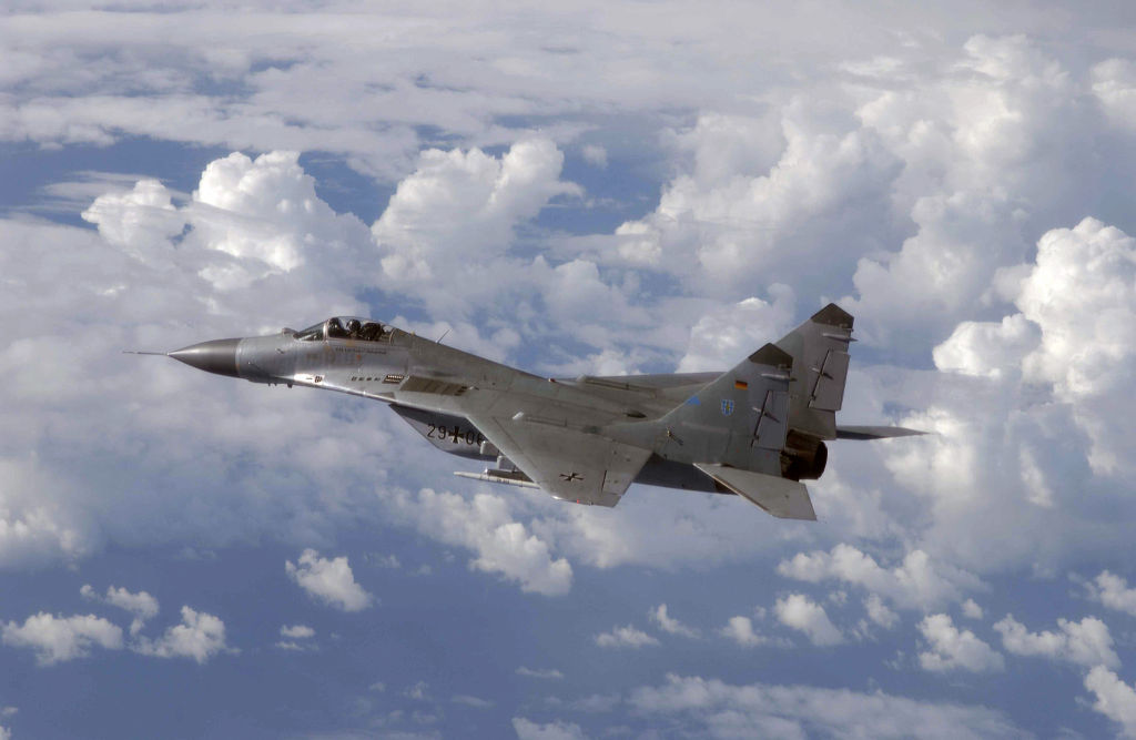
German Air Force MiG-29 from Laage (2003)
Source: US DoD, Scene Camera Operator: TSGT Michael Ammons
Today
Use
German Airforce airbase; airport.
Overview
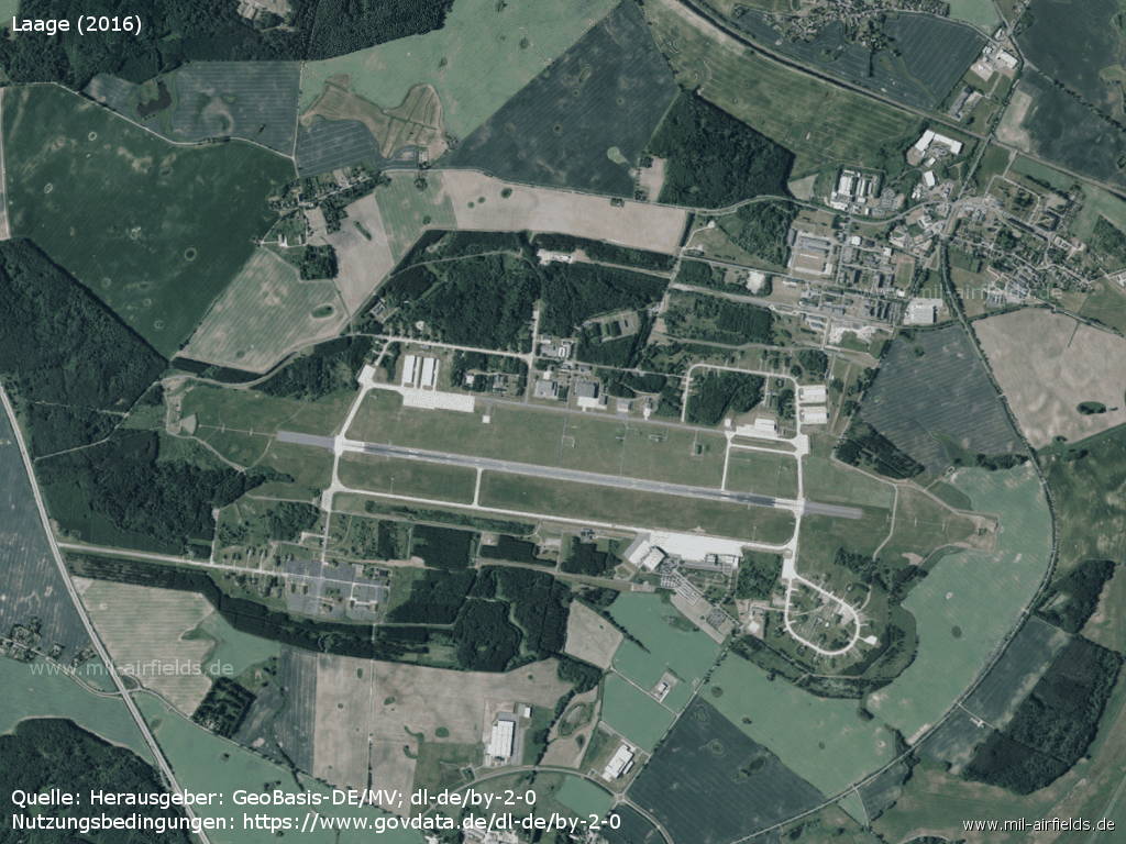
Aerial image of Laage Air Base (2016)
Source: Landesamt für innere Verwaltung M-V, Amt für Geoinformation, Vermessung und Katasterwesen - www.geoportal-mv.de, Data licence Germany – attribution – version 2.0, www.govdata.de/dl-de/by-2-0, http://www.geoportal-mv.de/
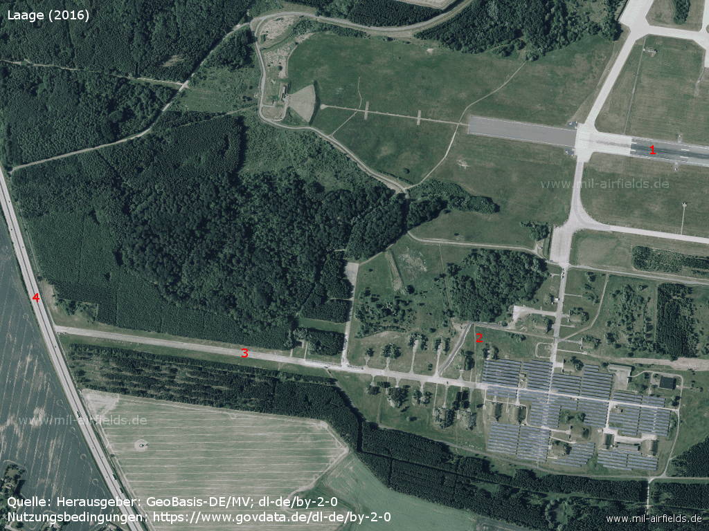
Southwest corner - 1: Runway; 2: former shelter area; 3: former taxiway to the Autobahn, the taxiway also served as an auxiliary runway; 4: autobahn Berlin-Rostock
Source: Landesamt für innere Verwaltung M-V, Amt für Geoinformation, Vermessung und Katasterwesen - www.geoportal-mv.de, Data licence Germany – attribution – version 2.0, www.govdata.de/dl-de/by-2-0
Sources
- https://www.archives.gov/ - National Archives
- United States Military Liaison Mission - Unit History 1988
Related topics
Airfields in the vicinity
- 337°/13km Kavelstorf: Highway Strip (Autobahnabschnitt ABA)
- 351°/13km Bandelstorf: Agricultural Airfield
- 020°/18km Sanitz: Helipad 3306 (HSLP 3306)
Categories
Military Airfields GermanyMilitary Airfields in former East GermanyAir bases of former National People's ArmyRecommended
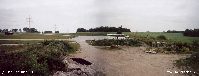
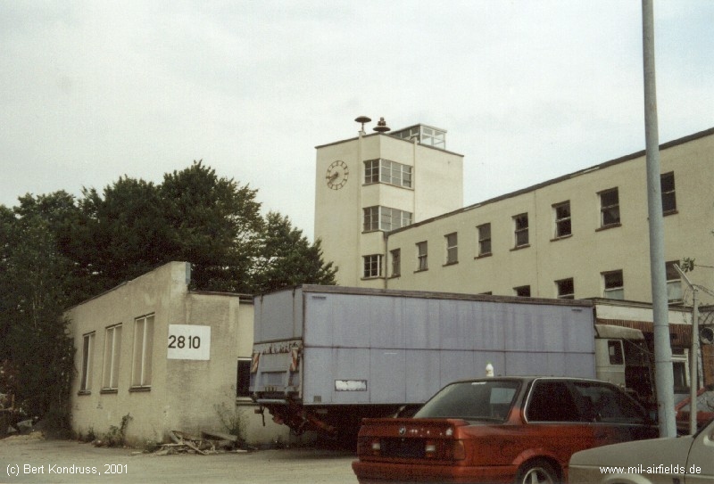
Image credits are shown on the respective target page, click on the preview to open it.
Contents
 Follow mil-airfields on Facebook