Radio beacons in Poland in the 1950s
Radiolatarnia w Polsce w latach 50
For historical information only, do not use for navigation or aviation purposes!
The following list contains the aeronautical radio beacons that were active in Denmark in the mid of the 1950s. All information is outdated and may not be used for navigational purposes.
The list is very incomplete, because especially the military radio beacons are missing.
Warschau-Okęcie airport was equipped with the Standard Beam Approach (SBA) as approach aid.
Explanations
![]()
Abbreviations
| approx. | approximately | |
| civ | civil | civil operator |
| GP | Glide path | Glide path transmitter |
| ILS | Instrument Landing System | (Approach and landing aid) |
| IM | Inner Marker | Marker beacon just in front the runway |
| kHz | Kilohertz | (Unit for frequency) |
| L | Locator | Non-directional beacon for the approach |
| LLZ | Localizer | Localizer transmitter |
| LMM | Locator Middle Marker | Combination of Middle Marker and Locator |
| LOM | Locator Outer Marker | Combination of Outer Marker and Locator |
| m | Meter | (Unit for length) |
| MHz | Megahertz | (Unit for frequency) |
| mil | military | military operator |
| MM | Middle Marker | Marker beacon |
| NDB | Non-directional beacon | Non-directional beacon on long or medium waves |
| NM | Nautical Miles | (Unit for length) |
| OM | Outer Marker | Marker beacon |
| PRMG | ПРМГ Посадочная радиомаячная группа | Soviet / russian military instrument landing system |
| RSBN | РСБН Rадиотехническая система ближней навигации | Soviet / russian military radio navigation system |
| SBA | Standard Beam Approach | Approach system, Lorenz system, predecessor of the ILS |
| THR | Threshold | Runway threshold (most often with number of runway) |
| transf. | transformed | Coordinates were converted from a different reference system, therefore there may be deviations. |
| VAR | Visual-Aural Rnange | |
| VOR | VHF Omnidirectional Radio Range | |
| W | Watt | (Unit for power) |
| WGS84 | World Geodetic System 1984 | (geospatial reference system, GPS coordinates) |
Directory
For historical information only, do not use for navigation or aviation purposes!
Brodnica: NDB
RV, 700 kHz
RV, 700 kHz
Czempiń: NDB
N5209 E01647 (approx.) Google Maps
AI, 409 kHz
N5209 E01647 (approx.) Google Maps
AI, 409 kHz
Operated Mondays from 0815 to 1015, from 1150 to 1340 and from 1430 to 1545; Tuesdays from 0820 to 0920 and from 1150 to 1545; Wednesdays from 0755 to 1015, from 1145 to 1340 and from 1430 to 1545; Thursdays from 0815 to 1015 and from 1150 to 1545; Fridays from 0755 to 1015 and from 1150 to 1545; Saturdays from 0820 to 0920 and from 1150 to 1545; Sundays from 1150 to 1305, from 1430 to 1545; and on request.
Łódź: NDB
N5143 E01924 (approx.) Google Maps
SRF, 357 kHz
N5143 E01924 (approx.) Google Maps
SRF, 357 kHz
Operated Mondays, Thursdays and Saturdays from 0650 to 1050 and from 1125 to 1630; Tuesdays and Fridays from 0650 to 1050 and from 1125 to 1720; Wednesdays from 0650 to 1420 and from 1445 to 1630; Sundays from 0925 to 1050, from 1125 to 1240 and from 1445 to 1605; and on request.
Skierniewice: NDB
N5158 E02009 (approx.) Google Maps
AM, 319 kHz
N5158 E02009 (approx.) Google Maps
AM, 319 kHz
Operated Monday and Thursdays from 0645 to 1050 and from 1120 to 1705; Tuesdays and Fridays from 0645 to 1050 and from 1120 to 1745; Wednesdays from 0645 to 1705; Saturdays from 0645 to 1050 and from 1120 to 1725; Sundays from 0935 to 1050, from 1120 to 1225 and from 1455 to 1635; and on request.
Toruń: NDB
BH, 290 kHz
BH, 290 kHz
Toruń: Airfield
For historical information only, do not use for navigation or aviation purposes!
Warsaw: Okęcie Airport (Port Lotniczy Warszawa-Okęcie, Lotnisko Chopina w Warszawie, Warsaw Chopin Airport)
Warszawa/Okęcie: NDB
N5210 E02101 (approx.), 248°/1.7 NM to field Google Maps
AO, 380 kHz
N5210 E02101 (approx.), 248°/1.7 NM to field Google Maps
AO, 380 kHz
Previous frequency: 227 kHz (1951); previous ident: SRO (1954). Operated Mondays and Thursdays from 0630 to 1040 and from 1115 to 1630; Tuesdays and Fridays from 0630 to 1040 and from 1115 to 1715; Wednesdays from 0645 to 1040 and from 1100 to 1630; Saturdays from 0645 to 1040 and from 1115 to 1700; Sundays from 0930 to 1040, from 1115 to 1205 and from 1505 to 1630; and on request.
Runway 15:
Warszawa/Okęcie: SBA
33.3 MHz
33.3 MHz
Operated on request.
Warszawa/Okęcie: OM 15 (SBA)
150° to THR 15
Dashes, 38 MHz
150° to THR 15
Dashes, 38 MHz
Warszawa/Okęcie: IM 15 (SBA)
150° to THR 15
Dots, 38 MHz
150° to THR 15
Dots, 38 MHz
For historical information only, do not use for navigation or aviation purposes!
Recommended
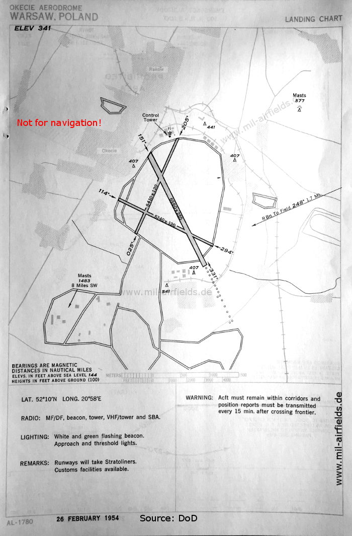
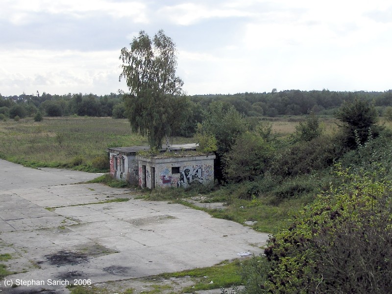

Image credits are shown on the respective target page, click on the preview to open it.