Bronkow: Airfield
For historical information only, do not use for navigation or aviation purposes!
| Coordinates | N514021 E0135742 (WGS84) Google Maps |
| Former East Germany (GDR) | District of Cottbus |
| Federal state | Brandenburg |
| Location indicator | EDBQ |
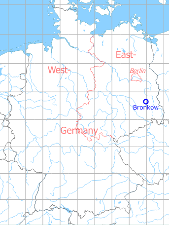
Germany during the Cold War Map
The history of the Cold War airfields: Bronkow
Location of airfield
3,2 km east of Bronkow.
During World War II
Use
Luftwaffe airfield.
During the Cold War
In the 1960s
Overview
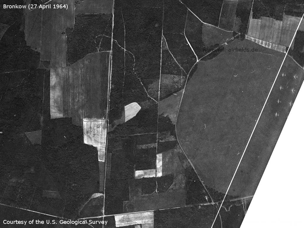
US satellite picture from Monday 27 April 1964 - The lower right part is missing in the original, the white line is an artefact on the picture.
Source: U.S. Geological Survey
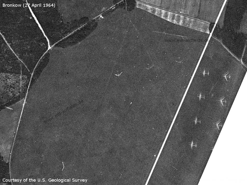
Bronkow air-ground firing range in the northeast of the airfield - Aircraft silhouettes on the ground represent targets.
Source: U.S. Geological Survey
In the 1970s
Situation

Bronkow Airfield on a map of the US Department of Defense from 1972
Source: ONC E-2 (1972), Perry-Castañeda Library Map Collection, University of Texas at Austin
Overview
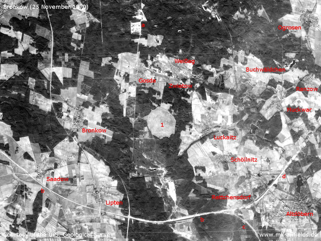
Bronkow and surroundings on a US satellite image from 25 November 1970 - 1: Airfield. Other objects: a: Radio transmission station 3 (FuSA-3) Werchow (Gosda/Cabel) of the National People's Army; b: railway line Lindthal-Altdöbern South; c: Curve to the railway line Calau-Großräschen; d: railway embankment north of Altdöbern. Other places: Buchwäldchen, Lipten, Luckaitz, Muckwar, Ogrosen, Ranzow, Rettchensdorf, Saadow, Schöllnitz, Weißag, Zwietow.
Source: U.S. Geological Survey
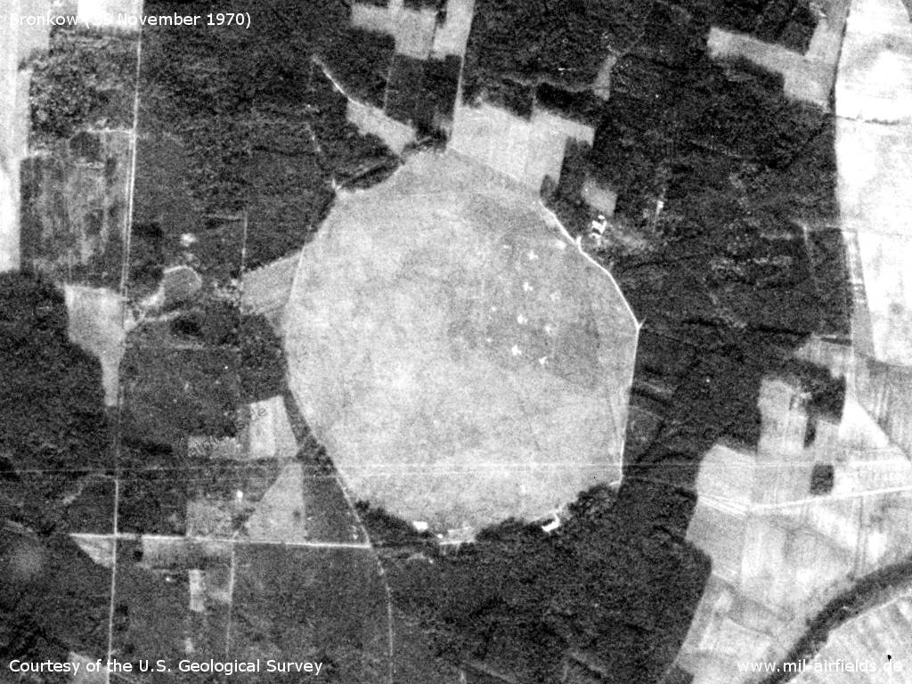
The airfield - The almost circular shape of the airfield is clearly visible. For the use as air-ground firing range, aircraft silhouettes are marked as targets in the northeast.
Source: U.S. Geological Survey
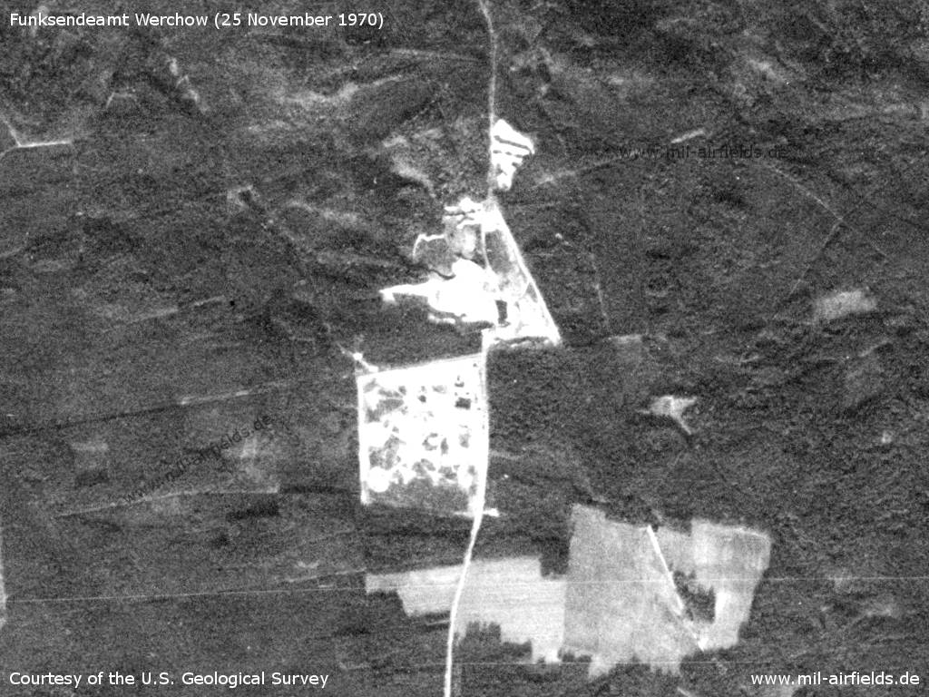
Radio transmission station 3 (FuSA-3) Werchow (Gosda/Cabel) of the National People's Army, 3.5 km nordwest of the airfield. - The bright colour indicates fresh earth movements, probably construction work is in progress or has only recently taken place.
Source: U.S. Geological Survey
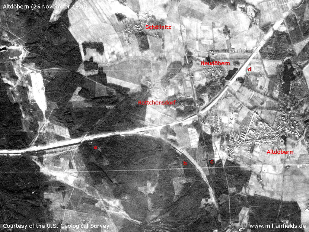
Not related to the airfield, but historically interesting is the railway line Lindthal - Alt Döbern - Located about 5 km southeast of the airfield is the village of Altdöbern. Here the railway line (a) coming from Lindthal near Finsterwalde flows with a bend (b) into the railway line Calau-Großräschen (c). In addition, a never realized continuation to the northeast was planned, for which, however, a railway embankment has already been built (d). On this satellite picture, the installations appear very bright, which indicates fresh earthworks. Obviously construction work is still in progress or took place shortly before.
Source: U.S. Geological Survey
In the 1980s and early 1990s
Use
Airfield of the former East German paramilitary organization Gesellschaft für Sport und Technik (GST).
The airfield was also used as ...
- Helipad 3013 for Radio Transmission Station 3 (FuSA-3) of East German Air Force (NVA LSK/LV).
- Helipad 3192 for Ammunition Depot 31 (ML-31) of East German Air Force.
- Helipad 6013 of East German forces.
Runways, taxiways, aprons
Dimensions: 900 m x 900 m
Surface: grass
Capacity: 1..10 helicopters
Surface: grass
Capacity: 1..10 helicopters
Radio communication
Aero Bronkow 122.2
Telephone
GDR Stabsnetz S1 9446-436 (FuSA-3), 9446-855 (ML-31)
Teletype
East German teletype network 17572
Airspace and procedures
GST airfield
Airfield zone Sunday until Saturday:
Lübbenau, Koßwig, Wiesendorf, Casel, Schöllnitz, Autobahn junction Bronkow, Crinitz, Schlabendorf, Lübbenau
(Source: Interflug Fernerkundung, Industrie- und Forschungsflug, Navigationshandbuch NH/VFR, as of 01 July 1989)
NVA Helipad
Usable at day during good weather conditions.
Alert time: 60 minutes.
Alert time: 60 minutes.
Today
Use
General aviation.
Airfields in the vicinity
- 169°/7km Großräschen: Helipad 3134 (HSLP / HLP 3134)
- 131°/16km Welzow: Air Base (Neu-Welzow, Spremberg Welzow, Аэродром Ней-Вельцов)
- 245°/17km Finsterwalde: Air Base (Schacksdorf)
- 079°/20km Leuthen: Helipad 3021 (HSLP 3021)
- 330°/25km Alteno: Airfield (Luckau)
Categories
Military Airfields GermanyMilitary Airfields in former East GermanyHelipads of former National People's ArmyRecommended
Image credits are shown on the respective target page, click on the preview to open it.
 Follow mil-airfields on Facebook