For historical information only, do not use for navigation or aviation purposes!
| Coordinates | N481220 E0111605 (WGS84) Google Maps |
| Elevation | 1703 ft |
| Federal state | Bayern (Bavaria) |
| Location indicator | DEFF (195x), EDSF (196x-1995), ETSF (1995-) |
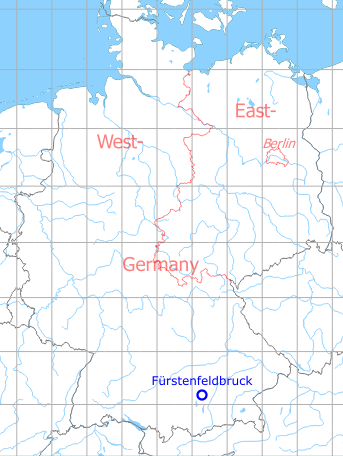
Germany during the Cold War Map
The history of the Cold War airfields: Fürstenfeldbruck
Overview
During World War II
Use
Luftwaffe airfield.
Situation
Fürstenfeldbruck Air Base in World War II on a US map from 1944
Source: McMaster University Library Digital Archive, Lizenz: Creative Commons Attribution-NonCommercial 2.5 CC BY-NC 2.5 CA
During the Cold War
Use
USAF until 1960, thereafter Luftwaffe airbase.
Units
Used by USAF until 1960:
- 1947-1948: 45th RS / 45th TRS with RB-26 / F-6
- 1948-1952: 36th FW / FBW (22nd, 23rd, 53rd FBS) with F-80, F-84
- 1952: 157th TRS, 160th TRS
- 1952-1953: 32nd TRS with RF-80A
- 1953-1958: 7330th FTW with T-33A
- 1960: 7367th FTG
- 1947-1948: 45th RS / 45th TRS with RB-26 / F-6
- 1948-1952: 36th FW / FBW (22nd, 23rd, 53rd FBS) with F-80, F-84
- 1952: 157th TRS, 160th TRS
- 1952-1953: 32nd TRS with RF-80A
- 1953-1958: 7330th FTW with T-33A
- 1960: 7367th FTG
Luftwaffe WaS Lw 50, JaboG 49 (G-91, Alpha Jet) until early 1990s, Tornado training unit until mid-1990s.
In the 1940s
Images
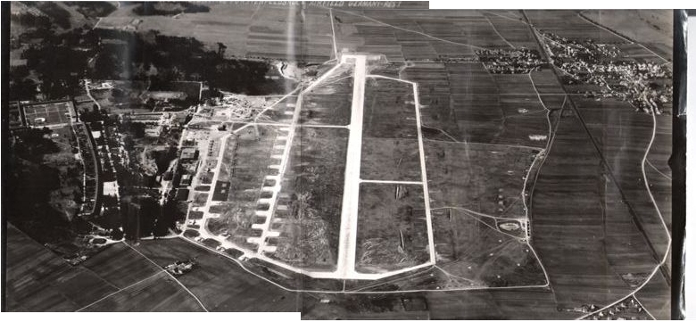
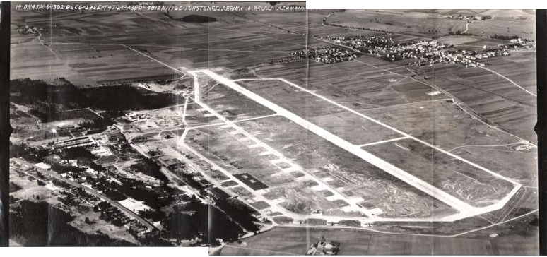
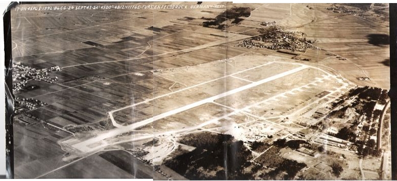
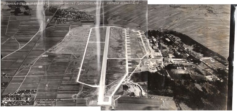
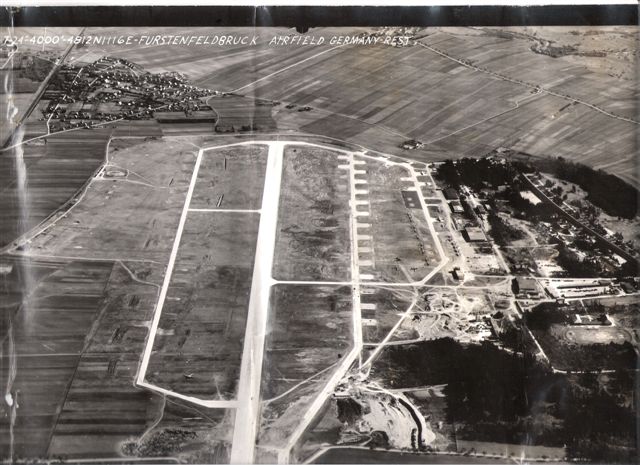
The following pictures show the airfield on the 29th september 1947, taken by Captain Robert C. Miller USAF in about 4000' in preparation of lengthening the runway. Courtesy of Don, thanks a lot!
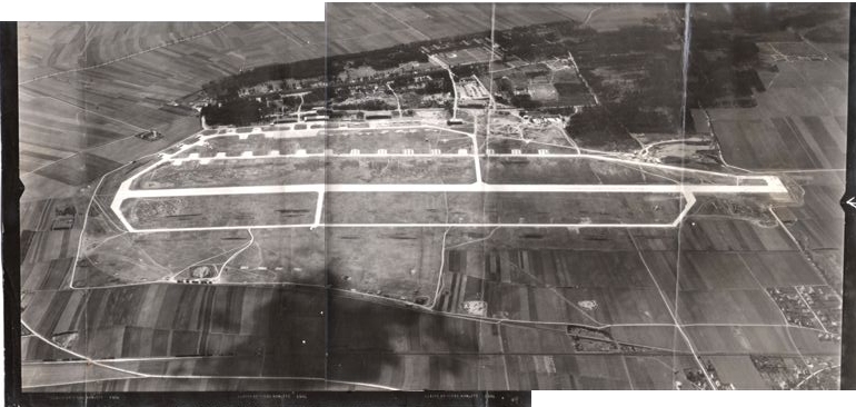
Looking to the south
to the west
to the northwest
to the northeast
View to the east
Enlargement
Detail with parked aircrafts
In the 1960s
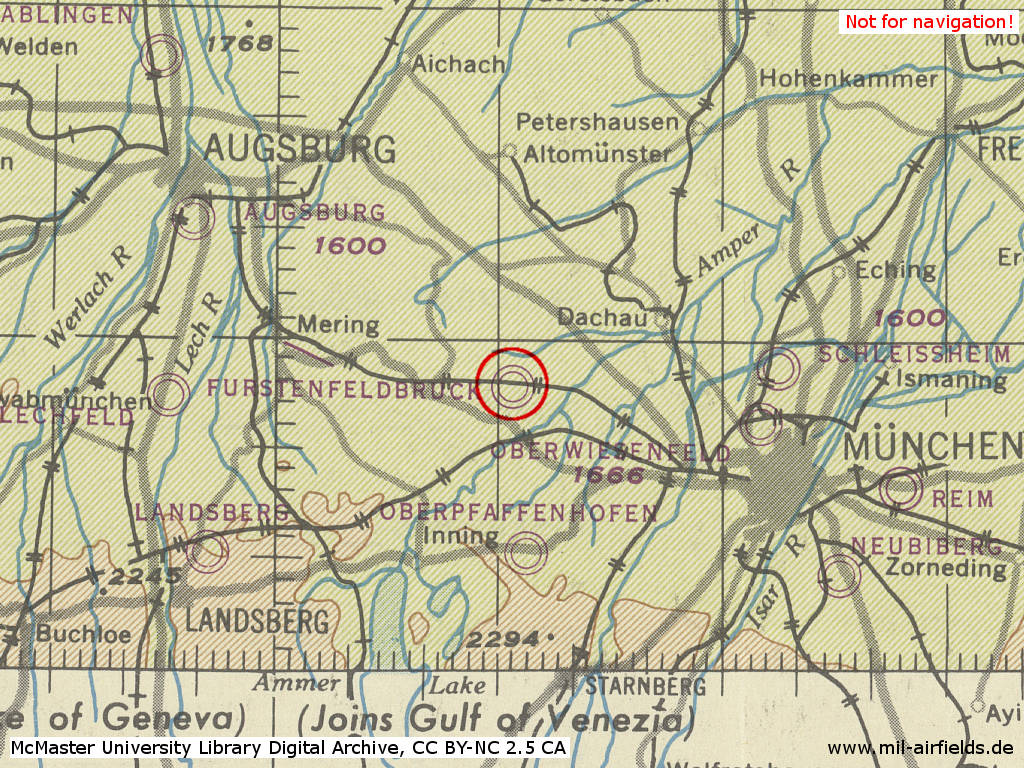
Situation
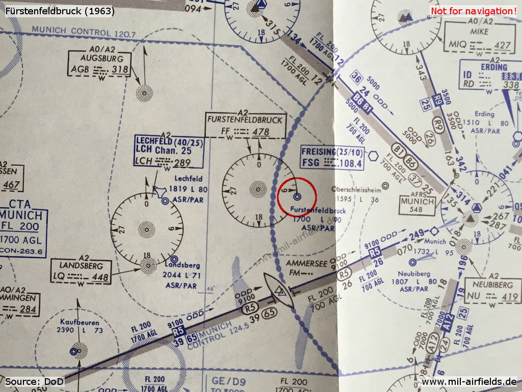
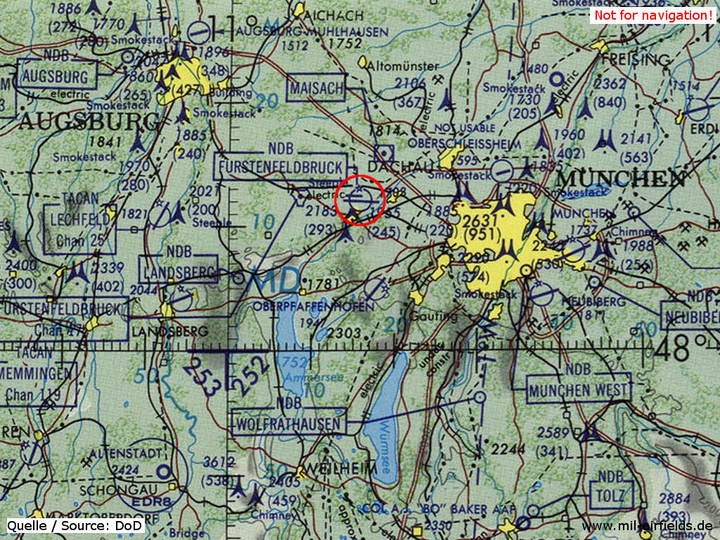
Fürstenfeldbruck and airfields in the vicinity on a map from 1963
Source: DoD
Overview
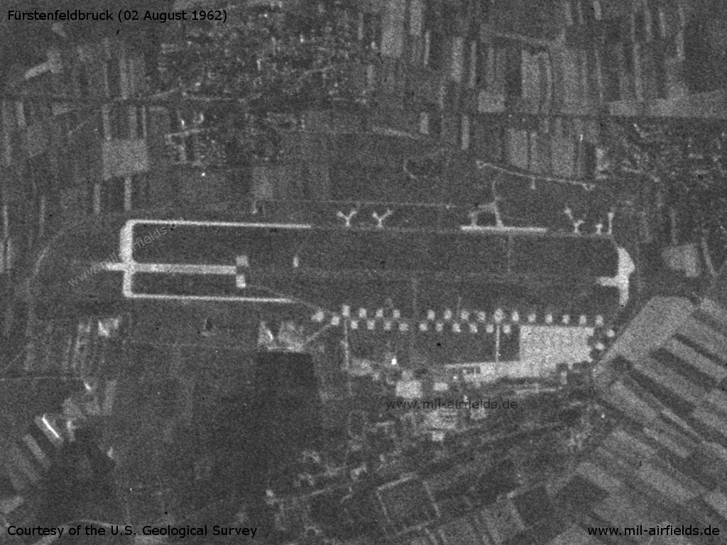
US satellite image from 02 August 1962
Source: U.S. Geological Survey
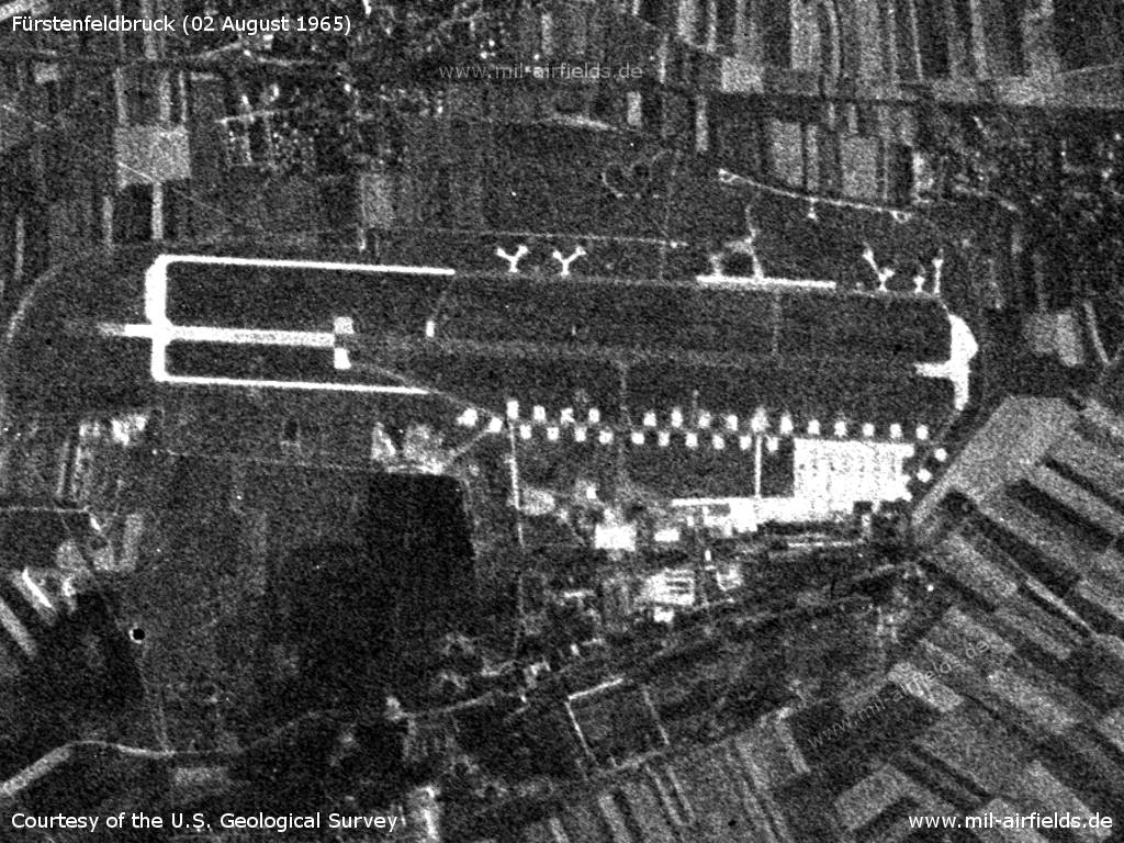
US satellite image from 02 August 1965 - Not much has changed compared to the image from 1962.
Source: U.S. Geological Survey
Airspace and procedures
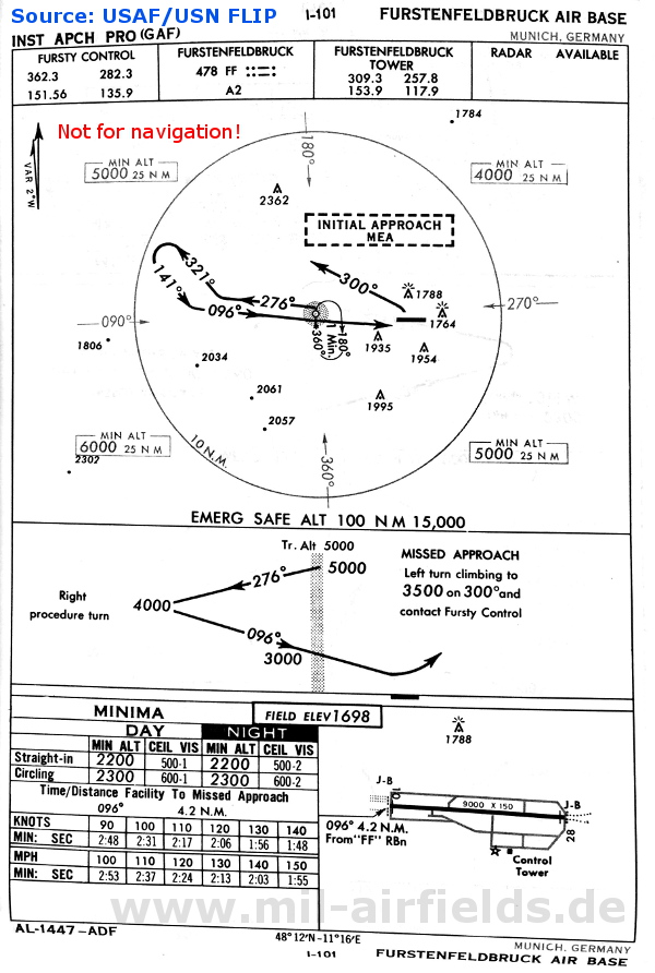
NDB approach in 1960
In the 1970s
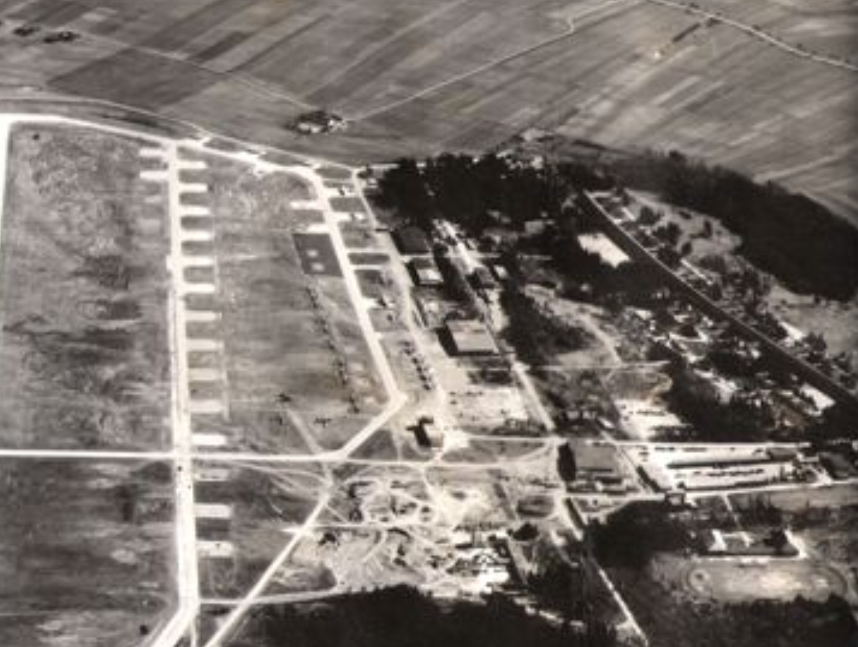
Overview
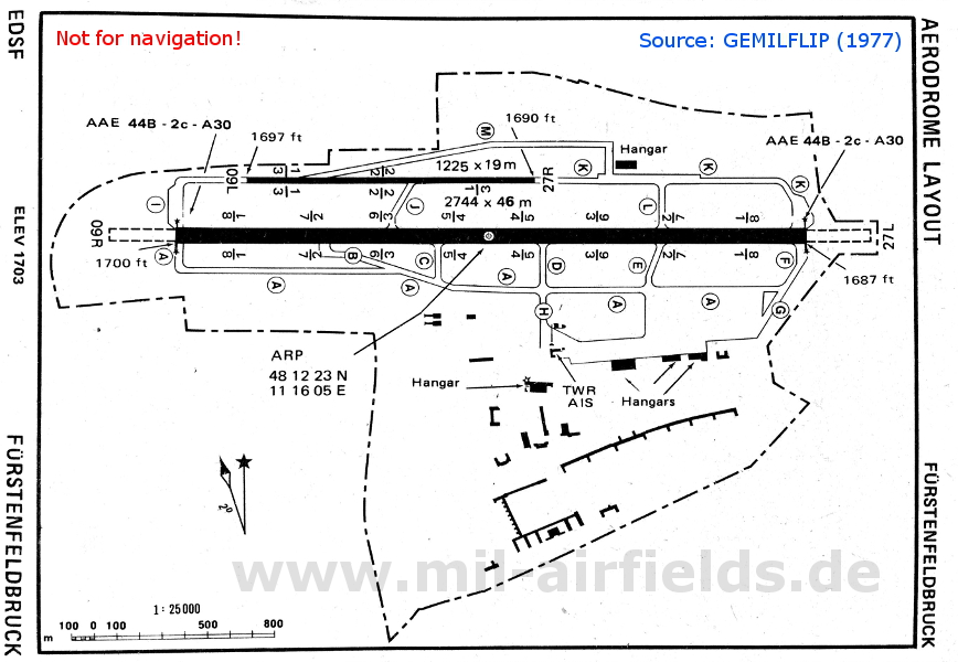
Map from 1977
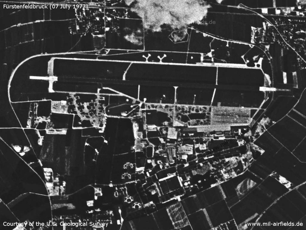
Fürstenfeldbruck Air Base on a US satellite image from 07 July 1977
Source: U.S. Geological Survey
In the 1980s and early 1990s
Situation
Fürstenfeldbruck Air Base on a map of the US Department of Defense from 1981
Source: ONC F-2 (1981), Perry-Castañeda Library Map Collection, University of Texas at Austin
Overview
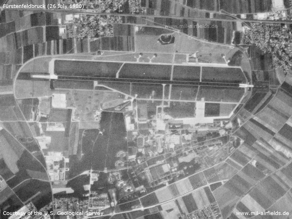
US satellite image from 26 July 1980
Source: U.S. Geological Survey
Runways
Data for the year 1990:
- 09R/27L: 2744 m x 46 m Concrete
- 09L/27R: 1225 m x 19 m
Radio beacons
Data for the year 1990:
- TACAN: CH17 "FFB", 093°/4.9 NM to field
Radio communication
Call sign FURSTY, DHK 27
Today
Use
Closed.
Overview
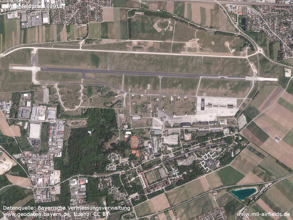
Aerial image (2018)
Source: Datenquelle: Bayerische Vermessungsverwaltung www.geodaten.bayern.de, License: Creative Commons Namensnennung 3.0 Deutschland (CC BY 3.0 DE)
Sources
- https://geoportal.bayern.de/ - Geoportal Bayern
Links
- http://www.fursty.org/ - Fliegerhorst FURSTY
Bibliography
- Ries, Karl; Dierich, Wolfgang: "Fliegerhorste und Einsatzhäfen der Luftwaffe" Motorbuch Verlag Stuttgart, 1993 - Allied map of the airbase
Airfields in the vicinity
Categories
Military Airfields GermanyMilitary Airfields in former West GermanyGerman Air Force Air BasesAir Bases of the United States Air Force (USAF) in GermanyRecommended
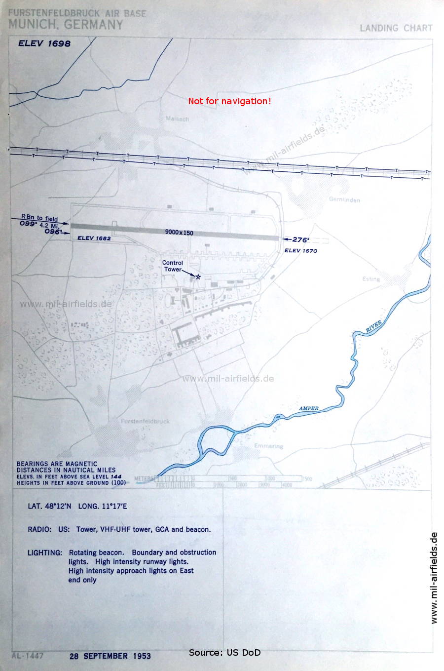
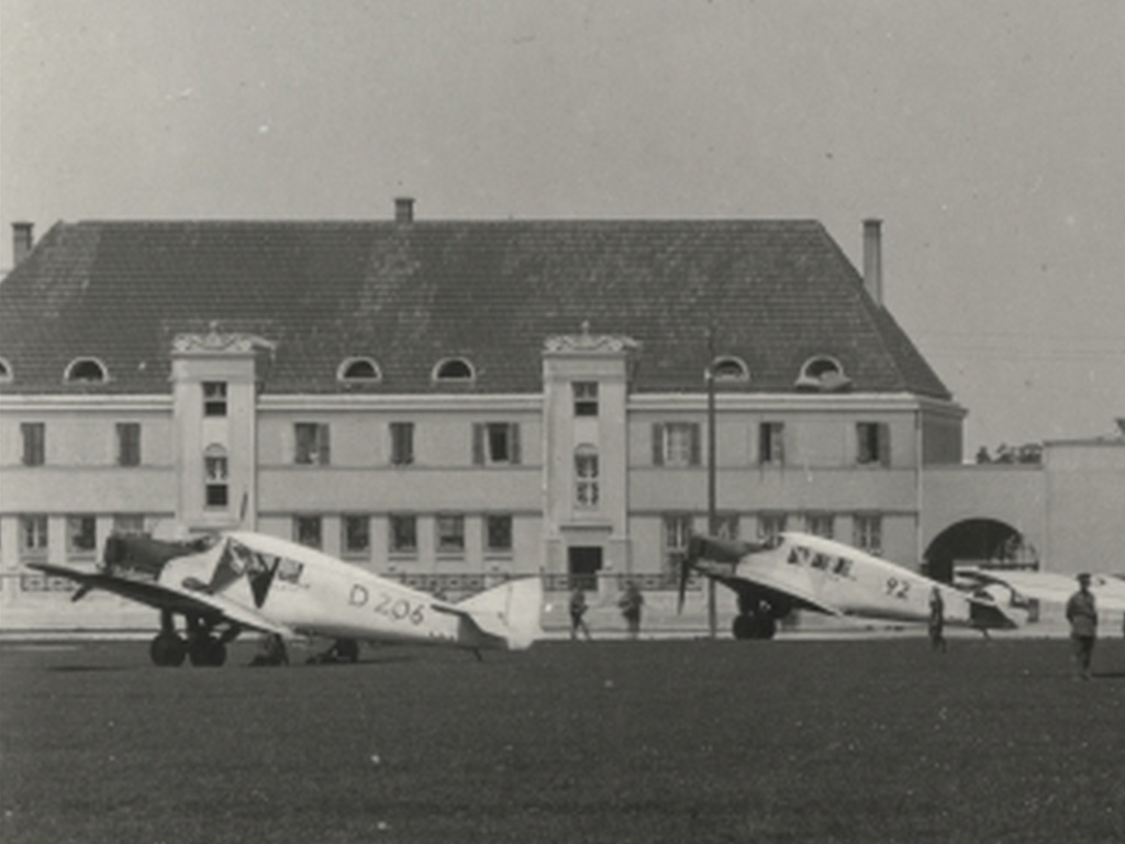
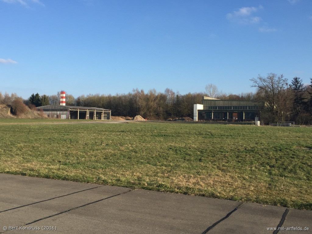
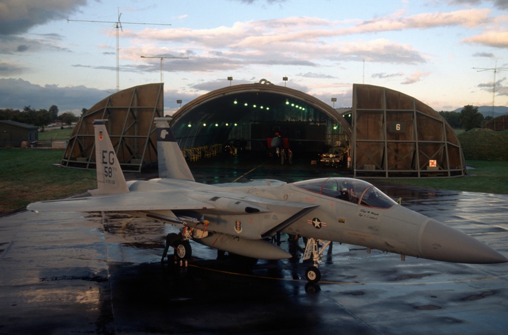
Image credits are shown on the respective target page, click on the preview to open it.
 Follow mil-airfields on Facebook