For historical information only, do not use for navigation or aviation purposes!
| Coordinates | N531208 E0123119 (WGS84) Google Maps |
| Elevation | 75 m |
| Former East Germany (GDR) | District of Potsdam |
| Federal state | Brandenburg |
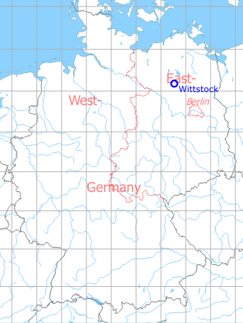
Germany during the Cold War Map
The history of the Cold War airfields: Wittstock
Location of airfield
5 km northeast of Wittstock/Dosse city center.
During World War II
Use
Luftwaffe air base (Fliegerhorst).
Situation
Wittstock Air Base in World War II on a US map from 1943
Source: McMaster University Library Digital Archive, Lizenz: Creative Commons Attribution-NonCommercial 2.5 CC BY-NC 2.5 CA
During the Cold War
Use
Soviet air base until 1994.
In the 1950s
Units
1954
- Headquarters Soviet Northern Fighter Corps
- Soviet fighter regiment (P. O. Box of the technical unit: 62 314),
- A total of 38 (?) MiG-15/MiG-15U were counted at the airfield.
Source: BND/Bundesarchiv B 206/3033
(For the P. O. Box numbers the digits 3 and 5 may be confused, because they are difficult to distinguish in the source document)
(For the P. O. Box numbers the digits 3 and 5 may be confused, because they are difficult to distinguish in the source document)
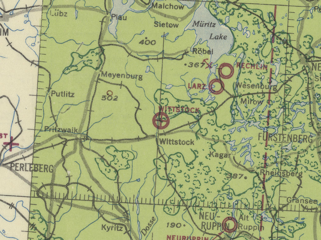
In the 1960s
Situation
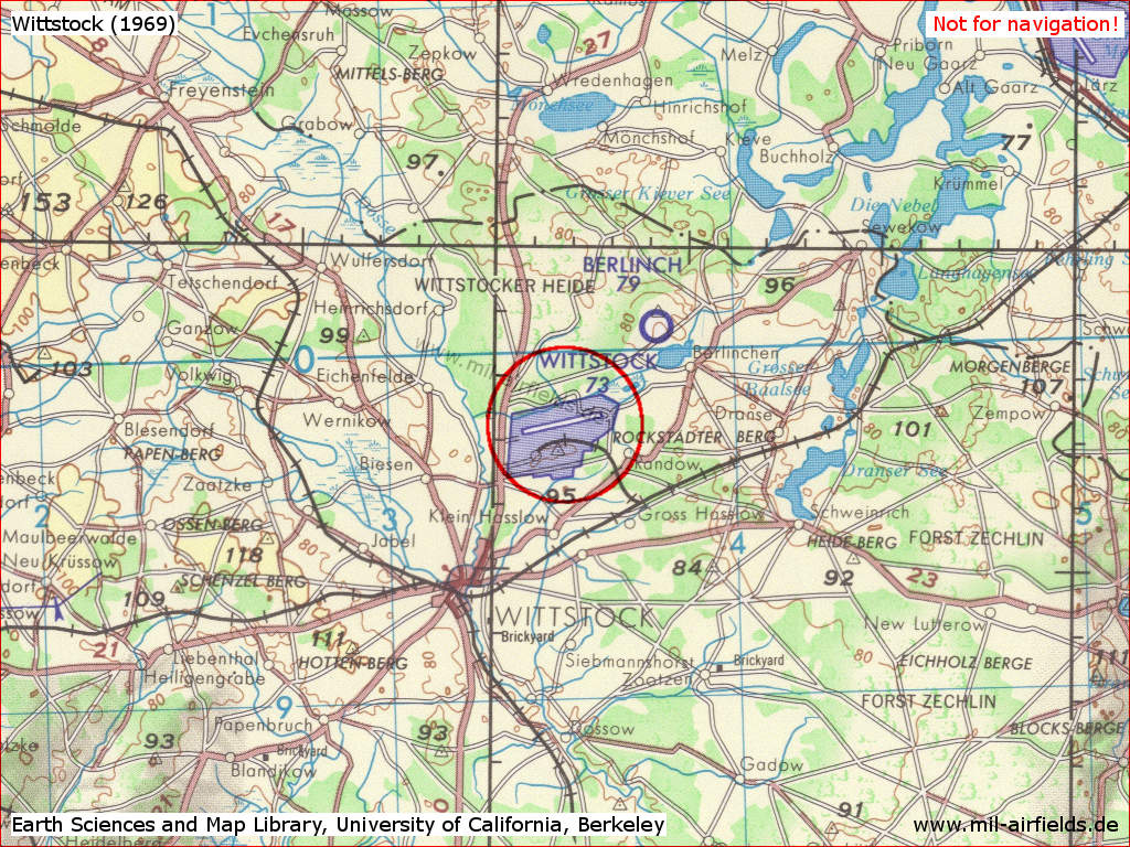
Wittstock Air Base on a US map from 1969
Source: Earth Sciences and Map Library, University of California, Berkeley
Overview
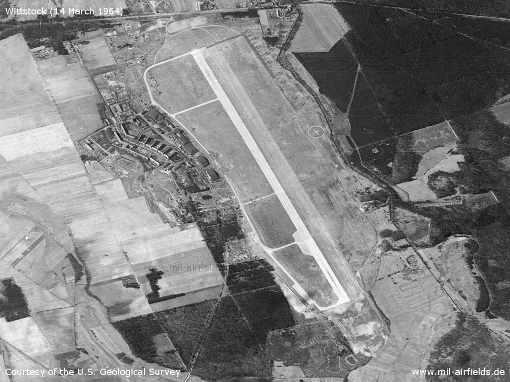
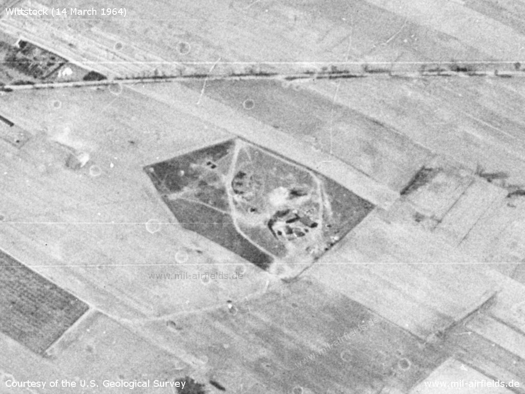
1964
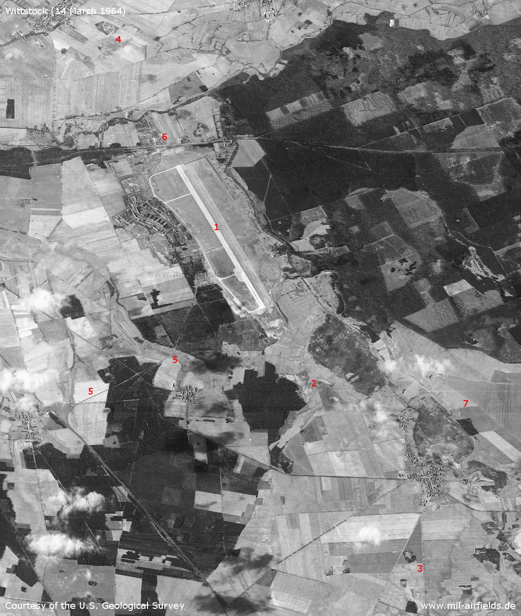
Wittstock Soviet Air Base on a US satellite image from 14 March 1964 - Viewing direction is approx. west. 1: Airfield; 2: inner radio beacon; 3: outer radio beacon; 4: radar site; 5: railway siding; 6: training ground; 7: Berlinchen airfield. The SAM site near Wulfersdorf did not exist at that time.
Source: U.S. Geological Survey
Airfield
Source: U.S. Geological Survey
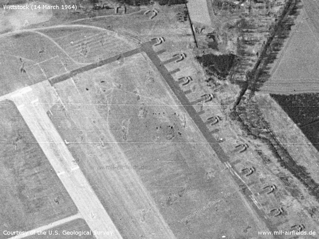
Southwestern end - Some aircraft are in blast walls, others next to it.
Source: U.S. Geological Survey
Northwestern end - A grass runway is marked directly north (here: on the right) of the paved runway. The aircraft revetments are empty.
Source: U.S. Geological Survey
The substance of the former Luftwaffe Fliegerhorst is still well preserved.
Source: U.S. Geological Survey
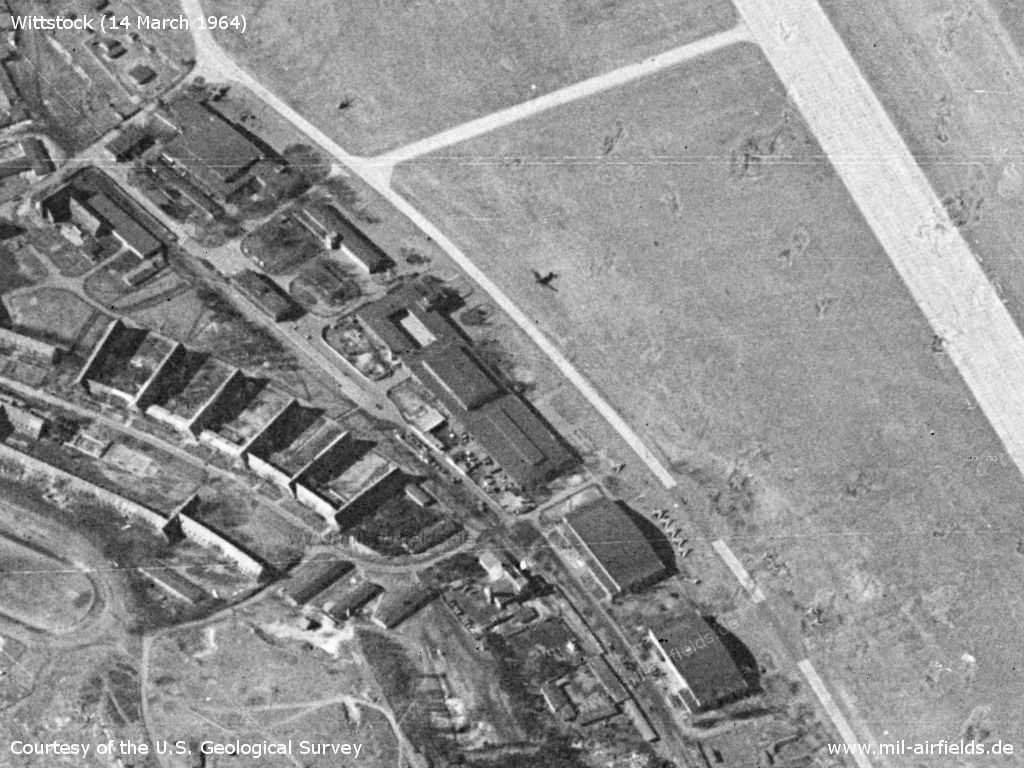
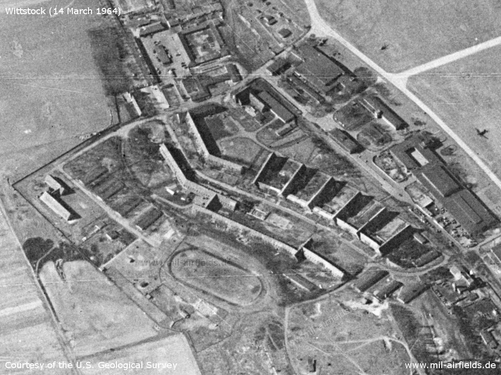
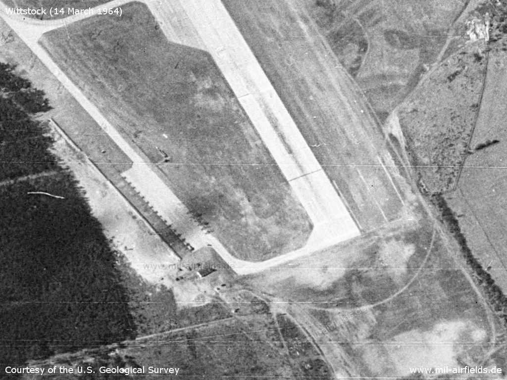
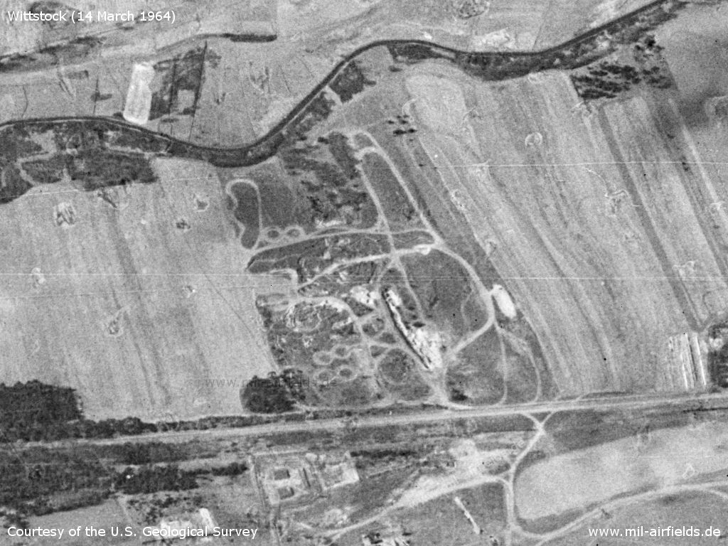
The field has numerous hangars - Directly in front of the upper hangar stands an airplane with stretched wings. The object opposite on the other side of the taxiway could be a helicopter. Approximately in the middle of the picture you can see a bigger plane. In front of the two lower halls there are several fighter planes.
Source: U.S. Geological Survey
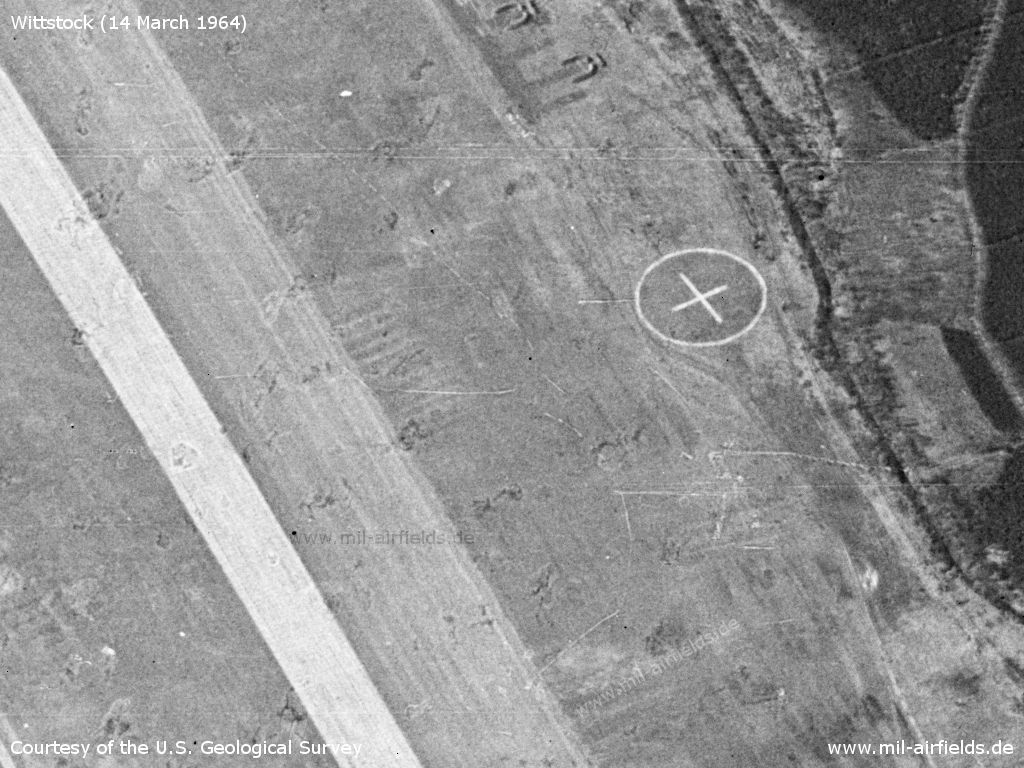
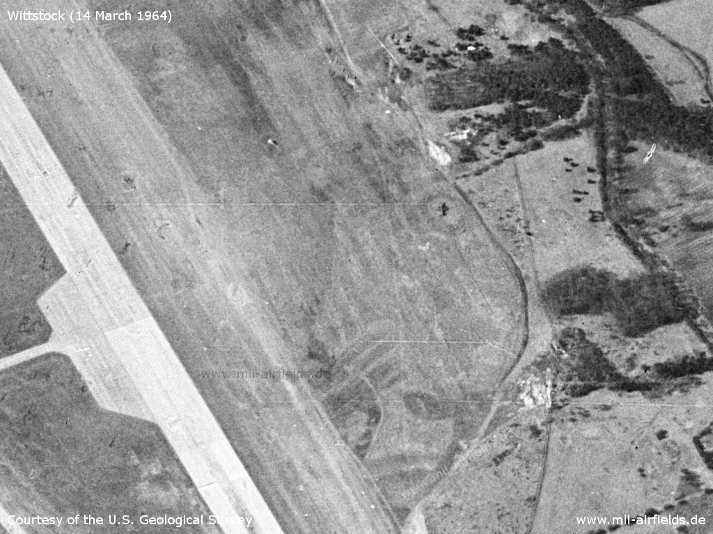
Target cross in the north
Source: U.S. Geological Survey
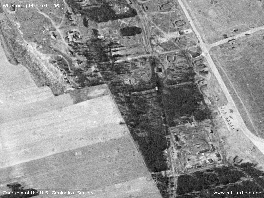
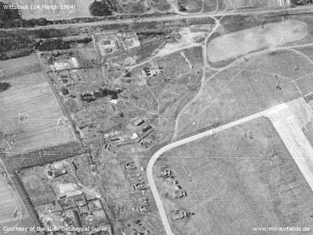
Further installations and railway siding
Source: U.S. Geological Survey
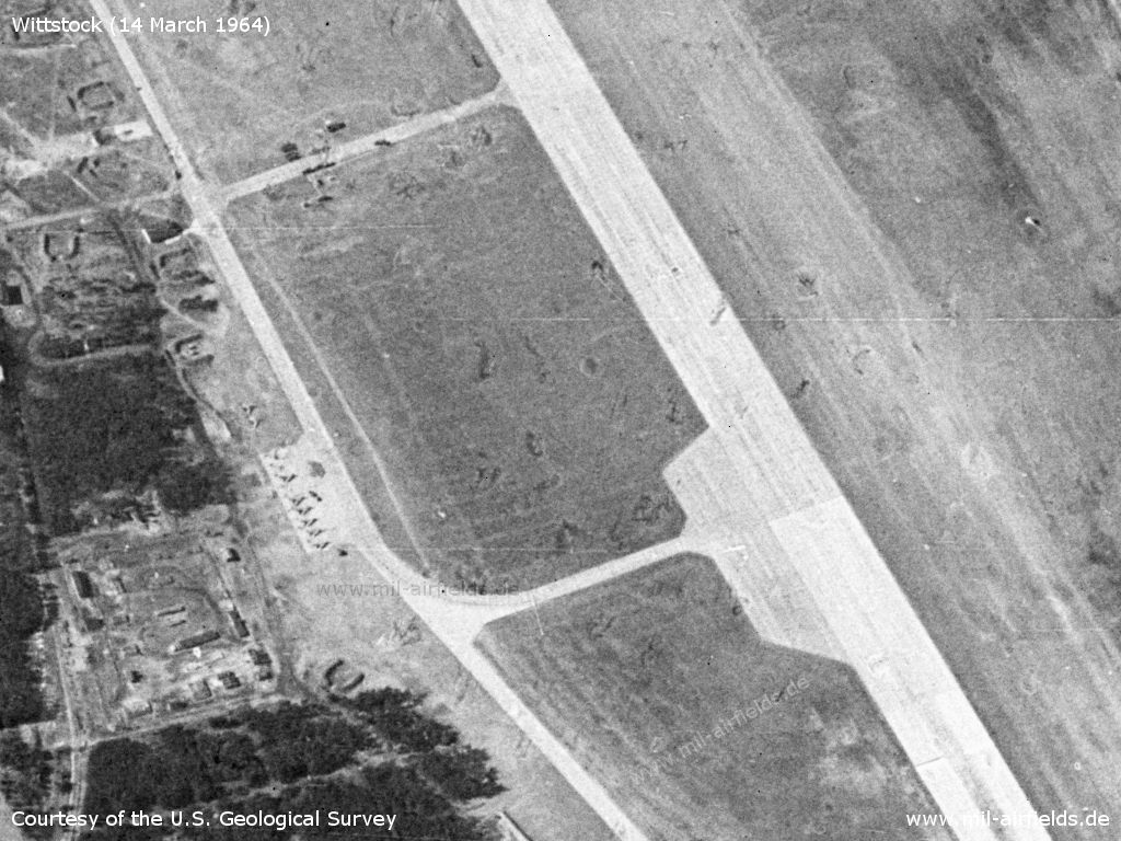
Parking areas and aircraft in the south-eastern part of the airport
Source: U.S. Geological Survey
Aircraft in the northeast - Decoy?
Source: U.S. Geological Survey
Beginning of the runway in the east - Here, too, the marked grass runway is visible directly to the right.
Source: U.S. Geological Survey
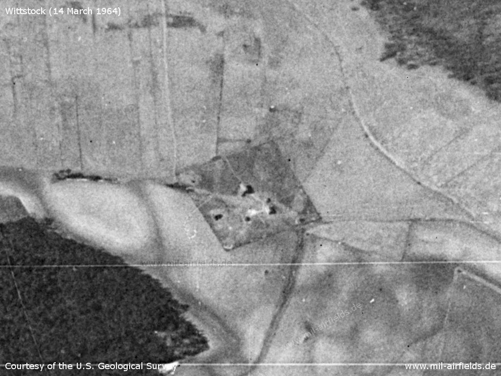
Inner radio beacon, approx. 1 km to east
Source: U.S. Geological Survey
Outer radio beacon, approx. 4 km to the east, between Berlinchen and Dranse
Source: U.S. Geological Survey
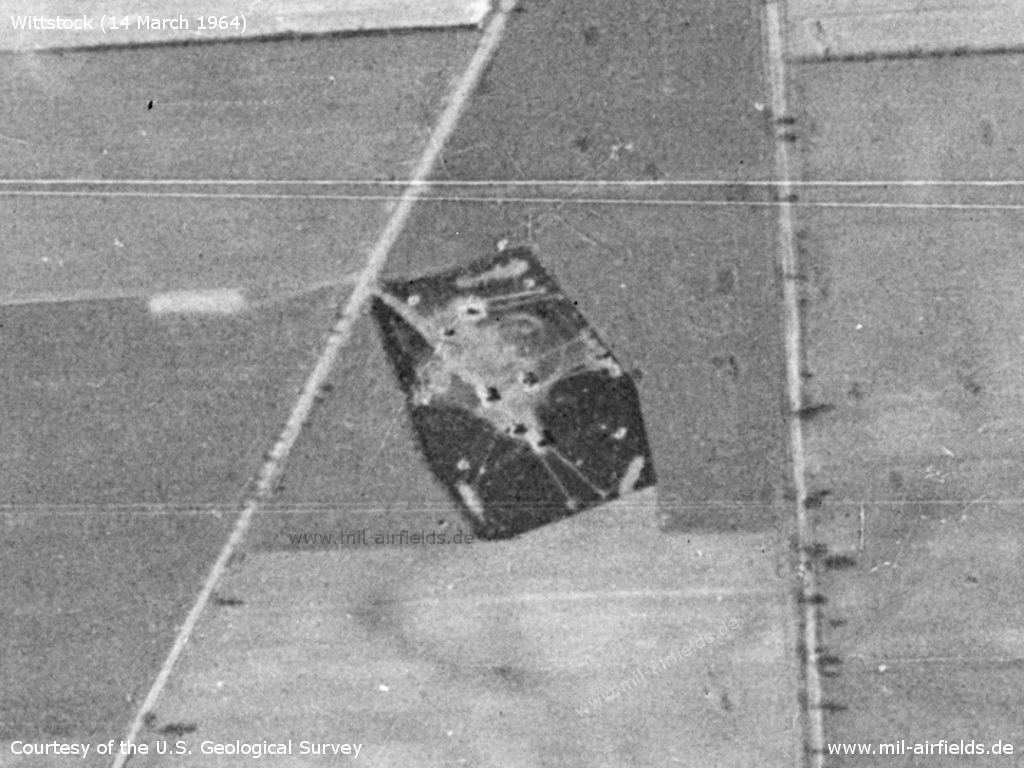
Radar site north of Biesen
Source: U.S. Geological Survey
Training area directly west of the airfield, on the road to Alt Daber
Source: U.S. Geological Survey
1969
Compared to 1964, the following pictures from 1969 show a significant change: There are now closed aircraft shelters at the airfield. In addition, about 8 km northwest near Wulfsdorf a surface-to-air missile (SAM) site has been built.
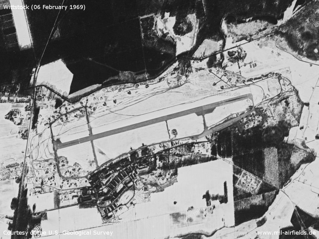
Satellite image from 06 February 1969, the area is covered with snow. - In the north, additional open revetments have apparently been built over the past 5 years.
Source: U.S. Geological Survey
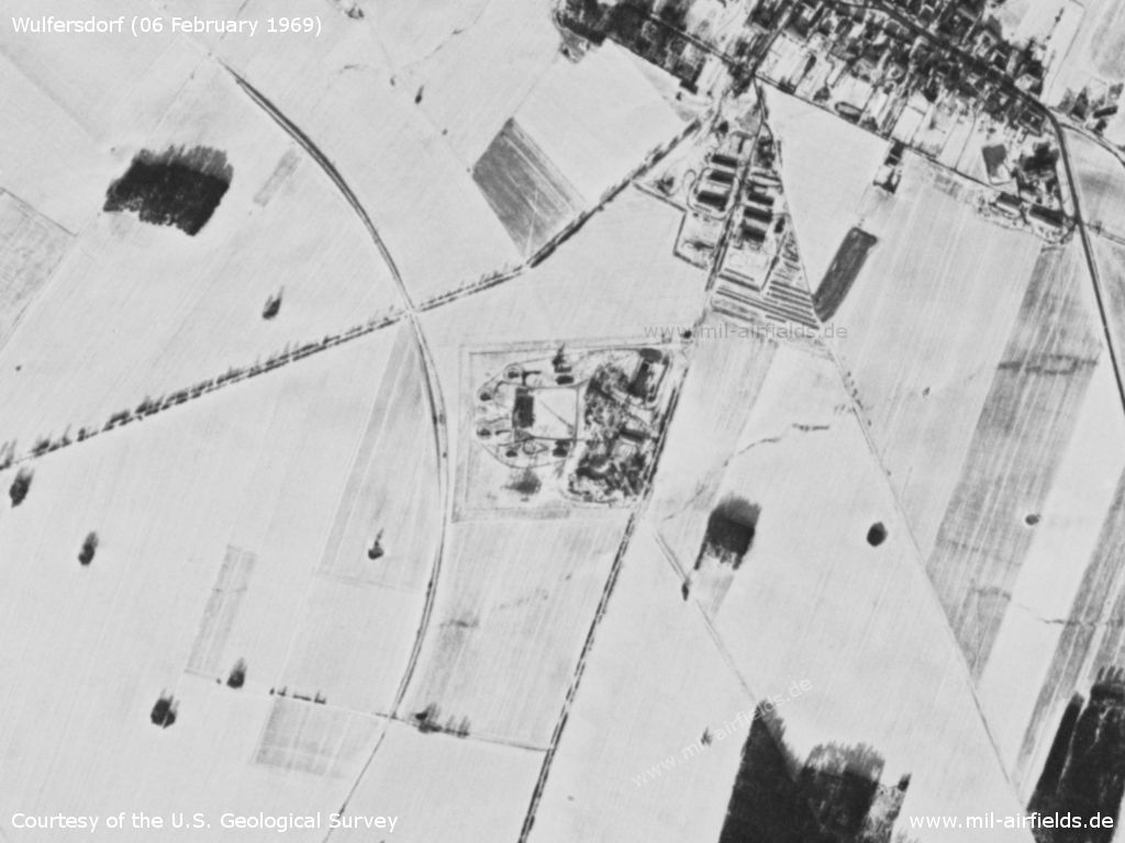
Soviet SAM site Wulfersdorf - Directly to the west, the Wittstock-Meyenburg railway line, which was closed down in 1967, passes in an arched shape.
Source: U.S. Geological Survey
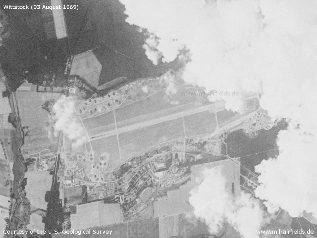
Even this satellite picture of 03 August 1969 is partly covered by clouds, you can see the aircraft shelter as dark objects.
Source: U.S. Geological Survey
Radio communication
The radio call sign of the air base was NAPJORSTOK.
History
- 1966
Observation by the US Military Liaison Mission: The single-jet (MiG-21PF) FISBED D interceptor aircraft joined the Wittstock regiment. In March, the arrival of a new squadron with that type was noticed. (Source: USMLM 1966)
Images
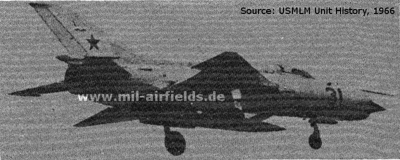
A MiG-21PF FISHBED D in 1966, probably from Wittstock
Source: United States Military Liaison Mission, Unit History 1966
In the 1970s
Situation
Wittstock Air Base on a map of the US Department of Defense from 1972
Source: ONC E-2 (1972), Perry-Castañeda Library Map Collection, University of Texas at Austin
In the 1980s and early 1990s
Runways
- 08/26: 2400 m
Radio beacons
- LOM 26: 421 "GJ", 4150 m
- LMM 26: 205 "G", 1100 m
- LOM 08: 421 "OR"
- LMM 08: 205 "O"
Radio communication
The Russian radio call sign for the airfield was GAZOVIJ ("Gas", original notation in Cyrillic: ГАЗОВЫЙ).
Standard training routes
"Flüge der LSK/LV der NVA und der LSK der GSSD im Rahmen der Gefechtsausbildung sind entsprechend der Grafik der Flugtage / -nächte auf der Grundlage der "Hauptflugregeln zum Fliegen im Luftraum der Deutschen Demokratischen Republik" auf Standardflugstrecken in den dazu festgelegten Flughöhen durchzuführen. ..." (Quelle: "Verzeichnis der Standardflugstrecken der LSK/LV der NVA und der LSK der GSSD"
As of 1989:
023 Wittstock, Pritzwalk, Neustadt-Glewe, Krudopp, Malchow, Wittstock
Höhe: 600, 900, 1200, 1850 m
Abfangabschnitt: Pritzwalk, Neustadt-Glewe, Malchow
Höhe: 600, 900, 1200, 1850 m
Abfangabschnitt: Pritzwalk, Neustadt-Glewe, Malchow
025 Wittstock, Pritzwalk, Neustadt-Glewe, Krudopp, Malchin, Schießplatz Retzow, Wittstock
Höhe: 900, 1200, 1850 m
Höhe: 900, 1200, 1850 m
026 Wittstock, Pritzwalk, Neustadt-Glewe, Krudopp, Malchin, Schießplatz Wittstock, Zechlin-Flecken, Wittstock (der Schießplatz Wittstock ist zu umfliegen)
Höhe: 900, 1200, 1850 m, ab Neustadt-Glewe 900 m
Höhe: 900, 1200, 1850 m, ab Neustadt-Glewe 900 m
027 Wittstock, Pritzwalk, Neustadt-Glewe, Crivitz, Neustrelitz, Wittstock
Höhe: 600, 1200, 1850 m
Abfangabschnitt: Crivitz, Neustrelitz
Höhe: 600, 1200, 1850 m
Abfangabschnitt: Crivitz, Neustrelitz
028 Wittstock, Pritzwalk, Ruhlsdorf, Loitz, Wittstock
Höhe: 8650, 9450, 11900-18000 m
Höheneinnahme: Traverse Parchim
Abfangabschnitt: Lindow, Stavenhagen
Höhe: 8650, 9450, 11900-18000 m
Höheneinnahme: Traverse Parchim
Abfangabschnitt: Lindow, Stavenhagen
029 Wittstock, Pritzwalk, Ruhlsdorf, Grimmen, Wittstock
Höhe: 11000-18000 m
Abfangabschnitt: Lindow, Teterow
Höhe: 11000-18000 m
Abfangabschnitt: Lindow, Teterow
Units
33 IAP: MiG-29, MiG-29UB, MiG-23UB (1990)
Installations
- Railway siding from Groß Haßlow to the southern part of the airfield.
- Radar site west of airfield near Biesen.
- The airfield's anti-aircraft missile site was near Wulfersdorf.
Today
Use
Closed.
Sources
- https://www.usgs.gov/ - USGS U.S. Geological Survey
- https://legacy.lib.utexas.edu/maps/ - Perry-Castañeda Library Map Collection
- https://digitalarchive.mcmaster.ca/ - McMaster University Library Digital Archive
Bibliography
- Ries, Karl; Dierich, Wolfgang: "Fliegerhorste und Einsatzhäfen der Luftwaffe" Motorbuch Verlag Stuttgart, 1993 - Allied map of the former Luftwaffe airbase
- /USMLM 1966USMLM 1966/:
United States Military Liaison MissionUnited States Military Liaison Mission: "Unit History 1966Unit History 1966" - Freundt, Lutz: "Sowjetische Fliegerkräfte in Deutschland 1945-1994, Band 3" Edition Freundt Eigenverlag, Diepholz 1999 - Description, pictures, aerial pictures from 1953 and 1991
- Freundt, Lutz: "Sowjetische Fliegerkräfte in Deutschland 1945-1994, Band 4" Edition Freundt Eigenverlag, Diepholz 2000 - Additions
- Freundt, Lutz (Hrsg.), Büttner, Stefan: "Rote Plätze - Russische Militärflugplätze in Deutschland 1945 - 1994" AeroLit Verlag, 2007 - Description, pictures, aerial pictures from 1953 and 1991
Related topics
Airfields in the vicinity
- 309°/13km Freyenstein: Agricultural Airfield
- 280°/14km Rohlsdorf: Helipad 3355 (HSLP / HLP 3355)
- 143°/16km Gadow: Airfield Replica
- 053°/19km Lärz: Air Base (Mirow, Rechlin-Lärz)
- 147°/20km Neuglienicke: Airfield (Glienicke)
Categories
Military Airfields GermanyMilitary Airfields in former East GermanyAirfields of the Soviet Forces in GermanyRecommended
Image credits are shown on the respective target page, click on the preview to open it.
 Follow mil-airfields on Facebook