Vienna Schwechat Airport
Wien
Historical approach and aerodrome charts
For historical information only, do not use for navigation or aviation purposes!
| Coordinates | N480657 E0163320 (WGS84) Google Maps |
| Location indicator | LOWW |
In the 1950s
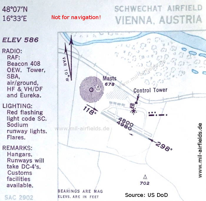
Airport (October 1950) - At this time, the airfield is operated by the Royal Air Force (RAF). Typical for RAF airfields are red airport beacons, here it has the Morse code "SC". (Source: US DoD)
In the 1960s
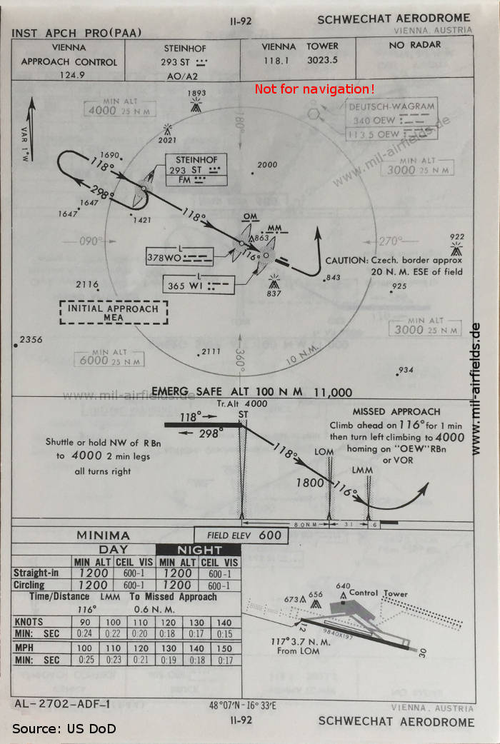
NDB approach runway 12 (October 1960) - At that time, the construction of a parallel runway was already planned. But while today's third runway is to be built in the south, here a parallel runway was planned in the northeast of the field. (Source: US DoD)
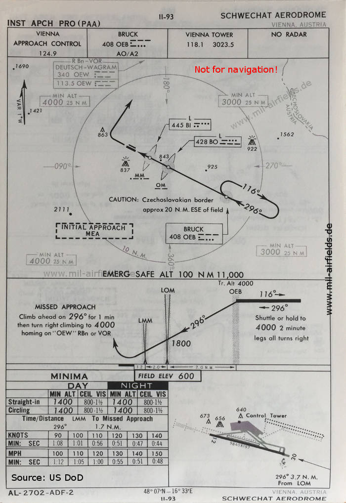
NDB approach runway 30 (October 1960) - In 1960, the runway still had the designation 12/30, while today it is 11/29. (Source: US DoD)
Source for all maps, if not marked otherwise: US Department of Defense (US DoD)
Recommended
Image credits are shown on the respective target page, click on the preview to open it.
Navigation
Historical approach and aerodrome charts - Austria