Tulln Langenlebarn Brumowski Air Base
Langenlebarn, Brumowski
Historical approach and aerodrome charts
For historical information only, do not use for navigation or aviation purposes!
| Coordinates | N481910 E0160654 (WGS84) Google Maps |
| Elevation | 575 ft |
| Location indicator | LOXT |
Until the Austrian State Treaty came into force in 1955, Tulln lay in the Soviet zone, but was used by US troops.
In the 1950s
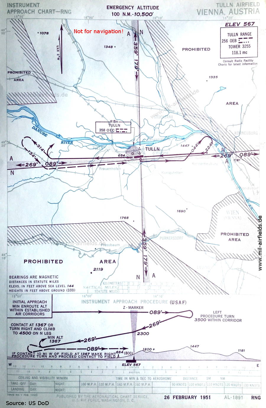
Range approach runway 09 (February 1951) (Source: US DoD)
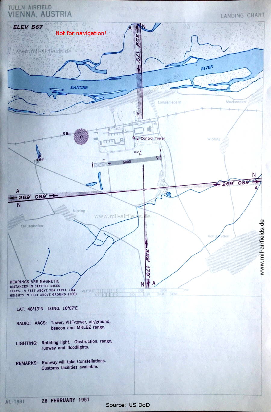
Airfield (February 1951) - Air traffic control services are provided by the Airways and Air Communications Service (AACS) of the US Armed Forces. (Source: US DoD)
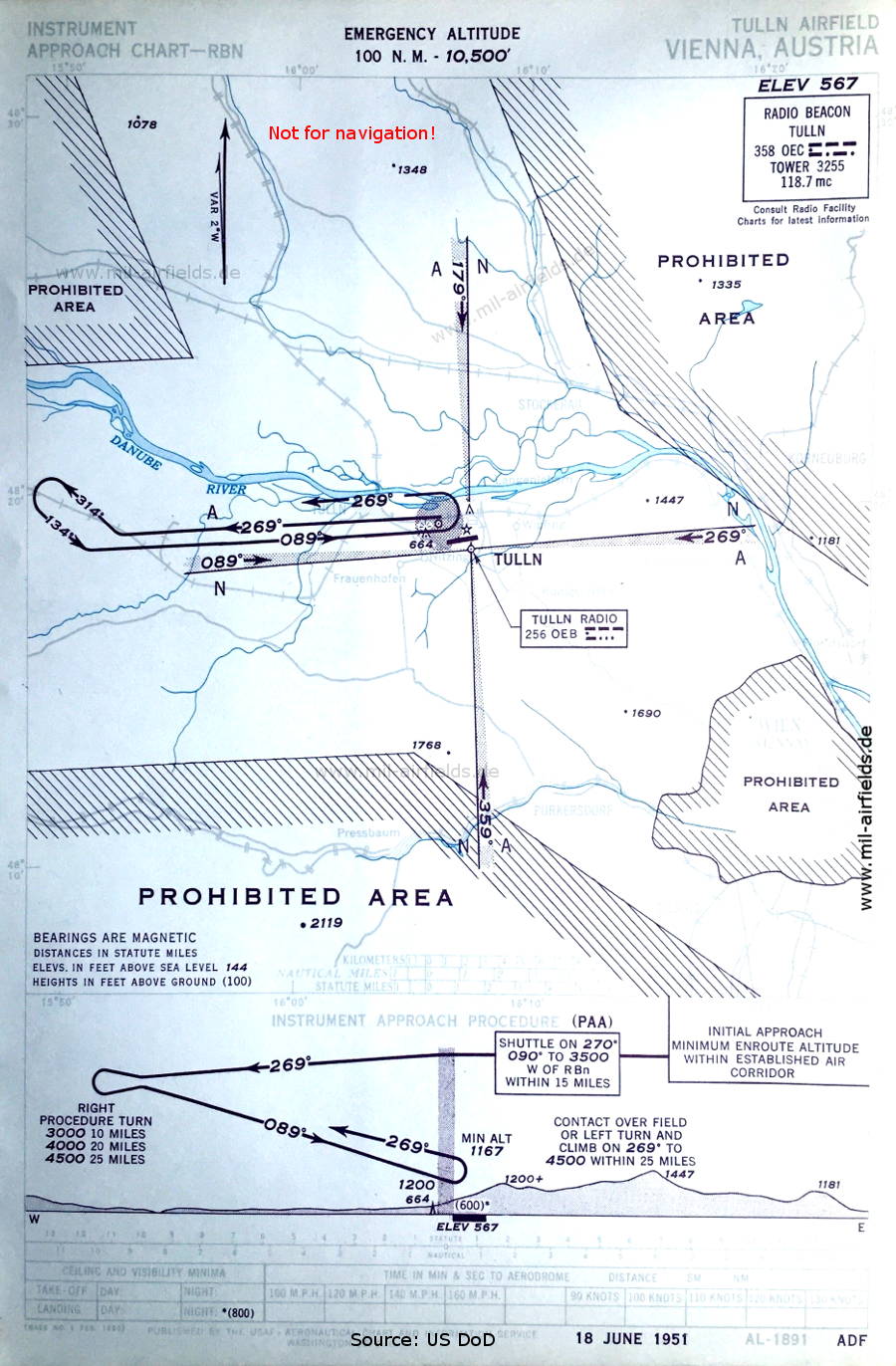
NDB approach runway 09 (June 1951) (Source: US DoD)
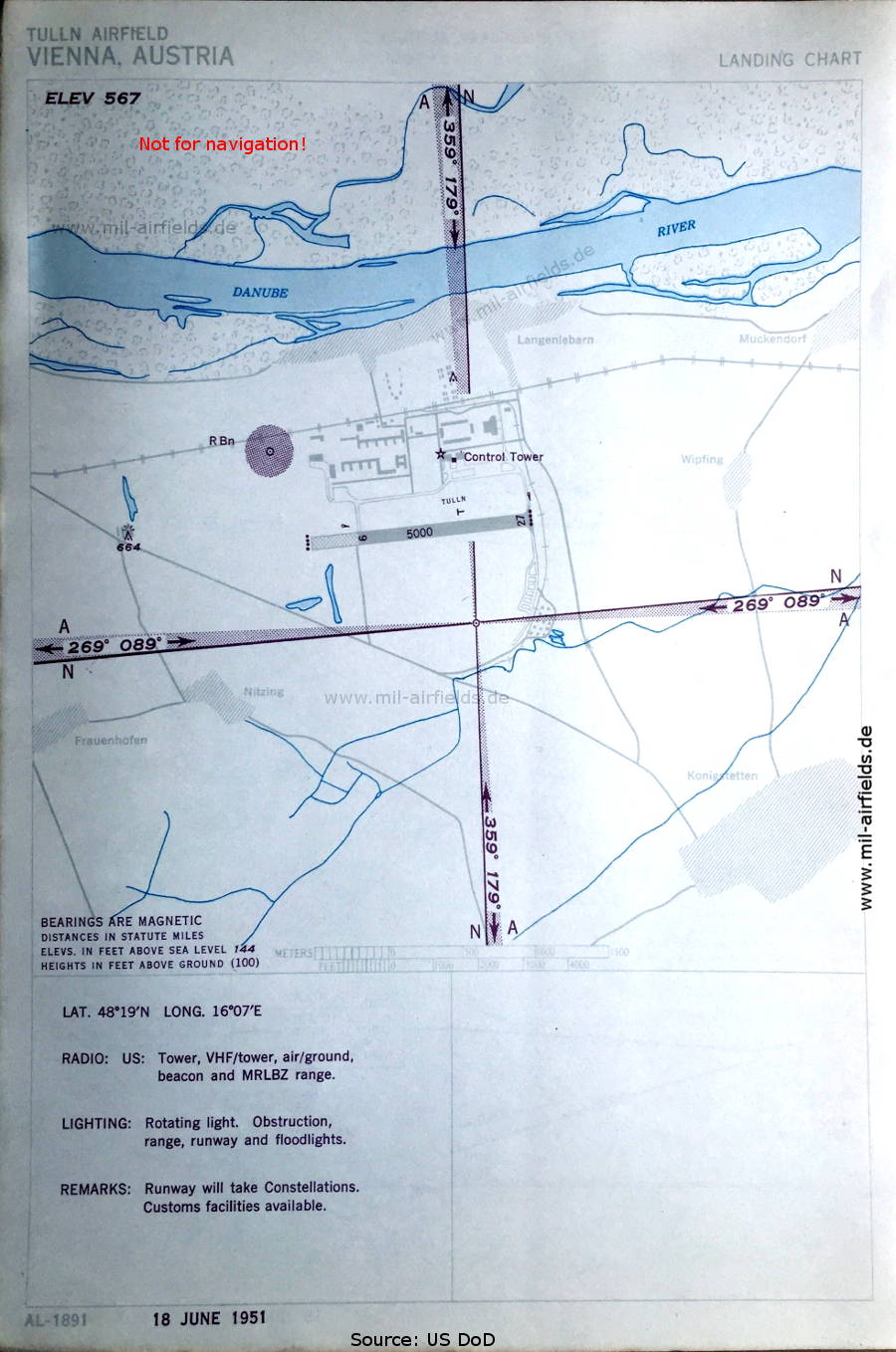
Aerodrome (June 1951) (Source: US DoD)
Index to the objects shown on the maps
Radio beacons:
- Tulln Range "OEB", NDB "OEC"
Air traffic control:
- Tulln Tower
Places:
- Danube,
- Floridsdorf, Frauenhofen
- Königstetten, Korneuburg
- Langenlebarn
- Muckendorf an der Donau
- Nitzing
- Pressbaum, Purkersdorf
- Stockerau
- Tulln
- Wien, Wipfing
Source for all maps, if not marked otherwise: US Department of Defense (US DoD)
Recommended
Image credits are shown on the respective target page, click on the preview to open it.
Navigation
Historical approach and aerodrome charts - Austria