Nörvenich Air Base
Düren
Historical approach charts
For historical information only, do not use for navigation or aviation purposes!
| Coordinates | N504952 E0063929 (WGS84) Google Maps |
| Federal state | Nordrhein-Westfalen (North Rhine-Westphalia) |
Location Indicator: DANW (RAF); DENV, EDNN, ETNN (GAF)
User: Royal Air Force (RAF), German Air Force (GAF)
In the 1960s
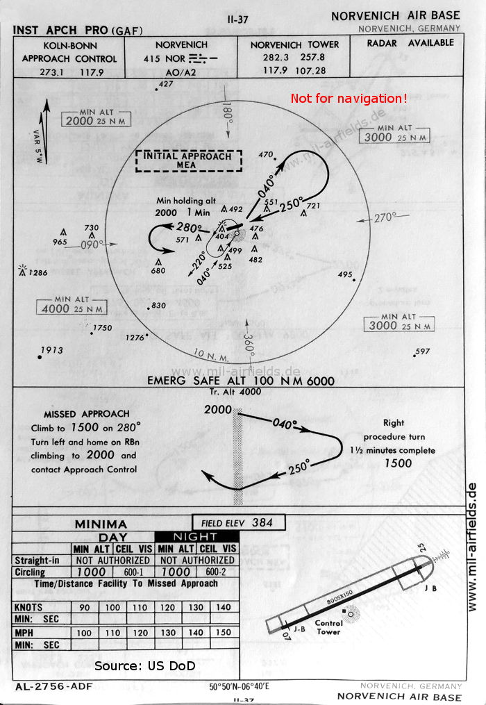
NDB approach runway 25 (October 1960) (Source: US DoD)
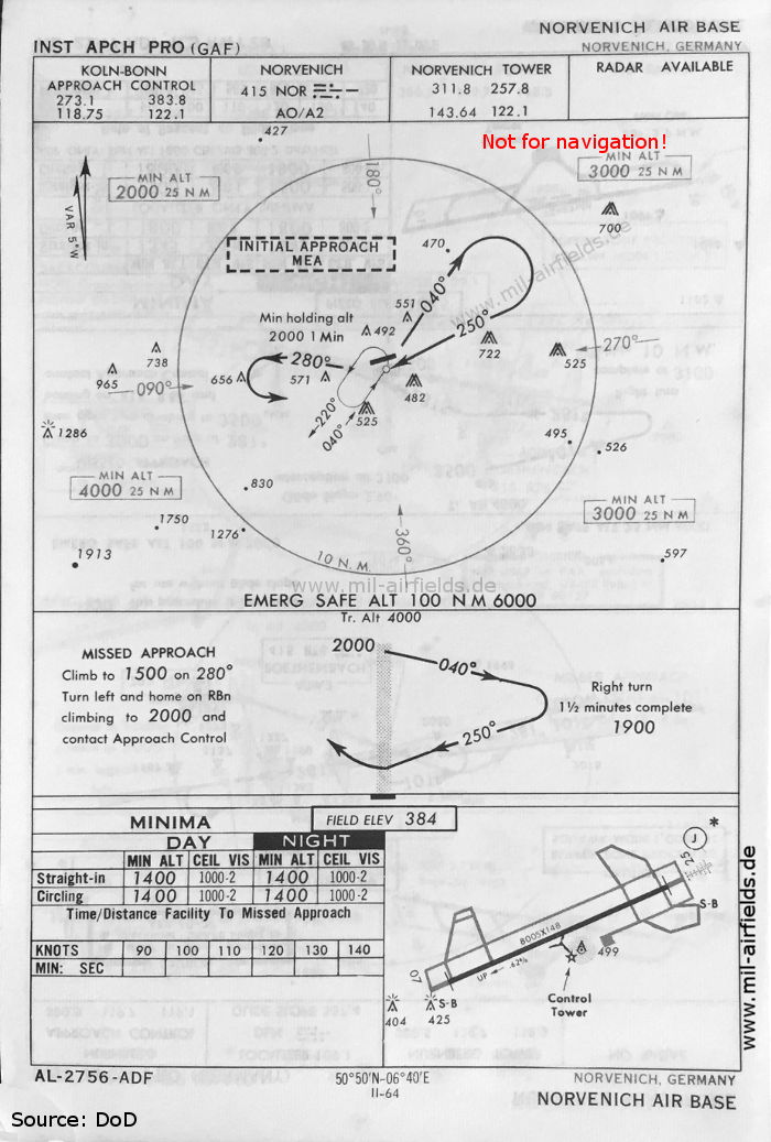
NDB approach runway 25 (May 1966) (Source: US DoD)
Source for all maps, if not marked otherwise: US Department of Defense (US DoD)
Recommended

Image credits are shown on the respective target page, click on the preview to open it.
Navigation
Approach and airfield charts - Federal Republic of Germany