Köln-Bonn Airport (Cologne Wahn)
Cologne, Wahner Heide, RAF Wahn
Historical approach and aerodrome charts
For historical information only, do not use for navigation or aviation purposes!
| Coordinates | N505158 E0070836 (WGS84) Google Maps |
| Elevation | 300 ft |
| Federal state | Nordrhein-Westfalen (North Rhine-Westphalia) |
| Location indicator | DDKB (195x), EDDK (civ), EDNK (mil), ETNK (mil) |
Airfield
Location Indicator: DAWA, DAWH (RAF); DENO (GAF); DDKB, EDDK (Airport)
User: Royal Air Force (RAF), German Air Force (GAF), Köln-Bonn Airport
In the 1950s
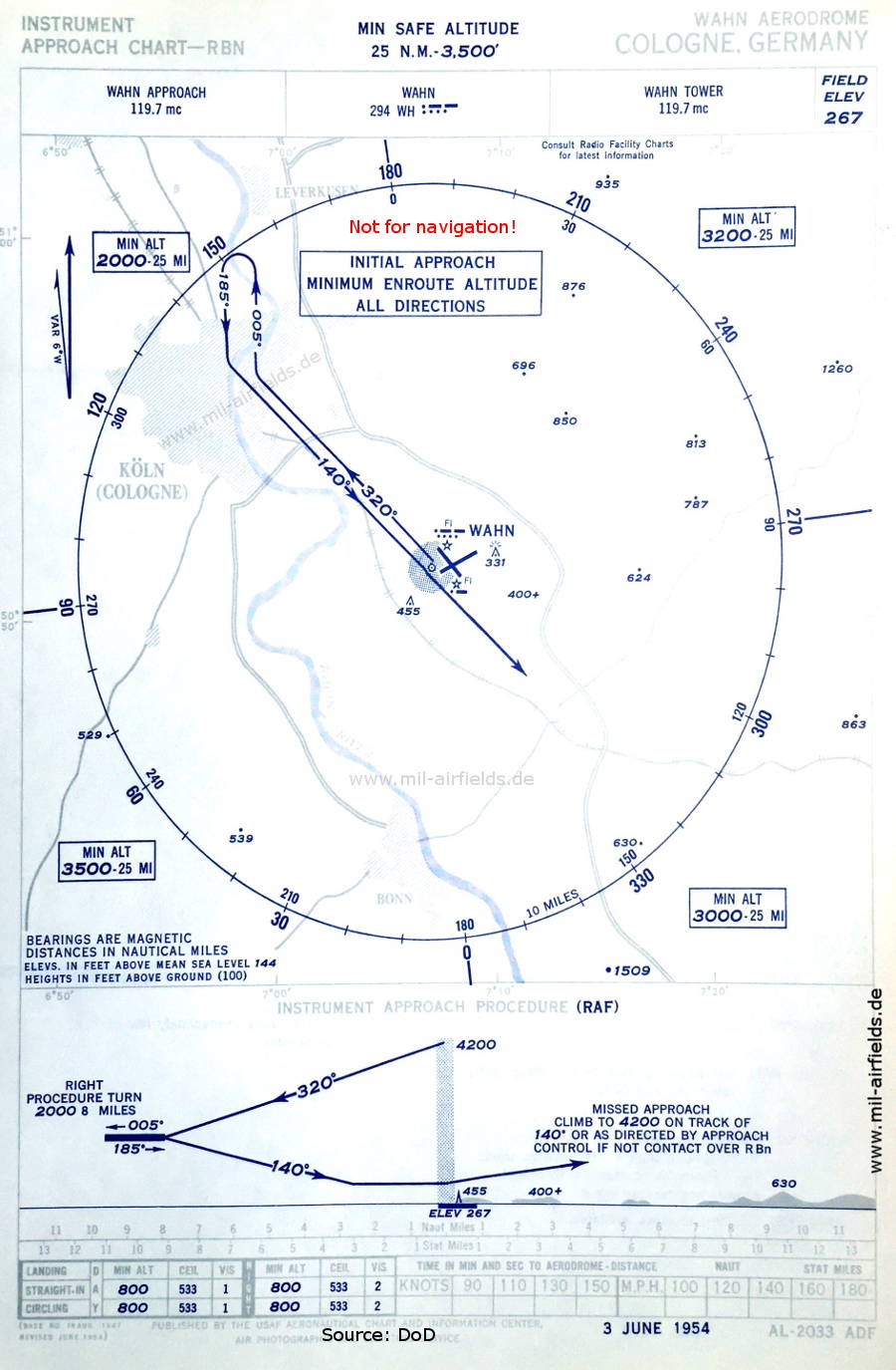
NDB approach runway 14 (June 1954) (Source: US DoD)
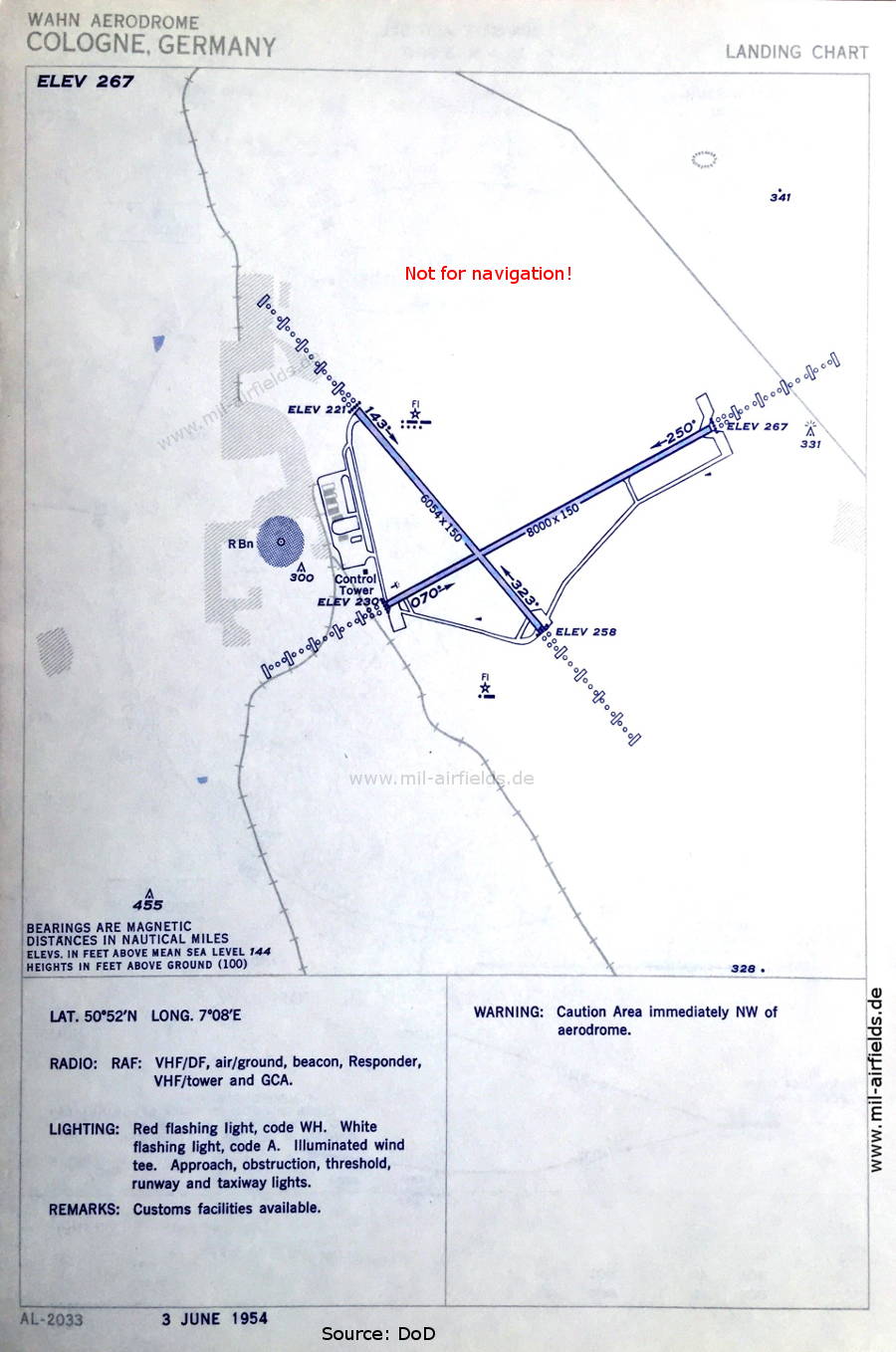
Aerodrome chart (June 1954) - The airfield is still operated by the Royal Air Force (RAF). Typical for RAF airfields is a red beacon, here it emits the Morse letters WH. There are two runways - 070/250: length 2438 m, width 46 m (8000 feet x 150 feet), 143/323: length 1845 m, width 46 m (6054 feet x 150 feet). (Source: US DoD)
In the 1960s

NDB approach runway 25 (October 1960) (Source: US DoD)
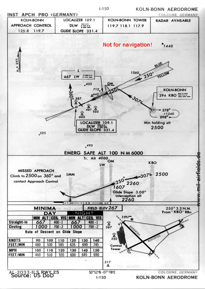
ILS approach runway 25 (October 1960) (Source: US DoD)
Source for all maps, if not marked otherwise: US Department of Defense (DoD)
Index to the objects shown on the maps
Radio beacons:
- Köln-Bonn NDB "KBO", Locator "LW", ILS "DLW", Outer Marker
- Wahn NDB "WH"
Air traffic control
- Köln-Bonn Approach Control, Köln-Bonn Tower
- Wahn Approach, Wahn Tower
Source for all maps, if not marked otherwise: US Department of Defense (US DoD)
Recommended


Image credits are shown on the respective target page, click on the preview to open it.
 mil-airfields.de at Facebook