Oldenburg Air Base
Historical approach and aerodrome charts Germany
For historical information only, do not use for navigation or aviation purposes!
| Coordinates | N531049 E0080939 (WGS84) Google Maps |
| Elevation | 40 ft |
| Federal state | Niedersachsen (Lower Saxony) |
| Location indicator | EDNO (1990) |
| Operator | Luftwaffe / German Airforce |
Location Indicator: DEOB, EDNO
User: Royal Air Force (RAF), German Air Force (GAF)
In the 1960s
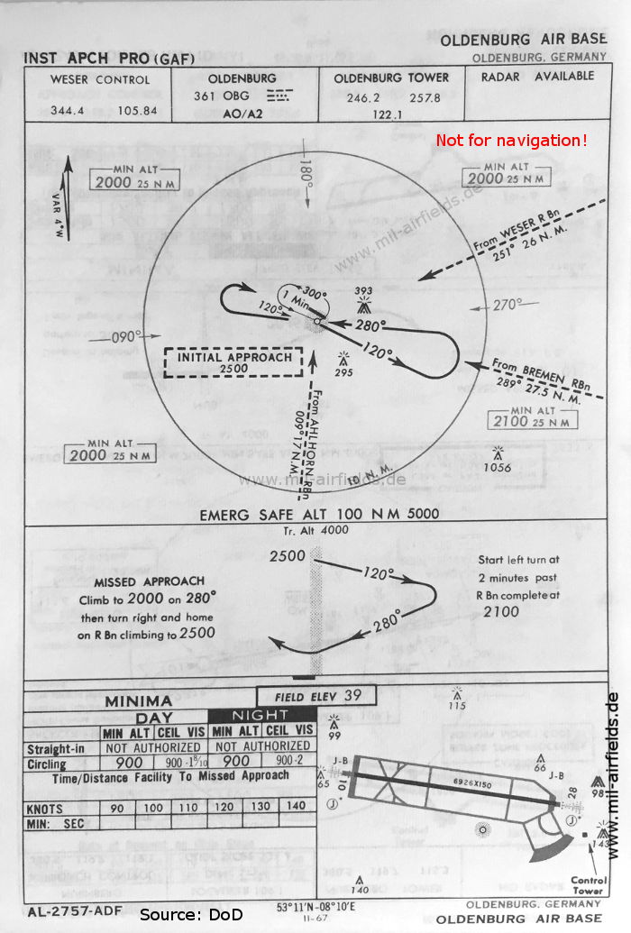
NDB approach runway 28 (May 1966) (Source: DoD)
Source for all maps, if not marked otherwise: US Department of Defense (US DoD)
Recommended

Image credits are shown on the respective target page, click on the preview to open it.