Pferdsfeld Air Base
Eckweiler
Historical approach charts
For historical information only, do not use for navigation or aviation purposes!
| Coordinates | N495120 E0073619 (WGS84) Google Maps |
| Elevation | 1299 ft |
| Federal state | Rheinland-Pfalz (Rhineland-Palatinate) |
| Location indicator | EDSP |
Location Indicator: DBPF, EDSP, ETSP
User: US Air Force (USAF), German Air Force (GAF)
In the 1960s

NDB approach runway 26 (October 1960) - Procedure by the US Air Force. Approach control is provided by "Sembach Control" (Source: US DoD)
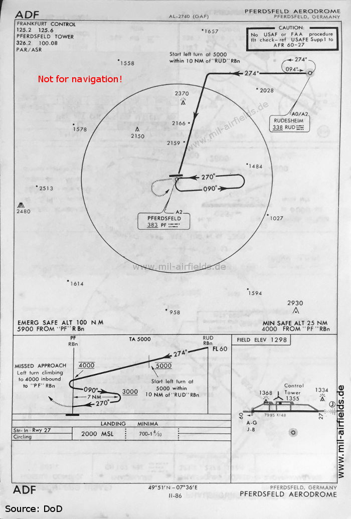
ADF approach (May 1966) - Procedure by the German Air Force. Compared to the chart from 1960, the NDB is now located in the south of the field. (Source: US DoD)
Source for all maps, if not marked otherwise: US Department of Defense (US DoD)
Recommended

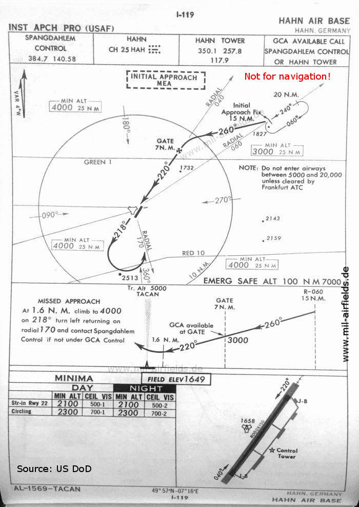
Image credits are shown on the respective target page, click on the preview to open it.
Navigation
Approach and airfield charts - Federal Republic of Germany