Hahn Air Base
Historical approach charts: EDAH, EDFH
For historical information only, do not use for navigation or aviation purposes!
| Coordinates | N495652 E0071547 (WGS84) Google Maps |
| Elevation | 1649 ft |
| Location indicator | EDAH (1990), EDFH (2000) |
| Operator | USAF |
Air Base / Airport
Region:
Rheinland-Pfalz, Hunsrück
Location indicator:
EDAH, EDFH
User:
US Air Force (USAF)
In the 1950s

NDB approach (January 1954) - Interim edition. (Source: US DoD)
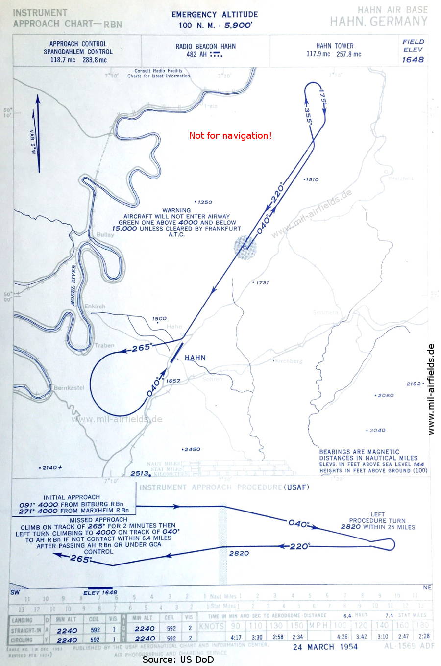
NDB approach (March 1954) - In contrast to the map of January, Spangdahlem Control is now responsible, no longer Bitburg Approach Control. (Source: US DoD)
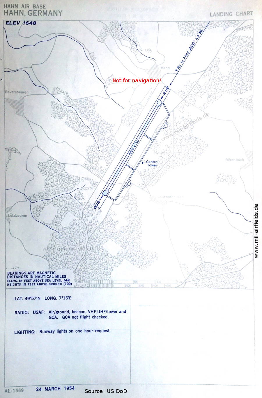
Aerodrome chart (March 1954) - There is one runway - 038/218: length 2438 m, width 46 m (8000 feet x 150 feet). (Source: US DoD)
In the 1960s
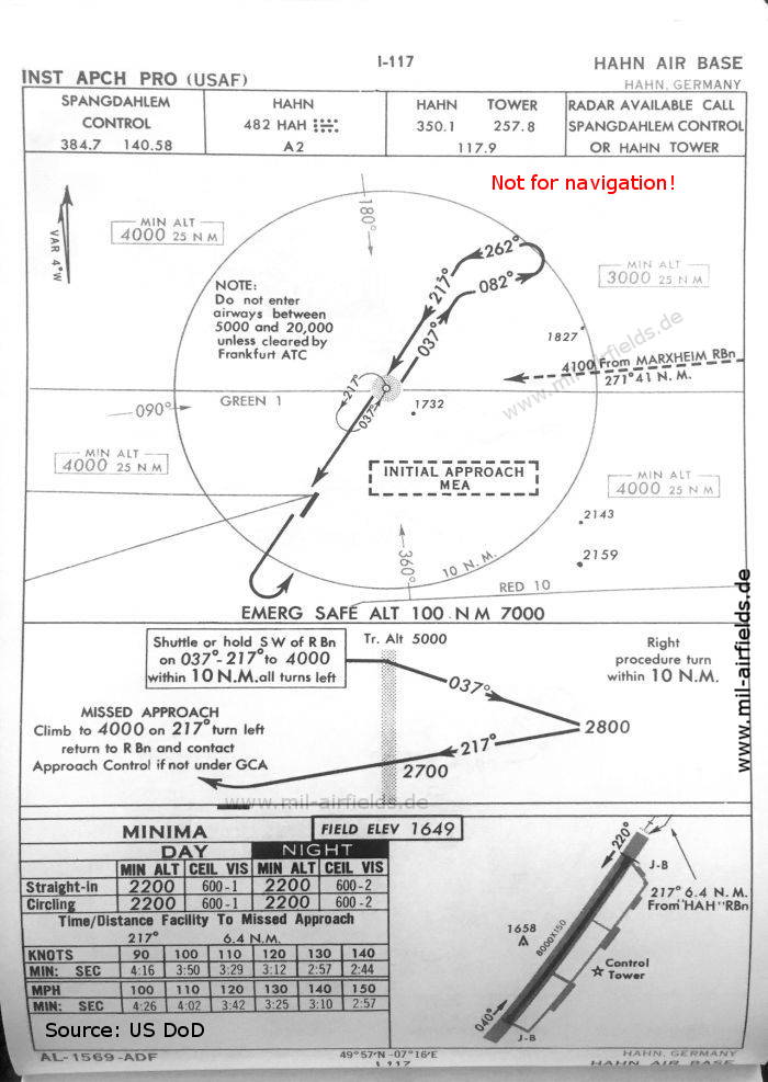
NDB approach runway 22 (October 1960) - The runway length is still shown with 2438 m (8000 feet). (Source: US DoD)
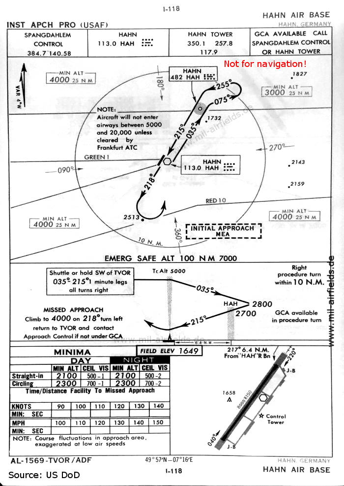
VOR approach runway 22 (October 1960) - As at many other US Air Force bases, Hahn had a VOR beacon for a few years. (Source: US DoD)
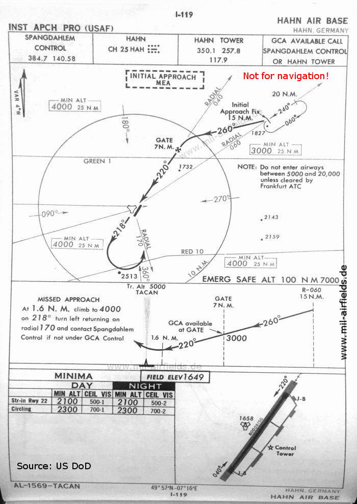
TACAN approach runway 22 (October 1960) (Source: US DoD)
Index to the objects shown on the maps
Airspace:
- Airway Green 1
Radio beacons:
- Hahn NDB "AH", "HAH", VOR "HAH", TACAN "HAH"
Air traffic control
- Bitburg Approach Control
- Hahn Tower
- Spangdahlem Control
Source for all maps, if not marked otherwise: US Department of Defense (US DoD)
Recommended

Image credits are shown on the respective target page, click on the preview to open it.
 mil-airfields.de at Facebook