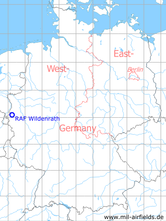
RAF Wildenrath
Historical approach charts - Federal Republic of Germany
For historical information only, do not use for navigation or aviation purposes!
| Coordinates | N510652 E0061307 (WGS84) Google Maps |
| Elevation | 291 ft |
| Federal state | Nordrhein-Westfalen (North Rhine-Westphalia) |
| Location indicator | EDUW |
In the 1960s

NDB approach (October 1960) - Characteristic for airfields of the Royal Air Force (RAF) is the Morse-coded flashing beacon, which is marked here south of the runway threshold 27 and which has the identifier "WI". (Source: US DoD)
In the 1980s and early 1990s
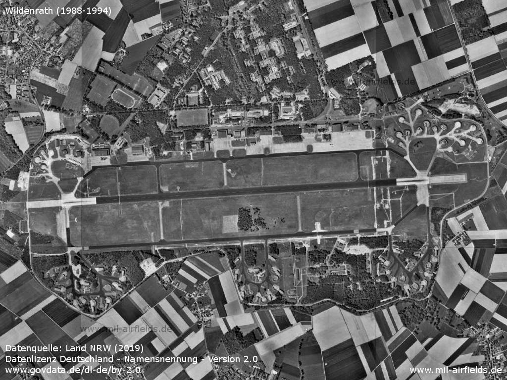
Air base - Aerial view taken between 1988 and 1994 (Source: Land NRW (2019) Datenlizenz Deutschland - Namensnennung - Version 2.0 www.govdata.de/dl-de/by-2.0)
Source for all maps, if not marked otherwise: US Department of Defense (DoD)
Frequently asked questions about Wildenrath Air Base
In which country was RAF Wildenrath located?
Germany.
In East or West Germany?
West Germany.
In which federal state was the airfield?
In Nordrhein-Westfalen (North Rhine-Westphalia)
Who was stationed at the airfield?
Wildenrath was used by the Royal Air Force (RAF).
How long was the runway at Leipheim?
In 1990 Wildenrath had a runway 09/27, length 2497 m, width 45 m.
What was the ICAO code?
When did the military use end?
What is today on the former air base?
Today, the Wegberg-Wildenrath test center, a railroad test track, is located on the site.
Recommended


Image credits are shown on the respective target page, click on the preview to open it.
 mil-airfields.de at Facebook