Wittmundhafen Air Base
Historical approach and aerodrome charts
For historical information only, do not use for navigation or aviation purposes!
Airfield
Region: Ostfriesland, Niedersachsen
Location indicator: EDNT, ETNT
User:
In the 1960s
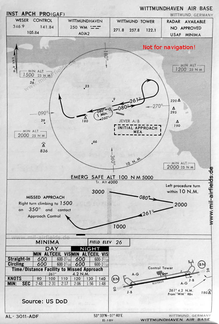
NDB approach runway 26 (May 1966) - Here the name "Wittmundhaven" is still in the spelling of the imperial navy with "v". There is one runway - 08/26: length 2440 m, width 30 m (8005 feet x 98 feet). (Source: US DoD)
Index to the objects shown on the maps
Aerodromes:
- Wittmundhafen, Jever
Radio beacons:
- Wittmundhaven NDB "WM"
Air traffic control:
- Weser Control, Wittmund Tower
Source for all maps, if not marked otherwise: US Department of Defense (US DoD)
Recommended

Image credits are shown on the respective target page, click on the preview to open it.
 mil-airfields.de at Facebook