Wunstorf Air Base
Kleinheidorn
Historical approach charts
For historical information only, do not use for navigation or aviation purposes!
| Coordinates | N522727 E0092551 (WGS84) Google Maps |
| Location indicator | DEWU (195x), EDNW (196x-199x), ETNW (199x-) |
Location Indicator: DAWU (RAF); DEWU, EDNW, ETNW (GAF)
User: Royal Air Force (RAF), German Air Force (GAF)
In the 1950s
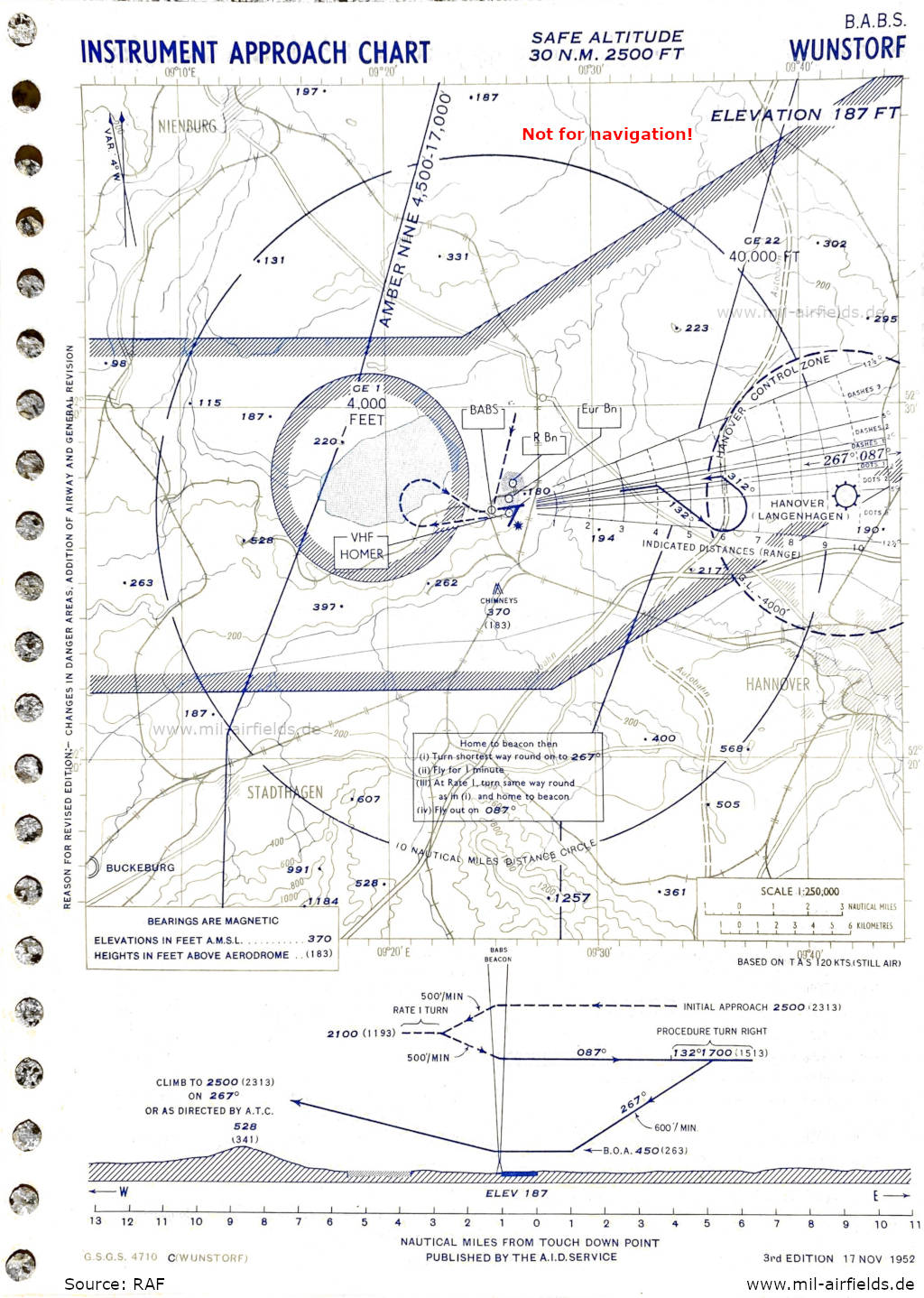
(Source: RAF)
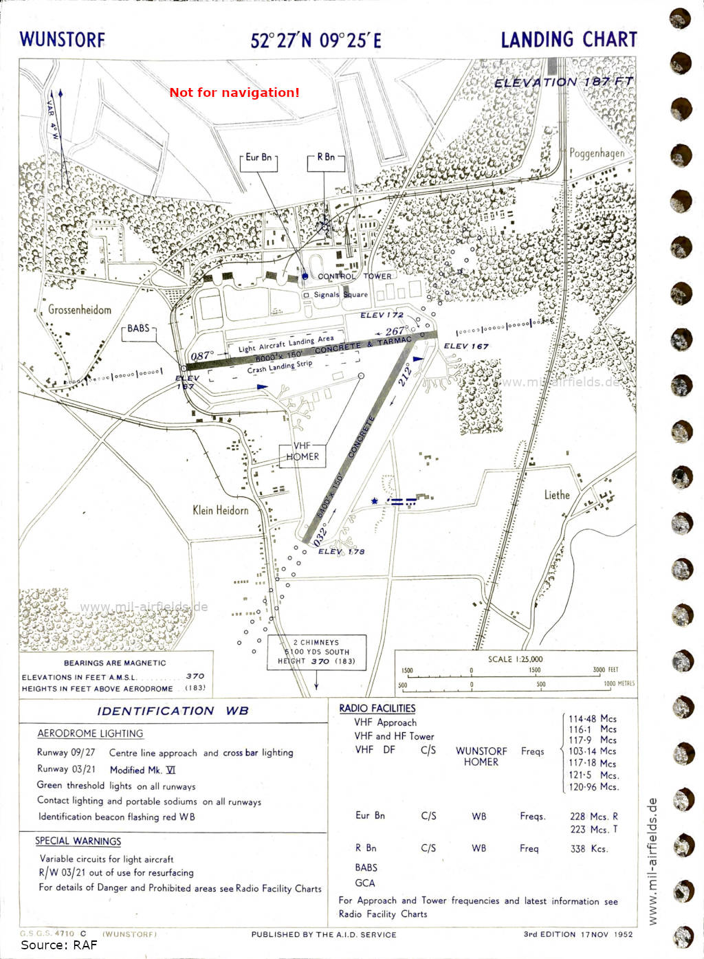
(Source: RAF)
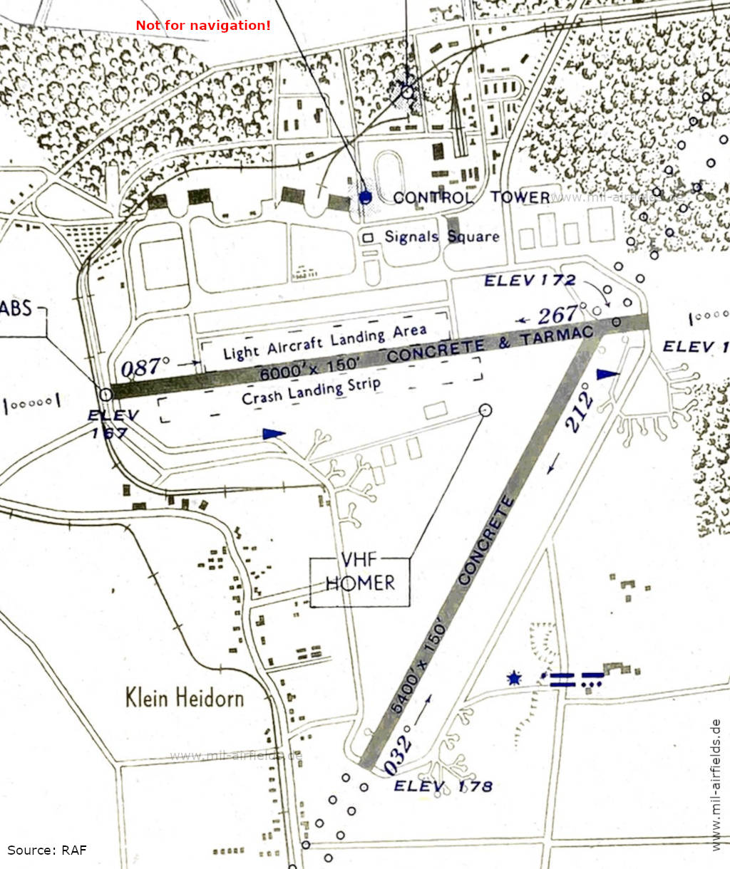
(Source: RAF)
In the 1960s
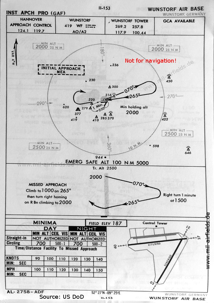
NDB approach runway 27 (October 1960) (Source: US DoD)
Source for all maps, if not marked otherwise: US Department of Defense (US DoD)
Recommended
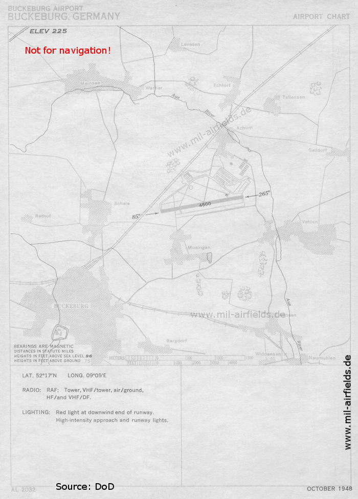
Image credits are shown on the respective target page, click on the preview to open it.
 mil-airfields.de at Facebook