Aalborg Airport / Lufthavn
Flyvestation Aalborg, Aalborg Lufthavn
Historical approach and aerodrome charts
For historical information only, do not use for navigation or aviation purposes!
| Coordinates | N570542 E0095118 (WGS84) Google Maps |
| Elevation | 10 ft |
| Location indicator | EKYT |
| Operator | RDAF |
Location Indicator: EKYT
In the 1950s
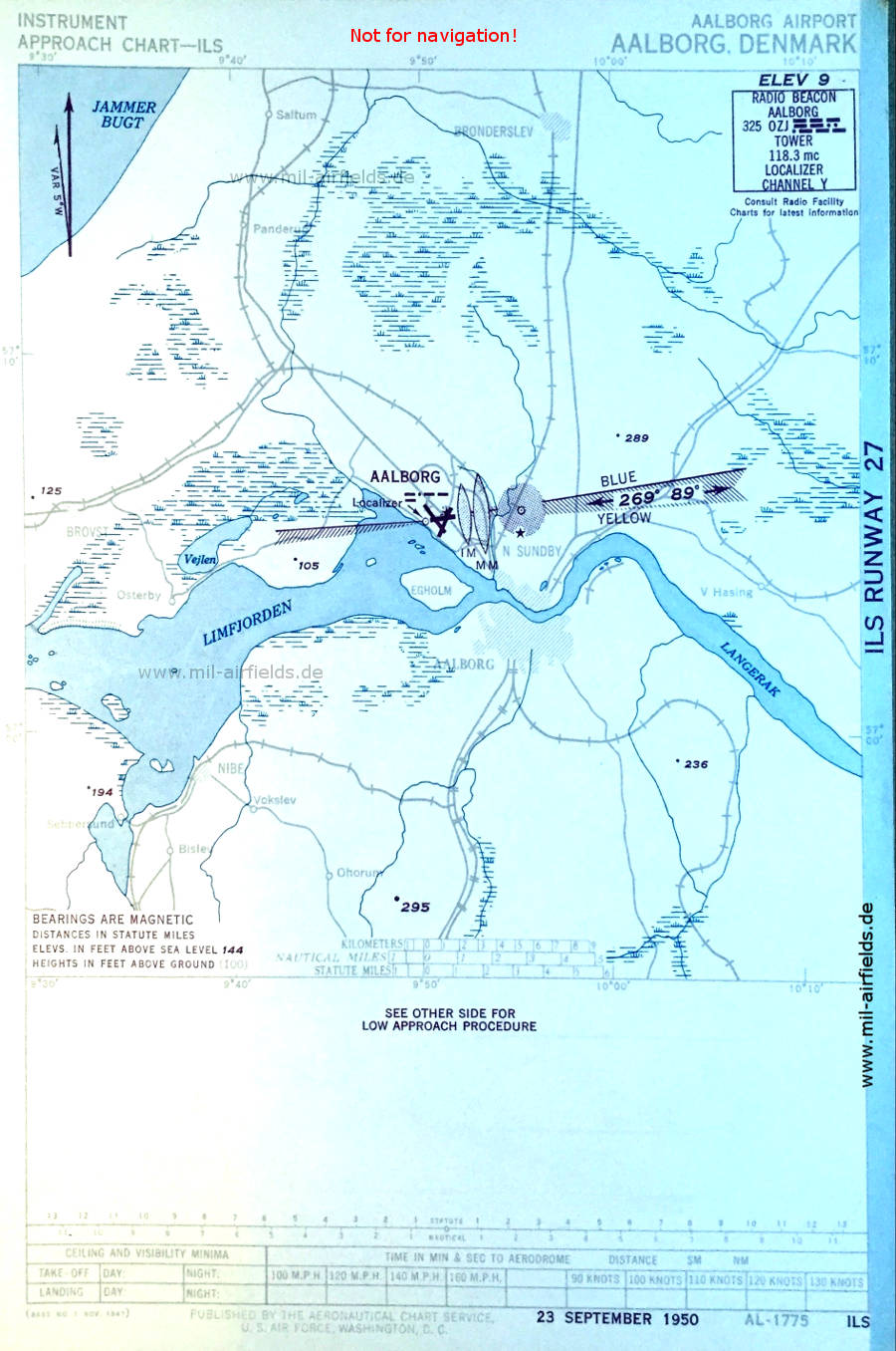
ILS (September 1950) (Source: US DoD)
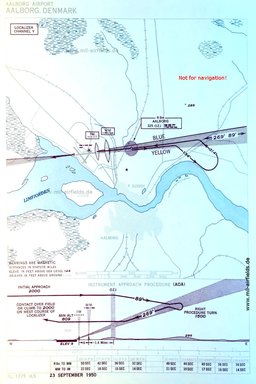
ILS approach runway 27 (September 1950) (Source: US DoD)
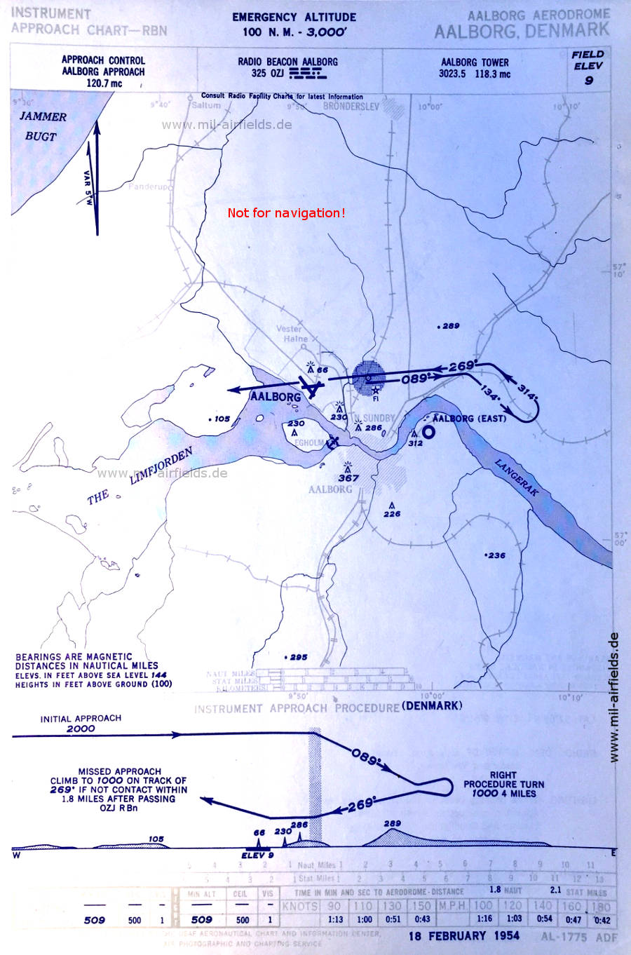
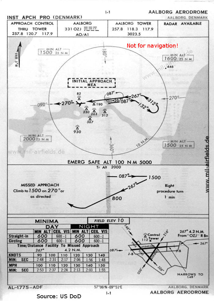
NDB approach runway 27 (February 1954) - Also shown is the today no longer existing airfield at Rørdal / Hennedal as "AALBORG (EAST)" and a water landing site at Limfjford opposite the island of Egholm. (Source: US DoD)
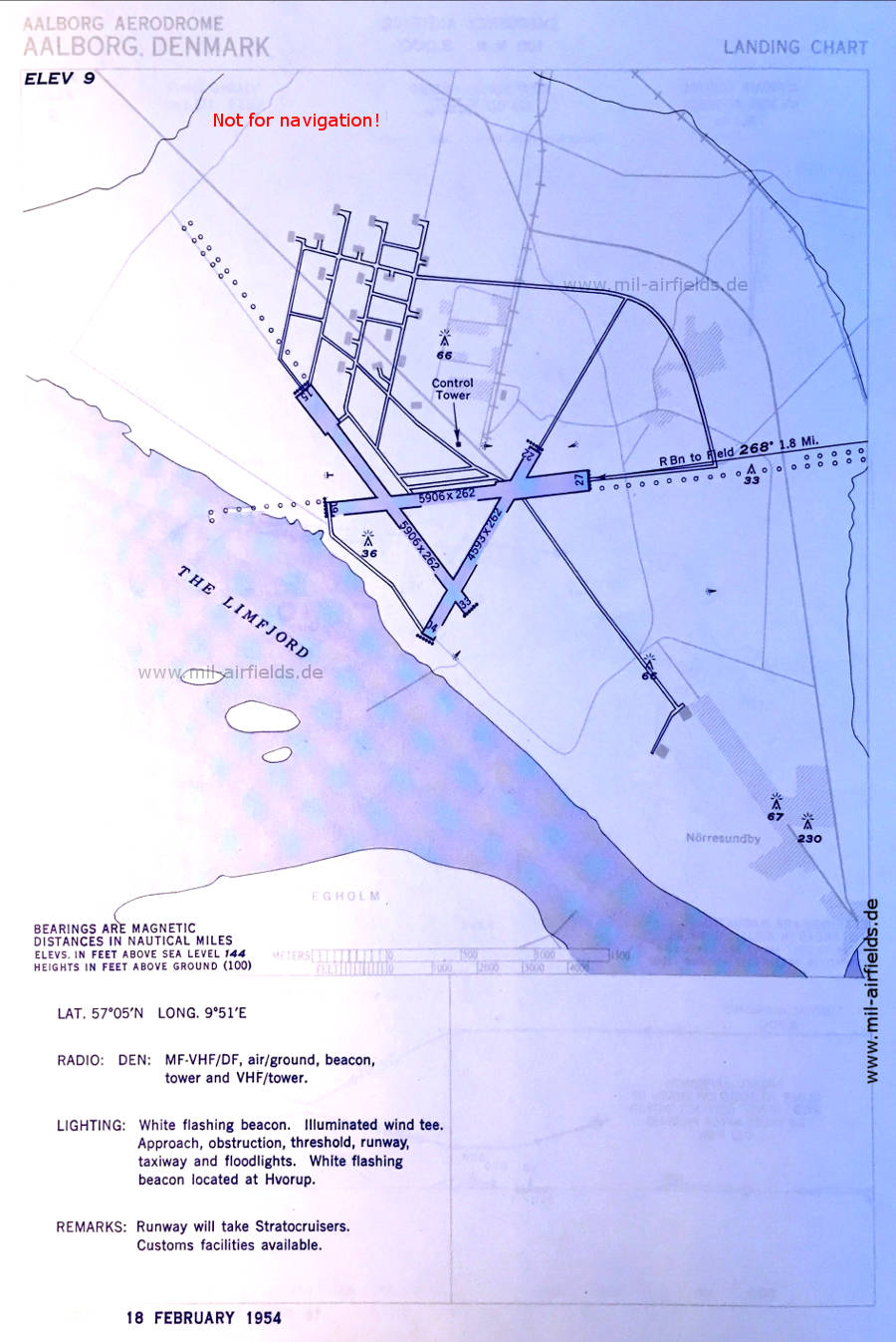
Map of Aalborg Airport (February 1954) - Runway dimensions are given in feet: 02/22: 1400 m x 80 m (4593 ft x 262 ft), 09/27: 1800 m x 80 m (5906 ft x 262 ft), 15/33: 1800 m x 80 m (5906 ft x 262 ft). A white flashing beacon is located outside at the village of Hvorup. (Source: US DoD)
In the 1960s
NDB approach runway 27 (October 1960) (Source: US DoD)
Source for all maps, if not marked otherwise: US Department of Defense (US DoD)
Recommended
Image credits are shown on the respective target page, click on the preview to open it.
 mil-airfields.de at Facebook