Copenhagen Kastrup Airport
Københavns Lufthavn
Historical approach and aerodrome charts
For historical information only, do not use for navigation or aviation purposes!
| Coordinates | N553660 E0123844 (WGS84) Google Maps |
Location Indicator: EKCH
In the 1950s
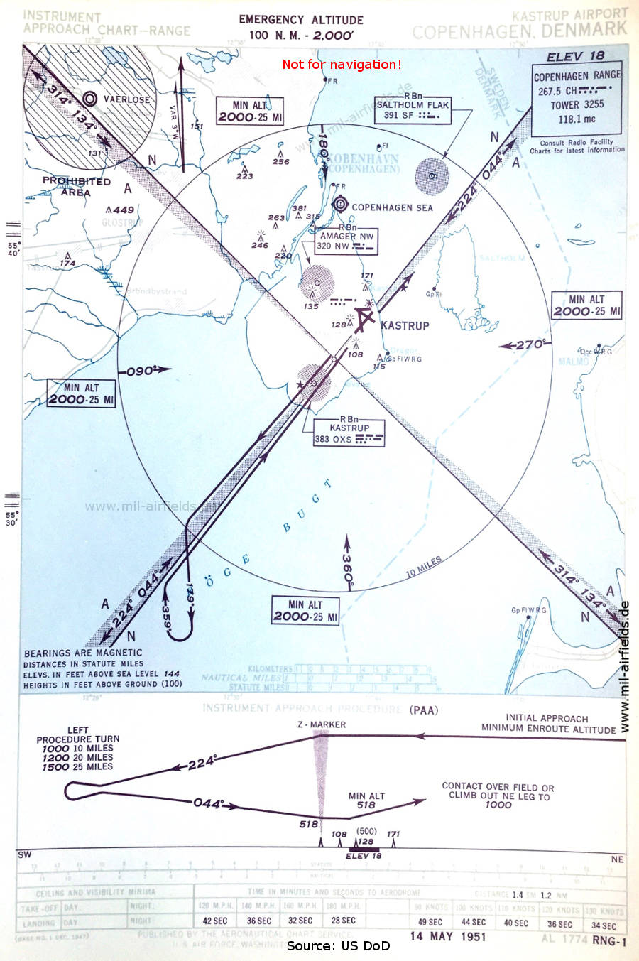
Range approach runway 04 (May 1951) - The map also shows the seaplane base at Holmen (COPENHAGEN SEA) (Source: US DoD)
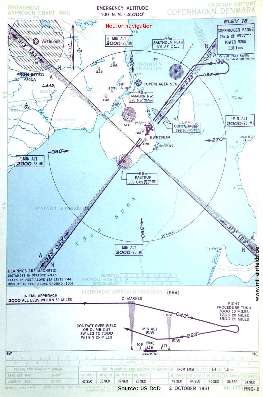
Range approach runway 22 (May 1951) (Source: US DoD)
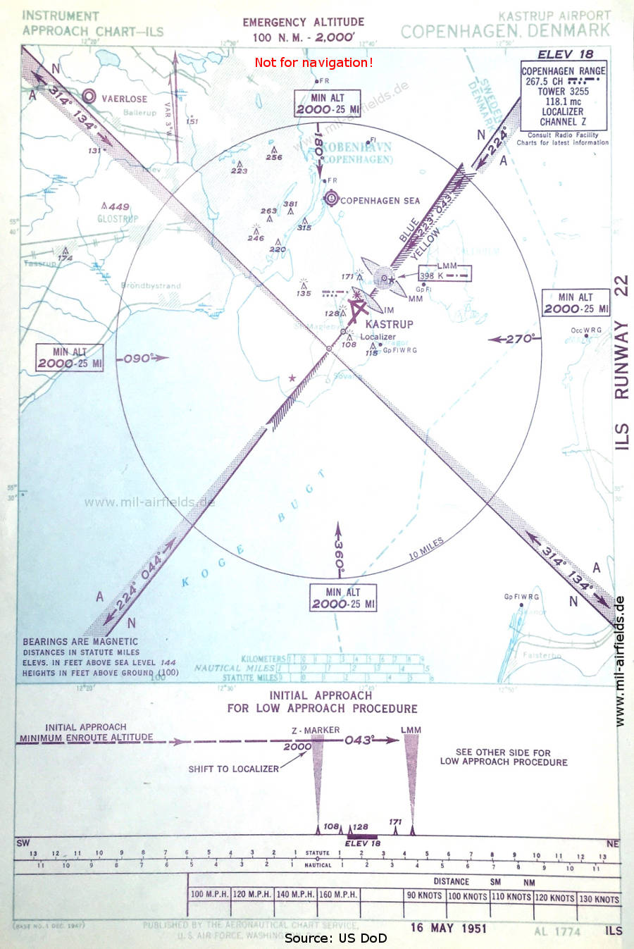
ILS approach runway 22 (May 1951) (Source: US DoD)
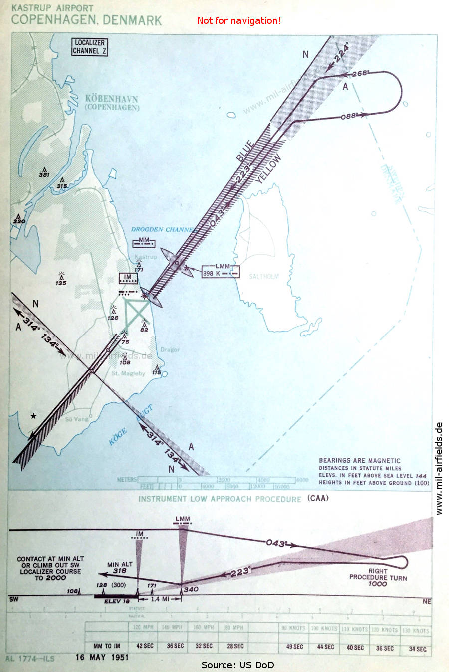
ILS final approach runway 22 (May 1951) (Source: US DoD)
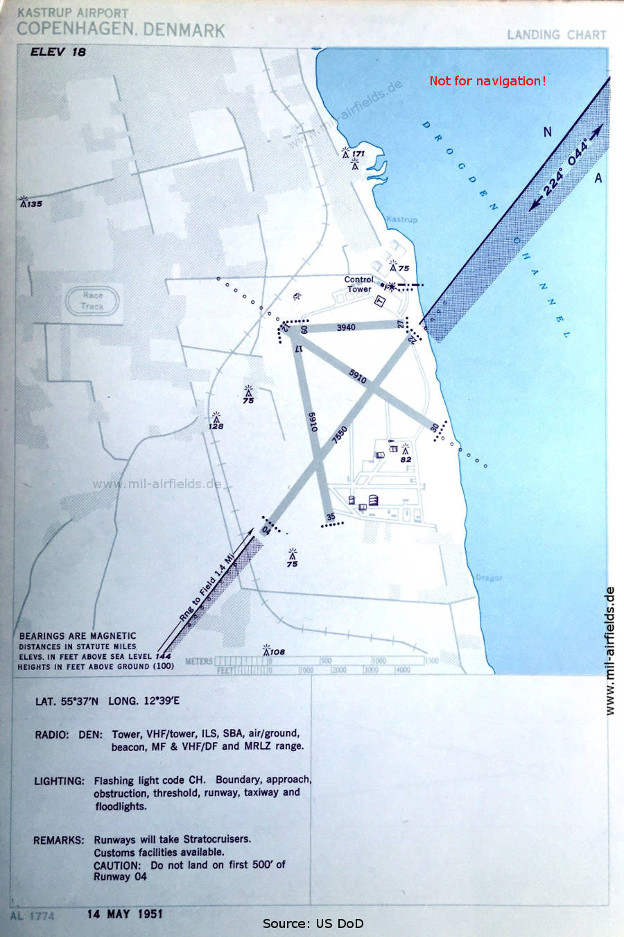
Airport (May 1951) - Runway lengths are given in feet: 04/22: 2301 m (7550 ft), 09/27: 1201 m (3940 ft), 12/30: 1801 m (5910 ft), 17/35: 1801 m (5910 ft) (Source: US DoD)
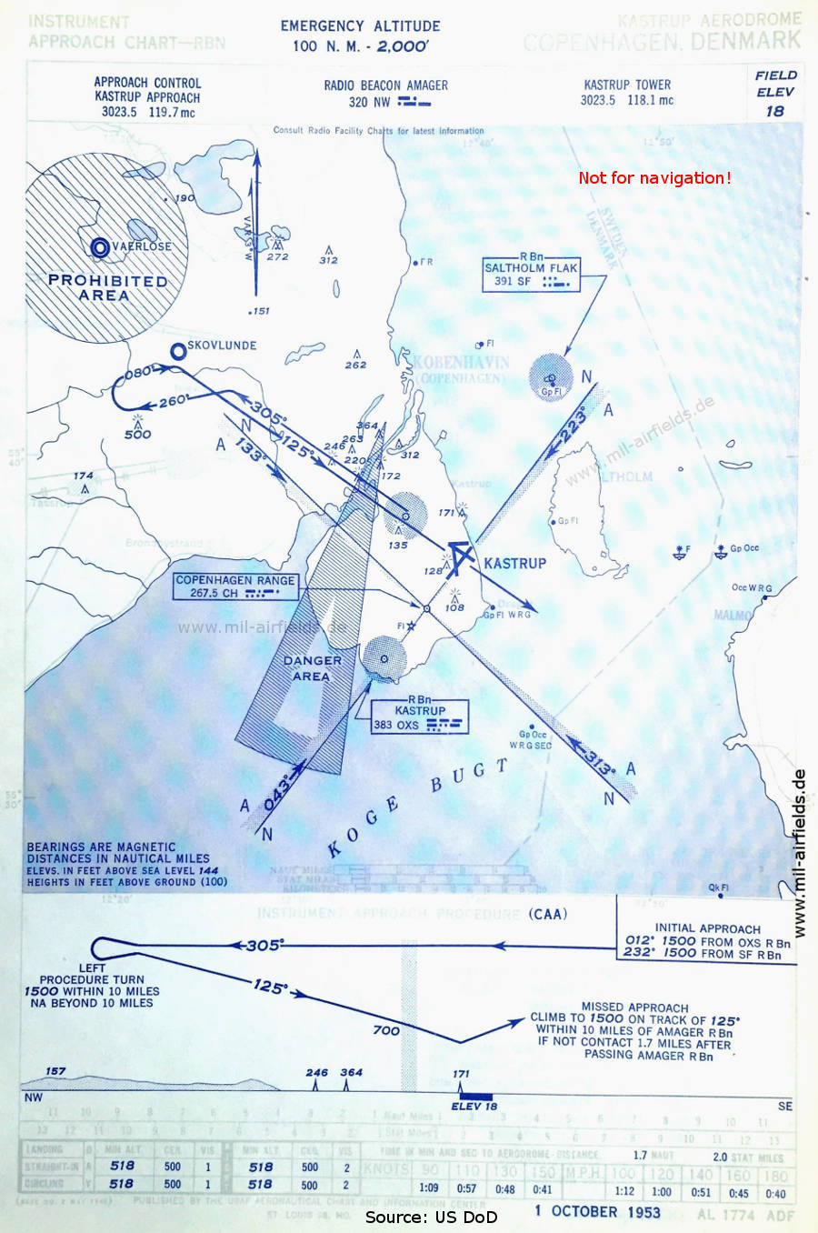
NDB approach runway 12 (October 1953) - The map also shows Skovlunde airfield, which is closed today. (Source: US DoD)
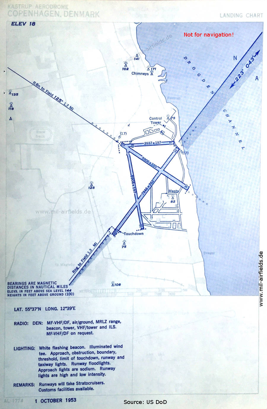
Aerodrome (October 1953) (Source: US DoD)
In the 1960s
NDB approach runway 04 (October 1960) (Source: US DoD)

NDB approach runway 12 (October 1960) (Source: US DoD)
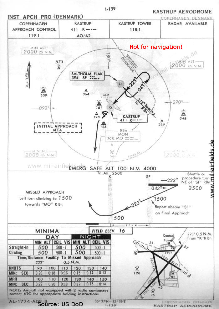
NDB approach runway 22 (October 1960) (Source: US DoD)
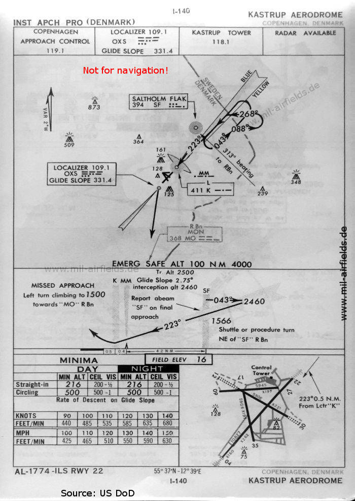
ILS approach runway 22 (October 1960) (Source: US DoD)
Source for all maps, if not marked otherwise: US Department of Defense (US DoD)
Recommended
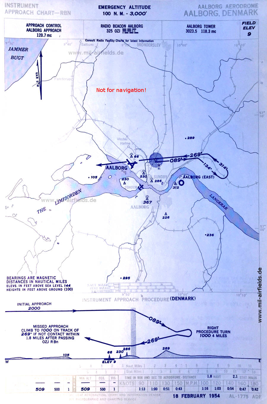


Image credits are shown on the respective target page, click on the preview to open it.
 mil-airfields.de at Facebook