Barcelona El Prat Airport
Muntadas, Aeroport de Barcelona, Aeropuerto de Barcelona-El Prat
Historical approach and aerodrome charts
Aeroport de Barcelona / Aeropuerto de Barcelona - Cartas de aproximación históricos
For historical information only, do not use for navigation or aviation purposes!
| Coordinates | N411739 E0020511 (WGS84) Google Maps |
Location Indicator: LEBL
In the 1950s
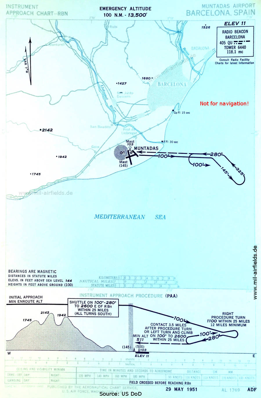
NDB approach runway 25 (May 1951)
(Source: US DoD)
(Source: US DoD)
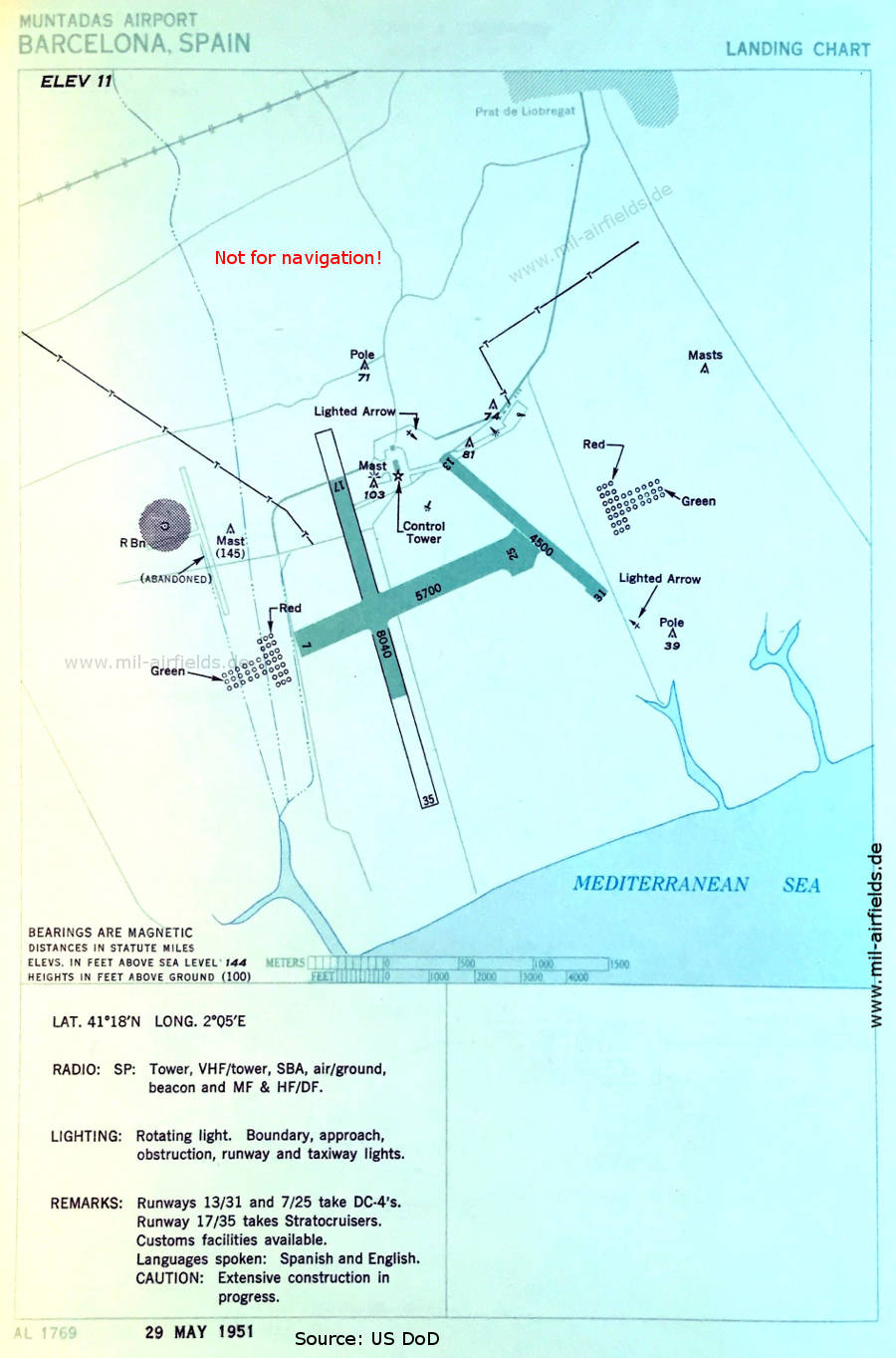
Airport (May 1951)
The runway lengths are given in feet: 07/25: 1737 m (5700 feet), 13/31: 1372 m (4500 feet), 17/35: 2451 m (8040 feet). In the northwest corner, former installations are shown.
(Source: US DoD)
The runway lengths are given in feet: 07/25: 1737 m (5700 feet), 13/31: 1372 m (4500 feet), 17/35: 2451 m (8040 feet). In the northwest corner, former installations are shown.
(Source: US DoD)
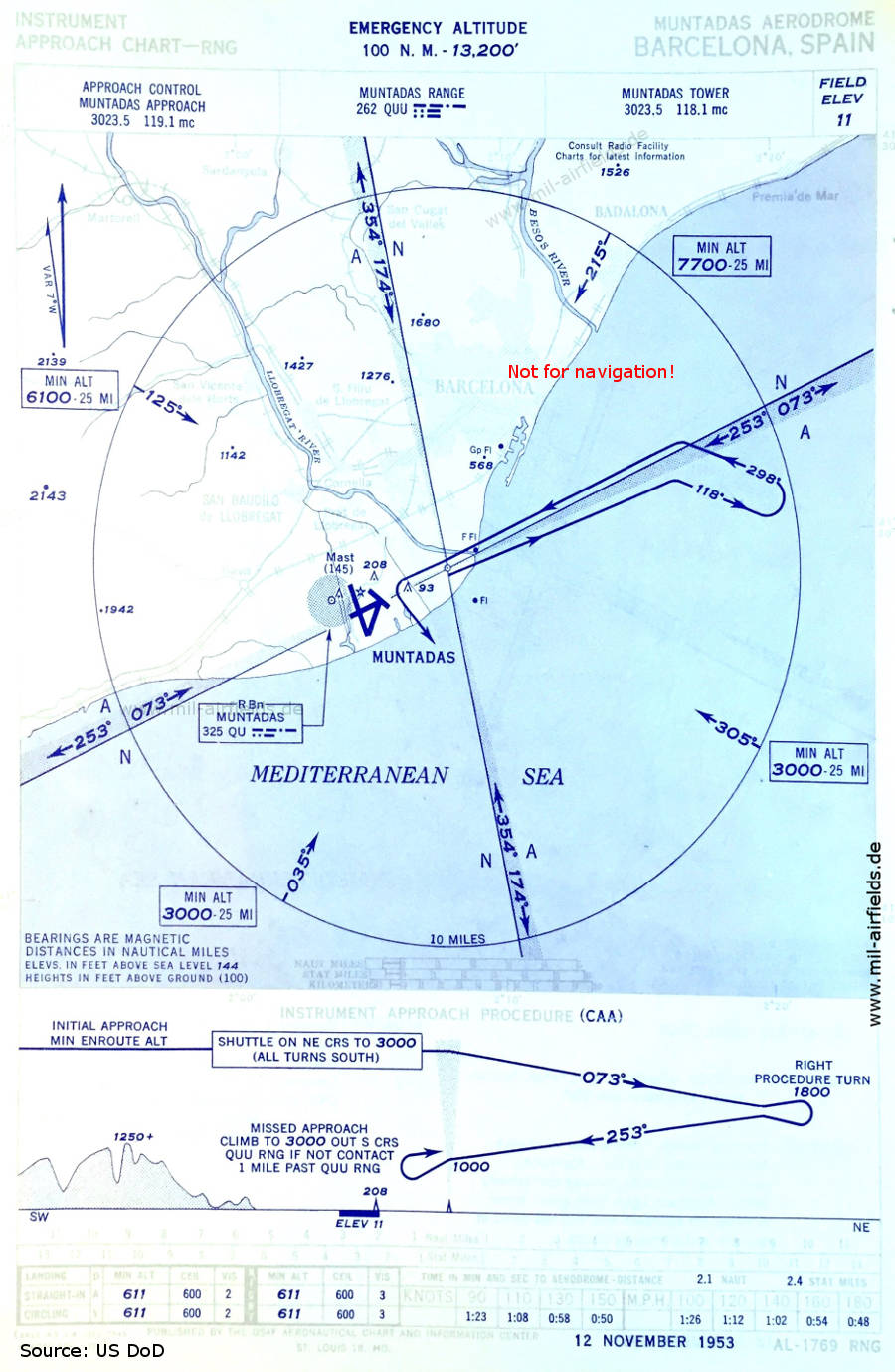
Range approach runway 25 (November 1953)
(Source: US DoD)
(Source: US DoD)
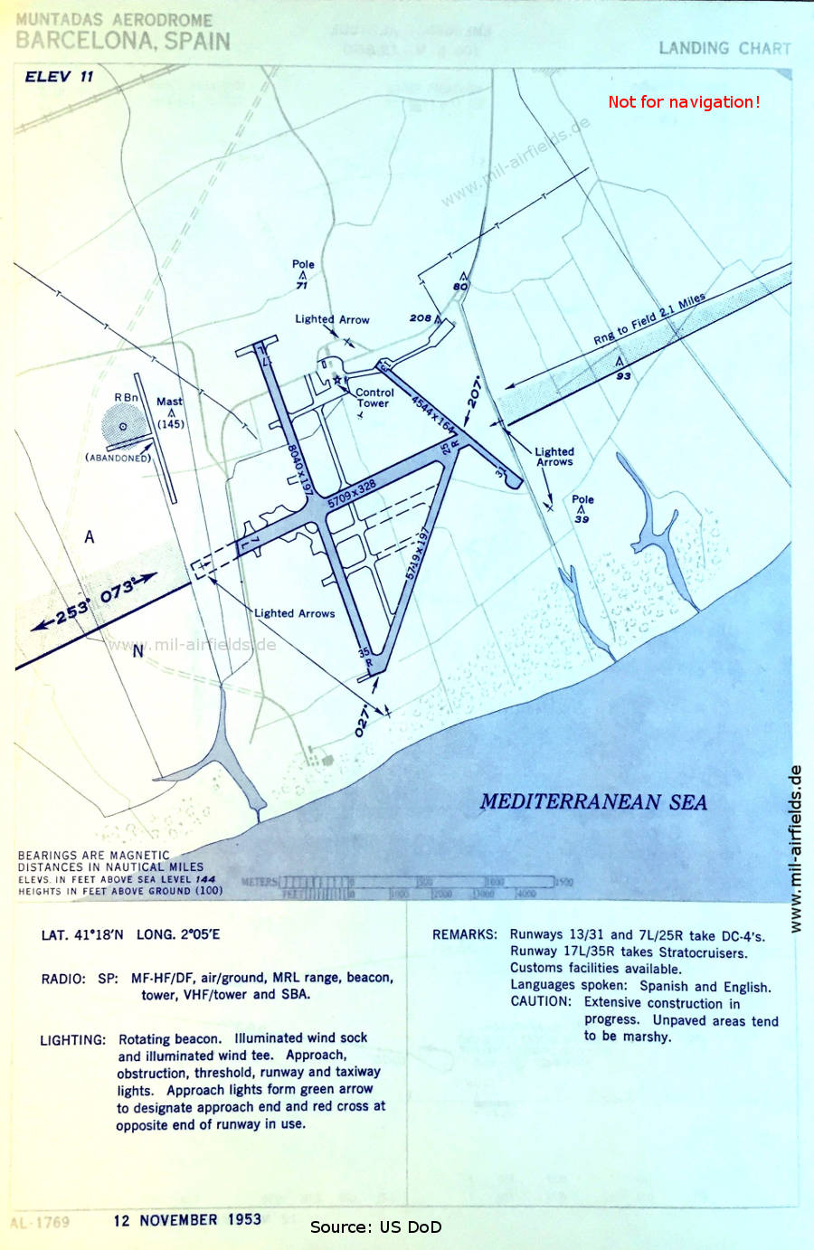
Airfield (November 1953)
Interesting are the green lighted arrows in the approach areas.
(Source: US DoD)
Interesting are the green lighted arrows in the approach areas.
(Source: US DoD)
In the 1960s

Range approach runway 25 (October 1960)
(Source: US DoD)
(Source: US DoD)
Source for all maps, if not marked otherwise: US Department of Defense (US DoD)
Recommended
Image credits are shown on the respective target page, click on the preview to open it.
 mil-airfields.de at Facebook