Madrid Barajas Airport
Aeropuerto Adolfo Suárez Madrid-Barajas
Historical approach and aerodrome charts
Aeropuerto Madrid-Barajas - Cartas de aproximación históricos
For historical information only, do not use for navigation or aviation purposes!
| Coordinates | N402928 W0033404 (WGS84) Google Maps |
Location Indicator: LEMD
In the 1950s

NDB approach runway 05L, 05R (July 1954) - Airfields in the vicinity: Cuatro Vientos, Getafe, Torrejón (Source: US DoD)
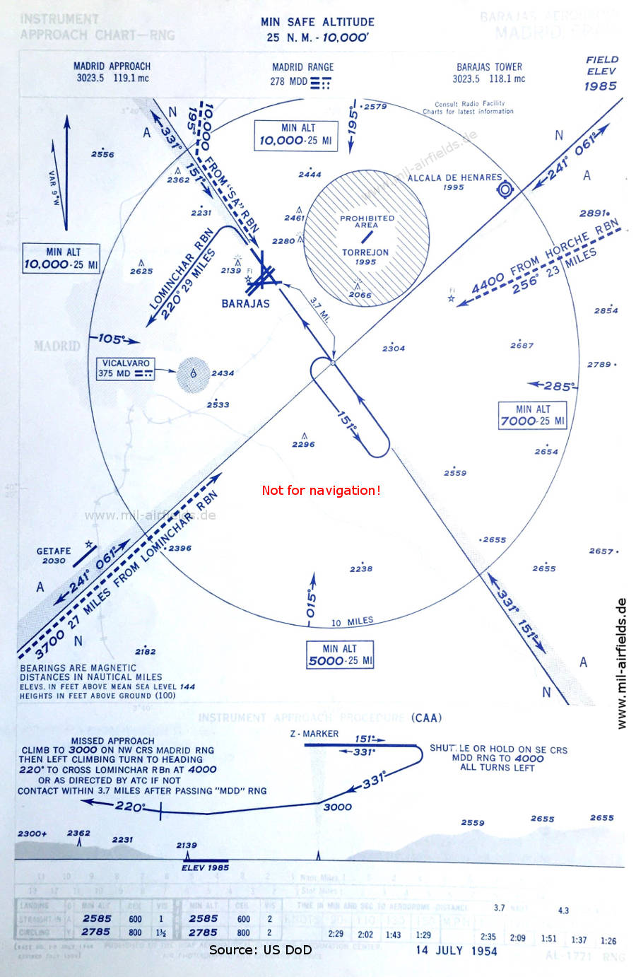
Range approach runway 33 (July 1954) - Also shown here: the Alcalá de Henares / Barberán y Collar airfield, which is closed today. (Source: US DoD)

Airport map (July 1954) - The runway dimensions are given in feet. (Source: US DoD)
In the 1960s
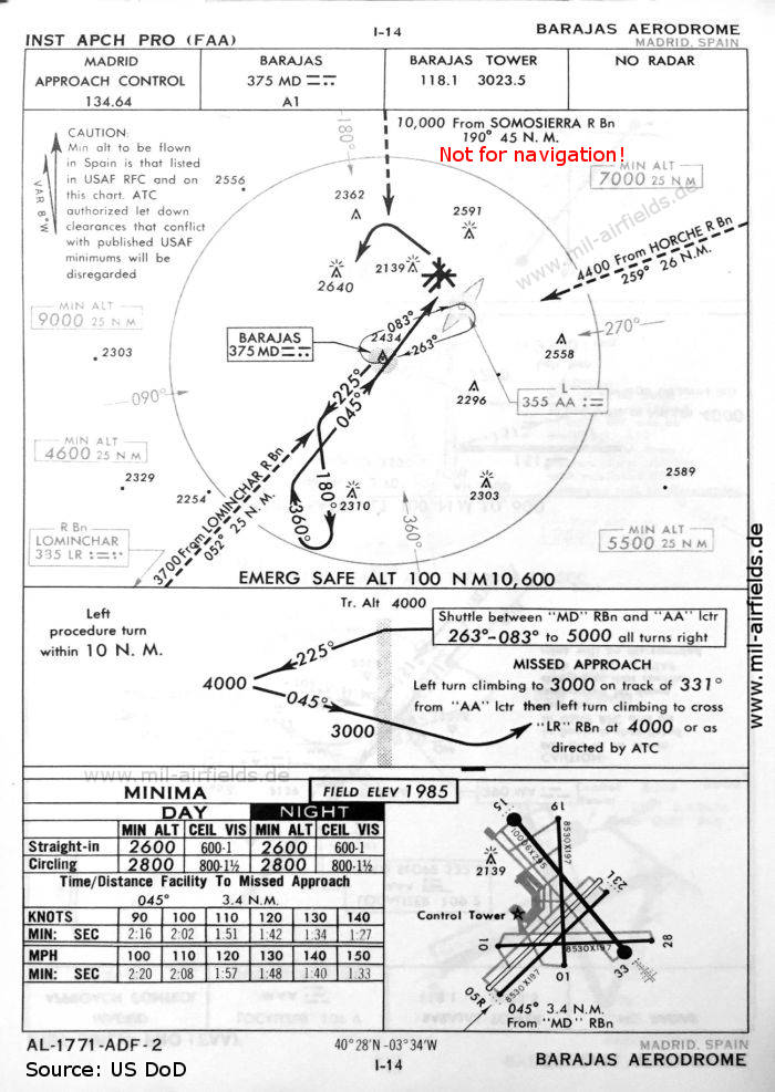
NDB approach runway 05 (October 1960) (Source: US DoD)

NDB approach runway 33 (October 1960) (Source: US DoD)

ILS approach runway 33 (October 1960) (Source: US DoD)
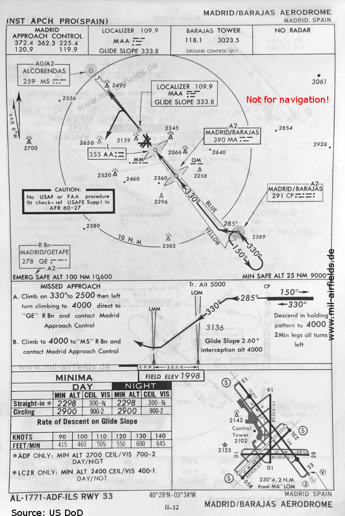
ILS approach runway 33 (May 1966) (Source: US DoD)
In the 1970s

Satellite image from 26 May 1972 (Source: U.S. Geological Survey)
Index to the objects shown on the maps
Aerodromes / Aeropuertos:
- Alcalá de Henares / Barberán y Collar
- Cuatro Vientos
- Getafe
- Madrid Barajas
- Torrejón
Radio beacons / Radiofaro:
- Alcobendas NDB "MS"
- Horche NDB
- Lominchar NDB
- Madrid/Barajas NDB "CP", "MY", Locator "AA", "MA", ILS "MAA", Outer Marker, Middle Marker
- Madrid/Getafe NDB "GE"
- Madrid Range "MDD"
- Somosierra NDB
- Vicalvaro NDB "MD"
Air traffic control / Control del tráfico aéreo:
- Madrid Approach Control
- Barajas Tower
Source for all maps, if not marked otherwise: US Department of Defense (US DoD)
Recommended
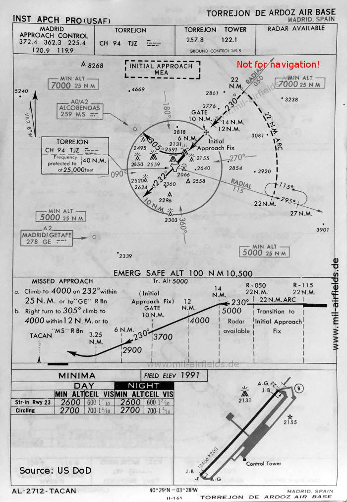
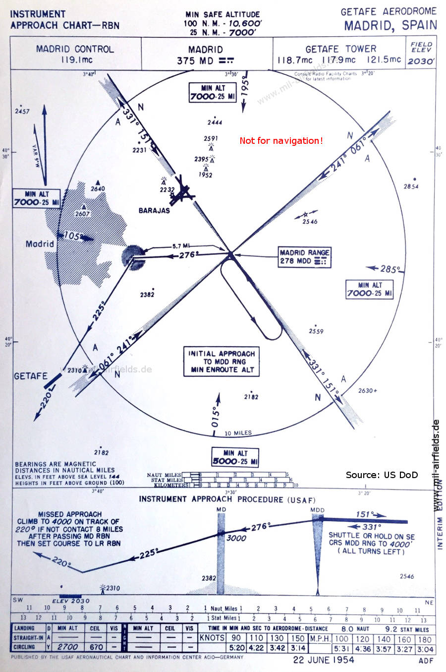

Image credits are shown on the respective target page, click on the preview to open it.
 mil-airfields.de at Facebook