Morón Air Base
Base Aérea de Morón de la Frontera
Historical approach and aerodrome charts
Base Aérea de Morón - Cartas de aproximación históricos
For historical information only, do not use for navigation or aviation purposes!
| Coordinates | N371034 W0053655 (WGS84) Google Maps |
Location Indicator: LEMO
In the 1960s
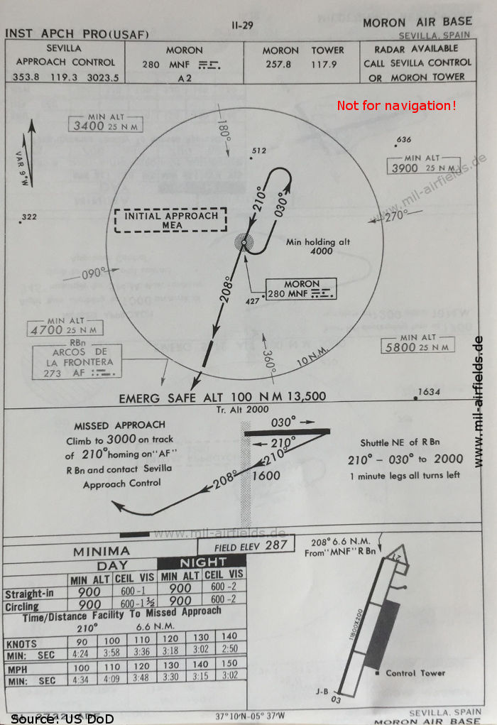
NDB approach runway 21 (October 1960)
(Source: US DoD)
(Source: US DoD)
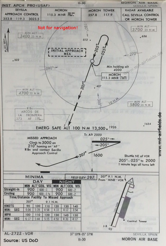
VOR approach runway 21 (October 1960)
(Source: US DoD)
(Source: US DoD)
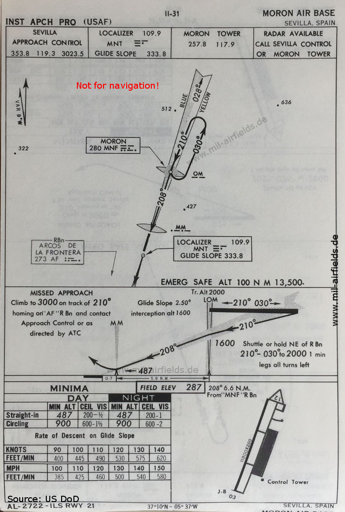
ILS approach runway 21 (October 1960)
(Source: US DoD)
(Source: US DoD)
Source for all maps, if not marked otherwise: US Department of Defense (US DoD)
Recommended
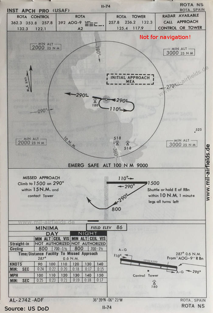

Image credits are shown on the respective target page, click on the preview to open it.
 mil-airfields.de at Facebook