Helsinki Malmi Airfield
Helsinki-Malmin lentoasema
Historical approach and aerodrome charts
Helsinki-Malmi lentoasema - Ilmailukartat
For historical information only, do not use for navigation or aviation purposes!
| Coordinates | N601508 E0250244 (WGS84) Google Maps |
Airfield
Region: South Finland, Uusimaa
Location indicator: EFHF
In the 1950s
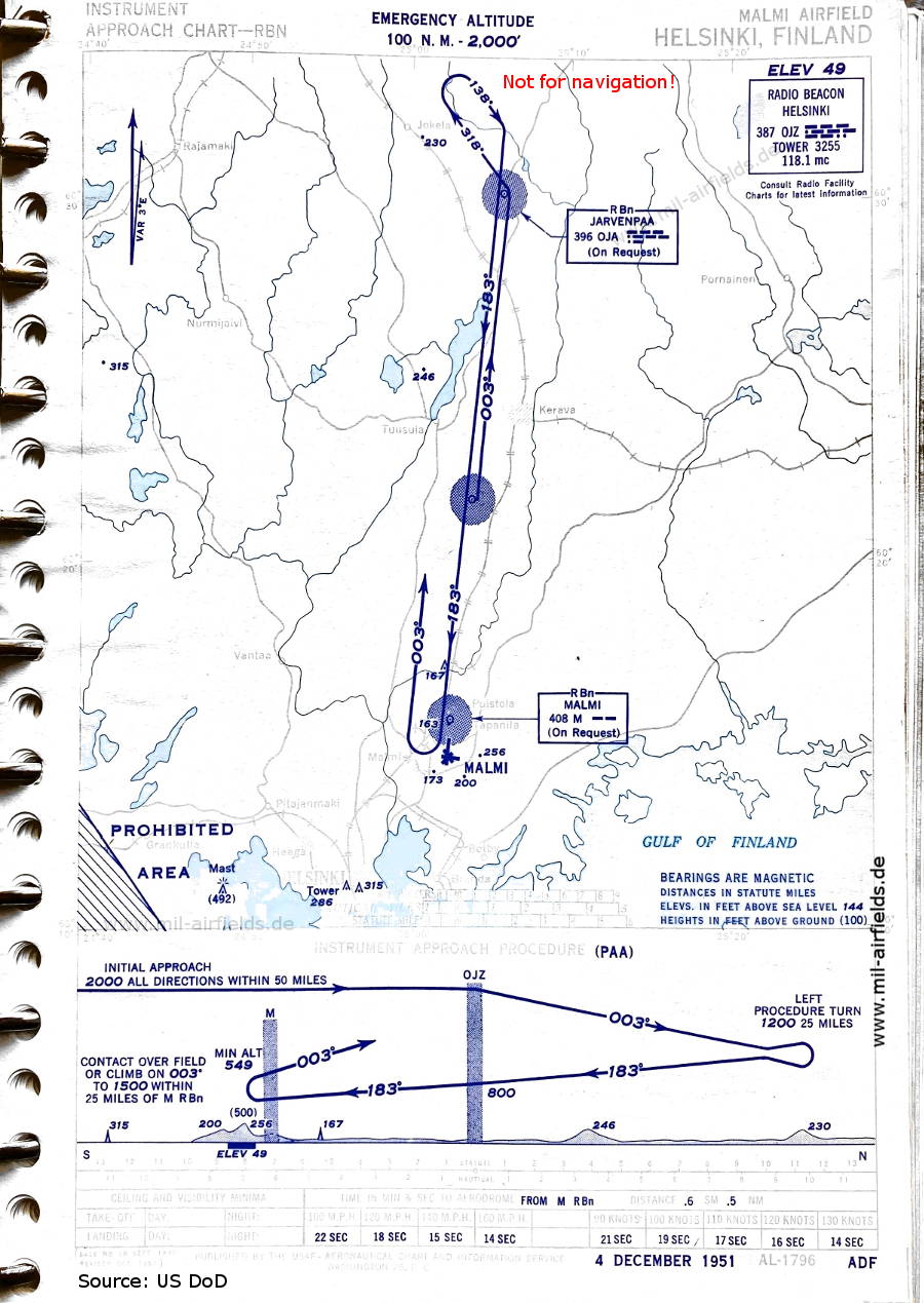
NDB approach runway 18 (December 1951) (Source: US DoD)
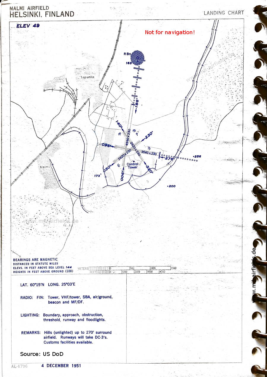
Airport map (December 1951) - There are three runways - 006/186: length 1399 m, width 70 m (4590 feet x 230 feet), 050/230: length 799 m, width 70 m (2620 feet x 230 feet), 096/276: length 1079 m, width 70 m (3540 feet x 230 feet). (Source: US DoD)
Index to the objects shown on the maps
Airspace / Ilmatila:
- Prohibited Area
Radio beacons / Radiomajakat:
- Helsinki NDB "OJZ"
- Järvenpää NDB "OJA"
- Malmi NDB "M"
Air traffic control / Lennonjohto:
- Malmi Tower
Source for all maps, if not marked otherwise: US Department of Defense (US DoD)
Recommended
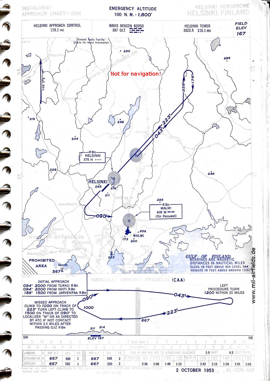
Image credits are shown on the respective target page, click on the preview to open it.
 mil-airfields.de at Facebook