Paris Orly Airport
Historical approach and aerodrome charts
Aéroport de Paris-Orly - Cartes d'approche historiques
For historical information only, do not use for navigation or aviation purposes!
| Coordinates | N484345 E0022204 (WGS84) Google Maps |
| Location indicator | LFPO |
In the 1960s
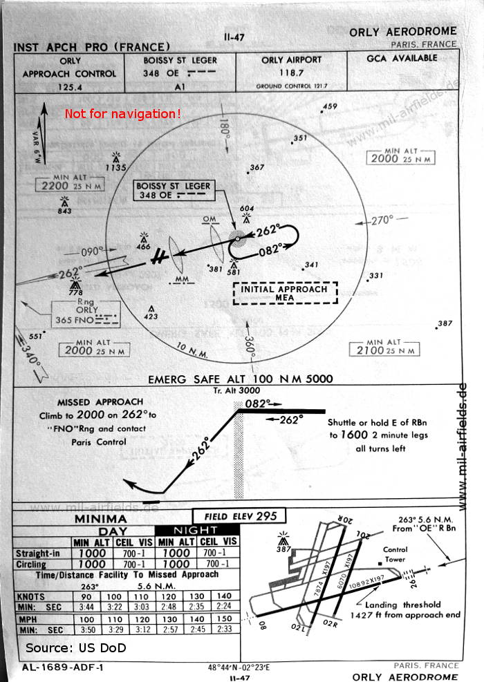
NDB approach runway 26 (October 1960) - There are three runways - 02L/20R: length 2400 m, width 60 m (7874 feet x 197 feet), 02R/20L: length 1850 m, width 60 m (6070 feet x 197 feet), 08/26: length 3320 m, width 60 m (10892 feet x 197 feet). (Source: US DoD)
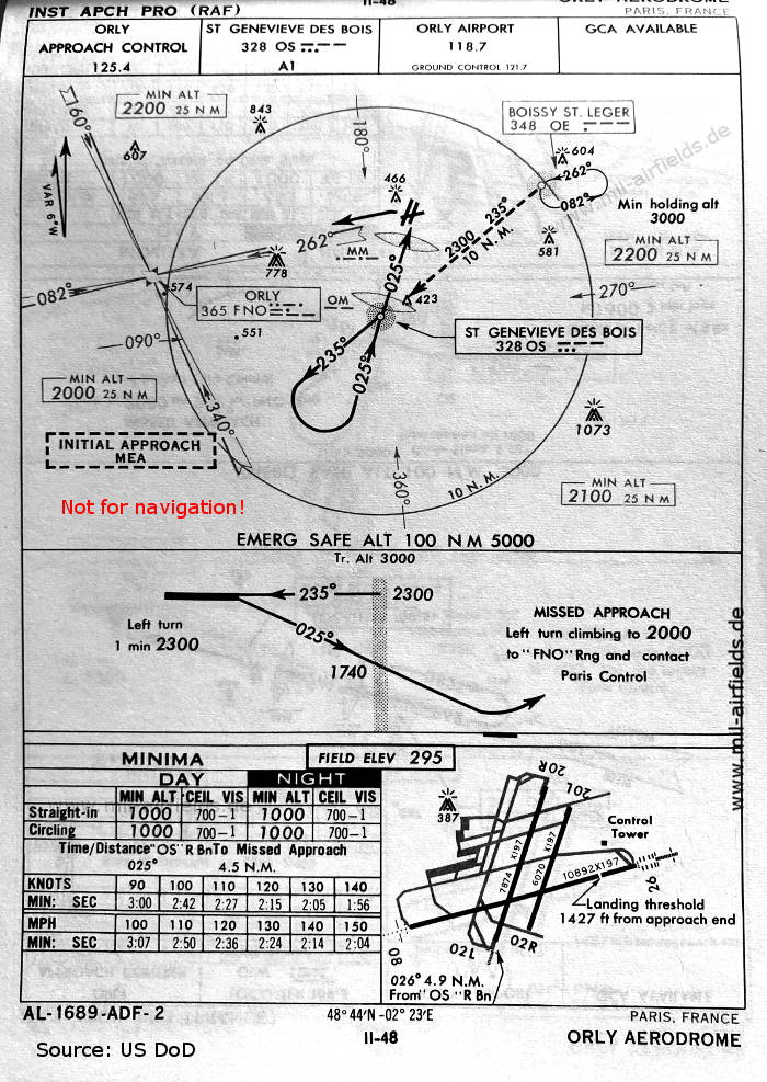
NDB approach runway 02 (October 1960) (Source: US DoD)

ILS approach runway 26 (October 1960) (Source: US DoD)
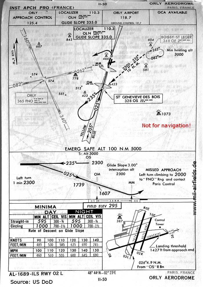
ILS approach runway 02L (October 1960) (Source: US DoD)
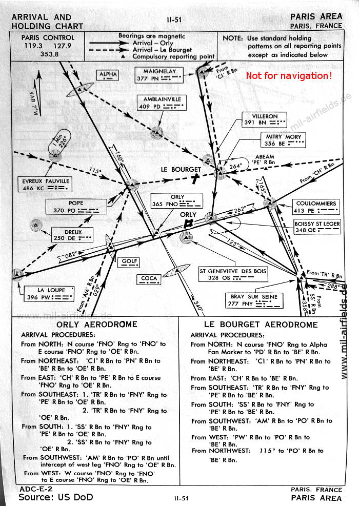
Arrival routes (October 1960) (Source: US DoD)

Departure routes (October 1960) (Source: US DoD)
In the 1970s
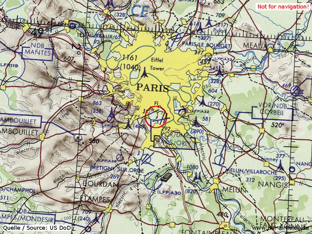
Paris Orly Airport on a map of the US Department of Defense from 1972 (Source: ONC E-2 (1972), Perry-Castañeda Library Map Collection, University of Texas at Austin)
Index to the objects shown on the maps
Radio beacons / Radiophares aéronautiques:
- Alpha Fan Marker
- Amblainville NDB "PD"
- Boissy St. Leger (Boissy-Saint-Léger) NDB "OE"
- Bray sur Seine (Bray-sur-Seine) NDB "FNY"
- Coca Fan Marker
- Coulommiers NDB "PE"
- Dreux NDB "DE"
- Evreux Fauville NDB "KC"
- Golf Fan Marker
- La Loupe NDB "PW"
- Maigneley (Maignelay-Montigny) NDB "PN"
- Mitry Mory NDB "BE"
- Orly Range "FNO", ILS "OLN", "OLW", Outer Marker, Middle Marker
- Pope NDB "PO"
- St. Genevieve des Bois (Sainte-Geneviève-des-Bois) NDB "OS"
- Villeron NDB "BN"
Air traffic control / Contrôle de la circulation aérienne:
- Orly Approach Control, Orly Airport
- Paris Control
Source for all maps, if not marked otherwise: US Department of Defense (US DoD)
 mil-airfields.de at Facebook