Phalsbourg Bourscheid Air Base
Historical approach and aerodrome charts
Base aérienne de Phalsbourg-Bourscheid, Quartier La Horie
For historical information only, do not use for navigation or aviation purposes!
| Coordinates | N484558 E0071202 (WGS84) Google Maps |
| Region | Grand Est, Département Moselle |
| Location indicator | LFQP |
| Operator | US Air Force (USAF), Aviation légère de l’armée de terre |
In the 1960s
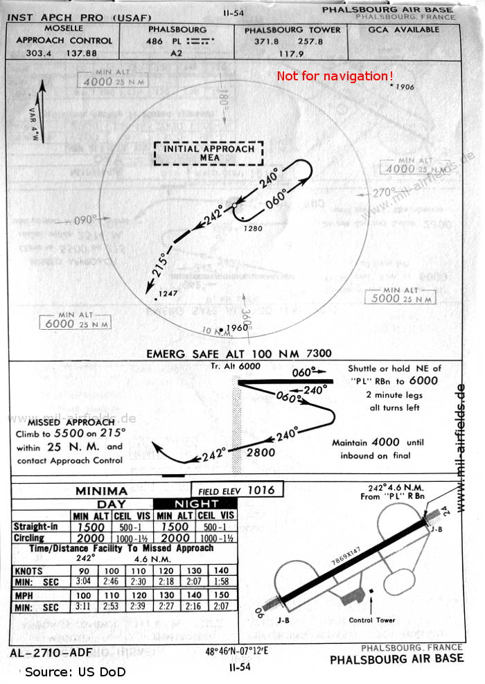
NDB approach runway 24 (October 1960) - There is one runway - 06/24: length 2398 m, width 45 m (7869 feet x 147 feet). (Source: US DoD)
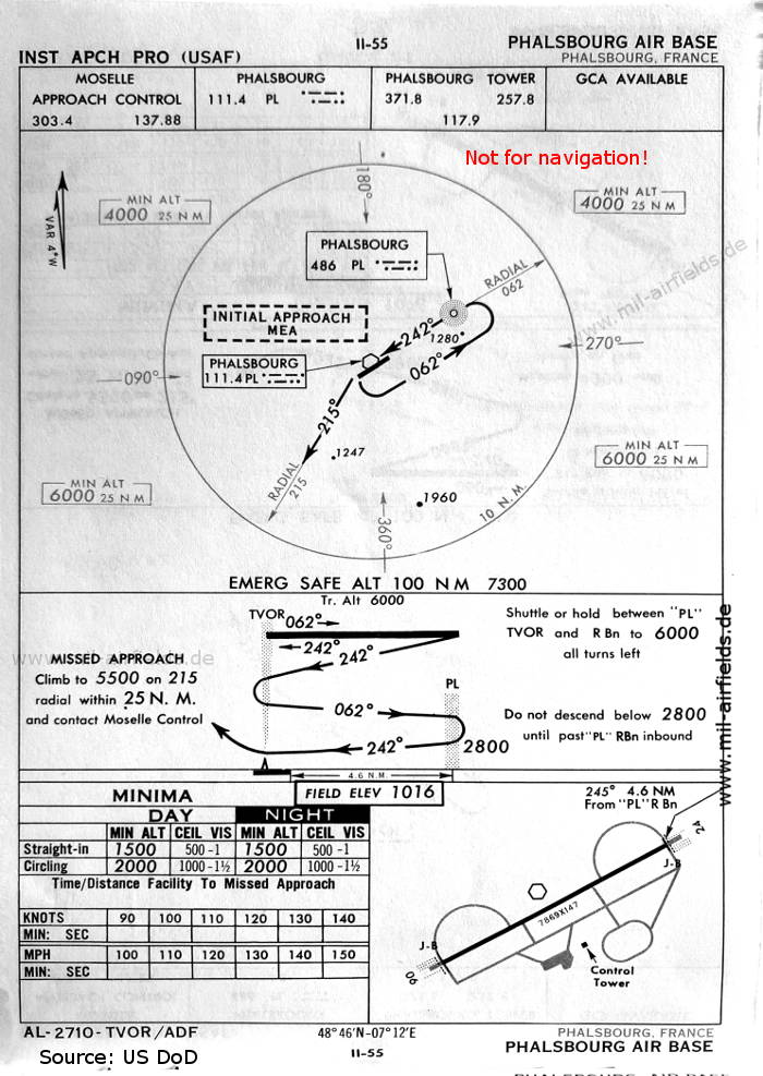
VOR approach runway 24 (October 1960) (Source: US DoD)
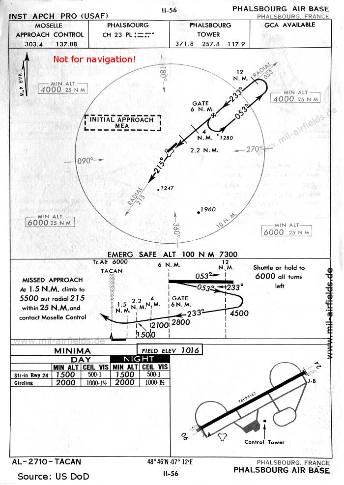
TACAN approach runway 24 (October 1960) (Source: US DoD)
In the 1970s
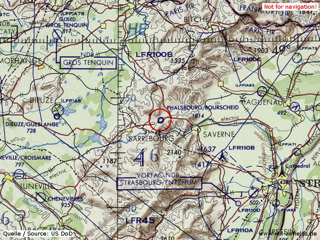
Phalsbourg Bourscheid Air Base on a map of the US Department of Defense from 1972 (Source: ONC E-2 (1972), Perry-Castañeda Library Map Collection, University of Texas at Austin)
Index to the objects shown on the maps
Radio beacons / Radiophares aéronautiques:
- Phalsbourg NDB "PL", VOR "PL", TACAN "PL"
Air traffic control / Contrôle de la circulation aérienne:
- Moselle Approach Control
- Phalsbourg Tower
Source for all maps, if not marked otherwise: US Department of Defense (US DoD)
 mil-airfields.de at Facebook