Reykjavík Airport
Reykjavíkurflugvöllur
Historical approach and aerodrome charts
Reykjavíkurflugvöllur
For historical information only, do not use for navigation or aviation purposes!
| Coordinates | N640743 W0215615 (WGS84) Google Maps |
| Location indicator | BIRK |
In the 1950s
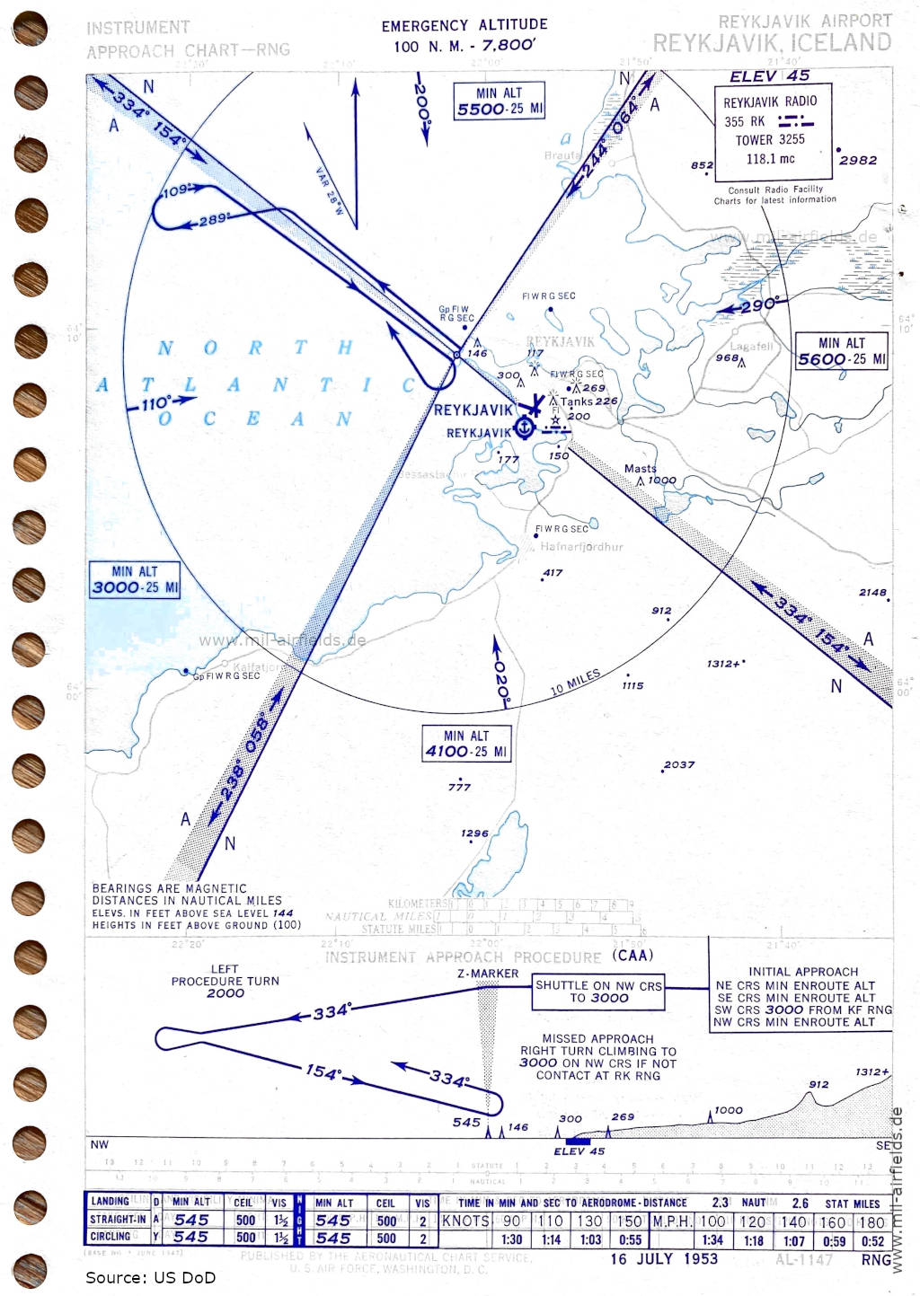
Range approach runway 14 (July 1953) (Source: US DoD)
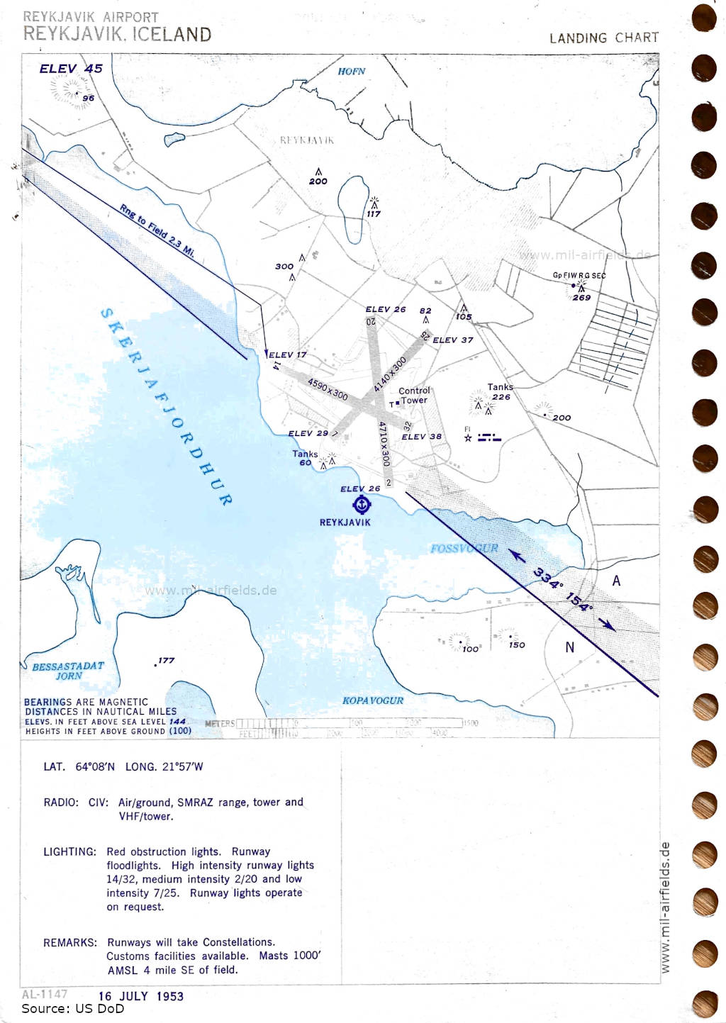
Airport map (July 1953) - There are three runways - 02/20: length 1436 m, width 91 m (4710 feet x 300 feet), 07/25: length 1262 m, width 91 m (4140 feet x 300 feet), 14/32: length 1399 m, width 91 m (4590 feet x 300 feet). In the south of the airfield, a seaplane base is marked. (Source: US DoD)
Index to the objects shown on the maps
Radio beacons with identifier:
- Reykjavik Range "RK"
Air traffic control / Communications:
- Reykjavik Radio, Reykjavik Tower
Places
- Bessastaðir, Bessastaðatjörn, Brautarholt
- Fossvogur
- Hafnarfjörður
- Kálfatjörn, Kópavogur
- Lágafell
- North Atlantic
- Reykjavík
- Skerjafjörður
Source for all maps, if not marked otherwise: US Department of Defense (US DoD)
Recommended

Image credits are shown on the respective target page, click on the preview to open it.
 mil-airfields.de at Facebook