Keflavík Airport
Keflavíkurflugvöllur, Keflavík Air Base
Historical approach and aerodrome charts
For historical information only, do not use for navigation or aviation purposes!
| Coordinates | N635906 W0223620 (WGS84) Google Maps |
| Location indicator | BIKF |
In the 1950s
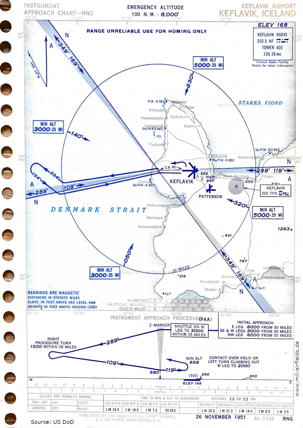
Range approach runway 12 (November 1951) - The Range radio beacon is shown as unreliable; it is to be used only as a non-directional radio beacon for homing. The old Patterson Airfield is shown to the southeast of Keflavik Airport. (Source: US DoD)
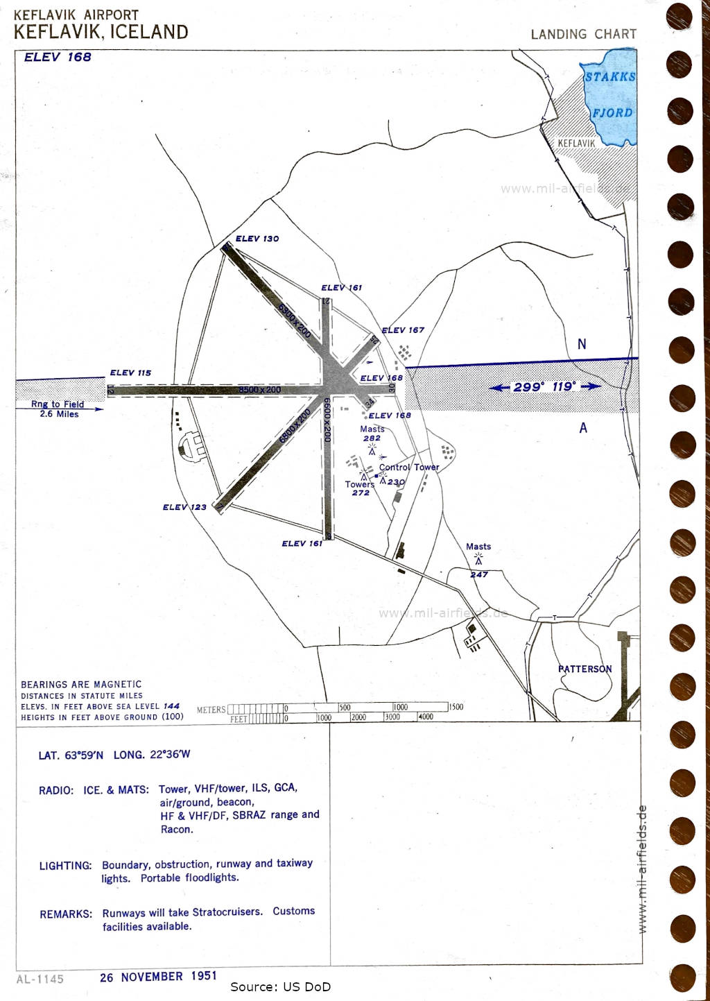
Airport map (November 1951) - There are four runways - 03/21: length 2012 m, width 61 m (6600 feet x 200 feet), 07/25: length 2073 m, width 61 m (6800 feet x 200 feet), 12/30: length 2591 m, width 61 m (8500 feet x 200 feet), 16/34: length 1920 m, width 61 m (6300 feet x 200 feet). (Source: US DoD)
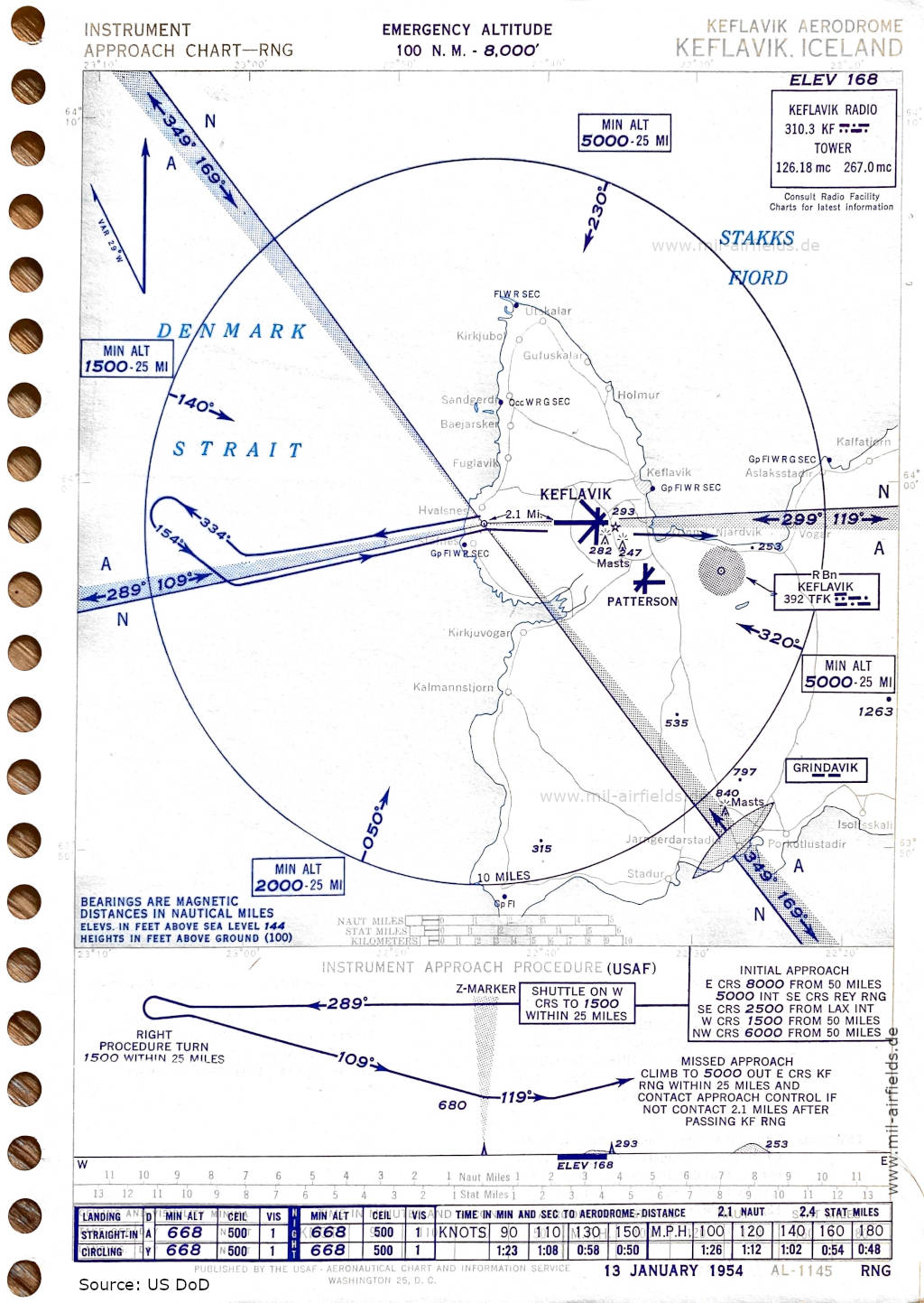
Range approach runway 12 (January 1954) (Source: US DoD)
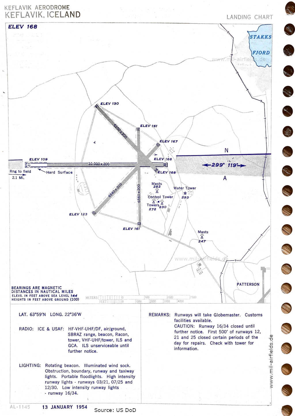
Aerodrome (January 1954) - Now the runways are shown as - 03/21: length 1999 m, width 61 m (6560 feet x 200 feet), 07/25: length 1993 m, width 61 m (6540 feet x 200 feet), 12/30: length 3048 m, width 61 m (10000 feet x 200 feet), 16/34: length 1859 m, width 61 m (6100 feet x 200 feet). (Source: US DoD)
Index to the objects shown on the maps
Aerodromes:
- Keflavik, Patterson
Radio beacons with identifier:
- Grindavik Marker
- Keflavik Range "KF", NDB "TFK"
Air traffic control / Communications:
- Keflavik Radio, Keflavik Tower
Places
- Bæjarsker
- Garður, Grindavík
- Hvalsnes, Holmur, Hop, Húsatóptir
- Isólfsskáli
- Járngerðarstaði
- Kálfatjörn, Kalmannstjörn, Keflavík, Kirkjuvogur
- Njarðvík
- Porkotlustadir
- Sandgerði, Staður, Stafnes, Stakksfjörður
- Útskálar
- Vogar
Source for all maps, if not marked otherwise: US Department of Defense (US DoD)
Recommended
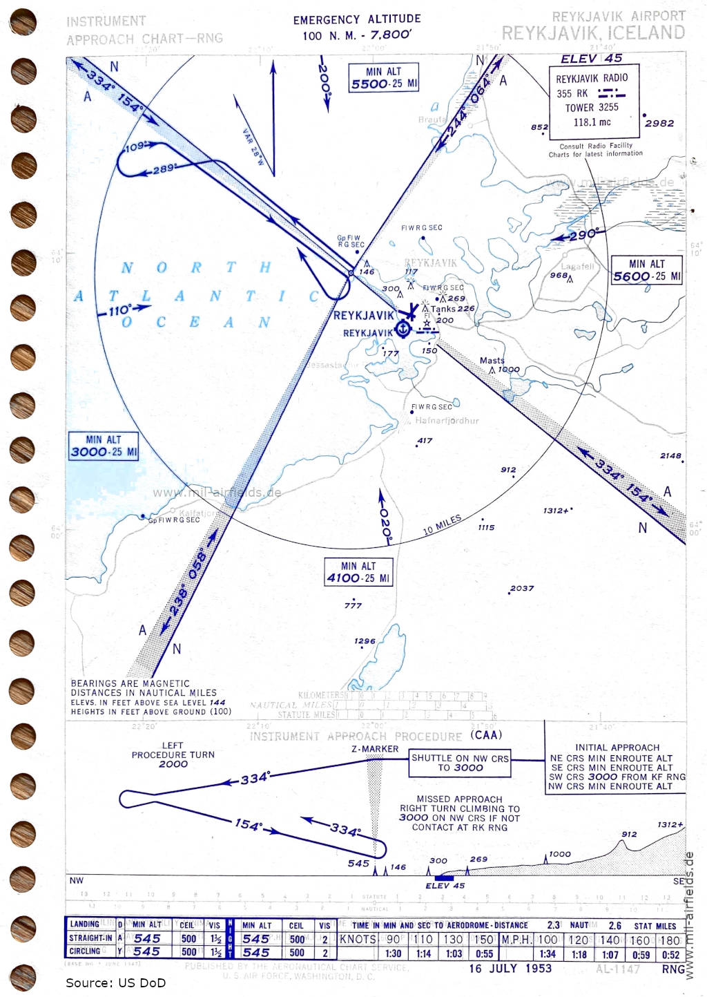

Image credits are shown on the respective target page, click on the preview to open it.
 mil-airfields.de at Facebook