Cagliari Elmas Airport
Aeroporto di Cagliari-Elmas "Mario Mameli"
Historical approach and aerodrome charts
Aeroporto di Cagliari-Elmas: Carte di avvicinamento
For historical information only, do not use for navigation or aviation purposes!
| Coordinates | N391448 E0090324 |
Location Indicator / Codice aeroportuale: LIEE
In the 1950s
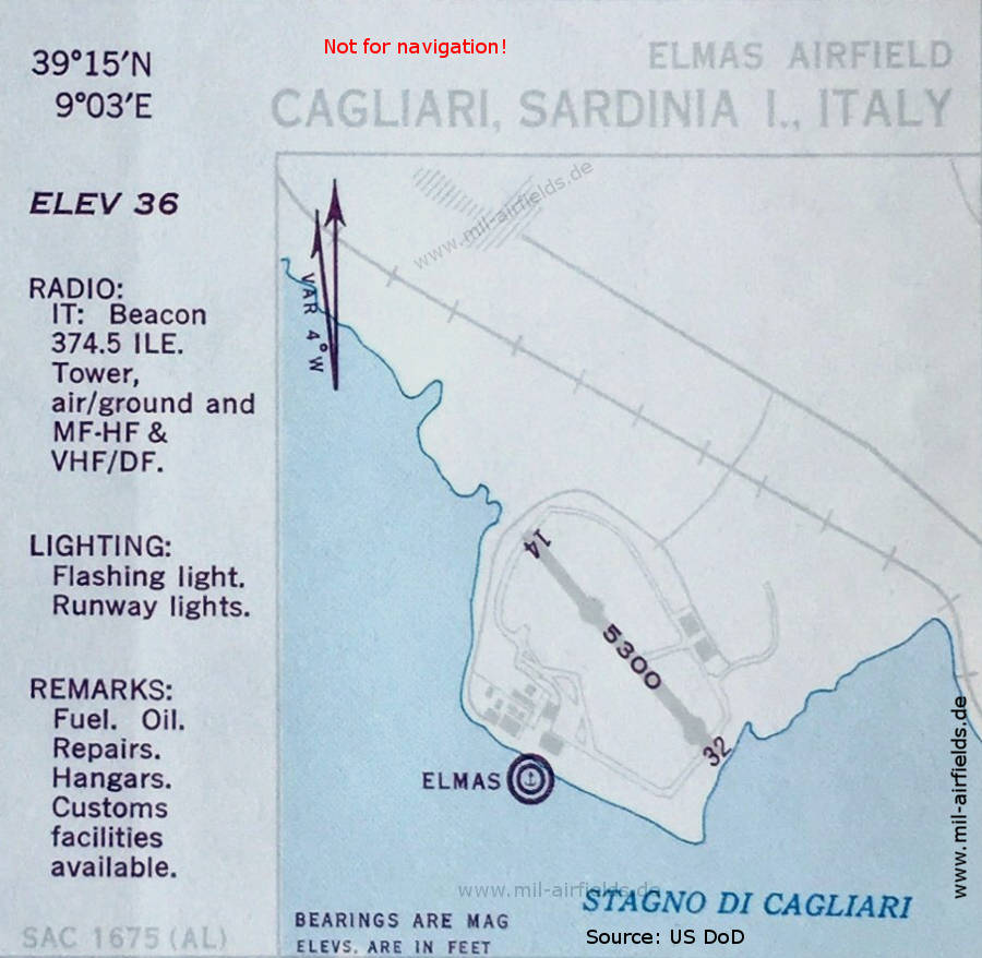
Airfield map (October 1950) - Runway 14/32 is 1,615 meters (5,300 feet) long. On the south side, the seaplane base is shown. (Source: US DoD)
In the 1960s
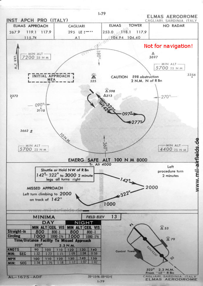
NDB approach runway 32 (October 1960) (Source: US DoD)
Source for all maps, if not marked otherwise: US Department of Defense (US DoD)
Index to the objects shown on the maps
Aerodromes / Aeroporti:
- Cagliari Elmas
Radio beacons / Radiofaro:
- Cagliari NDB LE
- Elmas NDB ILE
Air traffic control / Controllo del traffico aereo:
- Elmas Approach
- Elmas Tower
Recommended

Image credits are shown on the respective target page, click on the preview to open it.