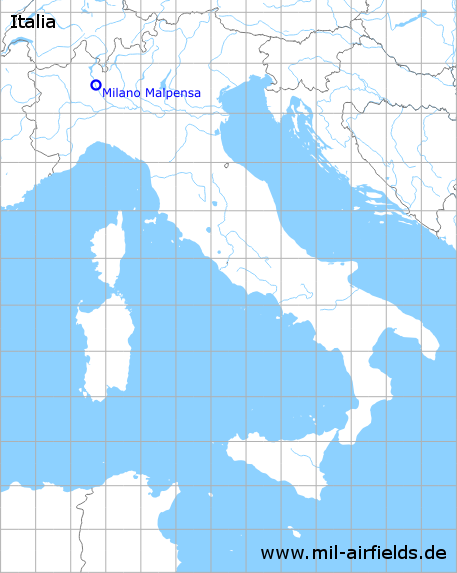
Milan Malpensa Airport
Aeroporto di Milano-Malpensa
Historical approach and aerodrome charts
Aeroporto di Milano-Malpensa: Carte di avvicinamento
For historical information only, do not use for navigation or aviation purposes!
| Coordinates | N453741 E0084344 (WGS84) |
| Location indicator | LIMC |
In the 1950s
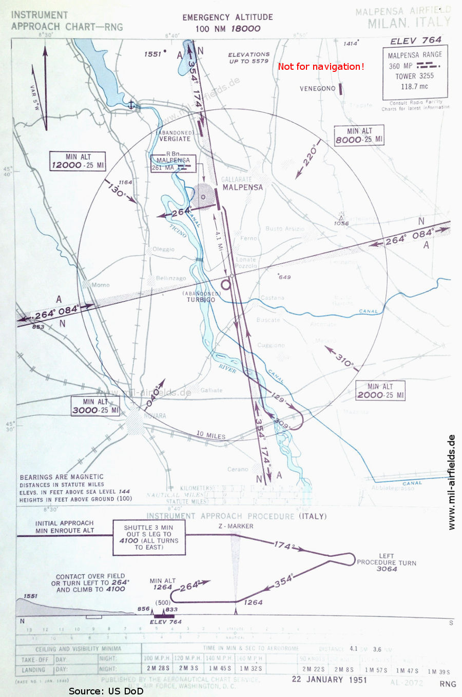
Range approach (January 1951) - The map also shows the airfields of Turbigo, Venegono and Vergiate. At Sesto Calende at the southern end of the Lago Maggiore, an anchor symbol indicates a seaplane base. The Range beacon with the identifier "MP" is located at Turbigo airfield, it is marked with the small circle and the four guiding beams. (Source: US DoD)

NDB approach (January 1951) - The non-directional beacon with the identifier "MA" is located in the west of the airport. (Source: US DoD)
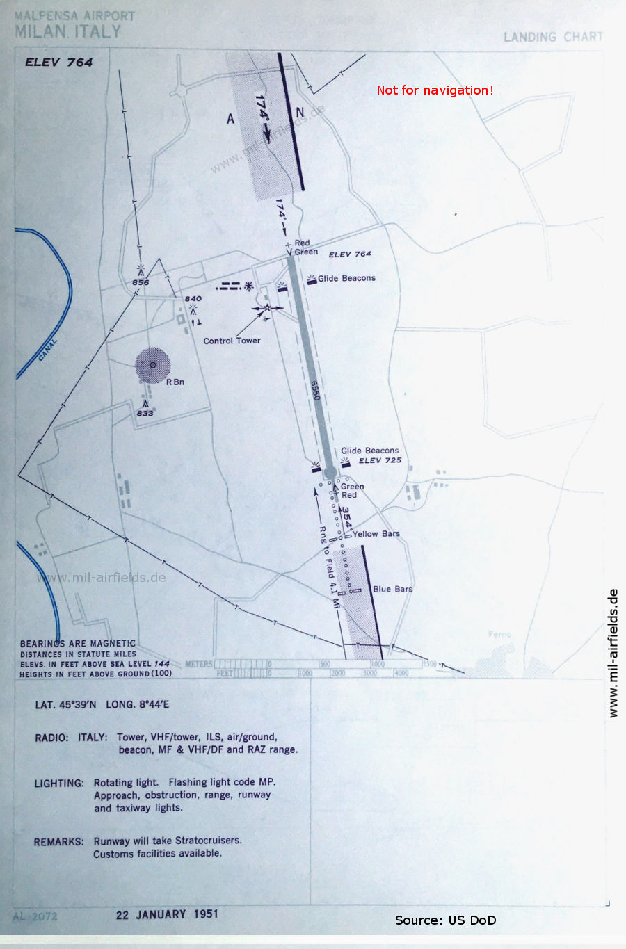
Airport map (January 1951) - The runway length is given in feet: 1,996 m (6,550 feet) (Source: US DoD)
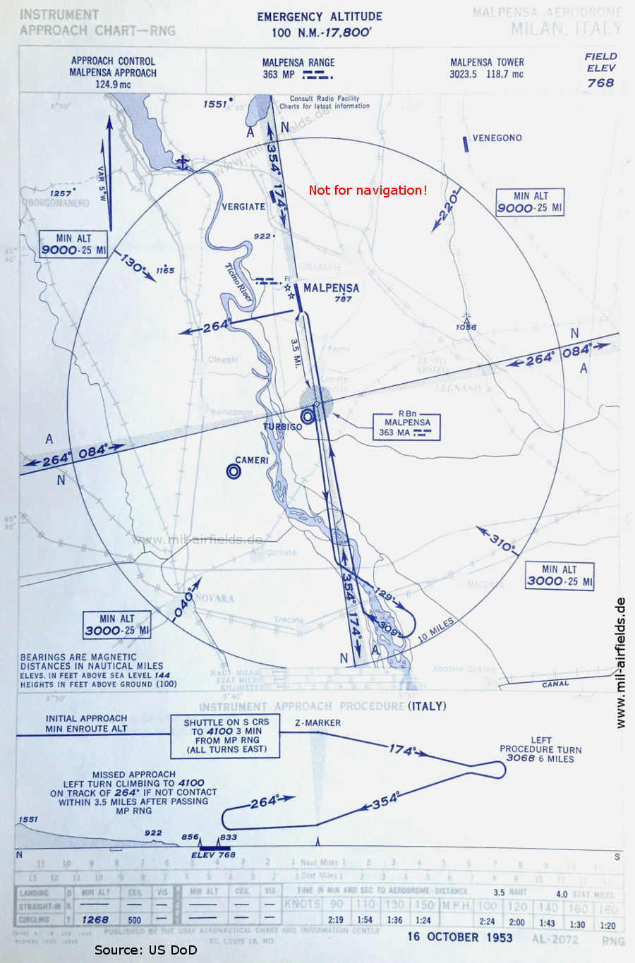
Range approach (October 1953) - The non-directional radio beacon with the identifier "MA" is now located at the "MP" Range and transmits on the same frequency 363 kHz when the Range is out of operation. Turbigo is now represented as a military airfield and Cameri is shown. (Source: US DoD)
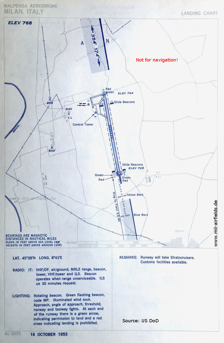
Airport map (October 1953) - The runway length is now 1,998 m (6,555 feet). (Source: US DoD)
In the 1960s
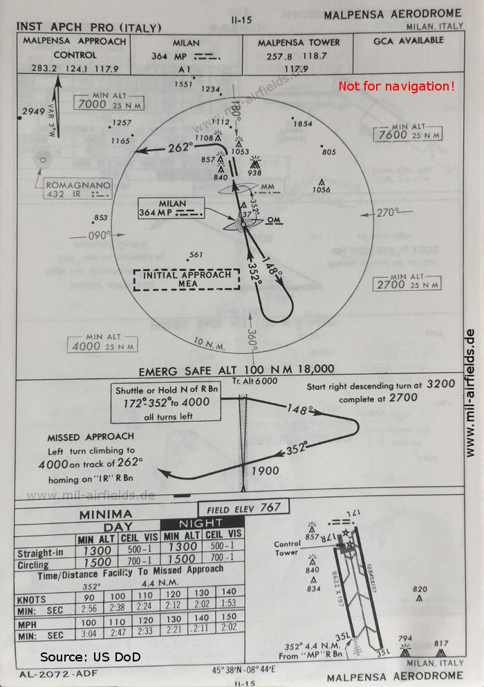
NDB approach runway 35L (October 1960) (Source: US DoD)
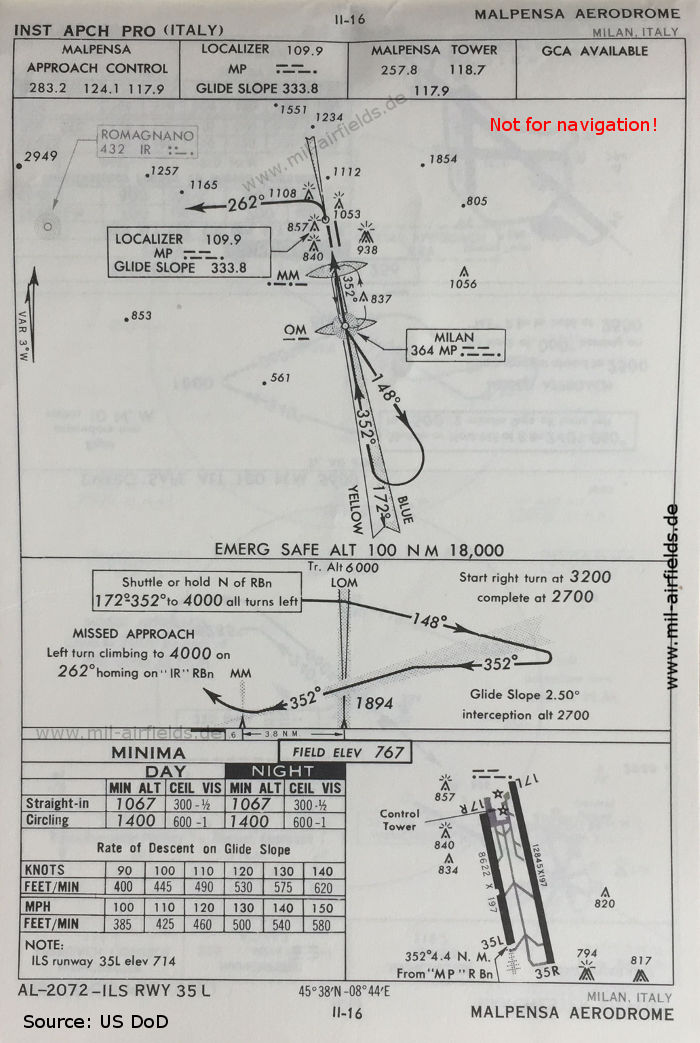
ILS approach runway 35L (October 1960) (Source: US DoD)
In the 1970s
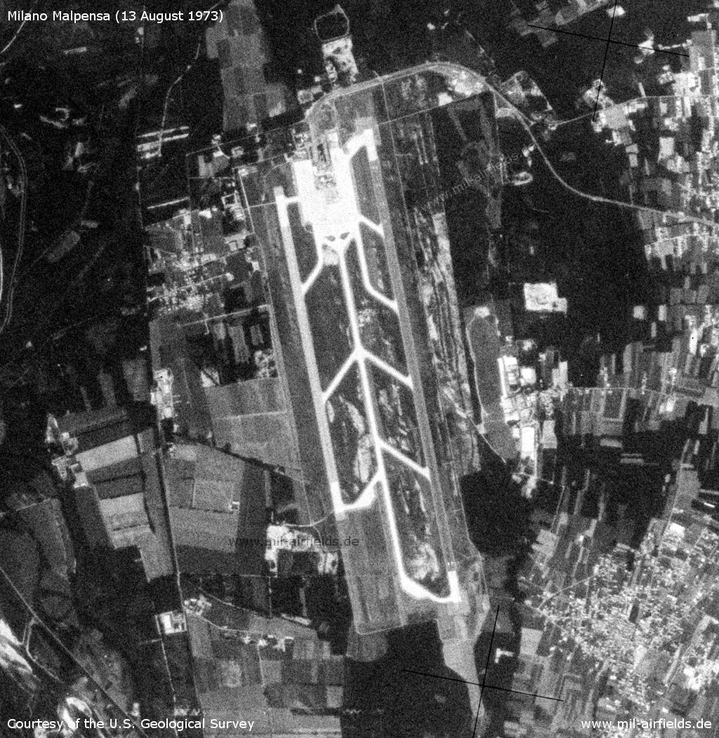
Satellite image from 13 August 1973 - The image is from a US reconnaissance satellite and was previously subject to high levels of secrecy. (Source: U.S. Geological Survey)
Index to the objects shown on the maps
Aerodromes / Aeroporti:
- Cameri, Milano Malpensa, Turbigo, Venegono, Vergiate
Radio beacons / Radiofaro:
- Malpensa Range "MP", NDB "MA", "MP", ILS, Outer Marker, Middle Marker,
- Romagnano NDB "IR"
Air traffic control / Controllo del traffico aereo / Communications:
- Malpensa Approach Control, Malpensa Tower
Landmarks and places:
- Abiategrasso, Bellinzago, Borgomanero, Buscate, Busto Arsizio, Castana, Castellanza, Cerano, Cuggiono, Ferno, Gallarate, Galliate, Lago Maggiore, Legnano, Lonate Pozzolo, Magenta, Momo, Novara, Olegio, Ticino (River), Tradate, Trecate, Varese
Source for all maps, if not marked otherwise: US Department of Defense (US DoD)
Title image: Unloading of a Ferrari Dino racing car from the Swissair DC-6A HB-IBB cargo airplane at Milano Malpena Airport. Source: ETH-Bibliothek Zürich, Bildarchiv/Stiftung Luftbild Schweiz / Fotograf: Swissair / LBS_SR12-15-155-AL, License: CC BY-SA 4.0
Recommended
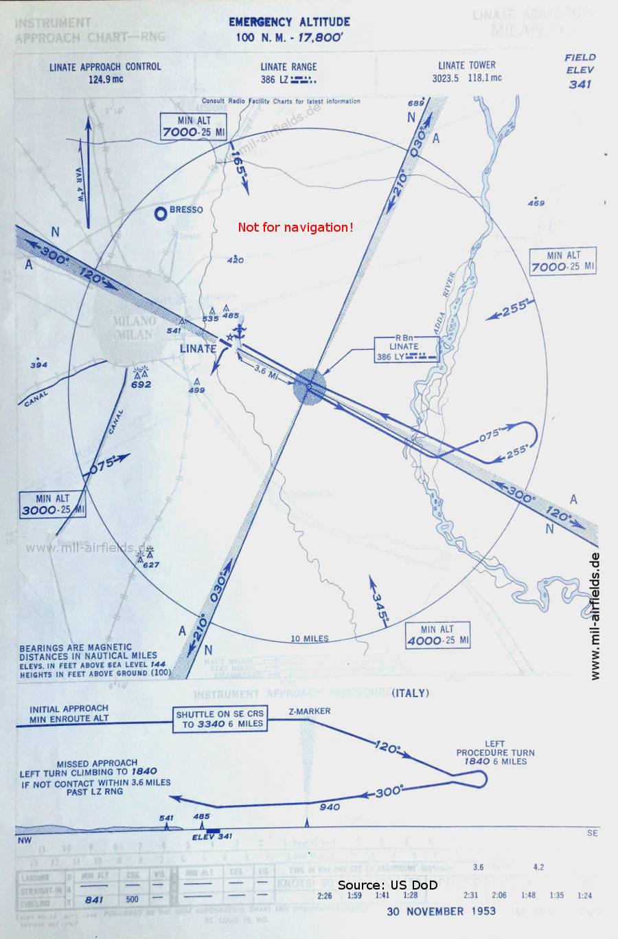


Image credits are shown on the respective target page, click on the preview to open it.