Pisa San Giusto Airport
San Giusto, Aeroporto Galileo Galilei
Historical approach and aerodrome charts
Aeroporto di Pisa San Giusto: Carte di avvicinamento
For historical information only, do not use for navigation or aviation purposes!
| Coordinates | N434104 E0102341 (WGS84) Google Maps |
Location Indicator / Codice aeroportuale: LIRP
In the 1950s
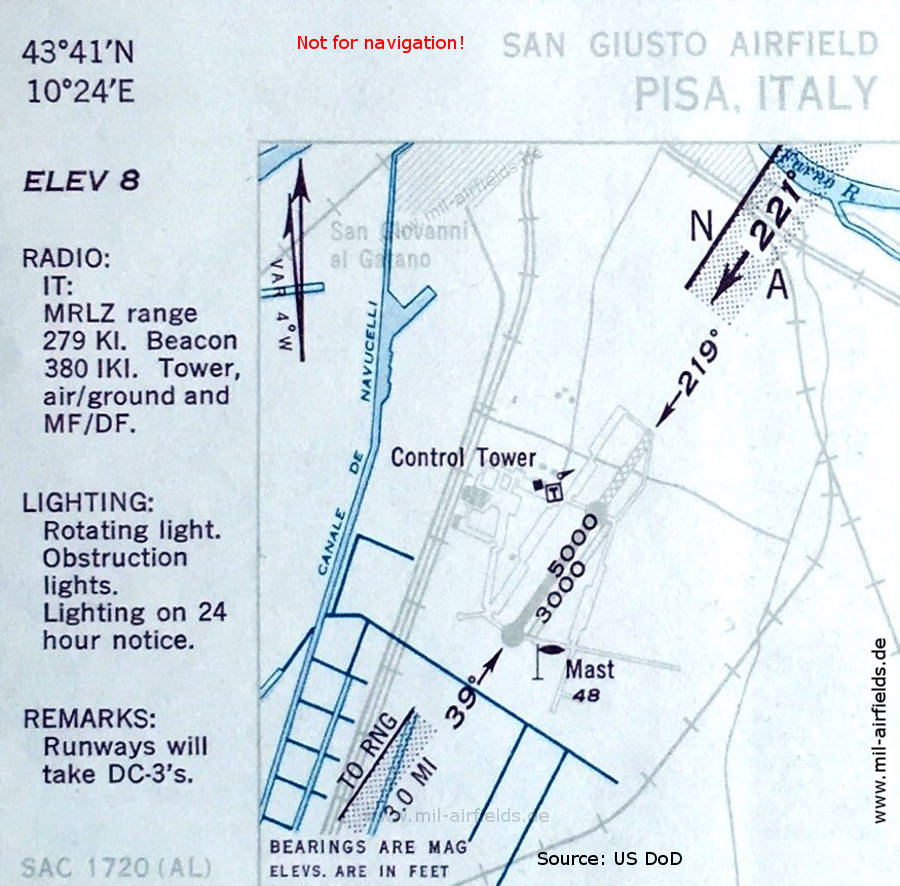
Aerodrome (October 1950) - There are two parallel runways. The longer one is paved and has a length of 1,524 meters (5,000 feet). The northeastern part consists of perforated steel plates (PSP), shown hatched. A grass runway runs parallel to it and is 941 m (3,000 feet) long. The Range beacon is located 3 miles to the southwest. (Source: US DoD)
In the 1960s
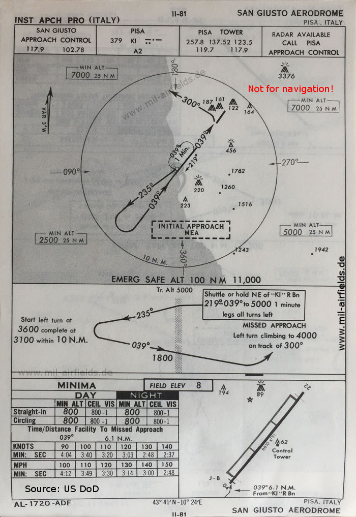
NDB approach runway 04 (October 1960) - There is one runway: 04/22 with 2990 m x 46 m (9810 feet x 151 feet). (Source: US DoD)
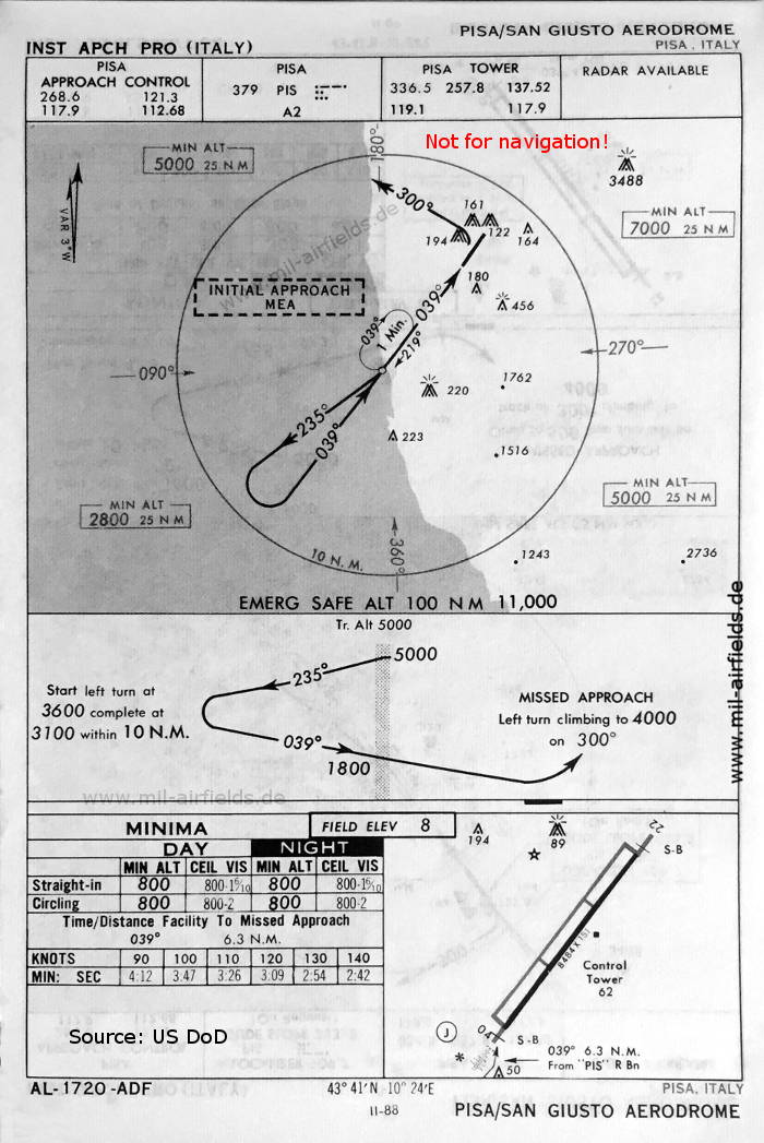
NDB approach runway 04 (May 1966) - Here, the dimensions of runway 04/22 are given as 2586 m x 46 m (8484 feet x 151 feet). (Source: US DoD)
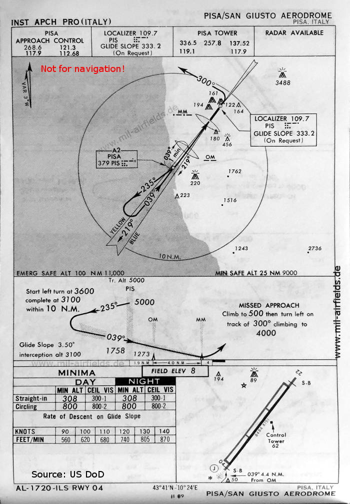
ILS approach runway 04 (May 1966) - It is interesting that the ILS glide path is only available on request. (Source: US DoD)
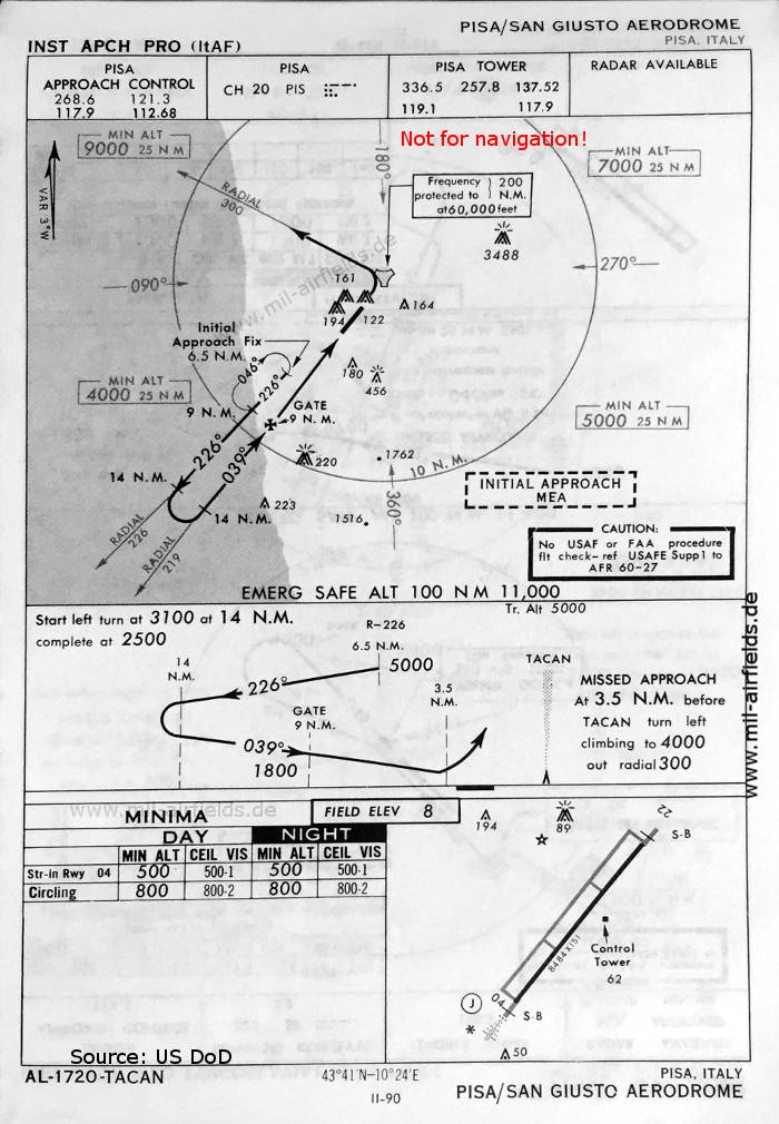
TACAN approach runway 04 (May 1966) - The TACAN station is located in the extension of the runway. This is rather unusual, but allows an approach exactly in the alignment of the runway. (Source: US DoD)
Index to the objects shown on the maps
Aerodromes / Aeroporti:
- Pisa San Giusto
Radio beacons with identificator / Radiofaro:
- Pisa Range "KI", NDB "IKI", NDB "KI", NDB "PIS", ILS "PIS", TACAN "PIS"
Air traffic control / Controllo del traffico aereo / Communications:
- San Giusto Approach Control, Pisa Approach Control, Pisa Tower
Source for all maps, if not marked otherwise: US Department of Defense (US DoD)
Recommended

Image credits are shown on the respective target page, click on the preview to open it.