Rimini Miramare Air Base
Aeroporto di Rimini-Miramare
Historical approach and aerodrome charts
For historical information only, do not use for navigation or aviation purposes!
| Coordinates | N440113 E0123642 (WGS84) Google Maps |
| Region | Emilia-Romagna, Adriatic Sea |
| Location indicator | LIPR |
In the 1960s
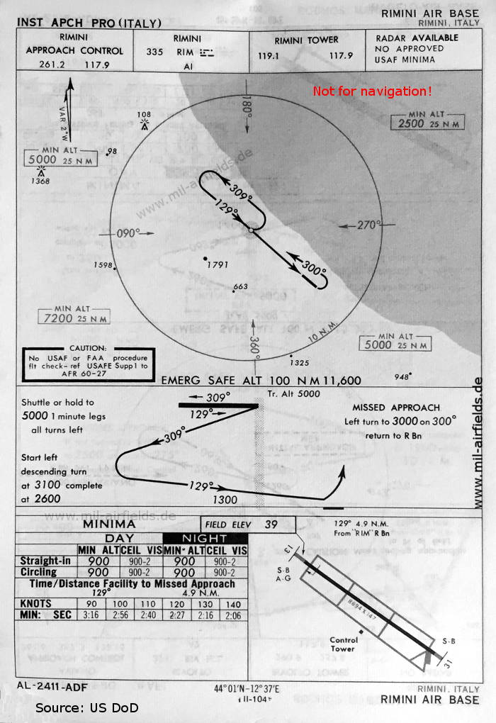
NDB approach runway 13 (May 1966) - There is one runway - 13/31: length 2650 m, width 45 m (8694 feet x 147 feet). (Source: US DoD)
Index to the objects shown on the maps
Radio beacons with identifier:
- Rimini NDB "RIM"
Air traffic control / Communications:
- Rimini Approach Control, Rimini Tower
Source for all maps, if not marked otherwise: US Department of Defense (US DoD)
Recommended

Image credits are shown on the respective target page, click on the preview to open it.
 mil-airfields.de at Facebook