Amsterdam Schiphol Airport
Historical approach charts - Netherlands
For historical information only, do not use for navigation or aviation purposes!
| Coordinates | N521832 E0044538 (WGS84) Google Maps |
Source for all maps, if not marked otherwise: US Department of Defence (DoD)
In the 1940s
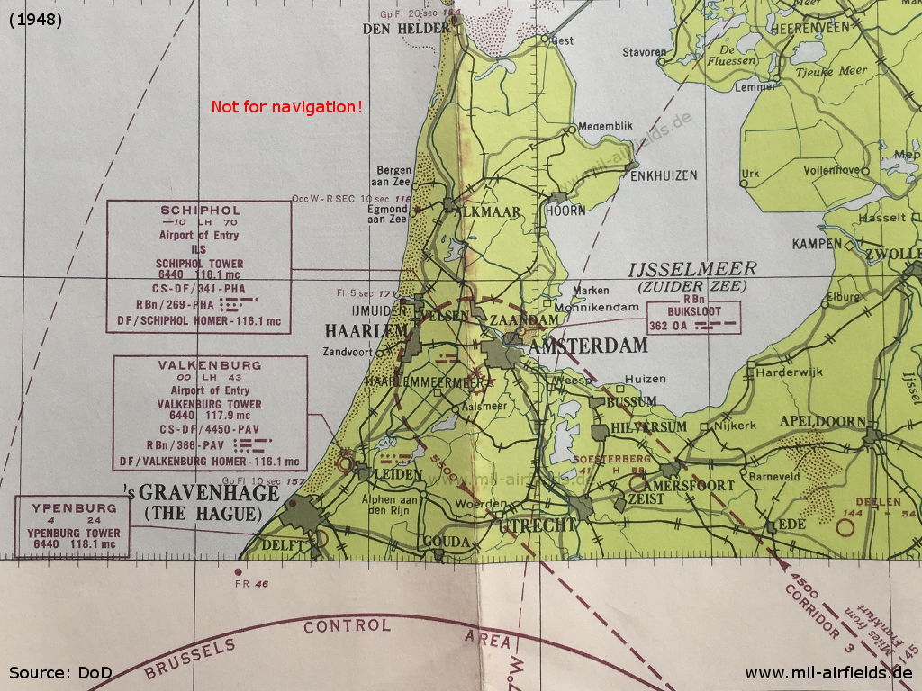
Amsterdam Schiphol, Valkenburg and Ypenburg airfields on a map from 1948 (Source: World Aeronautical Chart 170 (1948))
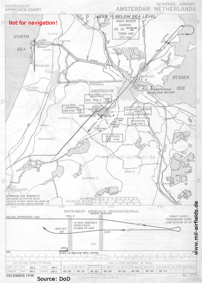
NDB approach runway 23 (December 1948) - Also shown on the map: Seaplane base Amsterdam Schellingwoude (Source: DoD)

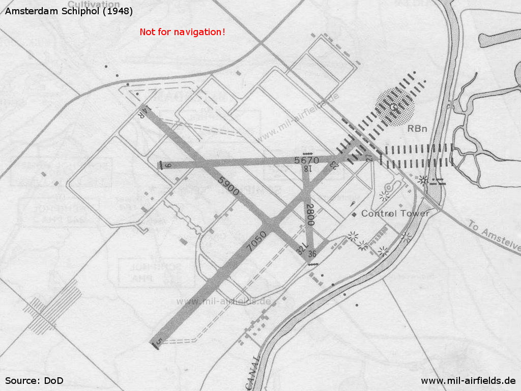
Landing chart (December 1948) (Source: DoD)
Enlargement (Source: DoD)
In the 1950s
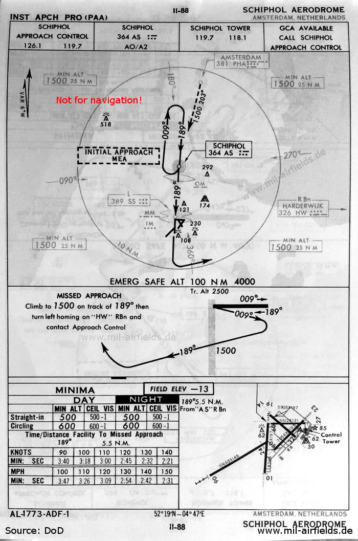
NDB approach runway 19 (April 1954) (Source: DoD)
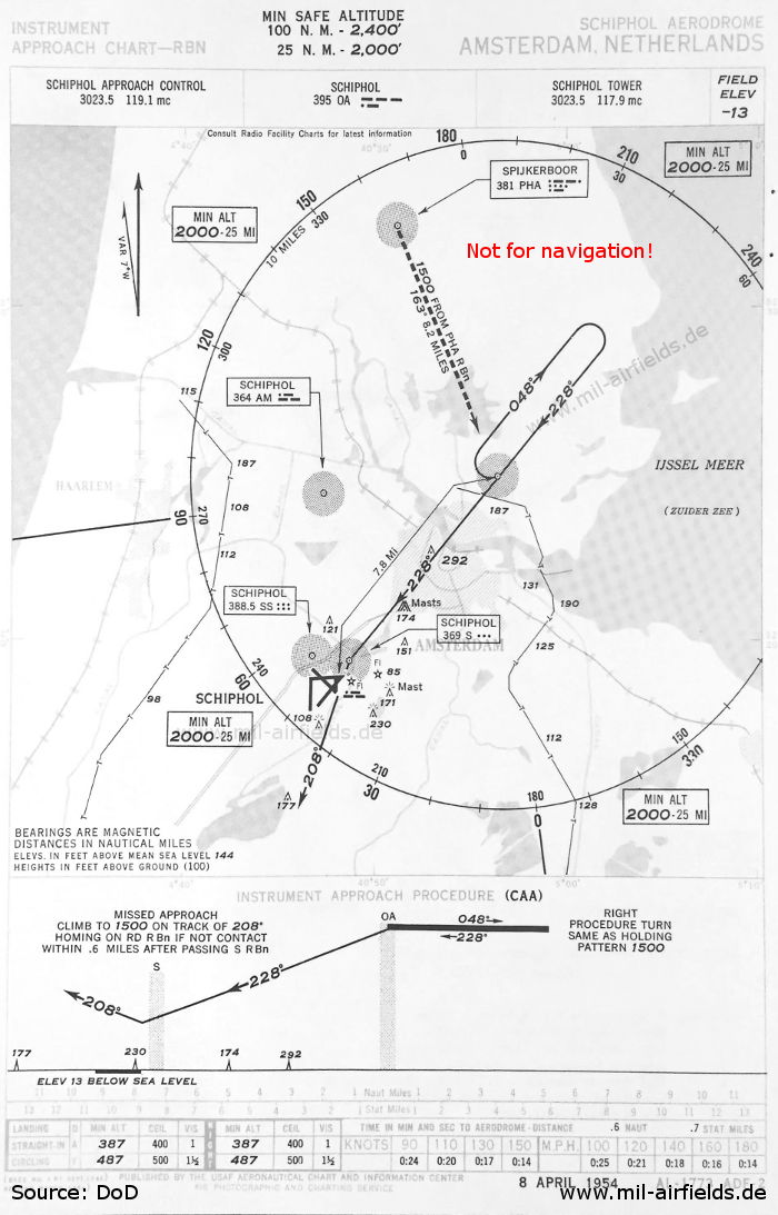
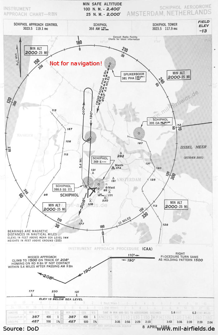
NDB approach runway 23 (April 1954) (Source: DoD)
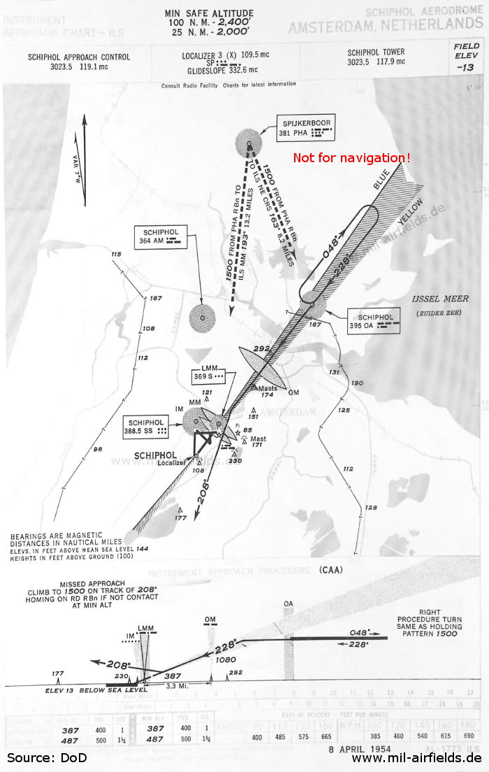
ILS approach runway 23 (April 1954) (Source: DoD)
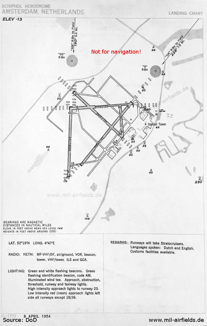
Aerodrome chart (April 1954) (Source: DoD)
In the 1960s
NDB approach runway 10 (October 1960) (Source: DoD)
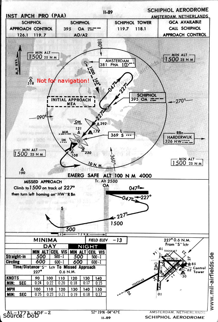
NDB approach runway 23 (October 1960) (Source: DoD)
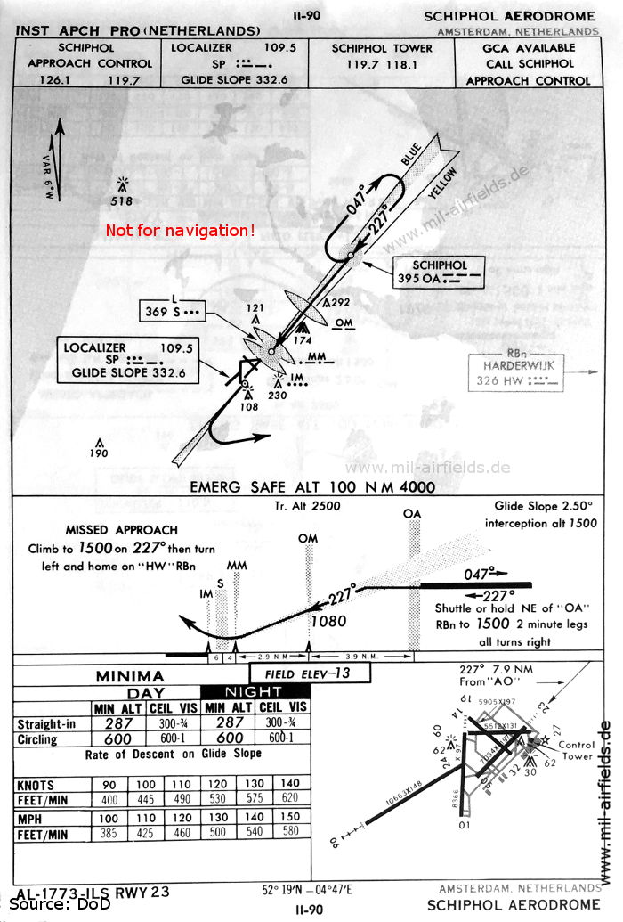
ILS approach runway 23 (October 1960) (Source: DoD)
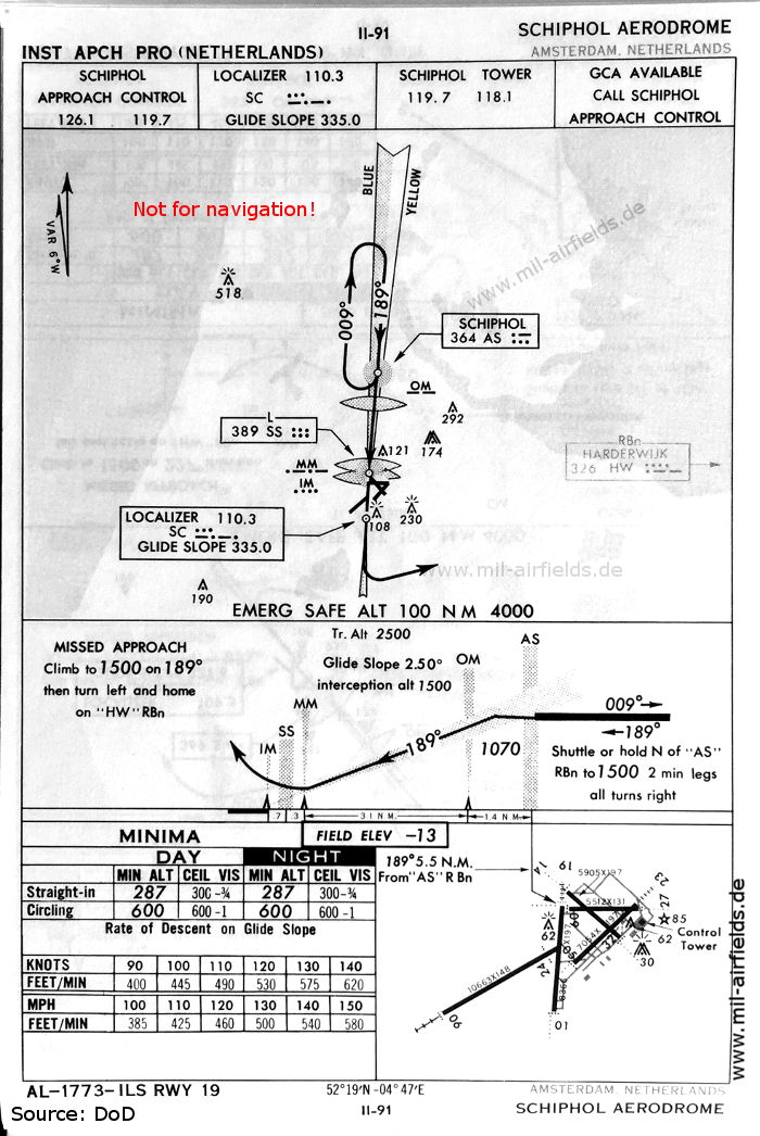
ILS approach runway 19 (October 1960) (Source: DoD)
Recommended

Image credits are shown on the respective target page, click on the preview to open it.